.
Terrestrial and Celestial Globes Vol II, Edward Luther Stevenson
|
COPYRIGHT, 1921, BY
THE HISPANIC SOCIETY OF AMERICA
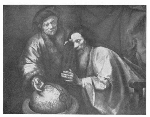
Table of Contents
| PAGE | ||
| List of Illustrations | vii | |
|
Chapter X: Globes and Globe Makers of the Early Seventeenth Century. The Dutch Scientific Masters and Their Preëminent Leadership. |
1 | |
|
The shifting of globe making interest to the northwest of Europe at the close of the sixteenth century.—The Van Langrens as leaders.—Jodocus Hondius and his son Henricus.—Willem Jansz. Blaeu and his sons, John and Cornelius.—The Ferreri armillary sphere.—Globes of Peter Plancius.—Isaac Habrecht.—Globes of Mattheus Greuter and their reproduction by Rossi.—Manfredus Settàla.—Abraham Goos.—Adam Heroldt. |
||
|
Chapter XI: Globes of the Second Half of the Seventeenth Century |
72 | |
|
Certain striking tendencies exhibited in the matter of globe making in this period.—The Gottorp globes.—Weigel’s globes.—Carlo Benci.—Amantius Moroncelli.—Castlemaine’s immovable globe.—The armillary of Treffler.—Armillary sphere of Gian Battista Alberti.—The numerous globes of P. Vincenzo Coronelli.—Certain anonymous globes of the period.—Johannes Maccarius.—Jos. Antonius Volpes.—Vitale Giordani.—George Christopher Eimmart.—Giuseppe Scarabelli.—Giovanni Battista.—Joseph Moxon.—The Chinese globes of Peking. |
||
|
Chapter XII: Globes and Globe Makers of the First Half of the Eighteenth Century—from Delisle to Ferguson |
137 | |
|
Activities of Guillaume Delisle.—Jean Dominique Cassini and his reforms.—Vincenzo Miot.—The globes of Gerhard and Leonhard Valk.—Activities of John Senex.—Nicolas Bion.—The armillary sphere of Carmelo Cartilia.—Mattheus Seutter of vi Augsburg.—Robert Morden.—Jean Antoine Nollet.—Johann Gabriel Doppelmayr of Nürnberg.—Terrestrial globe of Cusani.—Terrestrial globes of Siena.—The work of the monk Pietro Maria da Vinchio.—James Ferguson of Scotland. |
||
|
Chapter XIII: Globes and Globe Makers of the Second Half of the Eighteenth Century |
175 | |
|
Few globe makers of striking distinction in this period.—An apparent decrease in scientific interest in globes, but an apparent increase in popular interest.—Gilles and Didier Robert de Vaugondy.—The work of Desnos.—Globes of Gian Francesco Costa the Venetian.—Globes of Akerman and Akrel.—The French globe makers Rigobert Bonne and Lalande.—Charles Messier and Jean Fortin.—Globes of George Adams the Elder, of George Adams the Younger, and of Dudley Adams.—Small globes of Nathaniel Hill.—The work of Innocente Alessandri and Pietro Scaltaglia.—Charles Francis Delamarche.—Manuscript globes of Vincenzo Rosa.—Geographer and globe maker Giovanni Maria Cassini.—Globes of William Cary. |
||
|
Chapter XIV: The Technic of Globe Construction—Materials and Methods |
196 | |
|
General problems to be met.—Development from the simple armilla to the complex sphere.—The references of Ptolemy, Leontius Mechanicus, Alfonso.—Behaim’s leadership in practical globe making.—Materials employed.—Experiments in map projection.—The beginning and rapid development of globe-gore construction.—Various examples of early gore maps.—Equatorial polar and ecliptic polar mountings.—Special features of celestial globe maps.—Globe mountings.—Varying sizes of globes.—The uses of globes.—Moon globes and planetariums |
||
|
Bibliographical List |
220 | |
|
Index of Globes and Globe Makers |
249 | |
|
General Index |
276 | |
List of Illustrations
| Frontispiece. Rembrandt’s Philosophers | 2 | |
| FIG. | CHAPTER X | PAGE |
| 88. |
Terrestrial Globe of Jodocus Hondius, 1600. From original in Library of Henry E. Huntington, New York |
4 |
| 89. |
Celestial Globe of Jodocus Hondius, 1600. From original in Library of Henry E. Huntington, New York |
8 |
| 90. |
Dedication Appearing on Globe of Jodocus Hondius, 1600 |
6 |
| 91. |
Terrestrial Globe of Jodocus Hondius, 1618. From original in collection of The Hispanic Society of America, New York |
14 |
| 92. |
Portrait of Willem Jansz. Blaeu. From engraving by Falck |
18 |
| 93. |
Terrestrial Globe of Willem Jansz. Blaeu, 1606. From original in collection of The Hispanic Society of America, New York |
30 |
| 94. |
Terrestrial and Celestial Globes of Willem Jansz. Blaeu, 1616. From originals in collection of The Hispanic Society of America, New York |
32 |
| 95. |
Terrestrial Globe of Willem Jansz. Blaeu, 1622. From original in collection of The Hispanic Society of America, New York |
34 |
| 96. |
Section of Jodocus Hondius World Map, 1611. From Stevenson’s reproduction |
40 |
| 97. |
Terrestrial Globe of Willem Jansz. Blaeu, 1622. From original in Chigi Library, Rome |
44 |
| 98. |
Celestial Globe of Willem Jansz. Blaeu, 1622. From original in Liceum Foscarini, Venice |
44 |
| 98a. |
Terrestrial Globe of Willem Jansz. Blaeu, ca. 1640. From original in Royal Library, Madrid |
66 |
| 98b. |
Celestial Globe of Willem Jansz. Blaeu, ca. 1640. From original in Royal Library, Madrid |
66 |
| 99. |
Portrait of Peter Plancius. From an old print |
46 |
| 100. | viii
Terrestrial Globe of Peter Plancius, 1614. From original in Astronomical Museum, Rome |
48 |
| 101. |
Terrestrial Globe of Isaac Habrecht, 1625. From original in the collection of The Hispanic Society of America, New York |
50 |
| 102. |
Terrestrial Globe of Mattheus Greuter, 1632. From original in the collection of The Hispanic Society of America, New York |
54 |
| 103. |
Terrestrial Globe of Mattheus Greuter, 1638. From original in the collection of The Hispanic Society of America, New York |
62 |
| 103a. |
Terrestrial Globe of Dominico Rossi (Mattheus Greuter), 1695. From original in the collection of The Hispanic Society of America, New York |
64 |
| 103b. |
Celestial Globe of Dominico Rossi (Mattheus Greuter), 1695. From original in the collection of The Hispanic Society of America, New York |
64 |
| CHAPTER XI | ||
| 104. |
The Gottorp Armillary Sphere, 1657. From original in the National Museum, Copenhagen |
74 |
| 105. |
Terrestrial Globe of Silvester Amantius Moroncelli, 1672. From original in Marciana Library, Venice |
84 |
| 106. |
Manuscript Celestial Globe (Moroncelli?), Late Seventeenth Century. From original in Library of William R. Hearst, New York |
92 |
| 107. |
Portrait of Earl of Castlemaine. From an old print |
94 |
| 108. |
Globe of Earl of Castlemaine, 1679. From Coronelli’s Epitome Cosmografica |
94 |
| 109. |
Globe of Christopher Treffler, 1683. From Coronelli’s Epitome Cosmografica |
95 |
| 110. |
Portrait of P. Vincenzo Coronelli. From his Atlante Veneto |
98 |
| 111. |
Emblem of the Venetian Accademia Cosmografica degli Argonauti. From Coronelli’s Atlante Veneto |
100 |
| 112. |
Terrestrial Globe of P. Vincenzo Coronelli, 1688. From original in Marciana Library, Venice |
110 |
| 113. |
Celestial Globe of P. Vincenzo Coronelli, 1688. From original in Marciana Library, Venice |
112 |
| 114. | ix
Terrestrial Globe of P. Vincenzo Coronelli, 1688. From original in Landesmuseum, Zürich |
114 |
| 115. |
Terrestrial Globe of P. Vincenzo Coronelli, 1696. From original in collection of The Hispanic Society of America, New York |
116 |
| 115a. |
Terrestrial Globe of P. Vincenzo Coronelli, 1693. From original in Academy of Sciences, Turin |
118 |
| 115b. |
Celestial Globe of P. Vincenzo Coronelli, 1693. From original in Academy of Sciences, Turin |
120 |
| 116. |
Portrait of Joseph Moxon. From his Mechanick Exercises |
124 |
| 117. |
Ancient Mongolian Armillary Sphere, ca. 1274. From Thompson’s Illustrations of China |
130 |
| 117a. |
Armillary Sphere and Celestial Globe of Ferdinand Verbiest, 1673. From Thompson’s Illustrations of China |
132 |
| CHAPTER XII | ||
| 118. |
Terrestrial Globe of Guillaume Delisle, 1700. From original in Royal Library, Madrid |
140 |
| 118a. |
Terrestrial Globe of Johann Ludovicus Andreae, 1717. From original in City Historical Museum, Frankfurt |
138 |
| 119. |
Portrait of Jean Dominique Cassini. From an old print |
142 |
| 120. |
Terrestrial Globe of Gerhard and Leonhard Valk, 1750 (?). From original in collection of The Hispanic Society of America, New York |
144 |
| 120a. |
Southern Hemisphere Celestial Globe by Gerhard and Leonhard Valk, with Author and Date Legend, 1750 (?). From original in collection of The Hispanic Society of America, New York |
146 |
| 121. |
Terrestrial Globe of Gerhard and Leonhard Valk, 1750 (?). From original in collection of The Hispanic Society of America, New York |
148 |
| 121a. |
Celestial Globe of Gerhard and Leonhard Valk, 1750 (?). From original in collection of The Hispanic Society of America, New York |
150 |
| 122. |
Terrestrial Globe of John Senex, 1793. From original in Royal Library, Madrid |
152 |
| 123. |
Portrait of Nicolas Bion. From an old print |
142 |
| 124. |
Terrestrial Globe of Mattheus Seutter, 1710. From original in Astronomical Museum, Rome |
154 |
| 125. |
Celestial Globe of Mattheus Seutter, 1710. From original in Astronomical Museum, Rome |
156 |
| 125a. |
Terrestrial Globe of Van Lauen Zonen, 1745. From original in City Historical Museum, Frankfurt |
158 |
| 126. | x
Terrestrial Globe of Johann Gabriel Doppelmayr, 1728. From original in collection of The Hispanic Society of America, New York |
160 |
| 126a. |
Celestial Globe of Johann Gabriel Doppelmayr, 1728. From the original in collection of The Hispanic Society of America, New York |
162 |
| 126b. |
Celestial Globe of Johann Puschner, 1730. From original in Math. Phys. Salon, Dresden |
164 |
| 127. |
Portrait of James Ferguson. From an old print |
168 |
| 127a. |
Pocket Globe of James Ferguson, 1750 (?). From original in collection of The Hispanic Society of America, New York |
170 |
| 127b. |
Terrestrial Globe of Herman Moll, 1705. From original in collection of The Hispanic Society of America, New York |
170 |
| CHAPTER XIII | ||
| 128. |
Terrestrial Globe of Pietro Rosini, 1762. From original in the University Library, Bologna |
180 |
| 129. |
Armillary Sphere of Jean Fortin, 1780. From original in collection of The Hispanic Society of America, New York |
184 |
| 129a. |
Globe of L. C. Desnos, 1782. From original, Piacenza |
178 |
| 130. |
Terrestrial Globe of George Adams, 1782. From original in Astronomical Museum, Rome |
186 |
| 130a. |
Terrestrial Globe of Nathaniel Hill, 1754. From original in New York Public Library |
188 |
| 131. |
Terrestrial Globe of Giovanni Maria Cassini, 1790. From original in Astronomical Museum, Rome |
192 |
| 132. |
Anonymous Terrestrial Globe, ca. 1800. From original in collection of The Hispanic Society of America, New York |
194 |
| CHAPTER XIV | ||
| 133. |
Astrolabe. From Joseph Moxon, A Tutor to Astronomy and Geography, 1695 |
197 |
| 134. |
Globe Gores of Henricus Glareanus, 1527. From his Geographia liber unus |
203 |
| 135. |
Gore Map of Leonardo da Vinci, ca. 1515 |
206 |
| 136. |
Anonymous Globe Gores in Plane Map Construction, ca. 1550. From original manuscript in John Carter Brown Library, Providence |
206 |
| 137. | xi
Portrait of Johann Hevelius (Hevel). From his Prodromus |
208 |
| 138. |
Constellation Ursa Major. From Apianus Cosmographicus liber, 1529 |
210 |
| 139. |
Constellation of Orion by Hevelius. From his Prodromus |
212 |
| 140. |
Terrestrial Globe Gores by Johannes Oterschaden, ca. 1675. From original in collection of The Hispanic Society of America |
214 |
| 141. |
Celestial Globe Gores by Johannes Oterschaden, ca. 1675. From original in collection of The Hispanic Society of America |
216 |
| 142. |
Engraved Sections for Globe Horizon Circle by Johannes Oterschaden, ca. 1675. From original in collection of The Hispanic Society of America |
216 |
| 143. |
The Orrery. From an engraving by William Pether after engraving by Joseph Wright |
218 |
| CHAP. | TAILPIECES | PAGE |
| X. |
Armillary Sphere. From Blagrave, Mathematical Jewel, 1585 |
71 |
| XII. |
Ship. From Jodocus Hondius’ World map, 1611 |
174 |
| XIV. |
Printer’s Mark of the Blaeu Press |
219 |
Chapter X
Globes and Globe Makers of the Early Seventeenth Century. The Dutch Scientific Masters and Their Preëminent Leadership
The shifting of globe making interest to the northwest of Europe at the close of the sixteenth century.—The Van Langrens as leaders.—Jodocus Hondius and his son Henricus.—Willem Jansz. Blaeu and his sons, John and Cornelius.—The Ferreri armillary sphere.—Globes of Peter Plancius.—Isaac Habrecht.—Globes of Mattheus Greuter and their reproduction by Rossi.—Manfredus Settàla.—Abraham Goos.—Adam Heroldt.
AS the first post-Columbian century came to its close the center of interest in great transoceanic exploration and discovery shifted to the northwest of Europe, to England, and to the Netherlands. Since expeditions were daily setting sail to all shores of the world, “Quoniam in omnes mundi plagas quotidie magis magisque navigatur,” quoting the word of the enthusiastic Hondius, the chart and globe makers found their services in great demand, globes both terrestrial and celestial being still regarded as essential to a navigator’s complete outfit of sailing instruments. The quick-witted Netherlanders, with well-developed business instincts, engravers, printers, map and globe makers, set to work to correct the old and to construct new “seamen’s cards” to serve the seafarers in their enterprises,2 and it was not long after entering this field of scientific endeavor that leadership by them was clearly attained.
Although of Danish origin, perhaps logically the Van Langren family should have had first consideration in this chapter, since father and sons came to be loyal supporters of their new homeland’s interests, and it was in the Netherlands where were laid the scenes of their activities in the field here under consideration. Chronologically, however, they had place in the preceding chapter because their work as globe makers began in the early eighties of the sixteenth century. They, at least, be it said to their credit, led the way, achieving some of their highest successes in the early seventeenth century. This, too, was the time when the Hondius, the Blaeu, the Jansson, and the Goos families came to the front to contribute their part, in a very distinguished manner, toward the promotion of the work so ably begun by their contemporary, Jacobus Florentius van Langren.
Jodocus Hondius (1567-1611) was a native of Wacken (Fig. 60).1 To this village his parents, shortly before his birth, had fled from Ghent to escape the persecuting hand of Count Egmont. The father, Oliver de Hondt, a modest teacher but a man very learned in theology, had embraced the reformed faith and therefore became an outlaw by decree of the government. On the arrest of Egmont, he with his family returned to Ghent, to remain but a short time, for in the year 1569 we find a residence had been taken up at Duffel near Antwerp. In this city two children were born, a daughter whose name is now unknown and a son Henry, usually referred to as Henry the Elder.
Jodocus at an early age gave evidence of possessing very remarkable talent for designing and engraving. We are told that at the age of eight he began to apply himself to the art of portraiture, of ivory carving, and of copper engraving, and that his father, noting the exhibition of special talent in the son, placed him as an apprentice with an engraver and sculptor in Antwerp. During this period of apprenticeship3 he carried on his studies of the fine arts, also of Latin, Greek, and mathematics, under the direction of his father, at the same time applying himself to the work of map engraving. It probably was about the year 1585 that he went to England, where, by reason of the talent he exhibited, he found employment with the English geographers, Richard Hakluyt and Edward Wright, during which period he appears to have engraved and printed a small world map in hemispheres. In the year 1592 he returned to Amsterdam, where he established himself as an engraver and printer, turning his attention especially to the issue of geographical maps.2 Among his friends he numbered the men most prominent in his field, notably Petrus Bertius, very learned as a geographer, and Petrus Montanus.3 It appears to have been Bertius who informed him of the intention of the heirs of Mercator to dispose of that illustrious geographer’s engraving and printing establishment, and who perhaps negotiated the sale of the same. At any rate, we find that in the year 1604 Jodocus Hondius came into possession of the Mercator copper plates of the Ptolemy maps, and at the same time he seems also to have acquired the greater part of the edition of Mercator’s ‘Atlas’ of 1602 then remaining unsold. In the year 1605 Hondius prepared and issued a third edition of the Ptolemy maps; in 1606 he issued a third edition of Mercator’s ‘Atlas’; in 1608 he published a fourth edition; in 1609 and in 1610 other editions.4 It must have been in the year 1611 that he issued his great world map in two hemispheres, bearing the title “Novissima ac exactissima totius orbis terrarum descriptio magna cura & industria ex optimis quibusque tabulis Geographicis et Hydrographicis nuperrimisque doctorum virorum observationibus duobus planisphaerijs delineata. Auct. I. Hondio.” This work has been recently issued in a superb facsimile of the only known extant original copy, now in the possession of Prince Maximilian of Waldburg zu Wolfegg-Waldsee.5 Of such superior excellence is the work of Hondius, as exhibited in this4 masterpiece, that it justly entitles him to first place among those who, up to this date, had undertaken to construct world maps.
It seems to have been early in his career as engraver and printer that he prepared his first globe gores and issued his first celestial globe. The director of the Germanisches Nationalmuseum of Nürnberg, in courteous communication, reports that in the rich collection of that institution there is a Hondius globe of the year 1592, which date, if accurately read, makes this to be the only known copy of what must be taken as his first issue. The map is a colored copper engraving covering a ball of wood having a diameter of 60 cm. The mounting of the globe, which clearly is the original, consists of the usual circles, resting upon six wooden support columns. A more detailed description of this particular example it has not been possible to obtain.6
Not until the year 1600 does there appear to have been a second issue of his globes. Of this second issue a remarkably fine pair (Figs. 88, 89) was recently acquired by Mr. Henry E. Huntington of New York City.7 Excepting very slight damage to the celestial globe in the north polar region, they may be said to be in practically as fine condition as they were when first given out from the master’s workshop. Their complete history has not been obtainable, but so remarkably well preserved are they that it seems quite probable they have been kept through all these years in the library case of some rich Italian treasure-loving family. There cannot be the slightest doubt of their age, certainly none of the age of the spheres themselves, but the exact date of the bronze mounting, though clearly in the style of certain Italian workmanship of the period, is less easy to determine. These globes have a diameter of about 34 cm. and an entire height, including the base, of 73 cm. The spheres on which have been pasted the twelve engraved gores are of papier-mâché, over which is a covering of plaster and a coating of thick varnish or shellac giving a smooth surface 5for the terrestrial and the celestial maps. To each, color was artistically applied by hand, which still retains a richness of tone. Each is supplied with a bronze meridian and horizon circle and with an hour circle attached in the accustomed manner at the north pole. These circles are appropriately graduated, the horizon circle having, in addition to its graduation into three hundred and sixty degrees, a series of concentric circles engraved, counting from the outermost, with the names of the winds, compass directions in the Dutch language, the names of the months, and the signs of the zodiac. Each sphere with its circles is carried on a base composed of three artistically designed and engraved bronze supports, these being attached at their lower extremities by an appropriately designed plate, and in this plate has been set a compass, still apparently in perfect condition, the dial face of this compass having a diameter of 8 cm. Aside from their scientific value for the student of geography and of astronomy, these are fit pieces to adorn the library shelves of a prince among American book collectors, as they must, in keeping with the custom of the time, have once adorned the shelves of an Italian patrician book lover.
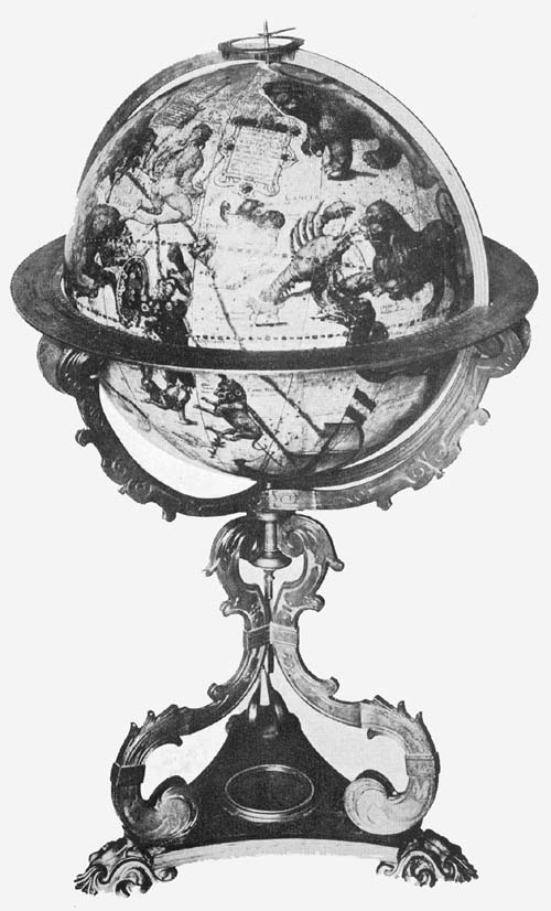
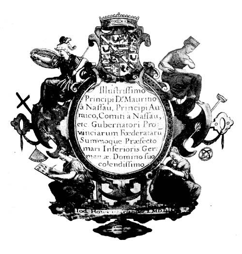
The terrestrial globe has the following dedication: “Illustrissimo Principi Do Mauritio à Nassau, Principi Auraico, Comiti à Nassau, etc. Gubernatori Provinciarum Foederatarū Summoque Praefecto mari Inferioris Germaniae Domino suo colendissimo. Jod. Hondius Flander L. M. D. D. Cum privilegio decem annorum.” “To the illustrious Prince D. Maurice of Nassau, Prince of Orange, Knight of Nassau, etc. Governor of the Federated Provinces and High Prefect of the Lower German Ocean, his Most Worshipful Master, Jodocus Hondius dedicates (this globe). With privilege for ten years.” This dedication is placed within an artistic cartouch (Fig. 90) which is surmounted with the coat of arms of the Princes of Nassau, to which appropriate colors have been added. To the left of the above is an address to the reader: “Iod. Hond. Lectori S. P.6 Quoniam crebriores in omnes mundi partes quotidie navigationes instituūus ejusdem certius perspicitur atque innotescit; nemini idcirco mirum spero visum iri, si haec nostri globi descriptio ab aliis antehac in lucem editis plurimū discrepet. Quin uti par est, nostrae diligentiae et curae favebit, qua recens patefacta et cognita, qua directiones, latitudines et similia cōgruenter distincta suis locis habentur. Quod ipsum in ducendis lineis Directorii fecimus et peritis cumulate satisfactum confidimus. Postremo lectorē benev. rogam⁹ ut si quam loci alicujis pleniorem notitiam habeat eandem nobiscū, provehēdi boni publici gratia, lubens comunicet. vale.” “Hondius to the reader greeting. Inasmuch as frequent voyages into all parts of the world are undertaken every day, whereby the several locations (of places) are more certainly seen and are made known, I hope therefore no one will be surprised to find this delineation on our globe very different from that on most others previously issued. But who, as is right, will not prefer our diligence and care, whereby recently discovered and known lands, and whereby directions, latitudes, and such like are all properly distinguished and are to be found in their places. What we have done in drawing the lines of direction, we trust will be satisfactory on the whole to experts. Finally, we ask the kind reader that, if he has fuller knowledge of any place, that of his own free will he will communicate the same to us, to the end of advancing the public welfare. Farewell.” Within the Arctic circle and north of North America is the title and date legend reading “Globus Terrestris de integri revisus & emendatus an. 1600.” “Globe of the entire earth revised and corrected in the year 1600.” To the right of the dedicatory legend we find instruction given as to the method of finding the direction from one place to another, of which one may be desirous of having knowledge; it reads: “Modus investigandi locorū directionē. Duorum locorum in hoc globo quorum directionem scire cupis hoc est in quam coeli partem alter ab altero vergat,7 primo longitudinis et latitudinis differentiam notabis, qua cognita vertas globum donec Rhumbus aliquis intersecet meridianum in latitudinē primi loci, deinde volvas versus Ortum aut Occasum, prout res postulat, donec gradus aequatoris numero aequales differentiae longitudinis duorū locorum meridianum pertranseant postea vide num assūptus Rhumbus intersecet meridianum in latitudine loci. Quod si fecerit hic est horum locorū Rhumbus sive linea directionem indicans: sin secus, alius assumendus est, usque dum occurrat qui hoc praestiterit. Subjecimus scalam longitudinum.” “Of two places on this globe whose direction from one another you are desirous of knowing, that is in what part of the heavens the one diverges from the other, first of all note the difference of latitude and longitude. This ascertained turn the globe until some one rhumb cuts the meridian in the latitude of the first place, then turn to the east or to the west as is required, until the degrees of the equator through which the meridians of the places pass equal in number the difference in longitude of the two places. Then note whether the selected rhumb cuts the meridian in the latitude of the place. If it does so then this is the rhumb of these places or the line which shows the required direction: but if it does not then another rhumb must be chosen until the condition is satisfied. We subjoin a scale of longitudes.” Other legends, describing briefly some event in the history of discovery, or describing briefly the characteristic features of some locality, are exceedingly numerous. As a record of the geographical knowledge of the time, this Hondius terrestrial globe map may justly be referred to as one of the most valuable of the period.
For astronomical study the celestial globe is none the less valuable and interesting than is the terrestrial for the study of geography. Its descriptive title reads: “Globus coelestis. In quo Stellae fixae omnes quae a N. viro Tycone Brahe sūma industria ac cura observatae sunt accuratissime designantur: nec non ea quae a peritis. nauclero Petro Theodori.8 Mateseos studioso annotatae sunt.” “Celestial globe, in which all of the fixed stars which were observed by the illustrious Tycho Brahe, with great care and industry, are most accurately shown for the scientific student: also those which were noted by the distinguished navigator Peter Theodorus.” The dedication differs somewhat from that on the terrestrial globe and reads: “Clarissimis Belgii luminibus sapientiae doctrinae et verae pietatis officinis Academiae Lugdunensis Batavorum et Francveriensis. Hos globos ad Mathematicas artes promovendas manu propria à se caelatas luculentissime dedicat consacratque Jodocus Hondius ann. 1600.” “To the most renowned lights of Belgium, fountains of wisdom, of doctrine and of true piety, of the Academy of Leiden and of Frankfurt these globes, for the promotion of the mathematical arts and constructed with his own hands, are dedicated and consecrated by Jodocus Hondius in the year 1600.” The several constellations are artistically represented in appropriate figures which include, in addition to those of Ptolemy, a considerable number in the southern hemisphere, for which, as the author states, he made use of the observations of the navigator Theodorus. That star in the constellation Cassiopeia, which so greatly interested Tycho Brahe, has a special but brief legend distinguishing it, reading “Stella mirabilis quae insolito prae aliis fulgore ao 1572 p. an. et trientem apparuit.” “Remarkable star which appeared with brightness beyond all others in the year 1572 and for a year and one third.”
A second pair of Hondius’ globes of the year 1600 is reported as belonging to Count Rocco Giannini of Lucca. Fiorini says of them that they have mountings of bronze, resembling in this respect the pair described above, but he adds that they are without inscriptions of special note.8 Either the information which he received concerning them was inaccurate or there exists a very marked difference between these pairs, the only ones it has been possible to locate.
9In the year 1601 Hondius issued a pair of globes which were somewhat smaller than the preceding, each having a diameter of 21 cm. The inscription on the celestial globe, in which appears the date of construction, differs but little from that appearing on the issue of the year 1600; it reads: “Globus coelestis in quo fixae omnes quae a N. viro Thicone Brahe sum̄a cura observatae sunt, accuratissime designantur quibus adjuncta sunt circa Pol. Australe stel. quae a pertissimo nauclero Petro Theodori. annotatae sunt simul accomodatae ad annum 1600. editus vero 1601.” “Celestial globe in which all the fixed stars which were observed with the utmost care by the illustrious Tycho Brahe and accurately noted, to which are added the stars around the south pole which were observed by the skilful navigator Peter Theodorus. Adapted to the year 1600, but edited in the year 1601.” The general design of the figures of the several constellations agrees with that of the first edition, the chief difference lying merely in the matter of size.
On the terrestrial globe is the following dedication: “Serenissimis Principibus Alberto et Isabellae Cla. austriacis Brabantiae Ducibus. Jodo. Hondius. auctor et Joan Baptista Vriendt. Antuerpiae.” “To the Most Serene Rulers Albert and Isabella, the renowned Princes of Austrian Brabant, Jodocus Hondius author and John Baptist Veen (dedicate this globe). Antwerp.”
The author has added a rather lengthy address to the reader, in which is interesting reference to the difficult problem of determining the longitude of places.9 “Hondius Lectori S. In locorum longitudine hactenus mirifice peccatum esse hydrographiae peritis satis constat: Regiones enim fere omnes descriptae sunt prout naucleri in suis navigationibus directionem duorum locorum ab uno loco ad alterum invenerunt, idque nulla habita ratione loci tertii, vel deviationis acus nauticae, vel etiam directorii nautici, quo indifferenter utuntur, quamvis in uno non aeque ac in alio chalyben ille acus ponatur, et a vero septentrione magis vel minus10 divertatur, pro uso loci in quo directoria fabbricata sunt, unde necessario longitudo locorum distorta est. Multi hos errores frustra conati sunt emendare per polares stellas, alii per Lunae cursum, alii certius per eclipses. Verum hoc opus, ille labor. Quis enim in tanta locorum multitudine eclipses observabit? At cum jam tandem per variationem, aut deviationem acus nauticae, ut vocant, locorum, longitudo inveniatur, operae praetium me facturum putavi si in hoc globo regiones omnes (saltem quarum longitudo jam cognita est) suis quas q̄ veris longitudinis gradibus delineavero, quamvis id non exigui laboris fuerit. Longitudines incepimus non ab Insulis Fortunatis ut Ptolomeus, sed ab iis quae açores vocantur quod acus nautica ibi recta in septentrionem vergat. Vale. Anno 1601.” “Hondius to the reader greeting. In the matter of the longitude of places all hydrographers, it is agreed, have blundered marvelously, since nearly all regions have been described as navigators, in their voyages, found the direction from one to another, of any two places, without reckoning having been taken from a third place, or account having been taken of the variation of the nautical needle, or even of nautical direction, which they indefinitely make use of, although in one place the needle does not point exactly as in another, being deflected more or less from the true north according to the usage of the country in which the compass card employed was made, and thus the longitude of places is made to vary. Many have tried in vain to eliminate these errors by the polar stars. Others have tried to do the same by noting the course of the moon, and others again, with more certainty, by observations of eclipses; but all this is with much labor, and who will be able thus to get an accurate observation? But now since the longitude of places has been sought through the variation or deviation of the needle, as they say, I thought it would be a work of merit if I noted on this globe all the regions (at least all whose longitude is known) each with its own degree of longitude although knowing this would be no little labor.11 We have begun our reckoning of longitude not from the Fortunate Islands, as did Ptolemy, but from those which are called the Azores, because there the nautical needle points directly to the north. Farewell. In the year 1601.”
These globes of 1601 are composed of a hollow wooden shell, over which have been pasted the twelve engraved gores. They are mounted on well-constructed bases of copper from which rise the supports for the horizon circle, on the surface of which are the usual graduations, the calendar and zodiacal representations. The meridian circles are of brass, are graduated, and have in addition the engraved designations “Zona torrida,” “Zona temperata,” “Zona frigida.” An example of each of these globes of 1601 may be found in the Museo Municipale of Milan, and one of the celestial globes in the library of the Seminario Vescovile of Rimini.
In the year 1613, shortly after the death of Jodocus Hondius, there was issued in Amsterdam, by Adrian Veen10 and Jodocus Hondius, Jr., a terrestrial and a celestial globe, each having a diameter of about 56 cm. The dedication of the first reads: “Illustrissimis, Nobilissimis, Amplissimis et Prudentissimis Federatarum Inferioris Germaniae Provinciarum Ordinibus ac Patribus Patriae Dominis Suis Clementissimis Dedicabant Jodocus Hondius Junior et Adrianus Veen. In the year 1613.” “To the Most Illustrious, Most Noble, Most Exalted, Most Prudent Lords of the Federated Provinces of the Netherlands, and Fathers of their Country, their Most Benign Masters, Jodocus Hondius Jr. and Adrian Veen dedicate (this globe).” The title of the terrestrial globe is given as “Globus terrestris summa cura ac diligentia a Jodoco Hondio piae memoriae inchoatus, globosis autem directorii nautici lineis ab Adriano Venone ad usum navigantium accomodatus, illiusque et Jodoci Hondii junioris ope et industria absolutus atque perfactus. Amsterodami 1613.” “Terrestrial globe begun with great care and diligence by Jodocus Hondius of pious memory, furnished12 with the lines of nautical direction (loxodromes) for the use of navigators, by Adrian Veen, and finished by the industry and labor of the same and of Jodocus Hondius, Jr. Amsterdam 1613.” It seems probable that the Jodocus Hondius here referred to was Henricus Hondius, who for reasons of business had taken the name of his father, affixing the word “Junior.”
The celestial globe to accompany the above terrestrial has the title, “Globus coelestis in quo stellae fixae omnes, quae a Nob. viro Tychone Brahe summa industria ac cura observatae sunt, accuratissima designantur, nec non circa polum austrum eae quae a Peritiss. nauclero Petro Theodorico et Friderico Houtmanno Mathessos studioso annotatae sunt.” “Celestial globe on which are accurately depicted all the fixed stars that were observed by the illustrious Tycho Brahe, with great industry and care: also those stars around the south pole which were noted for the scientific student by the skilful navigator Peter Theodorus, and by Frederick Houtmann.” Surmounting the cartouch containing the above title is a portrait of Tycho Brahe with the legend “Effigies Nob. viri Tychonis Brahe Dani Domini de Knudstrup. Summi Mathematici. Aetatis 47.” “Portrait of the illustrious Tycho Brahe, Danish Lord of Knudstrup, the great mathematician, in his 47th year.” The dedication of this globe differs somewhat from the former, reading, “Illustrissimis, Amplissimis, Clarissimisque D. D. Dominis Ordinibus Provinciarum Foederis Belgici, Don̄is suis Clementissimis in assiduae Gratitudinis memoriam, Dant Dedicantque Adrianus Veen et Jodocus Hondius Junior. Anno 1613.” “To the Illustrious, the Great, the Renowned Lords of the Provinces of United Belgium, their Most Benign Masters, as a token of constant gratitude, Adrian Veen and Jodocus Hondius Jr. give and dedicate (this globe). In the year 1613.” There is evidence that Hondius drew from the work of Willem Jansz. Blaeu for certain features of this edition, in which he followed a practice of the time. Frequent complaint13 is to be met with, that this borrowing was not always done with the proper note of credit. We find, for example, that in the year 1608 Blaeu presented a special plea to the States of Holland and West Friesland that he be made secure against the loss caused by pirated editions of his works. He informed the States that he had given himself hope of being able to support his family in an honest way, and that he would have succeeded with God’s mercy and blessing, if certain individuals engaged in the same business had not undertaken to copy his productions.11 It seems probable that Blaeu’s complaint touched in some manner his large world map of the year 1605, since there is striking resemblance between this and the world map of Hondius issued in the year 1611, and, as noted above, we find that Jodocus Hondius’ son, signing himself Jodocus Hondius, Jr., continued to borrow from his distinguished contemporary’s work. The practice of borrowing, however, seems to have been later reversed, when Blaeu, undoubtedly noting the success of Hondius’ large globe of 1613, decided himself to produce one yet larger, as a result of which we have the splendid Blaeu globe of 1622.
A pair of this issue of the year 1613 may be found in the Biblioteca Barbarini of Rome, and another pair in the Biblioteca Civico of Treviso. An example of the celestial globe may be found in the Museo di Strumenti Antichi di Astronomia e di Fisica of Florence.
In the year 1615 we find that Josef de Rossi of Milan undertook, without giving proper credit, the publication of the Hondius globes of the year 1601.12 In size there is agreement, but certain changes in dates are to be noted, as in the address to the reader, wherein we find 1615 instead of 1601, but in other respects there has been a literal transcription. In the celestial globe of 1601 we find the following reference to the recorded position of the fixed stars, “Accomodata ad annum 1600, editus vero 1601,” whereas in the Rossi copy we find “accomodatae ad annum 1614 editus vero 1615.”14 The dedication of this terrestrial globe of 1615 reads: “Illmo viro optimaraq̄ artium amatori et Fautori D. Paulo Mellino Romano. Josephus de Rubeis Mediolanensis devoti animi monumentum dat dicatque.” “To the Most Illustrious, the Lover and Promoter of the best arts D. Paulus Mellinus of Rome, Joseph de Rossi of Milan gives and dedicates this token of devoted friendship.” A copy of the terrestrial globe of 1615 may be found in the private library of the Italian artist, Lessi, of Florence, and a copy of the celestial globe belongs to Collegio Romano of Rome.
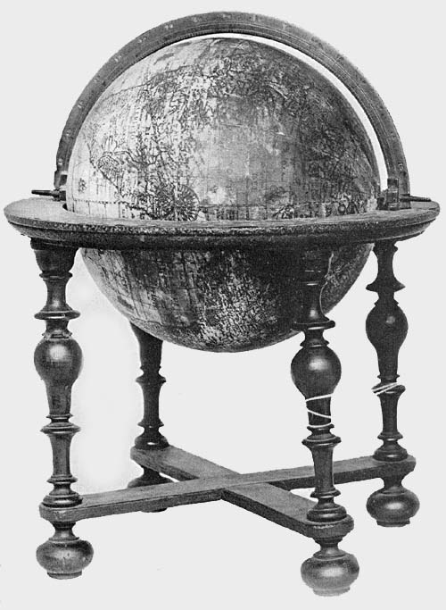
The Hispanic Society of America possesses a terrestrial globe signed Jodocus Hondius and dated 1618 (Fig. 91). Jodocus the elder died in the year 1611, and while the map of this globe may be a reprint of one which he had engraved, it should be noted that it does not agree in all of its details with any other known globe of his, and may therefore be the work of the son. The sphere of papier-mâché has a diameter of 20 cm. and is supported on a base of wood which includes a horizon circle, having pasted on its surface the usual representations of zodiacal signs, the calendar, and the names of the principal winds or directions. This horizon circle rests upon four small turned legs joined at the bottom by cross bars, covering which bars is a circular turned disc 22 cm. in diameter, from the center of which rises a short post. Through a slot in this post passes a graduated meridian circle within which the globe ball revolves.
The map is slightly water-stained, but the American portion is particularly well preserved. A crack in the sphere along the meridian of 150 degrees east extends from pole to pole, and is rather a disfigurement than a serious injury to any part of the surface. The map is a remarkably fine example of the Dutch map engraver’s art. The lettering and the continental outlines were remarkably well cut in the copper plate used in the printing, and in many places the luster of the ink is still preserved. In the northern part of North America is the brief and interesting dedication “Clarissimis 15Consultissimique Nauticae Belgicaeque Federatarum Inferioris Germaniae Regionum Praefectis D. D. Jodocus Hondius.” “To the most illustrious and most prudent prefects and seamen of Belgium and of the region of lower Germany, Jodocus Hondius gives and dedicates (this globe).” In the “Terra Australis incognita” is the address to the reader which is practically identical with that to be found on the Hondius terrestrial globe of 1601, omitting, however, the word “Vale” and changing the date to “1618.” Near the entrance to Hudson’s Bay is a legend reading “Huc retrocesserunt Amstelodamensis anno 1612.”
From this bay an arm extends to the southwest which is referred to as “The bay where Hudson did winter,” and an arm extends to the southeast, which is referred to as “The Bay of Gosneres.” A few other brief legends are given, referring to an event or to events supposed to have taken place in the locality in which they are placed. Small but artistically engraved ships sail the Atlantic and the Pacific, and here and there a marine animal is represented. Loxodromic lines are made a conspicuous feature, having their crossing centers at longitudes 0, 90, 180, and 270 on the equator, likewise on the prime meridian at latitude 35 degrees both north and south, as well as at the same latitudes on the opposite side of the sphere, where the prime meridian becomes the meridian of 180 degrees. In addition to this example belonging to The Hispanic Society’s collection, one may be found in the Germanisches Nationalmuseum of Nürnberg.13
Not until the year 1640 do we find the name Hondius again appearing on a dated globe. Attention has been called to the fact that Henricus, the son of Jodocus, continued, with more or less diligence, the work of map engraving and map printing, which the latter had carried on so successfully in Amsterdam until the time of his death. We are told that a partnership in the business, about the year 1639, was formed by Henricus Hondius with Johan Janssonius, his16 brother-in-law, and that this business, after the year 1644, passed entirely into the hands of the latter. It was in the year 1640 that the firm referred to undertook the reissue of the Hondius globes of earlier date. These had a diameter of about 52 cm. The gore maps, consisting of twelve parts, were made to extend to within twenty degrees of each pole, the polar space being covered with the usual polar cap.
The address to the reader, to be found on the terrestrial globe of the year 1613, is repeated on this of 1640,14 but the dedication differs somewhat in the two, reading, on those of the 1640 issue, “Illustrissimis, Nobilissimis, Amplissimis et Prudentissimis Foederatarum Inferioris Germaniae provinciarum Ordinibus ac Patribus Patriae Dominis suis clementissimis dedicabat Henricus Hondius. Henricus Hondius excudebat An. 1640.” “To the Most Illustrious, Most Noble, Most Exalted and Prudent Lords of the United Netherlands, the Fathers of their Country, his Most Clement Master, Henricus Hondius dedicates (this globe). Constructed by Henricus Hondius in the year 1640.” There have been added a number of interesting legends, such as the following: “Inter S. Laurentii et los Romeros insulas vehemens admodum est versus ortum et occasum fluxus et refluxus maris.” “Between the islands of St. Lawrence and Los Romeros there is an exceedingly strong ebb and flow of the sea eastward and westward”; “Psitacorum regio sic a Lusitanis appellata ob eorum avium ibidem magnitudinem.” “The region of the parrots, and this is so called by the Portuguese because of the great number of these birds found here”;15 “Promontorium terrae australis distans 450 leucas a capite Bonae Spei et 600 a S. Augustini.” “This promontory of the southern land is distant 450 leagues from the Cape of Good Hope, and 600 from Cape St. Augustine”; “Accolae Freti Magellanici septentrionem versus procerae, meridiem vero versus exiquae magnitidinis reperiuntur.” “The inhabitants of the Strait of Magellan toward the north are of large size, but toward the south they are of17 small stature”; “Lybia inferior quae hodie Saara appellatur quae vox idem quod desertum significat.” “Lower Lybia is called today Sahara, which word means desert.” In the Hudson Bay region we find, “In sinu Maris Hudsons Bay vulgo dictus ubi M. Hudson hybernavit, ibidem maris aestus non ultra duos pedes accrescebat, quod et observabit D. Thomas Jacobus a. 1631 in sinu ‘James his Bay’ dicto et ubi mensuram duorum pedum non excedebat maris tumor.” “In the bend of the sea called Hudson’s Bay, where Hudson passed the winter, the tide of the sea did not rise more than two feet, which also was observed by Thomas James in the year 163116 in the Bay called James his Bay where the rise of the sea likewise did not exceed two feet.” Near the last-quoted legend we find, “Thomas Button hibernans in portu Nelson ad altitudinem grad. 57 observavit singulis ex horis aestum maris accrescere 15 pedes aut ultra, qui flante Zephiro solito magis instar plenilunii intumescebat. Sequenti aestate animadvertit quoque ad altitudinem grad. 60 similes aestus maris qui nunc orientem versus nunc occidentem vergebant.” “Thomas Button,17 who passed the winter in Port Nelson, at the high latitude of 57 degrees, observed hour by hour the tide of the sea to rise 15 feet or more, which tide, with the accustomed wind blowing, swelled very like a (spring) tide. Next summer he noticed at a latitude of 60 degrees similar ocean tides which now had an eastward flow and now a westward.” A legend has been added relating to the magnetic poles and to the difficulty of locating the same, reading “Duos in hoc loco Gerardus Mercator et alii eundem secuti posuerunt Polos magnetis, unum respectu insularum capitis viridis, alterum respectu insulae Corvi et Floridis: cum vero de his nihil certi sit, et quotidiana experientia nos aliter doceat de deviatione acus nauticae ambos omissimus.” “Gerard Mercator and others following him have placed two magnetic poles in this locality, one according to the direction indicated (by the compass needle) at the Cape Verde Islands, the other according18 to the direction indicated at the Islands of Corvus and Flores: but as nothing is known for a certainty concerning these, and a daily experience teaches us otherwise concerning the variation of the magnetic needle, we have omitted both poles.”18
The globes of this edition were supplied with the usual brass meridian circles, wooden horizon circles, on the surface of which was pasted the printed representation of the zodiacal signs, the names of the months, and of the principal winds or directions.
The celestial globe follows, in its records, more closely than does the terrestrial, the issue of 1613. The title legend, the reference to Tycho Brahe, and the reference to the star which appeared in the year 1572 in the constellation Cassiopeia, all agree with those in the earlier edition, as do, in the main, the representations of the figures of the several Ptolemaic constellations and those added in the southern hemisphere. The dedication reads, “Illustrissimis Nobilissimis Amplissimis Clarissimisque D. D. Dominis Ordinibus Provinciarum Foederis Belgici Dominis suis Clementissimis in assiduae gratitudinis memoriam dat, dicat dedicatque Illustriss. Amplit. Vest. devotus Henricus Hondius.” “To the Most Illustrious, Most Noble, Most Exalted, Most Renowned Lords of the United Provinces of Belgium, his Most Clement Masters, as a memorial of constant gratitude, gives and dedicates to Your Illustrious Highnesses (this globe). Henricus Hondius.”
A copy of each of these globes of 1640 may be found in the library of the Seminario Vescovile of Portogruaro, a copy of each in the Biblioteca Quiriniana of Brescia, and one of each, though undated, in the Museo Civico of Vicenza.
If the Van Langren family and the Hondius family brought renown to their country through the excellence of their work in the field of cartography, so likewise did the Blaeu family, father and sons. Perhaps to Willem Jansz. 19Blaeu (Fig. 92) and his son, John, belongs first place in the long line of distinguished map and globe makers of the Netherlands.19
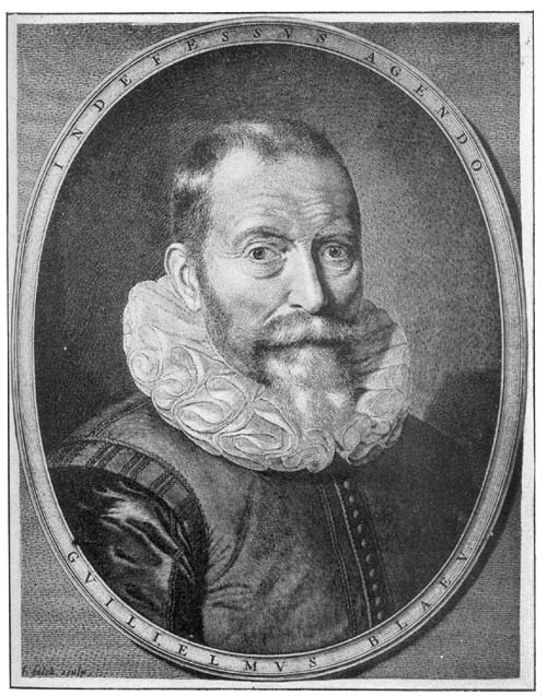
A record which finds general acceptance tells us that Willem Blaeu was born in the village of Alkmaar in the year 1571.20 Of his childhood years very little is known. It was some time in his early boyhood that he went to Amsterdam, where he found employment, it appears, at first in the house of a Holland merchant, and later as a joiner’s apprentice. We can be certain neither of the time when he decided to leave Amsterdam, nor of the exact circumstances which induced him to visit the island of Hveen, then belonging to Denmark, an event of much significance in his life. We, however, cannot be far wrong in asserting the promptings for this visit to have been his early liking for mathematical, geographical, and astronomical studies. It was here that he first came into intimate relations with Tycho Brahe, the famous Danish astronomer, who, in the year 1576, through princely favor, came into possession of this island, and, as before noted, had erected here his remarkably well-appointed astronomical observatory, which he called Uranienburg.21 For nearly a quarter of a century this was one of the most famous centers in all Europe for the study of astronomical science and of its practical application. Blaeu, however, was not the first of the young Netherlanders to find the way to Uranienburg to receive instruction from the great master.22 Of his sojourn on the island we have but little direct information. It appears certain that he passed at least two years with Tycho, engaged the while in study and in the construction of mathematical and astronomical instruments. That the relations between the two distinguished scientists continued to be of the most friendly character after Blaeu returned to Amsterdam is very certain. Not a few of those who in later years praised Blaeu’s scientific attainments refer to him as “the pupil and longtime friend of Brahe,” and Blaeu himself, in certain legends20 appearing on his globes and maps, refers to him as his teacher. It cannot be doubted that Blaeu owed to his abode on the Island of Hveen the real foundation of his scientific knowledge, both in the field of geography and astronomy, as well as his knowledge of the construction and the skilful use of mathematical instruments. We have reason for believing that a number of the instruments which served the great astronomer in his investigations23 were the work of Blaeu, and it is an interesting fact, as we know, that Brahe’s observations, here made, formed the basis for Kepler’s calculations, leading him to the discovery of the laws which immortalized his name.24
It was perhaps late in the year 1596 or early in the year 1597 that Blaeu returned to Amsterdam, where he soon established himself as a maker of mathematical instruments, of maps and of globes, and as an engraver and printer. There is good reason for thinking that from the first he prospered in his undertakings, and, from incidental references to his activities, it may be inferred that it was not long after 1600 he was in his own fully equipped house. From his presses numerous works were issued, the many examples of which, still adorning the shelves of most prominent libraries, are a monument to his great abilities.
On his ‘Paescarte,’ one of his earliest publications,25 and usually referred to the year 1606, we read that it was “Ghedruckt t’ Amsterdam bij Willem Janssoon op’t Waeter inde Sonnewijser,” a location often referred to in certain later publications as “op’ t water In de vergulde Sonnewyser,” reference here being to the gilded sundial which, as a business sign, adorned the gable of his establishment. It appears that in this originally selected locality his work was carried on until the year 1637, when his entire plant was moved into more commodious quarters in the Blumengracht, one year only before his death. The sons, John and Cornelius, succeeded to the business, and to the former especially belongs the credit of issuing the most sumptuous atlas21 in that period of remarkable map making.26 In the year 1672 practically the entire establishment was destroyed by fire.
Willem Blaeu’s training admirably fitted him to serve his country in matters pertaining to its maritime interests, and its calls as well as its rewards for service were not infrequent. As proof of the confidence that his contemporaries had in his knowledge of geography and navigation, the Estates General of Amsterdam, January 3, 1633, by resolution, appointed him Map Maker of the Republic, an honorable position held by him until his death, then being successively passed on to his son and to his grandson.27
We are told that Tycho had given to Blaeu a copy of his astronomical observations before their publication, that this copy was carried to Amsterdam, and that after a careful study of the records contained therein the latter began the practice of globe making.28 The implication contained in this reference is that his first work as a globe maker was the preparation of material for a celestial globe, but no such globe of his, bearing date earlier than 1602, is known. His first dated work appears to have been a terrestrial globe of the year 1599. In many of its features it gives evidence that Mercator was the master followed, notably in the representation of the loxodromic lines which radiate from the numerous wind or compass roses, or from centers regularly placed on the surface of the globe.
This first issue has a diameter of 34 cm., which is less than that of Mercator’s globe of the year 1541, but greater than that of the Van Langren globe of the year 1585.29 The gores, twelve in number, were cut seven degrees from the poles, the polar space being covered with a circular disc. Blaeu, as many other globe makers of his period, found that by thus dividing the engraved globe map a more nearly perfect covering for the sphere could be obtained. Meridians and parallels are drawn at intervals of ten degrees, the prime meridian passing through the island of Santa Maria in the Azores group. In a conspicuously placed cartouch he presents22 his address to the reader. “Spectatori meo S. Hanc terrae marisque faciem qui aspicis sic inspice ne dispicias: multa hic mutata, (sed nihil temere) quae, nisi attendas, facile fugiant. Ratio constructionis in multis nova, sed proba. Gibbum plano, planum globo commutavimus: duplicato labori: sed certiori: idque ut ventorum spirae justis per orbem trrarum gyris discurrerent: hinc factum ut in omnibus terrae oris praeter parallelorum et meridianorum etiam plagae ratio nobis fuerit habenda. Quae quidem omnia attento spectatori facile apparebunt. Vale et fruere. Guilielmus Jansonius Alcmariensis auctor et sculptor. 1599.” “Greeting to my observer. This representation of the earth and sea, which thou beholdest, be pleased to take note of in this manner. Many things here have been changed, but nothing without reason, and unless thou art attentive these things might easily escape thee. The method of construction is in many points new, but correct. We have changed that which is relief into the flat, and the flat into the globular, a double labor but more nearly correct, and we did this that the directions of the winds throughout the world might be given their proper (loxodromic) spirals: and we have made a representation of the coast lines of all shores of the earth, besides a representation of the parallels and meridians. All this will be seen by the attentive observer. Farewell, and may you be happy. William Jansz. Alcmar, author and sculptor. 1599.” Fiorini is of the opinion the expression “multa hic mutata” in the above quoted inscription indicates that the copies in which it is found are reprints of an earlier edition, and that it has been inserted for the purpose of keeping the globe on sale. Is not the reference rather to this simple fact that Blaeu borrowed much of his geographical information from others, as he admits, including Mercator and Van Langren, and that he had merely altered the same to the end of bringing his records to date? The dedication reads “Noblissimis, Amplissimis, Clarissimis, D. D. Dominis Ordinibus Foederatarum Inferioris23 Germaniae Provinciarum dignissimis fidis Patriae Patribus hoc terrae marisque Theatrum L. M. Q. Dat, Dicat, Dedicat Cliens Vester subjectis. Guilielmus Jansonius Alcmarianus.” “To the Most Noble, Most Distinguished, Most Illustrious, Lords of the United Provinces of Lower Germany, Fathers of their Country this representation of the land and the sea gives, grants, and delivers your humble client Willem Jansz. Alcmar.” It will be noted that the family name Blaeu was not employed in the signature, but instead Alcmar, the name of his native place. He apparently did not consider it essential always to employ the same name. Sometimes he gave this as Guilielmus Jansonius Blaeu, Guil. Jansz. Blaeu, Guiljelmus Blaeuw; sometimes he gave it as Guilielmus Janssonius Alcmarianus, or Guil. Jansz. Alcmar; sometimes as Guiljelmus Caesius or J. G. Caesius, in which he had classicized his name Blaeu; sometimes the name is coupled with that of the son as Guil. et Johan Blaeu. The legends on this globe are numerous which tell of great discoveries and explorations, of which the principal ones are here quoted from Baudet’s readings from the Leiden copy. Near the north pole we find “Hic tandem passi graviora Batavi, proxima tempestate diversum iam iter ingressi, nostrum altius mundi verticem versus progressi, ignotas quaerere terras, et si qua proprior ad Chinam aditus aggressi sunt. Mirum quid invenerint! immane quid evenerit! Sic, macte Proles Neptunia novisque honoribus hanc gentem nostram cumula, male coepisti, si hic sistas. Durum hoc, sed perdura, nec cede malis sed contra audentior ito. Fata viam expedient.” “As far as this, after suffering great hardships, the Dutch, in recent times have progressed toward the top of the world, seeking unknown lands, and if there is any shorter way to China. Wonderful are their discoveries! Strange things have happened! Go on, O blessed progeny of Neptune, and add new honors to our race. You have begun ill if you stop here. It is a hard task, but endure. Do not yield to misfortune, but24 on the contrary be more daring. Fate will clear the way.”
In the same locality “Immortale nomen & gloriam incomparabilem vobis, Columbe et Americe comparastis, Qui primi has terras (alteram orbis partem) tot iam secula latentes adire, detegere, lustrare et utinam perlustrare voluistis: Fructs vero maximos multis perperistis.” “Ye have gained an immortal name, and incomparable glory for yourselves, Columbus and Americus, who were the first to approach these lands to discover and disclose them (the other part of the world) unknown for so many centuries, and I would that you had desired to explore them. You have brought forth much fruit for the many.” Another reads, “Magnam porro gloriae partem Ferdinande Magellane, iure tibi vendicas: cui ... vastae regionis Australem terminum quaerere eamq. freto cognimini nobis perviam facere lubuit & licuit.” “A large share of the glory thou doest rightly claim, O Ferdinand Magellan, to whom it was pleasing and to whom it was allowed to seek the southern bounds of a vast region, and to open the Strait for us that bears thy name”; also a legend referring to the Cortereals, “Utinam vero par eventus Casparo Cortereali contigisset, qui iam ante maiori conatu quam successu transitum a Borea attentaverat: et quoties Britannis idem fervide molientibus et aeris iniutiis gradum revocare coactis.” “I wish that like success had come to Gaspar Cortereal, who before, with greater effort than achievement attempted to find a passage by way of the north. Likewise to the British (I wish success) strenuously attempting the same but forced to retreat by reason of adverse weather.”
As in the issue of his sheet maps, Blaeu was not always careful to add an exact date of preparation, in the majority of instances, indeed, omitting the date altogether, so also in the issue of his globes he frequently omitted dates or gave one which we know to have been later than was that of the original issue. His geographical records serve us, however, as fairly accurate guides in the determination of25 these dates, and what was so frequently true of the globes he constructed in the last years of his life was true of this his first. We have, for example, copies of this bearing date 1599, which contains geographical records of the year 1616, indicating therefore a later reprint with a few alterations.
It was not until the year 1603 that he undertook the preparation of a celestial globe to serve as a companion of his first terrestrial. This he dedicated, “Illustrisso Principi ac Domiōauritio, Principi Auraico Comiti de Naussau etc., Marchioni Veriae et Flissingae etc., Domino suo Clementissimo, Hos astriferum, stellarum arte coelo deductarum, coelum Gratus M.O.D.D.C.Q. Guilielmus Jansonius Alcmarianus.” “To the Illustrious Prince and Lord D. Maurice, Prince of Orange, Count of Nassau, etc., Marquis of Veria and Flissingen, etc., his Most Benign Lord, this globe of the stars brought down from heaven by art is gratefully dedicated by its maker with dutiful mind. Willem Jansz. Alcmar.” In his title legend he makes particular reference to his teacher Tycho, which legend reads: “Sphaera stellifera. In qua ut speculo quondam firmamenti Universaum Syderū ornatum ac stellarum ordinem summa, qua fieri potuit, industria a Guilielmo Jansonio, magni Tychonis quondam discipulo, accuratissime disposititum: earumque numerum multo quam hactenus, auctiorem ex observationibus recens. a Nob. viro D. Tychone Brahe, astronomo incōparabili, habitis, depromta anno 1600, et quo deinceps seculo, accommodata intueri liceat.” “Celestial sphere. Herein as in a mirror all the stars of the firmament are depicted, and in proper order with the greatest possible industry and accuracy by Willem Janson the former pupil of the great Tycho: their number much increased from recent observations made by the noble D. Tycho Brahe, that incomparable astronomer, taken from his observations made in the year 1600, and made with an accommodation for the coming century.” Near this cartouch is a portrait of the great astronomer with his favorite motto, “Non haberi, sed26 esse.” Near the south pole we find a reference to recent astronomical discoveries in the following words: “Habetis hic, Astronomum studiosi, trecentas et plures antarctici mundi vertici viciniores stellas, ex observationibus secundum jam a Frederico Houtmanno, majori studio et accommodatioribus instrumentis, ad stellas a Tychone positas factis, depromptas: auctiori numero et accuratiori dispositione vestro commodo et delectationi depictas A. 1603.” “Thou hast here, O student of astronomy, more than three hundred stars, that are nearest the pole of the antarctic world, from the observations made by Frederick Houtmann with further study and with more suitable instruments, along with the stars that were located by Tycho: this increased number and this more accurate location having been set down for your use and delight in the year 1603.” He adds here and there a brief legend in which he directs attention to recently discovered stars.
The purchase of a pair of these globes, that of 1599 and of 1603, was reported in the year 1885 by Dr. Baumgärtner,31 who refers to them as having a diameter of 34 cm., as being well mounted and artistically colored. On the first, he notes, are represented sea monsters swimming in the oceans, and the natives of many of the little known regions appear in picture, as, for example, in the region of Patagonia, near which appears the legend, “Patagonae regio ubi incolae sunt gigantes.” “The region of Patagonia where giants live.” Greenland is laid down as a small island, as is also Corea. The region of Bering Sea shows clearly how inexact was the knowledge of the North Pacific in his day, and the same inexact geographic knowledge of the southernmost region of South America and of Australia is strikingly recorded. There are slight differences apparently existing between Dr. Baumgärtner’s globes and certain other known copies of the same date, but differences which are of no special significance.
A pair of these globes was announced in the sales catalogue,27 “Geographie cartographie & voyage, 1891,” of Frederik Muller of Amsterdam. A geographical record on the terrestrial globe clearly indicates that it was not issued, however, until after 1616, although dated 1599, since it contains a reference to the Van Schouten voyage of 1615-1617. It was on this voyage, says Van Schouten in his ‘Journal,’ that he gave the name “Staten Lant” to that region on the left as one enters the Lemaire Strait, and the name “Isle of Barnevelt” to the island discovered in this strait.32 Both of these names appear on this globe. It has in addition an interesting legend which might be taken to suggest that the globe was not constructed until the year 1682, although the gores, save for this legend, may have been printed much earlier. This legend reads, “’t Amsteldam by Joannes van Ceulen, Joanniszoon op de hoek van de Mol-steegh, in de Nieuwen Atlas, werd gedruckt en op nieu uytgegeven met Praevilegie ... alle de Globes en Spaeren by den Heer Joan Blaeu Zal. nagelaten. Ao. 1682.” The celestial globe seems to agree with other known copies.
Two copies of the terrestrial globe of 1599 and two of the celestial of 1603 may be found in the Germanisches Nationalmuseum of Nürnberg. A pair may be found in the Biblioteca Angelica of Rome and a pair, reported to be in good condition, belongs to the Biblioteca Comunale of Fano. Adam Kästner reports, in his ‘Geschichte der Mathematik,’ the purchase of a pair of this first edition of Blaeu’s globes.33 According to a catalogue entry of objects belonging to the University of Leiden in the year 1716 there is reference to two pairs of Blaeu’s globes. Only one pair of these, however, seems now to be known, which pair a few years since was removed to the Astronomical Observatory.34
In the year 1602 Blaeu issued a terrestrial and a celestial globe, each having a diameter of 23 cm. In a legend on his terrestrial globe he refers to it as an improvement, doubtless meaning that he had undertaken to bring its geographical records to date. This globe he dedicates as follows:28 “Noblisis Illustris Hollandiae Zelandiae ac Westphrisiae ordinibus, P.P.P. Clementissis hanc terrae marisque aphaerum summa diligentia accuratissime fabricatam: debiti honoris gratique animi testimonium L.M.D.D.D. Amstelodami. Guilielmus Jansonius Blaeu. anno 1602.” “To the Most Noble, Most Illustrious Princes of Holland, Zeeland and West Friesland, Most Benign Rulers. This sphere of the earth and sea, accurately constructed with the utmost care is dedicated by Willem Jansz. Blaeu of Amsterdam as a testimony of honor due and of a grateful mind. In the year 1602.” Over this legend have been placed the coats of arms of the three provinces designated and near it a legend reading, “En denuo studiose Geographiae, terrestrem contractioriforma globum, multo, quam ante hac unquam, emendatius et auctius confectum: a ventorum spiris navigantium comodo, exquisitius adornatum: nec non navigationis curriculo, ab Oliverio van Noort Batavo in orbem peracto, notatum. Auctor Guilielmo Iansonio Blaeu.” “Here again, O student of geography, thou hast a terrestrial globe in smaller size, much smaller than ever before, and more accurately and completely furnished, having the spiral directions of the winds (the loxodromes) represented for the use of navigators. These have been carefully drawn, and there is also indicated the course of circumnavigation of the Dutchman Oliver van der Noort.35 Willem Jansz. Blaeu author.” Van der Noort, to whom reference is made in this legend, had started out in the year 1598, hence his expedition was a recent event and was therefore thought worthy of reference. He sailed through the Strait of Magellan, reached the Indies of the East, and with four of his original ships returned to Holland in the year 1601. Blaeu, as he states, marked on his globe the course of this expedition. The celestial globe constructed as a companion of the former has a similar dedication reading, “Nobilisis Illustis Hollandiae Zelandiae Westphrisiae Ordinibus D. D. suis Clementisis hunc astriferum inerrantium stellarum globum, summa cura et industria29 adornatum debiti ossequii et gratitudinis ... D. D. D. Guilielmus Jansonius Blaeu.” “To the Most Noble, and Illustrious Princes of Holland, Zeeland, and West Friesland, Most Benign Rulers: this celestial globe of the fixed stars, prepared with the greatest care and industry is dedicated as a gift of obedience due and of gratitude. William Jansz. Blaeu.” A legend somewhat descriptive in character near the former reads, “Habes hic Astrophile stellarum inerantium ex certisis D. Ticho Brahe (mei quondam praeceptoris) observationibus numero et dispositione prae aliis an̄o 1600 accomodatarum sphaeram accuratissime expolitam et Australibus asterismis quod novum a Federico Houtmano observatis exornatam. Auctor Guilielmo Janso Blaeu.” “Thou hast here, O lover of the stars, a globe of the fixed stars from the most accurate observations of D. Tycho Brahe (my onetime preceptor) in their number and disposition, besides other observations accommodated to the year 1600, finished and furnished with (a representation) of the southern stars which have of late been discovered by Frederick Houtmann. Willem Jansz. Blaeu author.” Stars varying in magnitude from the first to the sixth, receive each an appropriate representation or sign, and there is a separate distinguishing mark for the nebulae. To each of the constellations is given its Latin name. In addition to the forty-eight constellations of Ptolemy he gives the two sometimes referred to by the ancients, “Bernice’s Hair” and “Antinous,” adding, with names, more than ten constellations in the southern sky. A legend in the constellation “Cepheus” tells us, with reference to one of its stars, “Haec stupendae magnitudinis stella insolito fulgore anno 1572 in Cassiopeia sede amicuit.” “This star of great size and unwonted brilliancy appeared in the Chair of Cassiopeia.” In the constellation “Cygnus” is a legend reading “Novam illam stellam quae anno 1600 primum in pectore Cygni apparuit (atque etiam nunc immota parte) ex diligenti nostra ad eandem Lyrae lucidae observatione Longitudo 16° 15´, latitudo30 55° 30´ labore comperimus.” “The new star which in the year 1600 first appeared in the breast of the Swan and to the present has not altogether disappeared, this we have located, by diligent search in Lyra long. 16° 15´ and lat. 55° 30´.”
By reason of the fact that so few copies of this issue are known to exist, it has been thought that for some reason Blaeu issued a very limited number. We know, however, that his terrestrial globes were highly valued and were much in demand, because of the care with which they had been prepared, because of the efforts to give information concerning the latest discoveries, and because of his representation of the loxodromic lines which made them of special value to navigators; that his celestial globes found favor by reason of the fact that he was known to be a pupil of Tycho Brahe, and that he himself was known to be a mathematician and astronomer of distinction. To the following known examples of the 1602 issue brief reference may be made. In the Accademia dei Concordi of Rovigo, Italy, there may be found a fine pair. The Stadtbibliothek of Nürnberg possesses a fine pair, reported by the librarian to be in excellent condition, and two copies of the celestial globe may be found in the Germanisches Nationalmuseum of the same city. A copy of the terrestrial globe is to be found in the collection of the Königliches Museum of Cassel, and one in the town of Rüdingen near Schaffhausen.
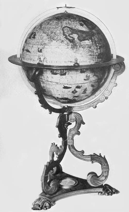
The Hispanic Society of America possesses, in its rich collection of globes, a fine example of Blaeu’s terrestrial of the year 1606 (Fig. 93). It has a diameter of 13.5 cm., is mounted on a substantial wooden base, has a graduated meridian circle, half of which, however, is missing, a wooden horizon circle, on the upper surface of which is pasted an engraved slip of paper with the usual graduation, the calendar, and the names of the zodiacal signs. A legend in the great austral land which is called “Magallanica,” contains the date and refers to its dedication to Blaeu’s learned friend of Edam, Cornelius Petrius. This legend reads 31“Omnium virtutū genere ornatissimo viro Domino Cornelio Petreio ecclesiastae apud Edamenses vigilantiss. et mathematico eximio suo singulari hanc orbis sphaerae a se hoc modo delineatae L. M. Q. D. D. Guilielmus Blaeu. Anno D. 1606.” “To Dom. Cornelius Petrius, a man adorned with all virtue, a most vigilant ecclesiastic among the people of Edam and a mathematician of singular renown, Willem Blaeu dedicates this terrestrial globe now completed by him in the year 1606.” In the northern part of North America is the title legend reading “Nova et accurata terrae marisque sphaera denuo recognita et correcta a Guilielmo Blaeu.” “A new and accurate sphere of the earth and sea newly revised and corrected by Willem Blaeu.” The globe ball is of hollow metal thinly covered with a preparation of plaster on which have been pasted the twelve engraved gores extending from pole to pole. As in the case of the Muller copy of the issue of 1599 this one, though dated 1606, contains a record of the discoveries of the Van Schouten expedition, that is, the names “Staten Lant,” “I. Barnevelt,” and “Fr. le Maire,” discoveries made in the year 1616, as before mentioned.36 The magnitude of the austral land is made to equal or to exceed that of the entire Old World, the most northern extension of which, in the East Indian region, bears the name “Nova Guinea.”37 Its geographical information in general agrees with that so carefully recorded on the Blaeu maps. In the western and southern sections of North America the source of information has been largely Spanish, in the eastern the source has been French and English, and in the northeast almost entirely English. In the north Atlantic we still find “Brazil,” “Maides,” and “Frisland,” the mythical islands of the Zeno Brothers, and north of Europe a record of the attempts of the Netherlanders to reach “Nowaja Semlja.” For so small a globe the detailed geographical information given is very remarkable.
In addition to this example the British Museum kindly sends the information that in its collection there is a copy32 of Blaeu’s terrestrial globe of the year 1606, agreeing in its dimensions with the copy in the collection of The Hispanic Society of America, also of a celestial globe of the same date which appears to be a unique copy.
The Hispanic Society of America also possesses a terrestrial and a celestial globe, the work of Blaeu, globes clearly issued as companion pieces (Fig. 94), which appear to be the only copies known, the latter dated 1616, the former undated.38 The spheres have each a diameter of about 10 cm., a substantial and artistic mounting of brass, including meridian and horizon circles, four twisted support columns, and a circular base plate. Though small in size, probably the smallest constructed by Blaeu, in their geographical and astronomical details they are remarkably full.
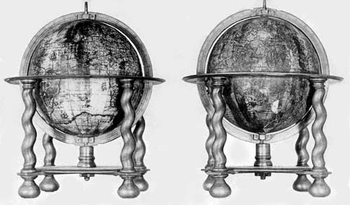
The terrestrial globe, in an artistic cartouch near the south pole, is referred to as “Nova Orbis Terrarum Descriptio Auctor Guilielmo Blaeu.” “A new description of the world by Willem Blaeu author.” Unlike that of the year 1606, noted above, it contains no reference to the expedition of Van Schouten and Le Maire, and records only the Strait of Magellan at the southern extremity of South America. Continental contours, even that of “Magallanica” and of the New World, agree in practically all details with his earlier globes and general world maps. He has retained certain geographical names which appear more or less conspicuously on some of the earlier maps, as “Estotiland” north of Labrador, “Frisland” and “Island” in the north Atlantic and “Norembega” applied to the coast of Maine. The north Pacific is entirely too narrow and the island of “Japan” is located not far from the west coast of North America. Bering Strait is well represented but is unnamed. The map is not well preserved, the chief injury to it being in the western part of North America and in the central and eastern Pacific.
The celestial globe, which is the companion of the former, has a similar brass mounting. It is remarkably well 33preserved and all inscriptions on the surface of the ball are easily legible. It is made to revolve about the axis of the ecliptic. The figures representing the several constellations have been artistically engraved, and stars up to the sixth magnitude have appropriate and distinct representation. A legend near the south pole reads “Sphaera stellata in qua ceu speculo Stellae fixae ex accuratis Nobilis viri D. Tychonis Brahe observationibus ad annum 1600 accommodatae conspicuae sito ponuntur.” “The starry sphere in which as in a mirror the fixed stars are placed by the accurate observations of the Noble D. Tycho Brahe, accommodated to the year 1600.”
Blaeu’s earliest globes, as has been noted, were of small dimensions. It must have been shortly after the year 1616 that he decided to undertake the construction of those of much greater size, to the end of making his work the more serviceable; but to this he may have been led in part, as before noted, by the success of the large globes of Hondius of the year 1613.39 Unfortunately it is not easy to determine the exact date of the several issues of his work appearing in the last twenty years of his life. In general, the date of the construction of the globes of these years is altogether wanting. The dedications in the several reprints or editions vary, as do many of the inscriptions, while the large size of the globes remains practically the same. One cannot feel certain that a date, apparently given as the year of construction, is accurate, since it is very evident in the several reprints care was not always given to this detail.
The first issue of his large terrestrial globes seems to date from the year 1622, though the suggestion is not wanting that he had actually completed the celestial globe before the close of the year 1616.
With but slight variation in the form of the expression, we find on all examples of his largest globes the inscription “Amstelredami. Excusum in aedibus auctoris ...,” indicating at least that the printing was done in the author’s34 Amsterdam workshop. All have a diameter of about 68 cm., though the mountings of the several known examples differ somewhat.
The Hispanic Society of America possesses a fine example of the terrestrial globe, dated 1622 (Fig. 95). The ball is formed of papier-mâché, having over its surface a thin coating of plaster made perfectly smooth and shellacked to receive the thirty-six engraved gores, or twice eighteen half gores, and the usual circular polar caps. It is well preserved, considering its great size and its age, though somewhat injured in the region of the western Mediterranean, in the East Indian Islands, in West Africa, in South America, and in parts of the Pacific Ocean. It is furnished with an elaborate wooden base, a considerable part of which appears to have been added subsequent to that constituting the main support, a horizon circle of wood, and a meridian circle of brass. The map is a fine example of the work done in the Netherlands by the copper engravers and printers of the period, in particular of the work which issued from the Blaeu press. Continental outlines are well drawn, lands and seas are crowded with geographical records, including individual names and legends. Very artistically designed ships sail the oceans singly or in fleets, and compass lines as well as loxodromic lines are very numerous, radiating from centers distributed over the surface of the map. Much of the original color which had been artistically applied by hand still remains, particularly on the southern hemisphere, which has been less exposed to the light and to careless handling. The author and date legend placed near the south pole in an artistic cartouch reads, “In ista quam exibimus, terreni globi descriptione omnium regionum juxta et insularum, quotquot hacetnus a nostris Argonautis, vel etiam ab aliarum gentium Naucleris visae et notatae, loca in suo secundum longitudinem et latitudinem situ, summa sedulitate et industria disposita invenies, quae res non solum Geographiae studiosis jocunda, verum etiam iis, qui terras longe dissitas et sub alio 35sole calentes frequentent, maxime utilis futura est. In quorum gratiam etiam rhombus nauticos (ita vocantur Helices lineae secundum ventorum plagus delineatae) quam accuratissime expressimus. Hunc igitur laborem nostrum ut tam Gratis animis accipiatis, quanta sedulitate a nobis est obitus, ex aequo omnes rogatos volo. Guiljelmus Caesius Auctor. Anno CICICCCXXII.” “In this terrestrial globe, which we here present, you will find all the regions and islands as far as they have been seen, up to the present, and marked by our navigators, or have been seen and marked by the navigators of other nations, placed in their own proper position of longitude and latitude, with the greatest care and industry, which not only will be a source of pleasure to the students of geography but also of the greatest utility to those who visit far distant shores, which are warmed by another sun. And for their benefit we have also inserted the nautical rhombs (for so are designated the lines which show the direction of the winds). This labor of ours I hope and pray you will accept with as much gratitude as we have bestowed care upon it. Willem Caesius. In the year 1622.” A citation of all legends which the author has placed on his map would indeed fill many pages, and but few of these are here quoted.
Fig. 95. Terrestrial Globe of Willem Jansz. Blaeu, 1622.
In the southern hemisphere, and particularly conspicuous by reason of the artistic cartouch in which it is placed, we find a reference to the question of the proper location of the prime meridian,40 somewhat lengthy but quoted here in full. “Quamvis longitudinis initium arbitrarium esset, ab occasu tamen ejus auspicium facere ideo veteribus placuit quod illic aliquis terrae limen esset, qui ortum versus nullis expeditionibus deprehendi potuisset. Atque eam ob causam Ptolemaeus (cujus sedulitati et industriae Geographiae incolumitatem omnes, vel inviti, debent) ab ultimo termino occidentis cognito, quae Insulae in Atlantico Mari Fortunatae dictae sunt, auspicium fecit in eisque primum Meridianum defixit: quod theticum principium deinceps fere omnes ejus36 auctoritate moti retinuerunt. Interim hoc seculo nonnulli hoc principium ex ipsa natura eruendum censuere. Qua in re acus Magneti junctae indicium sequendum sibi sumpserunt, eumque primum Meridianum statuunt quo in loco ea Boream spectat Quos plane allucinari addita illa Magneti vis convincit, penes quem nullum longitudinis arbitrium sit, cum is ipse sub eodem meridiano varium habeat enclisin prout huic aut illi continenti vicinus fuerit. Sed et illi ipsi qui ita sentiunt, ob instabile magnetis indicium, in primo Meridiano, multum inter se dissentiunt. Quamobrem ut summo Geographiae commodo, certus aliquis Meridianus tamquam primum principium servari et retineri possit, Ptolemaei vestigiis insistentes, easdem Insulas, et iis Junonem, quae Teneriffa vulgo creditur, delegimus, cujus excelsa illa et praerupta petra, perpetuis nebulis obsessa, Indigenis El Pico dicta, primi Meridiani terminus esto. Qua in re ab Arabum longitudinibus (qui extrema Africae littora versus occidentem delegerunt), vix unius gradus quadrante abimus diversi: quod quoque monuisse operae pretium putavi.” “Although the beginning of longitude is arbitrarily selected nevertheless it pleased the ancients to begin the counting of it from the west, because there was the limit of the earth, as some thought, while no expedition to the east was able to determine this. Therefore Ptolemy, to whose application and industry all men, even though unwilling to admit it, owe the preservation of geography (geographical science), made the location (of the beginning of longitude) in the farthest known limit of the west, which is called the Fortunate Islands, in the Atlantic Ocean, and in them he fixed the first meridian. This hypothetical beginning, almost all who came after him retained because of his influence. But in our century there are some who have said that this beginning should be taken from nature herself, and in this matter they have taken the indication of the magnetic needle as their guide, and fix the first meridian in that place in which the needle points to the true north: That this is clearly an37 error is proved by this additional (and peculiar) property of the magnetic needle, that on the same meridian it has a variation according as it is near to this or that continent. But the very men who think this, on account of the uncertainty of the variation, disagree much among themselves as to where the first meridian is to be located, and so for the highest good of geography, that this same fixed meridian as a first beginning may be marked and be retained, we ourselves, following in the steps of Ptolemy, have chosen the same islands as he, and from their number that one which is called Juno, or commonly Tenerif; of these (islands) that high and steep rock beset by perpetual clouds and called by the natives El Pico, shall for us be the location of the first meridian. In this matter, from the longitude of the Arabs, who selected the shore of Africa farthest toward the west, we vary scarcely the fourth part of a degree, and this I thought worthy to be noted.”
There is a brief but important legend near the Strait of Magellan reading, “Fretum Magellanicum, sic dictum a Ferdinando Magellano Lusitano, qui omnium primus id aperuit atque emensus est, anno 1520, Franciscus Draach et Thomas Candish, uterque anglus Fretum emensi sunt, ille anno 1579, hic anno 1587. Oliverius van Noorth et Georgius Speilbergius, uterque Belga annis 1600 et 1615.” “The Strait of Magellan, so called by Ferdinand Magellan a Portuguese who was the first to discover it and to sail through it in the year 1520, Francis Drake and Thomas Candish, both Englishmen, sailed through the strait, the one in the year 1579, the other in the year 1587. Oliver van Noort and George Spilbergen, both Belgians in the years 1600 and 1615.” Near the last-quoted legend we find “Fretum Le Maire a Wilhem Scouten Hernano et Jacobo Le Maire per eum inventum et lustratum Ao 1616.” “The Strait of Le Maire discovered and surveyed by Wilhem Scouten and Jacob Le Maire in the year 1616.” To the northwest in the Pacific we find “Magellanus ad insulas has38 delatus, cum in iis nec hominum ulla vestigia, nec quicquam humano usui opportunum invenisset, Infortunatus nuncupavit.” “Magellan came to these islands and finding in them no trace of man nor of anything suitable for human use called them the Unfortunate Islands.” Near New Guinea is the information recorded “Novissime detecta et lustrata est a Wilhelmo Scouten anno 1616.” “Very recently discovered and surveyed by Wilhelm Scouten in the year 1616.”
In the far north is a reference to the attempts made by numerous explorers to find a passage to the east by way of the north, reading, “Quemadmondum post apertum a Lusitanis iter illud ad regiones orientales, quod Promontorium Bonae Spei navigantes circumducit non defuere qui et ante Ferdinandum Magellanum, breviorem aliquam per Septentrionem Cauriumque ad easdem illas regiones opulentissimas ac toto orbe decantatus, Moluccas, indagarent viam: et nominatim quidem anno jam tum 1500, duobusque seqq. Gaspar et Michael Cortereales, fratres lusitani, et post eos anno 1507, Sebastianus Cabotus venetus: ita et post superatum jam a praedicto Magellano Fretum, quod de ejus nomine Magellanicum dicitur, extitere celebres aliquot praestantes naucleri, qui ne codem quidem itinere contenti, tum per easdem regiones septentrionales Caurique tractus, tum per Aquilonaria quoque Moscoviae Tartariaeque littora, idem tentaverint. Tales, ut alios nunc omittam, fruere anno 1553 Hugo Willoughbeus, Eques anglus, annis 1576 et 77 Martinus Forbisherus, et annis 1585, 86, 87 Ioannes Davisuis, uterque itidem anglus, item Guilijelmus Bernard et Ioannes Hugo Linschotanus, Batavi, annis 1594, 95 et 96. Quibus omnibus etsi, post incredibiles exantlatos labores, conatus non successissent, non destitere tamen Henricus Hudsonus, et ipse anglus ac post eum Batavi quidam Amsteredami emissi, eandem terram (quod dici solet) reciprocare. Is Hudsonus anno 1611, superato, ad Americae borealis oras, sub latitudinis 61, 62 et 63 gradu, ut indicat globus noster, praelongo freto, in exitu ejus engens ac late diffusum,39 invenit pelagus: cujus quidem detectio, multis spem addidit fore ut tandem inibi transitus aliquis inveniatur. Utrum vero huic spei eventus sit responsurus, propediem, quod vovemus, ipsum tempus ostendet.” “When the way had been opened by the Portuguese to the eastern regions which led the navigators round the Cape of Good Hope, there were some who said there was a way, even before Ferdinand Magellan, a shorter way by the north and the northwest to those opulent and world famous regions, the Moluccas. To name these, in 1500, the two brothers Miguel and Gaspar Cortereal, and after them in the year 1507 Sebastian Cabot a Venetian, and after the Strait had been navigated by the aforesaid Magellan, which is called the Strait of Magellan after him, there were certain famous and excellent navigators who, not content with a knowledge of this passage, attempted another both by the same northern and northwestern route and by the northern coasts of Moscovie and Tartary, among these, to omit others for the present, there were in the year 1553 Hugo Willoughby an English Knight: in the years 1576 and 1577 Martin Frobisher: in the years 1585, 86, 87 John Davis, both of the last named being Englishmen: also William Bernard and John Hugo Linschoten, Dutchmen, in the years 1594, 95, 96. Although none of these attempts, in spite of the Herculean labors, were successful, nevertheless Henry Hudson, himself an Englishman, and after him certain Dutchmen sent from Amsterdam, did not give up the attempts to find that land, as it was called. Hudson himself, in the year 1611, having navigated along the shore of North America in latitudes 61, 62, and 63, as our globe indicates, a very long inlet at its farthest extremity discovered an immense and far-stretching sea, the discovery of which gave hope to many that at last some outlet would be found therein. Whether the event would answer to this hope, and we pray it may, only time will tell.”41 Somewhat nearer the pole we read “Anno 1594 et seqq. Illm̄orum D. D. Ordinum Foederatorum, anno vero40 1596 Amplismi Senatus Amsterodamensis jussu atque auspiciis. Fortissimus Archithelassus Iacobus Heelmsterchius et cum eo pertissimus navarcha Guilijelmus Bernard filius uterque civis Amsterodamensis viam per Septentrionem ad regna Cathayae et Chinae indagaturi, cum littora Novae Zemlae usque ad gradum latitudinis 78 perlustrassent, neque immensis e glacie coacervatis montibus impedito, ulterius possent tendere, tertio postremoque itinere, quo loco casam a nobis expressam vides, hibernare coacti sunt.” “In the year 1594 and the following years, by the command and under the auspices of the illustrious Lords of the United Netherlands, and in the year 1596, under the auspices of the distinguished Senate of Amsterdam, the brave sea captain Jacob Heelmstrech, and with him the skilful navigator William Bernard’s son, both citizens of Amsterdam, sought passage by the north to the regions of Cathay and China. When they had passed the shore of Nova Zembla to latitude 78, without being stopped by the immense mountains of ice, and could have gone further, on this third and last journey they were compelled to pass the winter at the spot where you see a hut depicted by us.” In addition to the above legends we find such as “Hic anno 1611 H. Hudson hibernavit.” “Here in the year 1611 Henry Hudson passed the winter.” “Huc usque processit H. Hudson anno 1612.” “As far as this Henry Hudson came in the year 1612.” In the western part of North America, that is, in “Nova Albion,” there is a legend referring to the expedition of Francis Drake, reading, “Hoc loco ad latitu. 42 grad. appulsus Franciscus Dracus in gentem incidit prorsus indolatricam, et quod merito quis miretur ipso adeo mense Junio prae frigoris quam acerrime saevientis vi coactus est, terram hanc Novae Albionis nomine a se decoratam deserere.” “In this place, at latitude 42° Francis Drake came upon a tribe wholly idolatrous and what is justly to be wondered at, in the month of June he was compelled by the violence of the cold that 41raged here to desert this land of New Albion which he distinguished with its name.”42
The great inland sea appearing on the large world map of Jodocus Hondius of the year 1611 (Fig. 96), and called “Mare Septentrionale Americae,” is here represented as “Lacus iste quantum ex accolis colligi potuit trecenta ut minimum miliaria in longitudinem pateat.” “This lake, as far as can be learned from the inhabitants, stretches at least three hundred miles in length.”43

Fig. 96. Section of Jodocus Hondius World Map, 1611.
This representation is of particular interest in connection with a grant to the London Company, as expressed in its charter of the year 1609 wherein the jurisdiction of the company is defined as extending “In that part of America called Virginia, from the point of land called Cape or Point Comfort, all along the sea coast, to the northward two hundred miles, and from the said point of Cape Comfort, all along the sea coast to the southward, two hundred miles, and all that space and circuit of land, lying from the sea coast of the precinct aforesaid up into the land, throughout from sea to sea, west and northwest.”44 It is of further interest to note that on this globe of Blaeu there appears for the first time on a dated map the representation of Manhattan as an island.
The Osservatorio Astronomico, located near Florence, possesses a fine pair of Blaeu’s large globes, the terrestrial being signed, at the conclusion of the address to the reader, “Guiljelmus Blaeu” instead of “Guiljelmus Caesius,” as on The Hispanic Society’s copy, although as on this copy the signature “Guiljelmus Caesius anno 1622” appears on the celestial globe. The dedications of these Florentine examples read, “Serenissimo Potentissimoque Principi Ferdinando Secondo Magno Etruriae Duci, Domino Suo Clementissimo. Suos hosce Coelestem et Orbis Terrarum Globos accuratius pleniusque quam hanctenus descriptos editosque L. M. D. C. Q. Humillimus Cliens Guilielmus Blaeuw.” “To the Most Serene, Most Powerful Prince Ferdinand II, Prince42 of Etruria, his Most Clement Lord, these globes, both celestial and terrestrial, more carefully and more accurately depicted and edited than has been done previously, Willem Blaeu His Most humble client dedicates and consecrates.” It may here be noted that Ferdinand II was of the house of Medici and that he came to the throne in the year 1621.
A pair of Blaeu’s globes of 1622, signed “Guiljelmus Caesius,” belongs to the Biblioteca Comunale of Palermo, reported to be without mountings and otherwise in bad condition. Most of the terrestrial globe map is missing but there remains enough of each to determine their original likeness to the preceding pair.
In the archaeological section of the Biblioteca Gambalunghiana of Rimini there may be found a well-preserved pair, each dated 1622.
A terrestrial globe dated 1622, and a celestial clearly intended as its companion but dated 1616 and signed “Guilielmus Janssonius,” belong to the Biblioteca Barbarini of Rome. If correctly dated it is evident that Blaeu completed his work on this globe of large size in the same year that he completed his work on the smallest of all his globes, to which attention has been called above. These examples are in a fair state of preservation, having each a base consisting of a single column supported on the backs of two satyrs who are seated with hands upraised.
A pair of these globes of 1622 may be found in the Museo Civico of Venice with dedication differing from those which have been previously noted. On these globes we read, “Serenissimo Potentissimo Gustavo II ejus nomine Suedorum Gothorum, Vandalorum Regi et Principi hereditario, Magno Duci Finlandiae, Estmanniae, Westmanniaeque Domino Suo Clementissimo, Suos hosce coelestem et Ordis Terrarum Globos accuratius pleniusque quam hactenus descriptos L. M. D. C. Q. Humillimus Cliens Guiljelmus Caesius.” “To the Most Serene and Most Powerful Gustavus II, King and Hereditary Prince of the Swedes, Goths,43 and Vandals, the Mighty Ruler of Finland, Eastmania and Westmania, his Most Clement Lord, these his celestial and terrestrial globes more accurately and fully depicted and edited than previously, Willem Caesius, his humble client dedicates and consecrates.”
A copy of the 1622 celestial globe, signed “Guilielmus Caesius,” belongs to the Stadtbibliothek of Nürnberg, and a copy of the same, dedicated to Gustavus II of Sweden, is in the possession of Reichsgraf Hans von Oppersdorf in Oberglogau.
Eleven additional pairs of Blaeu’s globes, reprints, and reissues, not all agreeing in details, but alike in their main features, have been located. These belong to the years 1622-1640, having only an occasional record or date in legend to indicate, though indefinitely, the year of construction. A very brief reference to these editions here follows.
A pair may be found in the Osservatorio Astronomico of Bologna, somewhat damaged by neglect and careless handling. It seems probable, though the records are imperfect, that these are the globes referred to in an old catalogue of the Specola Library, and that they have been in the observatory since its founding in the year 1724.45
The Royal Estense Library of Modena is in possession of a well-preserved pair of Blaeu’s large globes, as the librarian has kindly informed the author.46 Each is supplied with an artistic wooden base, with a meridian and a horizon circle, the whole being about 79 cm. in height. Each is furnished with a domelike cover of pasteboard, over the outside of which, and crossing at right angles, are two bands of carved leaves, and in each of the four spaces thus formed is a decoration consisting of the lily of the Royal House of France. It appears not to be known how or when these globes came to the Estense Library; perhaps as a gift to a prince of the Ducal House of Este, from a member of the House of Orleans, or they were purchased perchance by an Estense44 ambassador once having residence in Holland, as has been suggested.
Other undated pairs of the 1622 and 1640 issues may be found in the Seminario Vescovile of Chioggia, in the Museo di Strumenti Antichi of Florence, in the Biblioteca Governativo of Lucca, in the Biblioteca Nazionale of Naples, in the Biblioteca Chigi of Rome (Fig. 97), in the Collegio delle Scuole Pie of Savona, in the Liceo Marco Foscarini of Venice (Fig. 98), in the Pinacoteca Quirini of Venice, and in the private library of Count Francesco Franco of Venice. A copy of the terrestrial only may be found in the Biblioteca Comunale of Como, in the Königl. Math. Phys. Salon in Dresden, in the Istituto Tecnico of Florence, in the Biblioteca delle Misione Urbane of Genoa, in the Germanisches Nationalmuseum of Nürnberg, and a copy of the eighteen unmounted terrestrial globe gores, probably of the year 1647, in the British Museum. A copy of the celestial globe only may be found in the Biblioteca Civico of Aquila in the Königl. Math. Phys. Salon of Dresden, and one in the British Museum, which is reported, however, to have a diameter of only twenty-four inches.
Fig. 97. Terrestrial Globe of Willem Jansz. Blaeu, 1622.
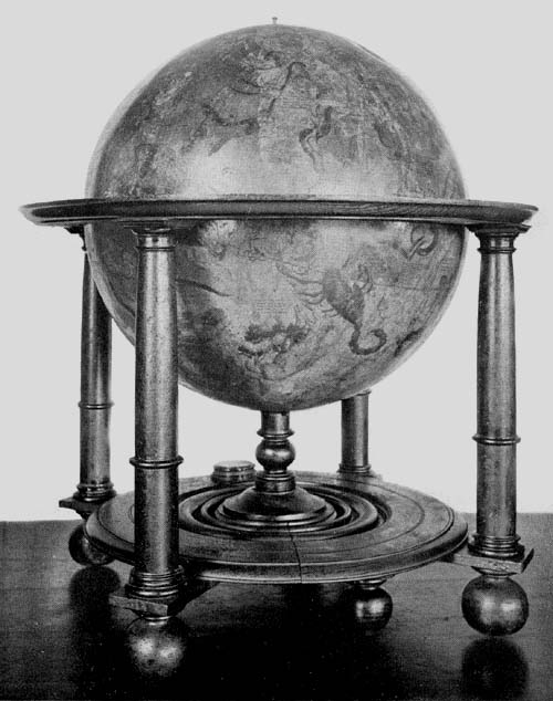
Fig. 98. Celestial Globe of Willem Jansz. Blaeu, 1622.
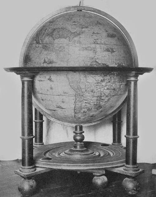
Fig. 98a. Terrestrial Globe of Willem Jansz. Blaeu, ca. 1640.
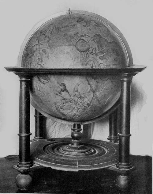
Fig. 98b. Celestial Globe of Willem Jansz. Blaeu, ca. 1640.
The Biblioteca Barbarini of Rome possesses four armillary spheres, all appearing to be of the early seventeenth century. A description of two of these, neither signed nor dated, it has not been possible to obtain; two are the work of J. Paolo Ferreri, the one constructed in the year 1602 according to the brief record “Jo. Paulus Ferrerius f. f. an. 1602,” and the other in the year 1624 being inscribed “Fco gio. Paulo Ferreri Rono ano 1624.” Professor Uzielli has given to the author the information that these are of brass, having each a graduated horizon circle supported by four half circles which in turn rest on a single brass column. Through this horizon circle passes an adjustable meridian circle 39 cm. in diameter, which is graduated and which supports other movable circles, such as the colures carrying the polar circles, the tropics, which are graduated, and the ecliptic,45 a broad band inclined 23½ degrees to the equator, likewise graduated and engraved with the names of the months and of the constellations of the zodiac. Within the circles of each of these spheres, placed at what may be called their common center, is a small solid sphere to serve as a representation of a terrestrial globe but without geographical details. There appear to be but slight differences in the construction of these two armillary spheres, the one of 1624 having certain circles which are slightly smaller than are the corresponding ones on that of earlier date. From the same source it is learned that the artist, Tito Lessi of Florence, possesses an armillary sphere signed and dated “Lud: s Sem: s Bon: Fac: A. D. MDCXII,” near which is a representation of a coat of arms with a dragon. The sphere is of brass, the diameter of its greatest circle being 63 cm. We know nothing of the Ludovico referred to as the maker, but who, as is noted, was a Bolognese. The same artist, as we are informed, likewise possesses another unsigned and undated armillary sphere which presumably is of the early seventeenth century.
Peter Plancius (1552-1622), a native of Drane-outer, West Flanders, is especially remembered as a militant theologian (Fig. 99) and as one of the most influential men active in the shaping of the colonial policy of the States of the Netherlands in the late sixteenth and early seventeenth centuries. His was indeed a stormy career wherein it touched the Reformation movements. In early life a monk, he later became an ardent reformer supporting the Calvinistic faith. After passing some years in Germany and in England in study, he became, in the year 1578, a pastor in the city of Brussels. When persecution threatened him, he fled, in the year 1585, to Amsterdam, where he again became a pastor, exerting for many years a far-reaching influence in matters touching the relations of the reform movements and the state. Plancius, however, was not only learned in matters theological, he was interested, as stated above, in Dutch46 colonial enterprise, was a geographer, and a map and globe maker of great distinction. He in part planned and actively supported the Dutch expeditions of Barents, Hemskerken, Linschoten, and Le Maire, who undertook to find new routes to the Indies, both East and West. He assisted in the organization of the East India Company, which company made large contributions to the commercial prosperity of the Netherlands.47 He was instrumental, with his countryman, William Usselinx, and others, in organizing the West India Company.48 He took an active part in the planting of New Amsterdam in the New World, and in the establishment of Batavia in Java. He was counselor for twenty-five years in practically all matters pertaining to the welfare of the peoples of the Netherlands.
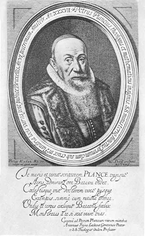
Fig. 99. Portrait of Peter Plancius.
As map maker Plancius appears to have begun his activities shortly after taking up a residence in Amsterdam. His great world map in two hemispheres, one of his first productions, and one which may in part have served Blaeu and Hondius in the preparation of their masterpieces, of the years 1605 and 1611, respectively, was issued in the year 1592, a unique copy of which belongs to the Collegio del Corpus Christi of Valencia.49 This map, bearing the title “Nova et exacta terrarum orbis tabula geographica ac hydrographica,” is composed of eighteen sheets, which, when joined, give a world map measuring 146 by 233 cm. Blundeville makes interesting reference to this map under the following caption: “A Plaine and full Description of Petrus Plancius his vniuersall Mappe, seruing both for Sea and Land, and by him lately put forth in the yeere of our Lord 1592. In which Mappe are set downe many more places, as well of both the Indies, as Afrique, together with their true Longitudes and Latitudes, than are to be found either in Mercator his Mappe, or in any other Moderne Mappe whatsoeuer: And this Mappe doth show what Riches, Power, or Commodities, as what kind of Beasts both wild and tame, what Plants, Fruits, or Mines any Region hath, and what 47kinds of Merchandize do come from euery Region. Also the diuers Qualities and Manners of the People, and to whom they are subiect. Also who be the most mightie and greatest Princes of the World: A Mappe meet to adorne the House of any Gentleman or Merchant, that delighteth in Geographie: and herewith this Booke is also meete to be bought, for that it plainely expoundeth euery thing contained in the said Mappe.”50 Blundeville notes further that Plancius drew another map of the whole earth in two hemispheres, employing the polar projection. He does not give the date of this map, but it presumably was issued shortly after that of 1592. A Plancius world map in two hemispheres, bearing title “Orbis terrarum typus de integro multis in locis amendatus, auctore Petro Plancio 1594,” appears in the account of Linschoten’s expedition of 1599.51 It is a well-drawn map, containing much valuable geographical data. Like Mercator, Hondius, and Blaeu, Plancius also undertook the construction of globes. Of these the oldest known appears to have been begun as early as the year 1612, the date appearing in the following dedication, “Nobilissimis Amplissimis Consultissimis ac Prudentissimis Dominis Consulariis Thalassiarchis atque Thalatto Oratoribus Hollandiae Zelandiae et Frisiae occidentalis nec non Magnificis ac Clarissimis Dominis Consulibus praeclarissimi Emporii Amstelodami, Petrus Kaerius humillimus cliens L. M. Q. dat, dicat, dedicat. Anno 1612.” “To the Most Noble, Exalted, Learned and Prudent Consular Lords and Orators Maritime of Holland, Zeeland and West Friesland, also to the Great and Distinguished Lords Counselors of the Renowned Emporium of Amsterdam, Peter Kaerius their humble client gives and dedicates (this globe). In the year 1612.” Below the legend is engraved “Petrus Kaerius excudit ann. 1614,” the date here given clearly indicating the year of issue. Not far from the dedicatory legend appears the following: “Ipsa experientia peritos Naucleros docuit volubiles libellas magnetis virtute infectas in Insulis Corvi et Florum48 Mundi polos recte respicere: idcirco ibi, taquam a communi Mundi Magn. Meridiano Logitud. justis de causis initum sumunt Petrus Kaerius et Abrahamus Goos patrueles sculptores.” “Experience itself has taught skilful mariners that loose leaves when under the electrical influence, in the islands of Corvo and Flores, turn directly toward the poles of the world, and for this reason it is here, as a common magnetic meridian of the world, that Peter Kaerius and Abraham Goos his cousin, engravers, locate with reason the beginning of longitude.” The customary address to the reader, though here not so designated, reads, “In hujus nostri Globi delineatione ubique castigatissimas Tabulas Hydrographicas ac Geographicas sequuti sumus, quibus Germani, Hispani, Galli, Itali, Angli, Scoti, Dani, Norvegi, Suedi nec non et navigationibus utuntur: ad quae omnia comparanda nulli nec labori nec sumptui pepercimus: ventorum quoque regimmes ad usum navigantium admussim accomodavimus: quemadmodum artis periti, proprius inspiciendo, reperient. Vale ac frere. Petrus Plancius.” “In the delineation of this our globe, we have everywhere followed the most correct hydrographic and geographic tables which the Germans, Spaniards, French, Italians, English, Scotch, Danes, Norwegians and Swedes use in their voyages. In doing this we have spared no labor nor expense. The directions of the winds (loxodromic lines) we have laid down with great exactness for the use of sailors, as those experienced in navigation will see on close inspection. Farewell and be happy. Peter Plancius.” This gives us definitely to understand that this terrestrial globe was the work of Plancius.
The sphere is covered with a world map engraved on twelve gores, truncated at latitude 70 degrees, the polar spaces being covered by the usual circular discs, each having in this case a radius of twenty degrees.
On his celestial globe, probably issued at the same time as the terrestrial just referred to, and intended as a companion of the same, having the same dimensions, we find 49the following legend: “In hac coelesti sphaera stellae affixae majore quam hactenus numero ac accuratiore industria delineantur. Novos Asterismos in philomathēom gratiam de integro addidi: quae omnia secundum Astronomorum Principis Tychonis Brahe, ac meam observationem verae suae Longitudinis ac Latitudinis ad annum Christi 1615 restitui. Petrus Plancius.” “In this celestial sphere the fixed stars to a greater number than previously and with more exactness are depicted. I have added for the use of the student some entirely new star readings according to the prince of astronomers Tycho Brahe, and also my own observations of their true latitude and longitude adapting these to the year of Christ 1615. Peter Plancius.” It then will be noted that the position of the stars located thereon is computed to the year 1615. In the southern hemisphere is a portrait of Tycho Brahe with the inscription “D. Tyco Brahe Summ. Mathematic,” below which is the legend “Tabula continens quantum quovis proposito anno vel addendum vel demendum sit Lōgitudini affixarum: nam hae 70 annorum et 5 mensis spacio unicum gradū secundū signorū ordinē, super Pol. Zod. progrediuntur.” “Table indicating how much for any given year is to be added to or to be subtracted from the longitude of the fixed stars. For these in the space of 70 years and 5 months move one degree reckoned on the signs of the zodiac.” But one pair of Plancius’ globes can now be located, this pair having been acquired a few years since for the Museo Astronomico of Rome (Fig. 100). They are reported to be in excellent condition. The spheres are of wood covered with plaster, having a diameter of about 21 cm., upon which the gores have been pasted. Wind roses are numerous, from which the usual direction or loxodromic lines radiate. Ships and sea monsters add to the decoration of the terrestrial globe map, and the figures of the several constellations have been artistically drawn. Each globe is furnished with a wooden base, having its horizon circle supported by four columns which are joined below by crossbars.50 Each has a brass meridian circle within which the globe is adjusted to revolve.
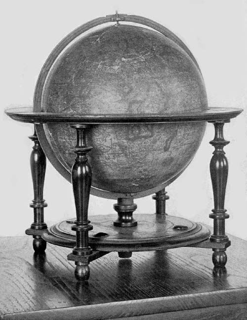
Fig. 100. Terrestrial Globe of Peter Plancius, 1614.
Fiorini reports information received from Gabriel Marcel of the Bibliothèque Nationale and Captain F. v. Ortroy that there may be found in the Stein Museum of Antwerp a terrestrial globe of copper, neither signed nor dated, but which is thought to be the work of Peter Plancius.52 Additional information concerning this globe has not been obtainable.
Isaac Habrecht (1589-1633), physician and mathematician, was a native of Strassburg, where he passed the greater part of his life.53 Incidental references to him assure that he was regarded in his day as a man of much ability. Among his publications, not numerous but scholarly, reference here may be made to his ‘Tractatum de planiglobio coelesti & terrestri,’ issued in Latin in the year 1628, and again in the year 1666 in both Latin and German, by Johann Christoph Sturm of Nürnberg.54 In this work Habrecht describes his terrestrial and celestial globes, constructed, it appears, a few years previous to the issue of the publication.
The Hispanic Society of America possesses a fine example of what appears to be his first terrestrial globe (Fig. 101). It is undated, but internal evidence assures us that it was not constructed prior to the year 1612. Near the Arctic circle and north of the representation of Hudson’s Bay we read “Huc usque retrocesserunt Amstelodamenses anno 1612.” “At this point the Amsterdam (explorers) turned about in the year 1612.” His first celestial globe, referred to below, seems clearly to be of the year 1619, and there is reason for placing his first terrestrial globe in the same year, since, in their size, and in many of their general features there is agreement. The globe ball of wood has a diameter of 20 cm. Its horizon circle, which has pasted on its upper surface the usual information relative to the names of the months, to the principal directions, and to the signs of the zodiac, is supported by four turned legs joined below by 51crossing bars, these bars in turn supporting a carved circular disc with a raised center through a slot in which the meridian circle is made to pass. The whole is indeed a remarkably well-preserved example of Habrecht’s work.
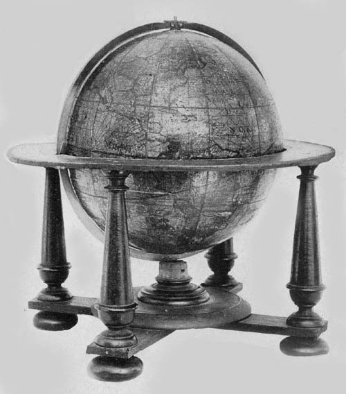
Fig. 101. Terrestrial Globe of Isaac Habrecht, 1625.
In an artistic cartouch to the south of the East Indian Islands and within “Terra Australis” is the following signed dedication: “Perillustri et Generossissimo Dno Dno Eberardo Dynaste in Rappolstein. Hohenaccio et Geroltzeccio ad Vogasinum Divi Mathiae II Imp. nec non Sereniss. Maximiliani Archiducis Austriae. P. M. Camerario et Citeriorum Ordinum Provincialium Praesidi Magnifico: ex antiqua Ducā Spoleti familia oriundo: Domino meo Clementissio Triplicem hunc globum: Coelestem scilicet: convexum et concavum et hunc terrestrem novissimae editionis et correctionis. D. D. D. Isaacus Habrect Phil. et med. d. Argentinensis.” “To the Most Illustrious and Most Generous Lord Eberhardt Ruler in Ruppelstein, Hohenau and Geroldseck in the Vosges, Divine Emperor Matties II and also the Most Serene Maximilian Archduke of Austria, the Exalted President of the Provincial Orders of the Cameria, and those on this side of the mountains, sprung from the Ancient Ducal Family of Spoleto, my Most Gracious Lord, this triple globe, that is celestial, convex and concave terrestrial, corrected according to the latest information, gives and dedicates Isaac Habrecht, philosopher and physician of Strassburg.” In the northern part of North America is a legend referring to the expeditions of Davis, Schouten, and Le Maire reading, “Versus Articum polum ulterior transgressus hactenus ab Herculis licet Davis Angli labore id examinatus fuerit sicut et circa antarcticum fretum noviter a Guilielmo Schout detectum Le Maire nuncupatum extremus adhuc navigationum est terminus. Quamvis nullus dubitet maxima totius orbis magnalia sub polis delitescere quorum detectionem forsitan summus Deus suo tempore reservat. Typis Jacop. ab Heyden Argentinae.” “Toward the Arctic pole the last voyage up to the present was made, with52 Herculean labors, by Davis an Englishman. Around the Antarctic a strait has lately been discovered by William Schouten and named Le Maire, and this, up to the present, is the extreme limit of navigation, although no one doubts that the greatest wonders of all the world lie hidden under the poles, the discovery of which, it may be that Almighty God reserves for his own time. Printed by Jacob von Heyden of Strassburg.” It is probable that the Jacob von Heyden here referred to was a relative of Christian Heyden of Nürnberg, mathematician and globe maker of renown.55 Below the legend last quoted is a brief one reading, “America septentrionalis a Christoforo Colombo 1492 detecta.” “North America discovered by Christopher Columbus in the year 1492.” This appears to have been quoted from the Hondius globe of the year 1618. The austral continent is referred to as “Terra Australis incognita,” and near New Guinea is inscribed the following, likewise quoted from Hondius: “Sic dicta quod ejus littora locorūqȝ Guineae Affricanae multum sint similia. Dicitur a nonnullis Terra de Piccinaculi; et sit ne insula an pars continentis Australis incertum est.” “So called because its shores are much like those of African Guinea. It is called by some the land of Piccinaculi: and it is uncertain whether it is an island or a part of the Australian continent.”
A considerable number of brief legends appear upon different parts of the globe map, each having a local significance. In coloring the map attention was given to the representation of territorial boundaries which gives an added interest to the globe. The “Meridianus Primus” is made to pass through the Island of Corvo, and other meridians are drawn at intervals of ten degrees. The loxodromic lines, as on the Hondius globes, are made a conspicuous feature of the map, having their crossing centers at longitudes 0°, 90°, 180°, and 270° on the equator, and on the prime meridian at latitude 35° both north and south, as well as at the same latitude on the opposite side of the sphere, where the prime53 meridian becomes the meridian of 180°. Habrecht appears to have followed somewhat closely the globes of Hondius for his geographical data.
In addition to the Habrecht terrestrial globe in The Hispanic Society’s collection, two other copies are known, which likewise are undated. One of these belongs to the Biblioteca Comunale of Sondrio, and the other to the Archivo Municipale of Asti.
Of the celestial globes of Habrecht four copies have been located; one being in the Biblioteca Comunale of Sondrio, in a good state of preservation; one in the Germanisches Nationalmuseum of Nürnberg, wanting, however, the original mounting, having its map engraved, as stated in a legend, by Jacob von Heyden et Johann Christoph Weigel; one in the Biblioteca Comunale of Asti; one in the Royal Museum of Cassel.
It is strikingly evident that Habrecht followed in the main the work of Willem Jansz. Blaeu, and Jodocus Hondius for his celestial globes. As the year 1619 was selected as the one in which star positions were to be recorded, it is probable, as intimated above, that these globes were constructed in that year. Each of the globes referred to is reported as retaining the brilliant coloring which had been laid on by hand.
Garcia de Céspedes, writing in 1606,56 calls attention to a globe, concerning which nothing farther is known, referring to it as a “Globillo que hizo en Portugal aquel grau Piloto que se emborrachana cuyo nombre no me acuerdo.” “A small globe constructed in Portugal by a great pilot, whose name is unknown, but who was a great drunkard.”
In the year 1893 Baron Nordenskiöld presented to the Royal Geographical Society a facsimile in gores of a globe map, which fact is noted in that society’s Journal. The globe is one of silver, bearing the author and date legend “Johann Hauer. 1620.” The record tells of its having been presented in the year 1632 to Gustavus Adolphus and that54 it is now one of the treasures of the National Museum of Stockholm. The engraved map is of the Hondius or the Mercator type presenting in the main the best geographical knowledge of the time. Its many legends are in the Latin language; the lettering, though small, is easily legible. The engraver has adorned the seas with ships and with such marine animals as are frequently to be found in the maps of the period.57
It has been previously noted that the employment of engraved gore maps in globe construction was not received with general favor in Italy in the sixteenth century, although Mercator’s globes were copied to some extent, as were those of De Mongenet. Toward the close of the century, the preference for manuscript globes, or for engraved bronze or copper globes seems gradually to have yielded to a belief in the more practical method of construction which had established itself in the North. Originality, however, does not appear to have been a striking feature of Italian endeavor in this method of globe making. There was an occasional manifestation of independence and individuality, it is true, but in general there was a disposition to copy, and the early seventeenth century furnishes us an example in the reissue by Giuseppe de Rossi of the work of Jodocus Hondius, but without credit, as has been previously observed.
Among those who attained distinction in Italy in the first half of the seventeenth century in the construction of globes having engraved gore maps, may be named Mattheus Greuter. He was born in Strassburg in the year 1556, where he learned designing and engraving. In early life he went to Lyons in France where he carried on his work, but later he removed to Avignon, adding to his art in this city that of type cutting. We next find him in Rome, busily engaged in the work of engraving, in which he had become exceedingly proficient, winning for himself a high place among the Italian artists of his day. Map engraving, we learn, early claimed his attention, and among his masterpieces in this 55field may be mentioned a large map of Italy. Of this work no copy is at present known, but it is thought that it probably served Magini as a model for his “Italia” which was published in the year 1620. It could not have been long after he had taken up his residence in Rome, where he became a naturalized citizen, that he began the preparation of his first terrestrial globe, which he issued in the year 1632. So well did he perform his work that he is entitled to rank with the leading globe makers of the Netherlands.
An excellent example of this first issue may be found in the Museum of The Hispanic Society of America (Fig. 102), this being one of the most valuable in its large collection. It has a diameter of 50 cm., and is mounted on a wooden base having four feet, which, though evidently very old, is clearly not the original base. It is furnished with a narrow wooden horizon circle which is not graduated, and the calendar and other representations, which one usually finds pasted on this circle in early globes, are entirely wanting. The meridian circle of iron, likewise, is not graduated, and like the wooden base is not a part of the original mounting. The sphere itself is remarkably well preserved, there being scarcely a noticeable injury to its surface save the slight discoloration of age. The engraved gore map covering the papier-mâché ball, which is of very light construction, is composed of twelve sections, or rather of twenty-four, since each of the sections is cut at the equator, and the poles are covered with small circular discs.
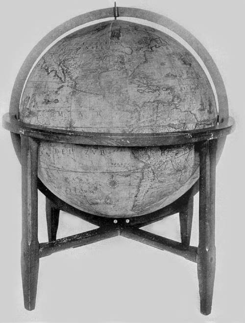
Fig. 102. Terrestrial Globe of Mattheus Greuter, 1632.
In the south Atlantic and near the great southern continent, in a neat cartouch surmounted by the coat of arms of the Boncompagni family of Bologna, is the following dedication: “Illustrissimo et Excellentissimo Principi D. Iacobo Boncompagno Sorae Arcisque Duci Marchioni Vignolae Aquini Comiti Dno suo colendissimo. Mattheus Greuter Humill. obseqii ergo. D. D.” “To the Most Illustrious and Excellent Prince Lord Jacob Boncompagni, Duke of Sora and Arce, Marquis of Vignola and Count of Aquino,56 his Most Worshipful Lord Mattheus Greuter with humble obedience dedicates (this globe).” Iacopo Boncompagni, to whom Greuter dedicated his work, belonged to a famous family of Bologna.58 He was born in Sora in the year 1613 and died in the year 1636. It was his great-grandfather, Hugo, who, in the year 1572, at the age of seventy, became Pope Gregory XIII, and who immortalized himself through his reform of the calendar. Iacopo, the grandfather of that member of the family to whom Greuter dedicated his globe, was in position, at the time of the elevation of his father to the Papacy, to have bestowed upon him great honors and riches. He was nominated Castellan of St. Angelo, and shortly thereafter, receiving the title General of the Holy Church, was sent to Ancona with a commission to defend the maritime regions of the papal states. He was soon thereafter admitted to the nobility of Rome, of the Kingdom of Naples, and of Venice. Through the riches of the Papacy he was able to purchase from Alfonso II of Este the Marquisate of Vignola for seventy-five thousand Roman scudi, the Duchy of Sora and of Arce from the Duke of Urbino for one hundred and ten thousand ducats, and the lands of Arpino and Roccasecca, together with the County of Aquino from Alfonso of Avalon, Marquis of Guasto, for one hundred and forty thousand ducats.
In the austral continent, and on the opposite side of the globe to that on which the dedication is placed is an address to the reader which is inscribed in a neat cartouch, reading “In ista quam exhibemus terreni globi descriptione omnium regionum iuxta et insularum quotquot hactenus ab Argonautis tam Lusitaniae quam aliarum gentium Naucleris visae et notatae loca in suo secundū longitudinem et latitudinem situ sum̄a sedulitate et industria disposita invenies quae res non solum Geographiae studiosis jucūda, verum etiam ijs, qui terras longe dissitas et sub alio sole calentes frequentent, maxime utilis futura est. Hūc igitur laborem nostrum ut tam gratis animis acceptatis sedulitate a nobis57 est obitus ex aequo omnes rogatos volo. Mattheus Greuter auctor. Excudit Roma Anno MDCXXXII.” “On this globe which we exhibit, you will find all the regions and islands as far as they have hitherto been seen and noted by navigators of Portugal and of other nations, set down in their proper positions of latitude and longitude with the greatest care and industry. This will be pleasing not only to students of geography but it will be especially useful to those who visit far distant lands (which are) warmed by another sun. I hope therefore that all those whom I ask will accept this labor of ours with as much gratitude as we have employed care upon it. Matthew Greuter maker. Made in Rome in the year 1632.” This address agrees with that on the Blaeu terrestrial globe of 1622 except that Blaeu wrote “vel etiam ab aliarum gentium ...,” whereas Greuter writes “tam Lusitaniae quam aliarum gentium ...,” and Blaeu inserted a reference to the loxodromes he had drawn on his map, which loxodromes Greuter, omitting, had therefore no occasion for such reference. In the inscription referring to the prime meridian, Greuter again borrowed from Blaeu with scarcely an alteration, as he did in his reference to recent discoveries made for the purpose of finding a way to the East by the North. Blaeu’s legend in the vicinity of the Tiborone Island, that near the Cape of Good Hope, and that near the Strait of Magellan were all copied literally by Greuter, and likewise that referring to the Le Maire Strait.
Greuter employed, in general, for the names of the regions of the Old World and for the seas, the Latin language, though he wrote “Mar del Nort” for the Atlantic and “Mar del Zur” for the Pacific. For the names of the New World he used the Spanish or the Portuguese, but occasionally the English, the French, the Dutch, or the language native to the region bearing the name. For the names of the cities he generally employed the language of the country or the Italian language.
Numerous ships are represented sailing the seas, and the58 pictures of sea monsters are many. A few wind roses adorn the map, but, as before stated, loxodrome lines, regarded in general at that time as of great importance to sailors who had occasion to make use of the chart or the globe, were omitted by Greuter.
Hudson Bay, which is left nameless, is represented without a definite coast line in the north, but through a wide and extended channel it opens into “Fretum Davis.” The St. Lawrence River appears to drain a lake, which may be taken from its location to be Lake Ontario; but the remaining four Great Lakes appear as one great inland sea with an outlet of somewhat uncertain character northward toward Hudson Bay. The geographical representations in this region are of special historical interest, as are indeed the geographical records in the several sections of North America, particularly in the South and the West.
As a companion to the terrestrial globe of the year 1632, Greuter prepared a celestial globe of the same dimensions, and with similar mountings, which he issued in the year 1636. He gives due credit, in one of his legends, to Tycho Brahe and to Willem Blaeu as sources of information for his representation of the stars and the several constellations, following, in particular, Blaeu’s globe of 1622. His explanatory legend reads “In hoc coelesti Globo notantur omnes stellae fixie an annum 1636 accom̄odatae q̄ iuxta observationē Nob. viri Tychonis Brahe, in max̄ illo Iansonii, an̄o 1622 edito, positae sunt additis stellis q̄ à peritisso nauclero Petro Theod: circa Pol. Aust. notatae sū novisque Asterismis et stellis min. apparētib’, ab aliis sum̄ studio observatis, omnia in Philomatico gratia copiosa delineata. Romae, 1636, M. Greuter.” “In this celestial globe are noted all the fixed stars accommodated to the year 1636, which are placed (on the map) according to the observations of the noble Tycho Brahe in that great (work) of Jansson (Blaeu), edited in the year 1622, to which are added the stars noted by the skilful navigator Peter Theodori around the south pole and59 the new and less apparent stars observed by others with great zeal. All these have been represented for the use of the student. At Rome, 1636. M. Greuter.” As to how much he thought should be added to or subtracted from the longitude of the fixed stars each year, to the end of taking due note of the precession of the equinoxes, he copied Plancius literally. The equatorial circle, the tropics, the polar circles, the equinoxes, the solstitial colures, the ecliptic, and twelve meridians are all represented. The constellations include the Ptolemaic, with the addition of those recently discovered and named in the southern hemisphere. The figures of the several constellations are well drawn, having their names in Latin or in Arabic, and are artistically colored in most of the copies of the globe known.
Greuter’s globes all appear to have been made in the same size, and they have the same general construction, with the exceptions noted below.
A pair of these globes, that is, of the terrestrial, of the year 1632 and the celestial of 1636, may be found in the following public and private libraries and museums in addition to those above mentioned: Scuole Comunale of Ancona; in the Biblioteca Comunale of Bologna; in the Biblioteca Comunale of Camarino; in the Seminario Vescovile of Carpi; in the Biblioteca Comunale and also in the Museo Agabiti of Fabriano; in the Biblioteca Comunale of Ferrara; in the Biblioteca di Santa Maria Nuova of Florence; in the Biblioteca Comunale of Gubbio; in the Biblioteca Governativo of Lucca; in the Biblioteca Capitolari of Reggio; in the Museo Astronomico, also in the Biblioteca Chigi and the Biblioteca Vittorio Emanuele of Rome; in the Biblioteca Comunale of Sanseverino; in the Biblioteca Gonzaga of Mantua; in the Biblioteca Universitario of Messina; in the Biblioteca Nazionale of Milan; in the Museo Civico of Modena; in the Museo di Fisica and also in the Seminario Vescovile of Padua; in the Biblioteca Palatina of Parma and a pair in the possession of Joseph Baer & Company of60 Frankfurt, 1914. A copy of the terrestrial globe of the year 1632, in addition to the one described above as belonging to The Hispanic Society of America, may be found in the Biblioteca Comunale of Bassano; in the Ateneo of Brescia; in the Museo di Fisica of Catania; in the Archivo di Stato of Venice. In private libraries copies of these globes may be found in the possession of the General Antonio Gandolfi of Bologna; of Sr. P. Marezio Bazolle, once belonging to the Counts of Piloni of Belluno; of Professor Luigi Bailo of Treviso; of Sr. D. Luigi Belli of Genga. A copy of the celestial globe of the year 1636 may be found in the Biblioteca Comunale of Serra S. Quirico, and also a copy in the library of Mr. W. B. Thompson of Yonkers, N. Y.
It does not appear that Greuter himself issued other editions of his globes. His death occurred in the year 1638, and in this same year what may be called a second edition of his globes of the years 1632 and 1636, having the same dimensions, was offered to the public. It has been noted above that one Giuseppe de Rossi of Milan reprinted in Rome, in the year 1615, the Hondius terrestrial and celestial globes of 1601, making but slight alterations in the same but giving the impression that he was the original author. It was perhaps a near relative of this Milanese engraver and printer, Giovanni Battista de Rossi, who in the year 1638 reprinted in Rome the Greuter globes with but few changes, none of which can be considered of special import save the introduction of his own name as printer instead of that of Greuter. It may, however, be noted that both globes are dated 1636, that below the Tropic of Capricorn on the terrestrial globe is the legend “Si stampa da Gio Bat̄ta de Rossi Milanese in Piazza Navona. Roma,” and that the title legend of the celestial reads “In hac coelesti sphaera stellae fixae majori quam hactenus numero et accuratiori industria delineantur novis Asterismis in Philomaticom̄ gratiam de integro additis: quae omnia secundum Astronomorum Principis Tychonis Brahe et aliorum observationem verae suae longitudini61 ac latitudini ad annum Christi 1636 restituta sunt. Romae Matteus Greuter exc. 1636.” “In this celestial globe are shown the fixed stars in greater number than previously, and with greater care and industry, the new constellations being added for the sake of the student. All these, according to the observations of the Prince of Astronomers, Tycho Brahe, and likewise the observations of others, have been assigned to their proper latitude and longitude for the year of Christ 1636. Made at Rome by Mattheus Greuter 1636.”
A pair of these globes of the second edition may be found in the private library of Cav. Giampieri-Carletti of Piticchio in the Marche; in a private library of Ancona (owner unknown); in the Seminario Vescovile of Toscanella. A copy of the terrestrial globe may be found in the Seminario Vescovile of Macerata; and of the celestial in the library of Count Francesco Conestabile of Perugia.
The Hispanic Society of America has in its collection a unique globe which is clearly the work of Mattheus Greuter (Fig. 103), although issued by Giovanni Battista de Rossi, as is attested by the legend, “Si Stampa da Gio Batta de Rossi Milanese in Piazza Navona Roma.” This legend, appearing in a neat cartouch, occupies the same position in the southern hemisphere, near the prime meridian, as that in which one finds the dedication of his first issue, but that part of the cartouch in the earlier issue showing the coat of arms of the Boncompagni family is here left blank. The title of the first issue is repeated save in the concluding words. Here we read “In iste quam exhibimus ... Mattheus Greuter auctor. Excudit Romae 1638.” Other legends, such as those in the northern part of North America beginning, “Post apertum a Lusitanis ...,” that southeast of Africa beginning, “Quam longitudinis initium ...,” and the briefer ones referring to the discovery of the Cape of Good Hope, to the expedition of Schouten, and to that of Magellan, are identical in the two editions. It, however, is to be noted that many of the briefer legends appearing in the62 first edition are wanting in this of the year 1638, and that in the latter the place names are greatly reduced in number. It is further particularly worthy of note that the North American continent in this later issue is very much altered in its outline. California appears as an island, “Insula California,” and is separated from the great northwestern section of North America, which is likewise represented, though somewhat doubtfully, as an island, by the “Stretto di Anian,” while the “Estreito de Jeso” separates the New World from Asia. The globe ball has a diameter of 26 cm. Its mounting is of wood. It has a broad horizon circle, on which are the representations of the signs of the zodiac, the calendar, the Roman and the Italian names of the winds or directions appearing in concentric circles, the whole being supported on a base consisting of four exquisitely carved and rather heavy support columns which are joined below by carved cross bracings. Its meridian circle is a comparatively recent and very clumsy substitute of wood for the original which doubtless was of brass. It is very seldom that one finds a globe of a date so early as is this which is so well preserved. The engraved map has the freshness of a new and unused print, excepting a very slight yellow tinge which is the contribution of age. On this globe map may be found one of the earliest attempts to give boundary lines to territorial divisions in the New World such as “Virginia,” “La Florida,” “Nuovo Mexico,” “N. Amsterdam,” “N. Suetia.”
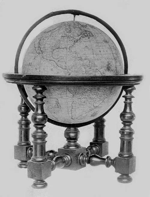
Fig. 103. Terrestrial Globe of Mattheus Greuter, 1638.
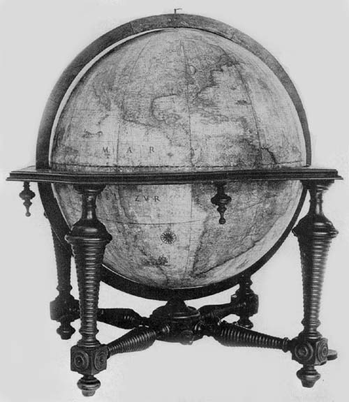
Fig. 103a. Terrestrial Globe of Dominico Rossi (Mattheus Greuter), 1695.
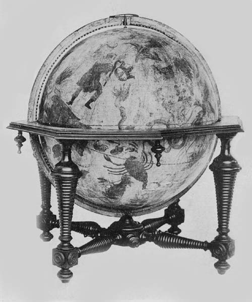
Fig. 103b. Celestial Globe of Dominico Rossi (Mattheus Greuter), 1695.
Attention has previously been called to the reproduction in Italy of the Hondius globes by Giuseppe de Rossi in the year 1615. It appears that to the Rossi family belonged a number of map engravers and art printers during the seventeenth century and particularly to that branch making its home in the city of Rome. As globe makers we however find them playing the rôle of copyists rather than that of independent producers.
In The Hispanic Society’s collection of old globes may be found a pair in an excellent state of preservation signed 63“Dominici de Rubeis (Rossi),” and dated “1695.” Each globe ball is composed of papier-mâché, having a diameter of 49 cm. and each is covered with a map printed on twelve gores, with a small circular disc for the polar space (Figs. 103a, 103b). In the List of Globe Makers other examples are noted.
In the South Pacific, on the terrestrial globe, one finds the inscription “Romae ex Chalcographia Dominici de Rubeis, heredis 70. Jacobi, ad templum S. Mariae de Pace, Anno 1695.” Dominico, whose name here appears, achieved considerable distinction as the publisher, with his relative Giovanni Giacomo de Rossi, of an atlas of one hundred and fifty-two maps, one of the finest examples of Italian cartography of the period. In a cartouch in the South Atlantic, on this globe, we find the name Mattheus Greuter given as the engraver, whose work has been referred to above, clearly suggesting that Rossi had merely reissued a globe of earlier date, since Greuter had died in the year 1638. A careful examination of the globe map confirms the suggestion, since no record is made of geographical discoveries after the year 1630. In the region of the North Pole the discoveries of the English and of the Dutch are recorded to the year 1628, and it may further be noted that in this same northern region the islands of “Frislanda” and “Brasil” are laid down, while in Greenland is a reference to the location of the fabled Monastery of St. Thomas.
References are made in legends to the discoveries of Magellan, Lemaire, Schouten, Frobisher, Davis, Hudson, and Drake. The region about New York is called “Nieu Nederland.” One can recognize the representation of the St. Lawrence, and the Mississippi. In the western region of the New World there appears to be considerable confusion as to the geography of the country, apparently the result of reading, without understanding, the records of the Spanish and of the English. One finds, for example, California represented64 as an island, and a double representation of the Strait of Anian.
The Spanish, French, English, Dutch, and Latin languages have been employed in names and legends.
The mounting of the globe is artistic and substantial, consisting of the usual horizon circle, octagonal on its outer edge, but circular on the inner edge to receive the globe ball, and having pasted on its upper surface the usual engraved paper strips and all that there is engraved thereon in the best examples of globe making. The meridian circle of wood, within which the sphere is made to revolve, is graduated. The supporting base consists of four exquisitely turned columns, braced at bottom with correspondingly well-turned crossbars.
The celestial globe has a mounting altogether like that of the terrestrial, and in the character of the map engraving there is agreement. The figures of the several constellations are copies of these drawn by Tycho Brahe, and all have been exquisitely colored. Stars from the first to the sixth magnitude are represented, while special attention is called to the new star in Cassiopeia first appearing in the year 1572, and to the comets of the years 1597 and 1616. Near Ursa Major is the author and date legend reading “In hoc Caelesto Globo notantur omnes stellae fixae, ad annum 1636 accommodatae, quae iuxta observationes Tychonis Brahae maximo illo Jansonii anno 1622 edito positae sunt, additis stellis quae a nauclero Petro Theod. circa Polum Australem notatae sunt ... Romae ex chalcographia Dominici de Rubeis, her. Jo. Jac. de Rubeis anno 1695.”
The twelve gores of the map have been mounted so as to join at the north and south poles of the ecliptic, there however being a small covering disc at each pole, so frequently employed since Mercator’s day, the globe itself being made to revolve on its equatorial axes.
To the makers of armillary spheres in the first half of the seventeenth century there may be added the name of Adam 65Heroldt, a native of Germany. We know little, however, of the extent of his activities. One example of his work is known, which bears the simple inscription engraved near the south polar circle “Adam Heroldt fecit Romae anno dn̄i MDCIL.” “Made by Adam Heroldt in the year 1649.” This sphere once belonged to the astronomer De Gasparis of Naples, but passed some years since into the collection of the Museo Astronomico of Rome. It is constructed entirely of brass, the diameter of the largest circle being about 14 cm. Its several circles, including the polar, the equatorial, the zodiacal, and the horizon, are graduated, the last-named having engraved on its surface the names of the months and of the winds, and resting on two semicircles, which in turn are supported by an artistically designed foot. The entire height of the sphere is about 20 cm. At the north pole is an hour circle bearing the inscription “Index Hor: Italic.” Within and at the common center of the several circles is a small ball representing the terrestrial sphere, which has a diameter of but 1 cm., and within the circle of the ecliptic and coördinated with it is a ring carrying the sun, while within this is one for the moon. The piece may be referred to as a fine example of the armillary sphere of the period.
Manfredo Settàla (1600-1680)59, a nobleman of Italy, was in his day a distinguished promoter of science and art, and an intelligent collector of rare objects, which he brought together in a museum of his own founding. This he described in a work bearing title ‘Museum Septalianum,’ which was published in Italian in the year 1666 by Scarabelli. This museum later passed into the possession of the Ambrosiana of Milan, where it has been considered one of the choicest additions.
Settàla had included globes in his collection, among which there has previously been mentioned that made by the Cremonese Gianelli, in the year 1549. But not only was he a collector; he likewise became interested in the actual work of globe construction. Among the objects coming to66 the Ambrosiana from his museum is an armillary sphere bearing the inscription, “Manfredus Settalius fecit MDCXLVI.”60 It is described as a sphere having a base of brass, its several circles including those representing the zodiac, the equator, the meridians, and the horizon, all being movable on a common axis, on which axis at the common center of the circles is a small ball 4 cm. in diameter, representing the earth. To this sphere rather extravagant praise is given in the descriptive catalogue referred to above.
There is a third armillary sphere belonging to the Settàla collection, which is of silver and which probably was constructed near the middle of the seventeenth century, although it is neither signed nor dated. It is 40 cm. in height, having a circle representing the ecliptic 15 cm. in diameter, which is graduated, having on its upper surface engraved figures representing the twelve zodiacal constellations. The meridian circle has a diameter of 16 cm., the horizon a diameter of 16 cm. and a breadth of 3 cm., on the upper surface of which have been engraved the names of the months, and the signs of the zodiac. In addition to the parts mentioned it has two small polar circles, and at the common center a small silver ball 1 cm. in diameter representing the earth.
Attention has been previously called to the transfer of the business of Jodocus Hondius into the hands of the son-in-law, Johan Janssonius, and of Abraham Goos, by whom it was carried on after the year 1640. This firm continued to issue the Hondius globes, modifying them from issue to issue with the addition of some of the latest geographical information obtainable. In the year 1648, with Johan Janssonius as editor and Abraham Goos as author and engraver, there was issued a pair of these revised Hondius globes, each having a diameter of 87 cm. On the terrestrial globe we read “Amstelodami Edebat Joannes Jansonius Sculpebat magnoque studio componebat Abrahamus Goos Amstelodamensis.” “Amsterdam. Edited by Johan Jansonius. Composed 67with much study and engraved by Abraham Goos a native of Amsterdam.” Further details concerning this globe have not been obtainable, but it is very certain, although differing in size, it contains practically all the features common to the earlier editions of the Hondius terrestrial globes, and especially of the later ones.
The celestial globes have the following inscription: “Sphaera nova summo studio summaque diligentia atque industria Clarissimi viri D. Adriani Metii Watheseos apud Frunequeranos Professoris Ordinarii ad abacos Nobilissimi viri Thiconis Brahe configurata observationibus quamplurimis tum circa polum arcticum a discipulo suo Houtmanno adhibitis aucta et in annum 1620 reducta. Edente Joanne Jansonio 1648.” “A new globe constructed with the greatest industry, zeal and diligence accommodated to the tables of the most noble Tycho Brahe, enlarged by very many observations, those around the Arctic pole being made by myself, and those around the Antarctic by his disciple Houtmann. All, accommodated to the year 1630. Constructed by Johan Jansonius, 1648.” A pair of these globes may be found in the library of the Marquis Borromeo of Milan.
NOTES
1 Dictionary of National Biography. Vol. XXVII, p. 242; Aa, A. J. v. d. Biographische Woordenboek der Nederlanden. Haarlem, 1853. “Hondius, Jodocus,” to which notice there is appended a list of short bibliographical references; Kramm, C. De Leven en Werken der Hollandsche en Vlaamsche Kunstenaars. Amsterdam, 1857-1861. “Hondius, Jodocus.”
2 See for an interesting example of his early work his world map printed at The Hague in the year 1595. This map, in two hemispheres, lays down the track of Drake’s circumnavigation, 1577-1580, and that of Cavendish, 1586-1588. An original of this may be found in the Grenville Library of the British Museum, a reproduction in the work referred to below, n. 42.
3 Aa, op. cit., “Bertius, Petrus de,” “Montanus, Petrus.” See also Kramm, op. cit.
4 For a list of the Hondius Atlases of various dates see Phillips, P. L. A list of Geographical Atlases. Washington, 1909-1914. 3 vols.68
5 Stevenson, E. L., and Fischer, J. Map of the World by Jodocus Hondius, with the title, ‘Novissima ac exactissima totius orbis terrarum descriptio magna cura & industria ex optimis quibusque tabulis Geographicis et Hydrographicis nuperrimisque doctorum virorum observationibus duobus planisphaerijs delineata. Auct. I. Hondio.’ New York, 1907. Facsimile in eighteen large sheets with key map and text.
6 There is much doubt as to the correct reading of the date.
7 These globes were acquired by Mr. Huntington at the auction sale held in the rooms of the American Art Association, November 24, 1916. They were listed in the catalogue of “Art treasures and Antiquities from the famous Davanzati Palace, and the Villa Pia, Florence, Italy,” under No. 575 as “a pair of sixteenth century Italian globes.” No other printed reference than that contained in this catalogue has hitherto appeared. It is hardly probable that a finer pair of these early Holland globes can be found in any of the museums or private libraries of Europe.
8 Fiorini. Sfere terrestre e celesti. p. 265.
9 Wagner, H. Lehrbuch der Geographie. Leipzig, 1903. pp. 78-81; Frisius, G. De principiis astronomiae et cosmographiae. Antwerp, 1530. Chap. titled “De novo modo inveniendi longitudinem”; Ptolemaeus. Geographia. Chap. 4. Ptolemy here refers to an eclipse of the moon, in the year 331 B.C., which was observed in Arbela the fifth hour, in Carthage the second hour. He therefore noted a difference in time of three hours between the two places, and he therefore concluded the difference in longitude to be 43 degrees. Since the actual difference in longitude is but 34 degrees his error was of considerable magnitude, which found expression in his maps, and in the maps of those who followed him, as the greatest of geographical teachers, well into the seventeenth century. The method of determining longitude by means of the observation of the eclipses of the moon remained practically the only method until the end of the fifteenth century. Attention may here be called to work of Cassini and of other astronomers of his period. See II, 141.
10 Aa, op. cit., “Veen, Adrien,” also Kramm, op. cit.
11 Baudet, P. J. H. Leven en werken van Willem Jansz. Blaeu. Utrecht, 1871. pp. 156-158; “Extract uit de Resol. der Staten van Holland en West-Vriesland, 5 Aug. 1608.”
12 Fiorini, op. cit., p. 271.
13 Information kindly furnished by the director.
15 The parrot particularly interested the early explorers who visited the South American coast. See the artistic representation appearing on the Cantino map, in apparently the oldest extant representation of an American landscape.
16 Voyages of Fox and James to the Northwest. Ed. by Christy Miller for the Hakluyt Society. London, 1894. See especially the second part of Vol. II, “The strange and dangerous voyage of Captain Thomas James, London, 1633.”
17 The voyage of Thomas Button was made in the years 1612-1613, an account of which is given in Voyages of Fox and James, Vol. I. pp. 162-201.
18 Bauer, L. A. Principal Facts Relating to the Earth’s Magnetism. (In: United States Magnetic Declination Tables and Isogonic Charts for 1902. Washington, 1902.) Printed also as a separate; Wolkenhauer, A. Beiträge zur Geschichte der Kartographie und Nautik des 15 bis 17 Jahrhundert.69 München, 1904; Hellmann, G. Ueber die Kentniss der magnetischen Deklination vor Christopher Columbus. (In: Meteorologische Zeitschrift. Braunschweig, 1906.) Gilbert, W. De Magnete. London, 1600, and reissued in translation in 1893. This work is one of great significance in its treatment of magnetism and electricity. See especially Bk. IV on Variation, Pedro Medina in his Art de Navigar, Valladolid, 1545, contended that the magnetic needle always points to the true north; Stevenson, E. L. Early Spanish Cartography of the New World. (In: Proceedings of the American Antiquarian Society. Worcester, 1909.) Attention is called in this paper to certain errors in early Spanish maps, probably due to a failure to note properly the declination of the magnetic needle.
19 Baudet, op. cit.; same author. Nachscrift, 1872; same author. Notice sur la part prise par Willem Jansz. Blaeu dans la détermination des longitudes terrestres. Utrecht, 1875. Stevenson, E. L. Willem Janszoon Blaeu (1571-1638), a sketch of his life and work with an especial reference to his large world map of 1605 with facsimile. New York, 1914; Aa, op. cit., Vol. II. pp. 578-580; Dozy, C. M. Willem Janszoon Blaeu. (In: Tijdschrift van het Nederlandsch Aardrijkskundig Genootschap. Amsterdam, 1887. pp. 206-215.); Tiele, P. A. Leven en werken van Willem Jansz. Blaeu door P. J. Baudet. (In: De Gids. Amsterdam, 1872. Dorde Serie, Vol. I, pp. 356-367.); Tiele, P. A. Nederlandsche Bibliographie van Land- en Volkerkunde. Amsterdam, 1884. See this work for a bibliography of the works of Blaeu.
20 Baudet, op. cit., pp. 77-114.
23 Pictures of these instruments may be found in Le grand Atlas.
24 Kepler, J. Astronomia nova ... De Motibus Stellae Martis. Prague, 1609; Allgemeine deutsche Biographie, “Kepler, Johann”; Wolf, Geschichte der Astronomie, pp. 281-310.
25 In his earliest maps and charts Blaeu clearly had as his main purpose that of being of service to navigators.
26 Blaeu, J. Le grand Atlas ou Cosmographie Blaviane. Amsterdam, 1663-1671. 12 Vols. Practically the same work in the Latin, the Dutch, and the Spanish languages. A bibliographical list of Blaeu’s principal geographical publications is given in Stevenson, op. cit., pp. 65-67, in Phillips, op. cit., and in Tiele, op. cit.
27 Stevenson, op. cit., p. 25.
28 Génard, P. M. N. J. Les globes de Guillaume Blaeu. (In: Bulletin Société Géographie d’Anvers. Anvers, 1883. Vol. VIII, pp. 159-160.); Baudet, op. cit., pp. 35-52; Stevenson, op. cit., pp. 15, 43-50.
29 The Mercator globe has a diameter of 41 cm. and the Van Langren a diameter of 32 cm.
30 Fiorini, op. cit., p. 242.
31 Baumgärtner, J. Zwei alte Globen von Blaeu. Erdkugel von 1599 und Himmel-Globis von 1603. (In: Das Ausland. Stuttgart, 1885. No. 15, pp. 299-300.)
32 (In: Hakluyt Society Publications, Ser. II, Vol. XVIII, pp. 187, 189.)
33 Kästner, A. G. Geschichte der Mathematik, Vol. III, p. 86.
34 Catalogus librorum, tam impressorum, quam manuscriptorum, Bibliothecae publicae Universitatis Lugduno-Batavae. Lugduni apud Batavos, 1716. p. 500.
36 See reference in note 32 above.
37 Compare the austral land on this globe with that on Mercator’s globe of 1541, on the Hondius globe of 1600, on the Spano globe of 1593, et al.
38 Photographs of these globes were reproduced in Stevenson, Willem Janszoon Blaeu. p. 44.
40 There was much discussion throughout these years as to the proper location of the prime meridian.
41 Asher, G. M. Henry Hudson the Navigator. (In: Hakluyt Society Publications. London, 1860. Ser. I, Vol. 27.)
42 Drake, Sir F. The World Encompassed, with introduction by Vaux, W. S. W. (In: Hakluyt Society Publications. London, 1854. First Series, 16.)
43 Stevenson and Fischer. World Map of Jodocus Hondius. The evolution of a knowledge of the Great Lakes region and its cartographical representation should prove to be a topic of absorbing interest.
44 Brown, A. The Genesis of the United States. Boston and New York, 1891. Vol. I, p. 229.
Historians of this period in American history, with scarcely an exception, have taken it for granted that the expression “from sea to sea” means from the Atlantic to the Pacific, apparently not stopping to inquire as to the geographical notions entertained at the time of the granting of the Charter concerning the regions in question. The interpretation here offered takes into consideration the fact that Jodocus Hondius, perhaps the most distinguished geographer and map maker of his day, was much in favor in England at the time of the formation of the London Company and was much consulted concerning the geography of the New World. What he thought of the Virginia region to the “west and northwest” he has laid down in his large world map. It seems all but proven that the statement “from sea to sea west and northwest” means from the Atlantic to the great but indefinite inland sea “Mare Septentrionale Americae.”
To interpret this expression as meaning from the Atlantic to the Pacific shows the historian, as Freeman has stated it, “in bondage to the modern map.” Here is a striking illustration of the importance attaching to the study of historical geography, and to its subordinate branch, historical cartography. Blaeu, Plancius, Greuter, and others, if not so clear and emphatic in their presentation of this region, evidently entertained practically the same geographical notion as Hondius.
45 Fiorini, op. cit., p. 257.
46 Letter to the author signed and dated, D. Fana, 28/1/1914.
47 Founded in the year 1602.
48 Jameson, J. F. Willem Usselinx, Founder of the Dutch and Swedish West India Companies. New York, 1887.
49 Wieder, F. C. De Wereldkaart van Petrus Plancius in het Colegio del Corpus Cristi te Valencia. (In: Tijdschrift van het Nederlandsch Aardrijkskundig Genootschap. Leiden, 1915. pp. 301-318.)
50 Blundeville. Exercises. pp. 245-278. In this volume pages are numbered on recto only.
51 Linschoten, J. H. v. Itinerarium ofte schipvaert naer dost ofte Portugaels Indien. Groningen, 1614.
52 Fiorini, op. cit., p. 278.
53 Doppelmayr, op. cit., pp. 101, 115, 116.
56 Garcia de Céspedes. Regimiento de Navigacion. Madrid, 1606. p. 148.
57 Royal Geographical Journal, London. London, 1893. p. 384.
58 Baglione, G. Le vite de’ pittori, scultori, architetti ed intagliatori dal pontificato di Gregorio XIII del 1572 fino ai tempi di Urbano VIII nel 1642. Napoli, 1743. p. 282; Vaugondy, R. d. Essai sur l’histoire de la Géographie. Paris, 1775. p. 189; Magini, A. Italia di Gio: Al Serenissimo Ferdinando Gonzaga duca di Mantova e di Monferrato, cum privilegio. Bononiae, MDCXX.
59 Litta, P. Le famiglie celebri d’Italia. Milano, 1819.
60 Fiorini, op. cit., pp. 299-301.

Chapter XI
Globes of the Second Half of the Seventeenth Century
Certain striking tendencies exhibited in the matter of globe making in this period.—The Gottorp globes.—Weigel’s globes.—Carlo Benci.—Amantius Moroncelli.—Castlemaine’s immovable globe.—The armillary of Treffler.—Armillary sphere of Gian Battista Alberti.—The numerous globes of P. Vincenzo Coronelli.—Certain anonymous globes of the period.—Joannes Maccarius.—Jos. Antonius Volpes.—Vitale Giordani.—George Christopher Eimmart.—Giuseppe Scarabelli.—Giovanni Battista.—Joseph Moxon.—The Chinese globes of Peking.
AMONG the globes constructed in the second half of the seventeenth century there were none which surpassed in scientific value, if indeed any equaled, those sent out from the workshops of the Netherland masters in the first half. The work of P. Vincenzo Coronelli, the Venetian monk, crowns the period. His abilities were of a high order, and entitle him to a place among the world’s great map and globe makers, but the traces of his influence seem not to be so pronounced as were those of his immediate northern predecessors.
The period was one which lent encouragement to some extravagance in globe making. The earliest of those constructed in the post-Columbian years, as has been noted, were of small size, but before the close of the sixteenth century we occasionally find one of large dimensions, as, for example, that of the great Danish astronomer, Tycho Brahe.73 Blaeu’s globes of the year 1622 were thought to be of extraordinary size, but the half century here under consideration furnishes us with examples of globes having gigantic proportions, globes such, for example, as would have pleased the Greek geographer, Strabo,61 who thought that one to be of value should have a diameter of at least ten feet. The Gottorp globe, the globes of Weigel, the Coronelli globes constructed for Louis XIV, were not such as would lend themselves to easy duplication, certainly not as to size, ranging as they did from about nine to fifteen feet. Of real value they possessed but little. They were interesting mechanical curiosities, representing a tendency in globe construction which might be referred to as the ultrapractical. In the following century we find the opposite extreme exemplified in what were known as pocket globes.
The so-called Gottorp globe, constructed in the years 1654-1664, at the instance of Duke Frederick of Holstein-Gottorp, we may refer to as the first one of importance of the period, as it was one of the largest, being, however, rather an object62 of interest by reason of its peculiar construction, than one of great scientific importance for the study of astronomy and geography. This globe, about eleven feet in diameter, was prepared by Andreas Busch of Limberg under the direction of Adam Oelschläger (Olearius)63 (1599-1671), Duke Frederick’s librarian and court mathematician. The world map on the outer surface of the sphere included a record of the recent discoveries according to the most reliable sources of information. It was furnished with a brass meridian circle, and within this it was so adjusted as to make one revolution every twenty-four hours. The pole elevation could not be altered, it being permanently set for the latitude of Gottorp, that is, for latitude 54° 30′. Its horizon circle was broad, and served as a platform upon which an observer might walk, he being thus enabled to examine the terrestrial map to the best advantage. A door was provided which could be opened and closed, permitting74 not less than twelve persons to enter the sphere at one time. On its inner surface was represented the entire expanse of the sky with the several constellations properly located, having their figures carefully outlined; the several stars being placed according to calculation for the year 1700, and each star was gilded that it might the more easily be seen. From the inner axis was suspended a circular gallery or platform from which the machine could be set in motion, and from which, as representing the horizon, one might observe the rising and the setting of the stars. The whole interior was lighted by two small lamps. At the center of the sphere, the inner surface of which, as stated above, represented the starry heavens, was placed a small ball, about 15 cm. in diameter, representing the earth. The great globe, driven by water power, was therefore made to appear to revolve around this central terrestrial globe. A representation of the sun, made of glass, had its own proper motion along the circle of the ecliptic, and a representation of the moon likewise was made to move in its own proper course. This globe, in the year 1713, was presented by the grandson of Duke Frederick to Czar Peter the Great of Russia.
A note in the Royal Geographical Journal refers to this as a seventeenth-century globe, adding in substance that the St. Petersburg Academy of Sciences has lately installed at Tsarskoe Selo this large globe, weighing some three and one half tons, constructed in the seventeenth century for Duke Frederick of Holstein, under the superintendence of Olearius, the astronomer and traveler. On its completion it was placed in the castle of Gottorp, from which fact it became known as the Gottorp globe. It was presented to the Academy in the year 1725 and up to the present has remained in the Zoölogical Museum.64
Fig. 104. The Gottorp Armillary Sphere, 1657.
Information has been kindly given by the director of the National Museum of Copenhagen that an exceedingly fine armillary sphere (Fig. 104) may be found in the Museum of National History in the Friedricksborg Castle. From the 75catalogue of this institution we learn that it was constructed in the year 1657 by Andreas Busch, under the guidance of Adam Olearius, for Frederick III of Holstein-Gottorp. As will be noted from the illustration it is an elaborately constructed piece of mechanism. What we may term the globe proper is composed of six great circles on which are the fixed constellations, having the several stars represented in silver. Through the mechanism passes a steel bar which carries a ball of brass representing the sun, which is at the center of the complicated system of circles. Around the sun are six circles of brass representing the orbits of the planets each carrying a small silver angel. That part of the mechanism which represents the equator and the zodiac is calculated to make one revolution in 25,000 years. In the base of the globe has been placed the clockwork by which the several movements of circles and planets are effected, and time is told by the striking of hours and quarters. Topping the piece is a small armillary sphere representing the Ptolemaic system.
We are likewise informed that in the National Museum’s collections may be found a celestial globe which is attributed to Petrus Theodorus. It is of gilded brass, having a diameter of 24 cm., and while undated presumably is of the last quarter of the seventeenth century. The globe ball is supported by a bronze figure of Atlas, the whole standing 86 cm. in height. Tycho Brahe is the accredited authority for the representation of the several fixed stars.
Erhard Weigel (1625-1699)65 has place among the globe makers of the period as one who sought to reform, and, in some measure, to popularize both astronomical and geographical science, particularly the former, applying his own inventive ability to that end in the matter of globe construction. In this he appears to have been rather more ingenious than practical. He seems to have achieved special distinction in his day as theologian, philosopher, astrologer, and mathematician.76
Weigel was a native of the Rhenish Palatinate. Under many difficulties, on account of the poverty of the family, he acquired the necessary educational training for admission into the University of Halle. Here he soon found himself in favor with Professor Bartholemeus Schimpfer,66 who was counted one of the leading astrologers of the time. In addition to the youthful student’s general duties as secretary to the professor, there was assigned to him the task of calendar making. This was a task which especially appealed to him, and he soon had a following, as a tutor, among those students who like himself found the astrological science one of absorbing interest. Led by the fact that students from the University of Leipzig came to him for instruction, he transferred his residence from Halle to this University, thinking thereby to improve his opportunities for mathematical studies. Here he continued his astrological work, not so much, it appears, because of a genuine belief in the practical value of the science, as such; the rather because he found in its pursuit a good source of income.67 His theological bent soon led him to a conclusion that the science of astrology rested upon a very unsubstantial foundation. “If God be the creator and supporter of the universe, what an insignificant part,” thought he, “can the stars play in determining the destiny of the individual.”
In the year 1654 he became a professor of mathematics in the University of Jena and sprang immediately into favor as a lecturer.68 Naturalism, as heralded in his day, appealed to him and he became an outspoken opponent of the Latinists and of the Scholastics. When his knowledge of mathematics failed him he was inclined to resort to theology as a subject furnishing endless themes and illustrative material. From his early belief in astrology he turned to astronomy, but he remained a visionary, making some contribution to the science but none of lasting value. He appears to have been particularly distressed over the heathen names of the several constellations and the figures which so long had been employed77 to represent them, regarding such representations as sacrilegious and wholly unworthy the great inventive genius of man. All this he wished to have swept from the heavens, proposing to substitute for the same the coats of arms of the ruling houses of Europe.69 For Ursa Major he proposed the name Elephas with the figure of the Danish elephant, for Orion the name Aquila biceps and the Austrian double eagle, for Hercules the name Eques cum districto gladio and the insignia of Poland, for Leo the name tria Castella cum Aureo Vellere and the insignia of Spain, for Erichthonius the name Lilia tria and the insignia of France, for Lyra the name Citharae and the insignia of Britain, running thus through the entire list. In assigning his new names to the constellations he endeavored, in so far as possible, to assign them to such relative position in the heavens as the respective countries or houses occupied on earth.
In one of his publications70 Weigel describes his several mechanical devices, including his globes, to which he refers as “Globus Mundanus,” “Viceglobus,” “Globus coelestis perpetuus,” and “Geocosmus,” the latter being referred to by the author as a useful terrestrial globe, which exhibits not only all countries, but the time of the day and of the year in all localities; also the wind and the rain and volcanic eruptions. Coronelli gives a brief description of the same, which he calls a “Pancosmo, o Mondo Universale,” from which, in the main, the following is taken.71
This machine, he says, has a circumference of thirty-two feet, being constructed in the form of an armillary sphere. On its surface the stars are represented, each in its proper size and place, and Coronelli, perhaps indirectly quoting Weigel’s own opinion of his production, notes its real superiority to nature, for he states that the stars, as represented, can be seen at all hours of the day and night and as well in sunshine or rain. This “Pancosmo” was made to appear, in its mounting, as if standing or resting on the clouds, the whole being supported by two statues each eight feet in78 height, the one representing Hercules and the other Athene. Through a door, which was practically invisible, the great sphere could be entered by a considerable number of persons at one time, and be enjoyed by them, implies Coronelli, some standing and some sitting. It was so arranged within that when one half of the celestial sphere was lighted the other half remained in darkness, the revolution of the sphere giving a representation of the rising and the setting of the stars. At the center was placed a small terrestrial globe within which was a reservoir; this could be made to serve in a representation of the subterranean fires which issued, at times most opportune, from the craters of volcanoes represented, such as Vesuvius and Aetna in the south of Italy, others in the East Indian Islands and still others in America. “They give out steam, flames, and pleasant odors,” says Coronelli, “which please the spectators.” By means of a screen and lantern it was made possible to represent the inhabitants of any country desired, moving about as in actual life, even “the antipodes,” says the author, “with heads downward and feet upward.” At pleasure a breeze could be made to blow from any desired quarter, meteors could be made to flit across the sky; rain- and hailstorms, lightning and thunder, could be imitated. On the surface of the terrestrial globe were represented the several countries of the earth, likewise the several seas. Coronelli notes that which Weigel seems to have regarded an especially commendable feature, the grouping of the stars into new constellations, which grouping was particularly designed to aid the memory. This of all the large globes constructed in the period seems especially to have represented the ultrapractical, and we have no knowledge that it was ever regarded in any other light than as a great mechanical wonder. The final disposition of this “Pancosmo” is unknown. Günther doubts that globes such as Weigel proposed to construct are still in existence. He, however, refers to a globe in the collection79 of the Germanisches Museum which exhibits the constellations somewhat after Weigel’s plan.
That a certain preference manifested itself in Italy, during the greater part of the sixteenth century, and among certain individuals interested in geographical and astronomical matters, in engraved metal globes or in globes with manuscript maps, has been previously noted. An argument frequently advanced in opposition to that favoring the use of printed maps was that the manuscript globe could the more easily be made of large size, indeed could easily be made of any desirable size. The later years of the seventeenth century furnish us with excellent examples in proof that a preference for such globes lingered in certain circles in the peninsula.
Carlo Benci (1616-1676), a Silvestrian monk, born in the Tuscan town of Montepulciano, may be named as one of the foremost among the manuscript globe makers of the period.72 At the age of twenty-one he entered the monastery of S. Benedetto of Fabriano, receiving in the ceremony attending his admission the name D. Doroteo. One year later we find him in the monastery of S. Giovanni in Montepulciano, and in the year 1652 in the convent of S. Stefano del Cacco of Rome, on entering which he changed his name to D. Carlo Benci, we are told, attained to a place of eminence among men of learning in Italy on account of his philosophical and theological studies. In the year 1645 he was chosen for an administrative office in his order, and later he successively became sacristan, curate prior, and titular abbé of S. Bonifazio near Cingoli in the Marche, retaining to the end of his life the headship of the parish of S. Stefano.
To his fame as philosopher and theologian he seems to have added that of expert cosmographer, winning through the wide extent of his interests the special favor of Pope Clement X, who selected him as his spiritual adviser. It must be noted, however, that his name nowhere appears especially conspicuous among contemporary writers on philosophical,80 theological or scientific subjects, and we have only the tangible evidence of his cosmographical interests in a fine pair of globes constructed in the year 1671, now belonging to Prince D. Camillo Massimo of Rome.
These globes have a diameter of about 1 m. and still retain the greater part of their original mounting, which, in each, consists of a meridian circle (this in the terrestrial globe is modern) not graduated, within which they are adjusted to revolve on their equatorial polar axes, of a horizon band, likewise not graduated, being circular on the inner edge, but octagonal on the outer, the whole being supported by four turned legs joined by crossbars at their lower extremities. Both spheres are of papier-mâché and are well preserved, the terrestrial having suffered slightly more injury than the celestial. The spheres are covered with somewhat irregular pieces of paper, though carefully matched, which are yellow with age. On this paper surface the maps terrestrial and celestial were drawn with a stylus.
On a plate attached to the terrestrial globe we find a dedication to Pope Clement X, this being surmounted with a coat of arms of the Altieri family, of which family Pope Clement was a member. This dedication reads:
“Beatissimo Padre. Non si debbono questi due globi rappresentanti il Cielo e la Terra da me con diligente studio composti consecrare ad altri che alla Sta Vra, come quella, che dell’ uno maneggia le Chiavi e dell’ altra regge lo Scettro. Considerava io, che l’ Imperio di Vra Beatitne per non avere confini, che lo restringano, è contanto vasto, che non può quasi essere da humano intendimo compreso, poichè non ha la Terra, nè monte, nè fiume, nè l’Oceano istesso, che i termini gli prescriva, nè ha il Cielo, nè Asterismo, nè gruppo di stelle sì folto che faccia sbarra et impedisca che l’ autorità della St̄a V.r̄a non giunga alle porte dell’ Empireo, che chiude e disserra a suo talento. Quindi riflettendo io sopra l’ampiezza o per così dire incomprensibilità del suo sacro Regno, per agevolare il suo conoscimo mi disposi di portare81 quasi in compendio de l’ uno e l’altro orbe, cioè Celeste e Terreno, in queste due moli di giro non ordinario la descritione dove possa l’occhio con un semplice sguardo ravvisare ciò che non può la nostra mente con la sua acutezza comprendere, e dove la S.t̄a V.r̄a, sollevata tal’ hora dal peso delle cure gravissime, possa rivolgere le luci per contemplare la D. grandezza del suo Sacro dominio. Di qui spero che V.r̄a Beatitudine sia per gradire queste mie deboli fatiche, come di un suddito che porta il carattere di suo servitore attuale, e che sia per misurare dalla grandezza di queste Sfere l’eccesso delle obbligazioni che le professo. E. qui augurandole l’età e gl’ anni di Nestore, le bacio humilmente prostrato a terra i Santissimi piedi.
“Di S. Stefano del Cacco di Roma li 28 di Dicembre 1671 “Di V.r̄a Beatitudine.
“Hummo Devotmo Obligmo servre e Suddito
“D. Carlo Benci Monco Silvestrino.”73
“Most blessed Father. These two globes, which represent the heavens and the earth, constructed by myself with painstaking industry, ought not to be dedicated to any one but to Your Holiness, who with one hand controls the keys and with the other wields the scepter. I reflect that the empire of Your Holiness, having no boundaries to restrict it, is so vast that it scarcely can be grasped by the human imagination, since earth has not mountain, river, or even ocean that can set limits thereto; nor is there sky, or planet, or star, or constellation so dense as to check or hinder Your Holiness from reaching the gate of empyrean which You open and shut at will. Reflecting therefore upon the expanse, and so to speak, upon incomprehensibleness of Your Holiness’ Empire, I determined, with a view to furthering the knowledge of it to give a representation of both worlds (that is of the celestial and of the terrestrial), much reduced, as it were, upon these two spheres of no mean size, on which the eye82 will be able at one glance to recognize what the human intellect with all its powers is impotent to grasp; and over which Your Holiness, when at times relieved from the pressure of overwhelming responsibilities, will be able to cast your glance in order to view the aforesaid vastness of Your Dominion.
“Wherefore I trust that Your Holiness will be inclined to accept these my feeble labors, as those of a subject whose real capacity is that of Your Holiness’ servant, and that You may be willing to take the great size of these globes as the measure of the vastness of the obligation which I avow myself under to Your Holiness. And now wishing Your Holiness the age and the years of Nestor, I humbly prostrate myself upon the ground, and kiss Your Most Holy Feet.
“San Stefano del Cacco, Rome, 28, December 1671.
“Your Holiness’ most humble, most devoted, and most obliged servant and subject,
“Dom Carlo Benci
“Silvestrin monk.”
Near this dedication is a portrait of the Pope, the subscription reading “Clemens Decimus Pont. Max.”
The terrestrial globe shows the parallels at intervals of ten degrees, and the meridians at like intervals counting from that passing through the Island of Ferro which has been taken as the prime meridian. The polar circles, the tropics, and the ecliptic are made especially prominent. Place names and legends are given either in Latin or in Italian, some of the briefer legends taking note of geographical discoveries of special importance, and clearly indicating that the author was well informed on the progress of discovery.
The celestial globe has represented on its surface both the equator and the ecliptic with their respective poles indicated; circles of latitude and of longitude are omitted. The year 1600 was selected as the normal year for recording83 the position of the stars, and a statement is made noting the corrections becoming necessary by reason of the precession of the equinoxes. Only the Ptolemaic constellations are given, and the figures representing the same are very artistically drawn. The famous star which appeared in the year 1572 and the position of numerous comets are indicated, with the date of the appearance of each.
Until the year 1862 these globes were preserved in the Altieri Library, when they were offered for sale and were purchased by Prince D. Camillo Massimo, finding a place in his palace at the Villa Peretti.
If Benci, through his cosmographical studies, as well as through his other studies, brought fame to himself and to his order of Silvestrin monks, to Amantius Moroncelli, likewise a member of this order and a contemporary, no less credit should be given for his achievements as a maker of manuscript globes.74 It has been noted that but one pair of Benci’s globes can now be located, but no less than ten constructed by Moroncelli may today be found in Italian libraries and museums, most of which possess both scientific and artistic value of a high order.
A pair of his earliest globes is in the possession of the Biblioteca di S. Marco of Venice (Fig. 105). These were probably constructed as early as the year 1672 for the monastery of Cassenesi, located on the Island of S. Georgio Maggiore. The director of the S. Marco Library informs the author75 that they have a diameter of more than 2 m., and that through want of proper care they are in a very bad state of preservation, being so darkened with age as to render their maps quite illegible. On the terrestrial globe there is a portrait, opposite which is a representation of the coat of arms of a bishop. The celestial globe is somewhat better preserved, having a title, only a part of which can be deciphered, reading “In hoc coelesti globo adnotantur omnes stellae fixae ad annum ... ac cometae,” and concluding “Extruxit D. Silvester Amantius Moroncellus Fabrianensis84 benedictinus sub congregationem Silvestri Abbatis. Venetiis in Augustissima bibliotheca S. Georgii Majoris....” The director of the library reads the date as 1683, others have thought it to be 1672.
Fig. 105. Terrestrial Globe of Silvester Amantius Moroncelli, 1672.
In the Biblioteca Alessandrini of Rome may be found two manuscript globes of Moroncelli, a terrestrial and a celestial, each having a diameter of about 88 cm. These spheres are covered with paper gores fashioned as are printed gore maps, eighteen in number, the polar space being covered with semicircular sections, two in number for each pole. On this paper covering the maps were drawn by hand. Each of the globes is furnished with a brass meridian circle and a horizon circle of wood, the whole being supported by a plane base. Under the portrait of Pope Innocent XI is the following inscription: “Regnante Innocentio XI. Hos cosmographicos globos toto studio construxit, calamoque conscripsit, D. Silvester Amantius Mon. Benedictinus Cong. Silvestrin. Ann. D. MDCLXXVII.” “In the Pontificate of Innocent XI these cosmographic spheres were constructed with all zeal, and completed with the pen, by D. Silvester Amantius a monk of the Benedictine order and of the Silvestrin Congregation. In the year 1677.” The legend containing the usual address to the reader is taken from Greuter’s globe of 1632 or from Blaeu’s globe of 1622,76 concluding, however, with the following, “D. Silvester Amantius Moroncellus Fabrianensis Monachus Silvestrinus auctor, construxit et notavit. Aetatis suae an. 27. 1679.” “D. Silvester Amantius Moroncelli of Fabriano, a monk of the Silvestrin order; constructed and lettered (this globe) in the 27th year of his age. 1679.” On the terrestrial globe meridians and parallels are indicated at intervals of ten degrees, the prime meridian passing through the Canary Islands.
On the celestial globe is the following legend or inscription: “Laudatissimum Astronomiae studium atquum sit difficilimum, jucunditas tamen cum difficultate conjungitur, prospere ut homines et coelum potius quam calcata intueri. 85Creator noster omnipotens cetera animantia per terram sternere jussit, at homines non sic, sed totum ad sidera extolli. Pronaque cum spectent animalia cetera terrae Os homini sublime dedit coelumque videre Jussit, et erectos ad sidera tollere vultus. Et ideo optimum erat ut aliquod exemplum sub oculis hic opponeretur quod non immerito in medio sapientiae sistit, ut sciant non aliter quam et per sapientiam ipsum posse cognosci.
“In isto igitur per ipsum coelestium siderum ordinem cognoscent et nomina astrorum juxta exactum observationem Hipparchi, Ptolomei, Alphonsi, et Copernici per Ticonem Brahe ad trutinam examinatiae, et ne octium me opprimeret, in istud quod cernunt per me accurate delineata. Ita ut omnes cognoscant in vita quod post mortem omnibus opto valeant. Romae apud S. Stephanum supra Caccum die VI men. Jan. MDCLXXX. D. Silvester Amantius Moroncellus Fabrianensis Mon. Congis Silvestrinorum.” “The much lauded study of astronomy, although it is very difficult, yet pleasure is joined with the difficulty, for it is a happier lot for men to look at the sky, than to look at the road trodden by their feet; our Omnipotent Creator ordained that other living beings should be prone on the earth, that man should not be so, but should be wholly lifted up to the stars. For while other living beings look earthward, He has given man an uplifted countenance and bidden him look heavenward, and raise his uplifted face toward the stars. And therefore it was good that some example should be placed here under his eyes, which might assist him to stand in the midst of wisdom, so that men might understand that God could be known in no otherwise than by wisdom. On this globe therefore, and by its aid will be known the order and the names of the celestial stars according to the exact observations of Hipparchus, Ptolemy, Alfonso, and Copernicus, and arranged for general use by Tycho Brahe; and that idleness might not oppress me, accurately depicted by me, according to their discoveries. This I have done in order86 that all men may know in their lifetime what I hope they may all attain to know after their death. At Rome, from S. Stevens on the hill, January 6th, 1680. D. Silvester Amantius Moroncelli of Fabriano, a monk of the Silvestrin Congregation.”
The tropics, the polar circles, and the ecliptic are represented, and the figures of the several constellations are artistically drawn, the effect being heightened by skilful shading.
The Biblioteca Municipale of Fermo possesses a fine manuscript terrestrial globe made by Moroncelli and dated 1713. This globe is not a perfect sphere, having a polar diameter of 180 cm. and an equatorial diameter of 194 cm. The ball is composed of thin strips of wood extending from pole to pole, having first, over the same, a covering of heavy parchment paper, and over this somewhat irregular but well-joined pieces of fine draughting paper. It is furnished with a meridian circle of iron, a horizon circle of wood, the whole resting on a wooden base. The author and date legend, placed in a shield-shaped cartouch, reads, “Opus meccanicum hoc mirifice compositum ab Ill. m̄o Domino Philippo Antonio Morrono Archipresbitero Firmno Mirificentius vere geographice distinctum a Revmo P. Abb. D. Silvestro Amantio Moroncello Fabrianensi. Anno a Redemptore nato MDCCXIII.” “This mechanical work was marvelously constructed by the Illustrious D. Philip Antony Morono, Archdeacon of Fermo. Its geographical details were wonderfully inserted by the Rev. Father Abbot D. Silvester Amantius Moroncelli of Fabriano, in the year of Redemption, 1713.”
In a cartouch similar to that containing the legend just quoted, though much larger and resting on a representation of the imperial eagle of Fermo, having a white cross on its breast and the motto “Firmum firma fides Romanorum colonia,” there is drawn a picture of the city of Fermo with a red background. Near the Tropic of Cancer, on the meridian of 250 degrees, there is a shield with the coat of arms of the Morone family, and below the Tropic of Cancer, on the87 meridian of 200 degrees, is the coat of arms of the author, likewise within a shield and artistically sketched. The picture of a Moor and of a black eagle, around which is a band of blue with three golden stars, the whole surmounted by a prelate’s black hat with tassels, the Moor indicating the origin of the name Moroncelli, and the prelate’s hat honoring the author’s intimate friend, Gian Francesco Albani, who became Pope Clement XI and who had nominated him a domestic prelate.
In longitude 113 degrees, in a shield, is the coat of arms of this pope, at the right of which is the inscription, “Implebitur vaticinium,” at the left “Replebitur majestate omnis terra,” and below “Irradiatibur evangelio, studio recentis Clementiae et Successorum.” There are two or three additional shields, in one of which is an illegible inscription, and one has been left blank. Although meridians and parallels are indicated, loxodromic lines are wanting, which so generally appear on those globes constructed in the Netherlands. The nomenclature is either Latin, Italian or local. Mythological and allegorical figures are numerous, as are also representations of sea monsters and sailing ships.
A pair of Moroncelli’s globes, in excellent condition, may be found in the Accademia Etrusca of Cortona. These are reported to have come to the Academy in the year 1727 as a gift from the Abbé Onofrio Baldelli. They have each a diameter of about 80 cm., are mounted on plain bases, and are furnished with the usual meridian circles within which they may be revolved. On the terrestrial globe a legend is placed within a shieldlike cartouch surmounted with a coat of arms of the patrician family Baldelli of Cortona, and reads, “Virorum probitas, eruditio et virtus existimationem exigunt. Haec in Illmo D. Abb. Onofrio Baldelli Patritio Cortonensi mirifice effulgent. Ne dum in Humanis Artibus summopere praedito. Verum etiam in Magnanimitatem laudabili: Dum ad complementum Bibliotechae, pro Studiorum Concivium utilitate et eruditione, ab ipso erectae, globos88 etiam cosmographicos, licet etiam dispendio trescentorum scutorum libenter auxit. Quamobrem tantis meritis coactus D. Silr Amantius Moroncelli Fabrianens: Abb: Bened. Congr. Silvestrinorum Auctor ad perpetuam rei memoriam Monumentum hoc posuit Ann. Sal. MDCCXIV.” “The uprightness of men, their learning and virtue call for respect; these qualities marvelously shine forth in the illustrious lord Abbot Onofri Baldelli of patrician rank of Cortona; not only was he endowed beyond others in the humanities, but also he was praiseworthy for his magnanimity. To furnish the library erected by him, for the use and the instruction of his student fellow citizens, he generously contributed these cosmographic globes, although they cost 300 scudi. Wherefore, being executed by his great abilities, D. Silvester Amantius Moroncelli of Fabriano, Benedictine Abbot of the Silvestrin Congregation, has erected this monument for their perpetual remembrance of his generosity. In the year of our Salvation 1714.”
A second legend in a less decorative cartouch reads, “Orbis Terraquei, juxta presentem notitiam, cum multa adhuc invenienda remaneant, non solum in Terra Australi incognita, verum etiam in Septentrionalibus Americae Superioris ubi molta Jam occulta manent a D. Silvestro Amantio Moroncelli Fabrianensi Abb: Bened: Congr. Silvest. Cosmographo Reginae Svecorum, nec non Sapientiae Rom. Anno etatis sue, 64, Red. v͞o MDCCXV.” “In our present knowledge of the terraqueous world much yet remains to be discovered, not only in the unknown lands of the south, but also in the northern regions of North America where many things are still undiscovered. D. Silvester Amantius Moroncelli of Fabriano, Benedictine Abbot of the Silvestrin Congregation, Cosmographer of the Queen of Sweden and also of the Roman Academy (made this globe) in the 64th year of his age, and in the year of Redemption, 1715.”
The parallels and meridians are drawn at intervals of five degrees, and one compass is placed in the southern hemisphere.89 Both Latin and Italian have been employed for the geographical names.
The celestial globe contains the figures of the several constellations exquisitely drawn, the name of each being given in Latin, in Arabic, and in Greek. One finds on this globe but the one short legend reading “Stella praeclara et peregrina Anno D. 1572 et per annum et quatuor menses, scilicet a principio Novvemb. usque ad ultimum Martii 1573.” “A very bright and wandering star (appearing) in the year 1572 and for one year and four months, visible from the first of November to the last of March 1573.”
Another fine pair of Moroncelli’s manuscript globes, constructed in the year 1716, is to be found in the Biblioteca Casanatense of Rome. They have each a diameter of about 160 cm. and are mounted on plain octagonal bases. The terrestrial has a graduated meridian of brass, a horizon circle of wood, likewise graduated and having indicated on its surface the several signs of the zodiac, the names of the months, and of the principal winds. On the surface of the globe, the parallels and the meridians are drawn at intervals of five degrees, the prime meridian passing through the most western island of the Canaries. The address to the reader, like that on the globe in the Alessandrian Library, is practically a copy of the one to be found on the Greuter globe of the year 1632. A lengthy legend relating to the prime meridian reads: “Ut recta methodo ad cognitionem Geographie deveniamus, Principium desumere a po Meridiano, a quo longitudo habetur, debemus. Unde sic. Quamvis igitur Longitudinis initium arbitrarium sit, ab occasu tamen ejus auspicium facere ideo Veteribus placuit quod illic aliquis Terre limes esset inventus qui Ortum versus nullus expeditionibus deprehendi potuisset atque eam ob causam Ptolemeus cujus sedulitati ac industriae Geographie incolumitatem omnes vel inviti debent ab ultimo termino Occidentis cognito que Insule in Atlantico mari Fortunate olim dicte nunc Canariae vocantur auspicium fecit. In iisque Primum90 meridianum defixit quod theticum principium deinceps fere omnes ejus auctoritate moti retinuerunt. Nunnulli quidem Seculo transacto principium tenendum censuere ubi Acus Magneti junctae recta in boream spectat: Sed multum inter se dissentientes allucinantur. Nos autem Ptolomei vestigiis insistentes easdem Insulas delegimus et Lineam meridionalem in Insula De Ferro dicta que de Fortunatis ut olim et de Canariis nunc, una de Principalibus est fiximus.” “That we may come to the right method for acquiring a knowledge of geography we must make a beginning from the first meridian from which longitude is reckoned. Although the beginning of longitude is arbitrary it pleased the ancients to make this beginning from the west because there was found a limit of the earth which could not be found by voyages toward the east. For this reason Ptolemy, to whose application and industry all men owe the preservation of geography though grudgingly, made the beginning from the farthest known bounds of the west, which are the Fortunate Islands in the Atlantic Ocean, but now called the Canary Islands. In these he fixed the first meridian, and this hypothetical beginning almost all who have followed him have been led by his authority to retain. Not a few in the century just passed have thought that the beginning should be made where the magnetic needle points directly to the north. But these, as they disagree among themselves are mistaken. We follow in the footsteps of Ptolemy and have chosen the same island, and placed the meridian line in the Island of Ferro, one of the principal islands of the Fortunate group now called the Canaries.”
In addition to the one just quoted there are a few other legends relating to geographical discoveries which contain allusions, very similar to the many which may be found on certain other globes of the period, adding little or nothing that is new.
The celestial globe, mounted practically the same as the terrestrial, contains the following legend: “Ecce damus91 methodo Ptolemaica seu Orteliana coelestium siderum quotquot hodie extare comperimus schemata, situs et ut decet reperiuntur perfecta. Sunt enim ex descriptionibus Hipparchi, Ptolomei, Alphonsi, Copernici, per Tyconem Brahe ad trutinam examinata, nec non Joannis Bayeri, qui Uranometriam per imagines in tabulis aeneis expressit. Et nunc per me D. Silvestrum Amantium Moroncelli Fabrianen̄ Abbatem Bened. Congreg. Silv. calamo descripta coloribusque effigiata adattataque ad Ann. 1716.” “Observe that we give after the method of Ptolemy or Ortelius the settings of the stars of heaven, as far as they have, to the present, been discovered, and as far as their positions have been made known. We have employed the descriptions of Hipparchus, Ptolemy, Alfonso, and Copernicus, as tested and confirmed by Tycho Brahe, and also by the observations of Johannes Bayer, who expressed the star system (of Tycho Brahe) objectively in brass tables, now by myself D. Silvester Amantius Moroncelli of Fabriano, Benedictine Abbot of the Silvestrin Congregation. All these have been expressed in letters and represented in colors, and accommodated to the year 1716.”
There is given a second legend of some importance reading, “Tabula continens quantum quovis proposito anno vel addendum vel demendum sit longitudini affixarum. Stellae enim spatio septuaginta Annorum et quinque mensium unicum gradum secondum Asterismorum ordinem super Polum Zodiaci progrediuntur ab Occasu ad Orientem. Ex hujusmodi Regula invenitur Sidera migrasse a Mundi creatione usque ad hunc annum 6915, Gr. 98, M. 47, S. 20. Et ab adventu D. N. J. C. usque ad hunc annum 1716, Gr. 24, M. 30, S. 25.” “Table noting how much must be added to or subtracted from the longitude of the fixed stars in any given year. The stars move from west to east one degree in the space of seventy years and five months according to the order of the constellations of the zodiac. From this rule it is found that the stars have moved from the creation of the world a period of 6915 years to the present 98 degrees, 4792 minutes and 20 seconds, and from the advent of Our Lord Jesus Christ to this year 1716, 24 degrees, 30 minutes, and 25 seconds.”
In addition to the above-mentioned examples of Moroncelli’s work, there may be cited a number of allusions to others which cannot now be located. Fiorini notes first a fine cosmographic sphere designed to represent both the terrestrial and the celestial, having a circumference of 2.62 palms, and probably constructed for the patrician family Trevisiani.77 It appears that it later passed into the hands of Prince Lucio Odescalchi of Milan, and in the year 1849 was taken to Rome, after which it appears that all trace of it was lost. It is said to have been a very artistic piece, brilliantly colored with numerous pictures executed in miniature, and to have been dated 1690. The anonymous biographer of Moroncelli, whose account exists only in manuscript and is frequently cited by Fiorini, notes that Moroncelli constructed a manuscript globe for Queen Christina of Sweden.78 This has been thought by Porti to be the globe just referred to, but the identity is doubtful. Again Fiorini makes allusion to the probable existence at one time of a pair of Moroncelli’s globes in the Monasterio Biblioteca of S. Benedetto of Fabriano, and of still another pair in the Collegio De Vecchi of the same city, but of these nothing at present is known.79 The anonymous biography likewise alludes to one of his celestial globes which he constructed and dedicated to Cardinal Alessandro Albani of Urbino. In this the author undertook, like certain others of his day, to substitute for the Greek mythological characters or figures representing the several constellations, pictures of biblical objects and characters, or of individuals selected from Christian martyrology.80 While this particular globe cannot now be located, there is a small one of similar character which belongs to the Accademia Etrusca of Cortona, having a diameter of about 27 cm., its map being partly in manuscript and partly printed. There is the following author and date 93legend: “Sacrometria omnium asterismorum coelestium figuris Aecclesiasticis reformatorum a Rev. Abb. D. Sil. Amantio Moroncelli Fabrianen. Silvestrino Ann. 1710.” “Sacred measurements of all the heavenly stars expressed in ecclesiastical notation by the Rev. D. Silvester Amantius Moroncelli of Fabriano, a Silvestrian, in the year 1710.” A brief descriptive legend reads, “In hac coelesti sphaera Stellae affixae majori quam hactenus numero et accuratiori industria delineantur novis asterismis in Philomateorū gratiam de integro additis: quae omnia secondum Astronomorum Principis Thyconis Brahe et aliorum observationem verae suae Longitudini ac Latitudini ad annum Christi 1636 restituta sunt.” “In this celestial sphere the fixed stars are depicted in greater number than previously and with more accurate care, the new stars being added for the use of the student; all of which, according to the observations of that Prince of astronomers Tycho Brahe, and of others, are given with their true latitude and longitude, and accommodated to the year of Christ 1636.” This library of Cortona possesses a manuscript of Moroncelli titled “Sacrometria omnium asterismorum continens schemata figuris ecclesiasticis expressa Silvestri Amantii Moroncelli Fabrianensis ecc. anno 1707.” “Sacred measurement of all the stars being a scheme expressing in ecclesiastical notation by Silvester Amantius Moroncelli of Fabriano in the year 1707.” The constellations he divides into three groups: the boreal from 1-19, the zodiacal from 20-31, the southern from 32-58, giving to each a new name. Hercules, for example, he changed to Samson; Lyra to David; Cassiopeia to Eve; Virgo to Virgo Maria Assumpta in Coelum. One can scarcely affirm that Moroncelli exerted a wide-reaching influence, nevertheless he has, for his day, a place of considerable prominence among globe makers.
Mr. William R. Hearst of New York possesses an exceedingly fine manuscript celestial globe which circumstances have not left it possible to identify. He has courteously furnished94 the photograph from which it is here shown in illustration (Fig. 106). Once belonging to Mr. Stanford White, it probably was purchased in Italy, passing in the year 1907 into the hands of Mr. Hearst. In the sales catalogue of The American Art Society it is referred to as a globe of the sixteenth century. There, however, is reason for assigning it to the latter part of the seventeenth century, as there is reason for attributing it to the Abbot Silvester Amantius Moroncelli. If the authorship is correctly attributed it may be counted one of great value. The figures of the several constellations are well colored. The mounting is of wrought iron, with gilt ornaments. The globe itself has a diameter of about 90 cm., while its entire height, including the tripod base, is about 200 cm.
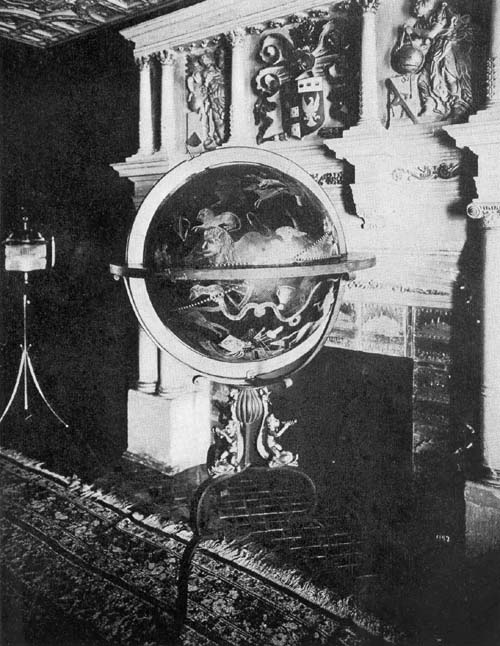
Fig. 106. Manuscript Celestial Globe (Moroncelli?), Late Seventeenth Century.
Roger Palmer (Fig. 107), Count of Castlemaine (1634-1705),81 published, in the year 1679, a work bearing the title ‘The English globe being a stabil and immobil one, performing what the ordinary globes do, and much more.’ In this he described a globe of his own invention, having a diameter of about one foot. It does not appear that the Earl especially distinguished himself in matters either geographical or astronomical. As a diversion from his other interests which claimed his attention, he appears to have turned to the construction of a globe for which he claimed an especial superiority over all others, primarily on account of its simplicity. He set forth in his descriptive text more than twenty of its superior features, and it is interesting to note that Moxon thought well enough of the work to reissue it in the year 1696.82 (Fig. 108.)
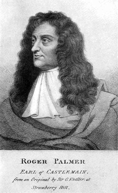
Fig. 107.
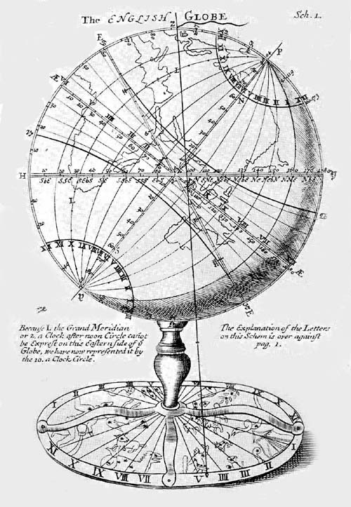
Fig. 108. Globe of Earl of Castlemaine, 1679.
Coronelli gives us the following information concerning a rather remarkable globe which he had occasion to examine in the city of Augsburg, of which he made a drawing for the Venetian Academy (Fig. 109), as he tells us, afterward reproducing the same in his ‘Epitome Cosmografica.’83 This globe he says was the invention of Christopher Treffler of Augsburg and was constructed by Christopher Rad, jeweler 95to His Majesty the Emperor, in the year 1683. He calls it an “Automaton Sphaeridicum,” that is, a celestial globe provided with an automatic movement, so contrived as to exhibit accurately the course of the stars, and to indicate the years, months, days, hours, and minutes, together with the eclipses for seventeen years in advance. At the top of the instrument was placed a little sphere by means of which one could represent certain celestial phenomena, past and future. This mechanism, says Coronelli, is ornamented with96 great ingenuity, good taste, and all regardless of expense. In its construction eighteen hundred ounces of gold and silver had been used. Its height was seven feet, and at the bottom it measured four feet, the entire work rising in the manner of a pyramid above its support of four artistically designed figures. This globe, says Coronelli, which we have seen and handled, and of which we have an exceedingly high opinion, was for sale at eight thousand thaler, and had been fully described in a duodecimo volume printed by the House of Koppmeyer, in the year 1683.84 It is not known what became of this globe which Coronelli found to be so worthy of his commendation.
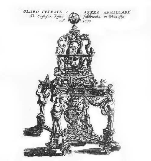
Fig. 109. Globe of Christopher Treffler, 1683.
The Atheneo of Brescia possesses an armillary sphere, having on one of its armillae an inscription which tells us that it was constructed by Gian Battista Alberti in the year 1688, for Count Martinengo.85 The graduated horizon circle, on which appear the names of the sixteen principal winds or directions, rests upon two semicircles, which in turn rest on a support of brass ornamented by six allegorical figures. In this supporting base there has been placed a compass. Its graduated hour circle is furnished with a movable index, such as had become common in globe construction. Five prominent circles represent the equator, the tropics, and the polar circles, to which is added a zodiacal band which is graduated and bears the names and the symbolical figures of the twelve constellations, and the names of the months. Two rings for the purpose of indicating celestial latitude and longitude are placed within the above-named circles and carry representations of the sun and the moon.
A contemporary of Alberti, Giovanni Maccari of Mirandola, likewise a maker of armillary spheres, is known to us through one only, but a fine example of his work.86 This sphere belongs to the Liceo Spallanzi of Regio Emilia. The meridian circle, having a diameter of about 16 cm., is graduated both for latitude and co-latitude by fives. Adjusted to this meridian is a circle representing the colures, likewise97 graduated both for latitude and co-latitude, but by tens, and adjusted to these are the polar circles, the tropics, and the equator. On the zodiacal circle are engraved the names of the twelve constellations, the names of the days, and on the inner surface the inscription “Joannes Maccarius Mirandulanus Feccit 1689.” The supporting base is triangular in shape, having a compass placed in the center. Within the three angles of this base shields have been placed, the one bearing the inscription “Anno Domini 1689,” the second the name “Jo Vulpis Mirandulanus Domus,” by whom the work was probably ordered; the third has a representation of a fox, the emblem of the Volpi family. In addition to the above the base is ornamented with a bronze scroll, to the points of which are attached semicircles which support the horizon circle. This circle has a diameter of about 15 cm., on which are engraved the usual zodiacal names and signs, the names of the months, and of the principal winds or directions. An hour circle is placed at the south pole with a movable index, and within, at the common center of the circles, a small sphere to represent the terrestrial globe, through which the polar axis is made to pass.
In the Biblioteca Estense of Modena there may be found three armillary spheres apparently of about the same date as the two just described.87 One of the three bears the inscription “Jos Antus Vulpes Mirandula Domin. anno Domini 1689.” The other two, somewhat larger in size than the preceding, give us no particular indication of the maker, and no exact date of construction. They may be the work of Alberti or of Maccari.
In Italy’s long line of illustrious geographers, cartographers, and globe makers none has rank in advance of P. Vincenzo Maria Coronelli (1650-1718).88 His achievements within his field were prodigious.89 While, as noted above, there is wanting the evidence that his influence was extended in striking manner into transalpine countries, he seems at least to have won the enthusiastic recognition of contemporary98 men of science, as one worthy of honor for his great achievements.
He was a native of Ravenna (Fig. 110), a member of the Franciscan Order of monks, serving in the last years of his life as its general. It was in his young manhood that he went to Venice, which city became the scene of the greater part of his literary and scientific activities.
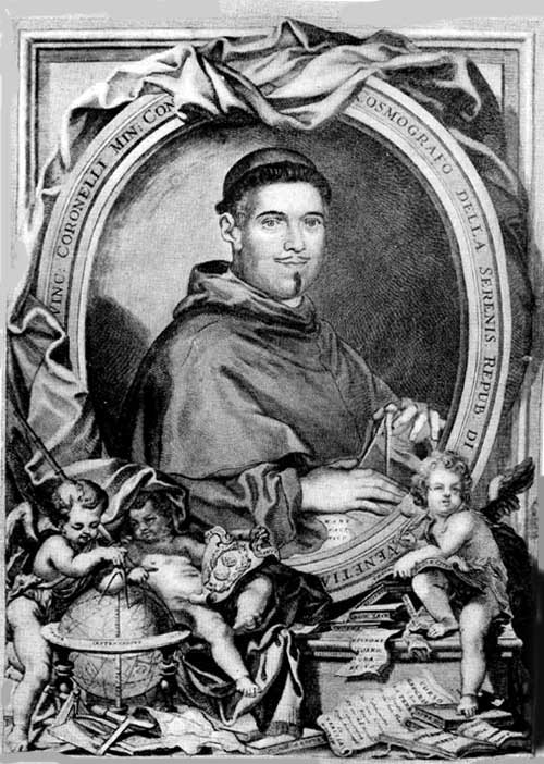
Fig. 110. Portrait of P. Vincenzo Coronelli.
More than four hundred maps were drawn, engraved, and printed by him in the Franciscan Convent located on one of the Venetian islands, and known as the Gran Casa del Frari, where he lived with other brothers of the Order. It was in this convent that Coronelli founded, in the year 1680, the first geographical society, to which he gave the name Accademia Cosmografo degli Argonauti,90 which in its organization followed somewhat that of certain other learned societies owing their origin to the literary and scientific activities of the renaissance period. Its membership, in the course of years, included men of distinction in other cities of Italy and in the North; men famous for their achievements and for their interest in geographical science, literary men, men who held high rank in Europe’s aristocracy, cardinals, prelates, princes, and monarchs.91 The society became one of the most active of the period, and the list of publications which issued from its press, each bearing the argonautic emblem or device—a ship on a terrestrial globe with the motto “Plus Ultra” (Fig. 111)—is a long one.92
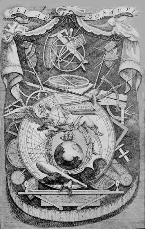
Fig. 111. Emblem of the Venetian Accademia Cosmografica degli Argonauti.
So great had become the fame of Coronelli as early as the year 1685, that he was honored with the title Cosmografo della Serenissima Republica, and was granted an annual allowance of four hundred florins, and a copyright privilege protecting him in his right to print and publish any of his works for a period of twenty-five years.93
We have no definite information as to the circumstances attending Coronelli’s first interest in globe construction. It appears that his first work in this line, a pair of large manuscript99 globes, opened immediately to him a path to fame, for these had come to adorn the library of the Duke of Parma to whom the French Cardinal, d’Estrées, in the year 1680 had occasion to pay a visit and they immediately won the cardinal’s interest. A pair of such globes, thought he, for so runs the story, would be a source of great delight to His Majesty the French King, Louis XIV. Learning that the construction of still larger globes was altogether possible, but that their removal from Italy to France would be attended with great difficulty, he persuaded Coronelli to accept an invitation to take up a residence in Paris, there to direct the construction of a terrestrial and a celestial globe, sparing neither labor nor expense that they might be worthy of presentation to the Grand Monarch. If Olearius could construct a globe ten feet and more in diameter for Duke Frederick of Holstein, and Weigel one of similar dimensions for the demonstration of his theories, why, thought Coronelli, should I not undertake the preparation of those at least fifteen feet in diameter, which in all the details of globe construction should be made to surpass any that had hitherto been conceived? The author himself has given us the first though brief description of his completed work,94 and the royal astronomer, La Hire, supplemented this description in his little volume published in the year 1704, when the globes had been placed in the Chateau Marly.95 In the author’s own account he alludes to the globes as having been constructed at Paris under his direction, and by order of the Most Eminent Cardinal d’Estrées, for the service of His Most Christian Majesty. Great care was especially exercised in the construction of the machinery designed for the rotation of the spheres, the author being especially proud of the fact that, so delicate was this mechanism, each could be set in motion by a single finger. He further gives us to understand that each sphere was so well fashioned “one could design upon its surface all the degrees in the manner in which a turner designs any circle on a ball without having100 it removed from the turner’s lathe,” and that the material of which they were constructed was so solid and so well joined that each was able to sustain the weight of thirty men. Each was furnished with a door through which a considerable number of persons might enter at one time, their presence within affecting in no wise the solidity of construction. Each was covered with fine canvas so carefully laid on that none of the joints could be seen, giving a surface smooth as ivory. The meridian and horizon circles were of bronze, the whole being supported by columns which were richly ornamented. In the base, between the four columns supporting the meridian circles, large compasses were placed, being so designed as properly to indicate the needle’s declination.
On the celestial globe the greater and the lesser circles were represented in gilt bronze, and were so graduated for both latitude and longitude, ascension and declination, that it was made easy for an astronomer to pass from one co-ordinate to the other without the aid of trigonometry. On a fine background of ultramarine the several constellations with their respective figures were represented, each of the planets and fixed stars being gilded in order to give it due prominence. The author so designed his star map as to represent the appearance of the heavens at the time of the birth of the Grand Monarch,96 as is told in the following dedication engraved on a brass tablet and attached to the surface of the sphere: “A l’Auguste Majesté de Louis le Grand l’Invincible, l’Heureux, le Sage, le Conquerant. Cesar Cardinal d’Estrées a consacré ce globe celeste, ou toutes les etoilles du firmament, et les planetes sont placées au lieu mesme, ou elles estoient a la naissance de ce Glorieux Monarque, afin de conserver a l’eternite une image fixe de cette heureuse disposition, sous laquelle la France a receu le plus grand present, que le ciel ait iamais fait a la terre. M.DC.LXXXIII.” “To His August Majesty Louis the Great, the Invincible, the Happy, the Wise, the Conquering. Cesar 101Cardinal d’Estrées has dedicated this celestial globe, on which all the stars of heaven and the planets are placed in the same position in which they were at the birth of the Glorious Monarch, in order to preserve throughout eternity a fixed image of that happy disposition under which France has received the most noble present which Heaven has ever made to earth.”
On the terrestrial globe, which in its general features resembled the celestial, the seas were painted blue and the land white, that the several names and legends might appear the more distinct. A portrait of the King was placed above a cartouch containing the dedication, resembling that on the celestial globe, reading “A l’Auguste Majeste de Louis le Grand l’Invincible, l’Heureux, le Sage, le Conquerant. Cesar Cardinal d’Estrées a consacré ce globe terrestre, pour rendre un continuel hommage a sa Glore, et a ses Heroiques Vertus, en mostrant les pays ou mille grandes Actions ont esté executées et par Luy Mesme, et par ses Ordres, a l’estonnement de tant de nations, qu’il avroit pu soumetre a son empire, si sa Moderation n’eust arrestè le Cours de Ses Conquestes, et prescrit des bornes a Sa Valeur, plus grande encore que sa Fortune. M.DC.LXXXIII.” “To His August Majesty Louis the Great, the Invincible, the Happy, the Wise, the conquering. Cesar Cardinal d’Estrées has dedicated this terrestrial globe, in order to render perpetual homage to His Glory and to His Heroic Virtue in representing the countries wherein a thousand great acts have been performed both by Himself and by his Order, to the astonishment of all nations, which He would have been able to bring under his subjection if his moderation had not restrained the course of his Conquests and prescribed bounds to his Courage yet greater than his Fortune. M.DC.LXXXIII.”
Below this dedication, likewise below the corresponding dedication on the celestial globe, we read “Cet ouvrage a eté inventé et achevé par le Père Coronelli Venitien des.102 Min. Conv.” “This work was conceived and accomplished by P. Coronelli, a Venetian of the Minorite Order.”
In his brief description, the author says that he has shown on his terrestrial globe all ancient and modern discoveries, basing the same on the maps, the observations, and the reports of the most renowned geographers, to which he has added the results of his own studies not recorded on other globes nor in other maps. Special mention is made of information given concerning the interior regions of Africa, noting that “besides outlining the Monomotapa and Abyssinia countries, we have been the first to describe correctly the source as well as the course of the Nile River correcting, by many degrees the errors of the ancients.” Andrea Baba, public censor and secretary of the Argonauts, notes, in his letter to the reader appearing in the first volume of the ‘Atlante Veneto,’ that the author of the two globes, constructed for the King of France, had obtained numerous authentic reports of geographers and explorers, which he had included in his work. Ludolf, writing in the year 1691 concerning Ethiopia, records “Ethiopia: Nostram tabulam chorographicam comunicavimus cum P. Vincentio Coronellio, nunc cosmographo Veneto, qui eam adhibuit in globis quos Cardinalis Estresius pro rege Galliae construi fecit, maximos, qui unquam visi fuerint. Ibi in Globo terrestri Habessina et Nilus secundum nostram delineationem visitur. Satis mature eam communicaverim Adamo Oleario, cum insignem globum, qui Gottorfii cernitur, construeret, sed ille mihi, ut tum temporis juveni, fidem non habuit.” “Ethiopia: we made known our chorographic record to P. Vincentio Coronelli now cosmographer of Venice, who included it on his globe which Cardinal d’Estrées had made for the King of France, the largest globe ever seen. There, on the terrestrial globe, Abyssinia and the Nile are seen following our representation. Quite a long time ago we made this known to Adam Olearius, when he was making the renowned globe103 which may be seen at Gottorp, but he, as I was then a young man, did not have confidence in me.”97
Marcel, in writing of the Portuguese in Africa, observed: “Si nous examinons les cartes de Mercator, de Bertius, de Hondius, de Meursius, de Sanson, de Duval, nous y trouvons un cours du Cuama ou Zanbèsi absolument fantaisiste. Il faut arriver au fameux globe de Coronelli pour y trouver en 1683 le cours de Zambèse tracé comme sur la carte que nous reproduisons. Il est évident que ce géographe vénitien a pu consulter des documents portugais aujourd’hui perdus, cartes ou relations de voyages, qui viendraient jeter un jour infiniment précieux sur les explorations des Portugais et les relations qu’ils entretenaient avec les populations belliqueuses du bassin du Chiré.” “If we examine the maps of Mercator, of Bertius, Hondius, Meureius, Sanson, Duval, we will find the course of the Cuama or Zambesi absolutely fantastic. One must examine the famous globe of Coronelli to find in 1683 the course of the Zambesi represented as on the map which we reproduce. It is evident that the Venetian geographer had been able to consult Portuguese documents which today are lost, maps or accounts of Voyages which would throw light of great value on the explorations of the Portuguese and the relations they had with the warlike people of the basin of the Chiré.”98
Coronelli adorned his globe map with very artistic representations of merchant ships sailing over the ocean highways, and with elaborate pictures of many naval battles.
It was in the year 1704 that these globes were placed in the royal Château Marly,99 where they remained until the year 1722, when they were placed in the old Palace of the Louvre. A final resting place was found for them in the Royal Library, now known as the Bibliothèque Nationale, in a room especially constructed to receive them. Recent information from the library notes that, on account of certain reconstructive work, they have been placed in an inaccessible part of the building, and cannot be photographed.
104The success of this first endeavor to construct globes of large size led other Princes to entertain the thought of adorning their palaces with similar productions. It is not known, however, that the great Venetian actually set himself to the task of duplicating his French masterpieces; we have rather the assurance, as is noted below, that he thought better of a plan for issuing globes of smaller size, whose map records should contain practically all he had been able to include in his large work. The Royal Estense Library of Modena possesses a manuscript, cited by Fiorini, which assures us that Coronelli had been approached with a proposition to construct for Francis II of Modena a pair of globes equal in size to those he had prepared for the French King. This document reads: “Rispondendo il P.r̄e Cosmografo Coronelli alii di lei questiti per la fabbrica delli globi, gli dice, che il farà tanto grandi, quanta sarà la capacità della stanza, e bisognando fabbricare anco una stanza dentro del Globo, resta solo che il Principe che la desidera, habbia curiosità e volontà do spendere; limitandosi però il P. Cosmografo alia grandezza di Globi di diametro di quindici piedi, dice, che per il solo pagamento di materiali, e degli Artifici, si ricercano ducento doppie; che per delineare la Geografia, scriveri, collocarvi le stelle, ed assegnare il luogo alle figure vi vorrà di spesa quattrocento doppie. Per accomodare il luogo che sia capace per la fabrica delli Globi di questa grandezza, vi vogliono cinquanta doppie. Per gli ornamenti della Pittura, Miniatura, Scultura, et altri, si potrà fare quella spesa che parerà più propria al Principe, che desidera; mentre in questi si può o meno. E perchè il Principe conosca il genio dell’ autore in questa materia, osserverà nella picciolezza delle due mostre, ch’esibisce, confrontandole colle migliori carte, di qual perfetione e pulizia sarebbe questa di quindici piedi. Il P. Coronelli per ricompensa desidera una pensione annua sua vita durante di quella soma che parerà propria alia generosità del Principe. S’aggiunge, un quinternetto della supputazione delle stelle105 d’Orione, perchè il Principe osservi l’accrescimento delle stelle di questa costellazione, come sono accresciute di gran numero tutte le altro del Globo del Cielo del P. Coronelli.” “Father Coronelli, in reply to your questions regarding the construction of the globes which you say you wish to have made as large as the capacity of the room will allow, and with space in the globe itself, says that all that is necessary is to know how much his Excellency the Prince should wish to expend. However Father Coronelli limits himself to the construction of globes of fifteen feet in diameter, for which the cost of the material alone and of the workmanship is two hundred doubloons. For outlining the geographical map, for the proper placing of the stars, and the representation of the figures, the cost will be four hundred doubloons. To arrange a place for globes of this size another fifty doubloons will be necessary. For the decorations, the miniatures and engravings His Excellency can spend as much as he desires. In order that His Excellency the Prince may appreciate the great genius of the author in this matter, he will please take note of the two small globes which he exhibits, (and think) how perfect and attractive those fifteen feet in diameter will be in comparison with the best of maps. Father Coronelli desires, as compensation, an annual pension for life, such sum as His Excellency the Prince considers sufficiently generous. We enclose an account showing the representation of the stars of Orion, in order that the Prince may note the increase in the number of the stars in this constellation, and also note how all of the other constellations as represented on the globe of Father Coronelli show an increase in the number of stars.”100 There is no evidence known that this work was actually undertaken by our Venetian globe maker, the presumption being that the matter did not receive further consideration.
As an expression of appreciation for the honors shown to him by the Academy of the Argonauts, Coronelli decided to issue his Paris globes reduced in size, choosing a diameter of106 three and one half feet or about 107 cm. instead of fifteen feet. His globes, therefore, of the year 1688 were the largest to date in which engraved gore maps had been employed in construction. In one of his legends he thus alludes to the Academy. “Il genio della virtù raccomanda all’eternità il nome di Cesare Cardinale eminentissimo d’Estrées, Duca e Pari Francia, mentre fece elaborare per Ludovico il Magno dal P. Coronelli due gran Globi l’idea dei quali ha poi epilogata in questi per l’Accademia cosmografica degli Argonauti. L’anno MDCLXXXVIII.” “The genius of virtue commends to posterity the name of Cesar, most eminent Cardinal d’Estrées, Duke and Peer of France, since he had constructed for Louis the Great by P. Coronelli two large globes, the idea of which he then summarized herewith for the Cosmographical Academy of the Argonauts. In the year 1688.” The dedication, the same as that on the celestial globe, reads as follows: “Alla Serenissima Republica e Serinissimo Principe Francesco Morosini Doge di Venezia Capitan Gen: de Mare. Vincenzo Coronelli M. C. Suddito Cosmografo e Lettore publico.” “To the Most Serene Republic and the Most Serene Prince Francesco Morosini, Doge of Venice, Captain General of the Sea, by Vincenzo Coronelli M. C., the above mentioned cosmographer and public reader.” Placed below this legend in a cartouch containing the portrait of the author is the inscription “P. V. Coronelli M. C. Cosmografo Publico.” There is an inscription on the celestial globe which reads, “Si presentano a V. Serenità li Globi del Mondo, Teatro delle cospicue attioni de’ Principi, perchè mentre corre il terzo decimo secolo (ch’è quasi la quarta parte della vita d’esso) ne’ quali la Serenissima Republica agisse ugualmente e collo splendore delle lettre e col luminoso dell’armi, Vede l’Universale delle genti col mezzo di Stampa così reguardevole sin dove si vada sempre più estendendo la gloria del Veneto Nome. Quella che se ne assume l’Accademia Cosmografica degli Argonauti nella presente dedicazione e chi vive di V. V. Coronelli Cosmografo107 della medesima.” “There are hereby presented to Your Serene Highness these globes of the world, the scene of the remarkable deeds of Princes, in order that while the thirteenth century is passing (which makes nearly a fourth part of the life of the world) wherein the Most Serene Republic has proceeded equally with the splendor of letters and the brilliancy of arms may be seen by the universality of the races; by means of this so important publication however there is more widely spread the glory of the Venetian name; of which glory a portion is assumed by the Cosmographical Academy of the Argonauts, in the present dedication, and by him who lives by our permission, Coronelli, Cosmographer of the same.”
The author selected the year 1700 as that in which to indicate the position of the stars which he represented on his globe, referring to this fact in his legend. “L’epoca di questo globo è perfissa nell’anno futuro 1700 acciocchè l’arte in quest’ opera precorra quel tempo che per natura dovrà consumarla. Prevenendo questo globo tardo il Corso veloce del Cielo, comparisce presente il secolo venturo acciò possi ognuno con ordine più facile ridurre agli anni scorsi le stelle fisse colla sottrazione di 51 secondi come piace a Ticone, o 50 seguendo il parere del Ricciolo. Volendo specolare il sistema degli anni anco posteriore all’epoca stabilita, aggiungasi proporzionalmente al 1700 che seguirà la riduttione senza errore sensibile per tutto lo spazio di 400 anni.” “The epoch of this globe is fixed for the year 1700, in order that the labor in its construction may have the time which naturally will be required for its completion. As this belated globe anticipates the rapid movement of the sky, the coming century appears as though present, anyone may be able in easier fashion to change to past years the fixed stars, by the subtraction of fifty-one seconds as Tycho reckons, or fifty according to the opinion of Ricciola. If one desires to speculate also upon the system of the years posterior to the established epoch, let him add proportionally to 1700, and the108 change will follow without sensible error for the entire period of 400 years.”
To the constellations he makes the following reference: “Furono osservate molte stelle in vicinanza del Polo antartico incognite non solo agli Egizij e Greci, ma ancora a Ticone Brahe. Osservò parimente Federico Houtmano, nell’Isola Sumatra, molte stelle vicine al Polo medesimo, le quali essendo state incognite agli accinnati autori, le ridussero in 13 costellazioni cioè Fenice Colomb Mosca, Pesce volante, Camaleonte, Triangolo Australe, Uccello Indiano, Pavone, l’Uomo Indiano, la Gru, il Toucan, l’Hindro e il dorado; altri dopo v’hanno aggiunto la Nube Grande, la Picciola e la Romboide. Noi abbiamo arricchito questo Globo d’un maggior numero di stelle, scoperte dall’ Hallei Inglese, che si trasportò a tal effetto nell’Isola S. Elena, coll’aggiunta d’altre osservatione, così do questo come d’altri scritton.” “There have been observed many stars in the vicinity of the Antarctic pole, unknown not only to the Egyptians and Greeks, but also to Tycho Brahe. There have been observed likewise by Frederick Houtmann, on the Island of Sumatra, many stars near the same pole which having been unknown to the above-mentioned authors, they reduced to 13 constellations, namely the Phoenix, the Dove, the Fly, the Flying Fish, the Chameleon, the Southern Triangle, the Indian Bird, the Peacock, the Indian Man, the Crane, the Toucan, the Water-Snake, and the Goldfish; others since then have been added to these, the Greater Cloud and the Lesser, and the Rhomboid. We have enriched this globe with a considerable number of stars discovered by the Englishman Halley, who was sent to the Island of St. Helena for this purpose, with the addition of other observations as they have written.”
Thirty-eight constellations are designated in the northern hemisphere, twelve in the zodiac, and thirty-three in the southern hemisphere, thus adding thirty-five to the number as given by Ptolemy. Instead of Ptolemy’s 1022 catalogued109 stars, including fifteen of the first magnitude, forty-five of the second, two hundred and eight of the third, four hundred and seventy-four of the fourth, two hundred and seventeen of the fifth, forty-nine of the sixth, and forty which were nebular and indistinct, Coronelli gives the number as 1902, including eighteen of the first, sixty-eight of the second, two hundred and thirty-seven of the third, four hundred and ninety-six of the fourth, four hundred and eighty-nine of the fifth, five hundred and sixteen of the sixth, and seventy-eight which were nebular and indistinct. Five of the latter, having been discovered in the previous one hundred and twenty-five years, had wholly or in part disappeared in Coronelli’s day, of which, that making its appearance in the constellation Cassiopeia in the year 1572 disappeared in the year 1574, that discovered in the year 1596 in the Whale was rapidly diminishing in size, that discovered by Tycho Brahe in the Swan in the year 1600 ceased to be visible in the year 1629 to reappear in the year 1659, that in the Serpent larger than the planet Jupiter which was visible but thirteen months, that in the head of the Swan discovered in the year 1670 and still visible.
Coronelli seems to have made every endeavor to produce maps for his terrestrial globes which should omit nothing of real interest and value to geographers, navigators, and explorers. He added a rather unusual number of legends, explanatory and informative in character, but never seemed to crowd the space which he had at his disposal. So exquisitely engraved were his maps that he was able to avoid the appearance of confusion noticeable on certain other globes of his century, as, for example, in the Old World parts of Blaeu’s globe of 1622. It is very evident that many pages would be required for anything like a detailed description of his records, and the great majority must necessarily be omitted. To those quoted above a few, however, may be added.
Blaeu’s reference to the prime meridian was cited in full as was that of Moroncelli; Coronelli’s reference is here like110wise cited, which, it will be noted, is not without errors. It is one having to do with problems concerning the determination of longitude, hence involving interests of vital concern to navigation. “Del primo meridiano. Sono in questo 72 meridiani, 36 con linee continuate, le altre sono di punti, da ciascuno dei quali è diviso in G. 5 di longitudine che è il corso del Sole in un terzo d’oro. Li Geografi antichi e moderni non convengono nel luogo dove passa il primo meridiano; tra li primi Eratostene l’ha posto alle Colonne d’Hercole, Marino di Tyr all’Isole Fortunate, Tolomeo nella sua Geografia ha seguito la stessa opinione; ma ne’ suoi libri di Astronomia l’ ha passato per Alessandria d’Egitto. Tra li moderni Ismaele Abulfeda lo segna a Cadiz, Alfonzo a Toledo, Pigafetta et Herrera hanno fatto il medisimo; Copernico lo pone a Freudenburgo; Renoldo a Monte Reale o Konisberg; Keplero a Uraniburgo; Longo Montano a Kopenhagen; Lansbergius a Goes; Ricciolo a Bologna. Gli Atlanti di Jansonio e di Blaeu a Monte Pico. Per continuare l’origine della mia Geografia ho posto in questo Globo il primo meridiano nella parte più occidentale della Isola di Ferro, com’onche per seguire il Decreto di Luigi XIII, che col consiglio de’ Geog. nel 1634 lo determinò in questo stesso luogo.” “Concerning the first meridian. There are represented on this 72 meridians, 36 with continuous lines—the others are marked,—by each of which it is divided into 5 degrees of longitude, which is the course of the sun in one third of an hour. The ancient and modern geographers do not agree upon the place through which the first meridian passes: among the former, Eratosthenes put it at the Pillars of Hercules; Marinus of Tyre at the Canary Islands; Ptolemy in his geography has followed the same opinion, but in his books on astronomy he has located it as running through Alexandria in Egypt. Among the moderns, Ismail Aboulfeda puts it at Cadiz; Alfonso at Toledo; Pigafetta and Herrera have done the same; Copernicus puts it at Freudenberg; Reinhold at Mount Royal (Königsberg); Kepler at Uranienburg;111 Longomontanus at Copenhagen; Lansberg at Goa; Ricciola at Bologna; the atlases of Jansson and Blaeu at Mount Pico. To continue the precedent of my geography I have on this globe placed the first meridian in the most western part of the Island of Ferro,—as also to follow the decree of Louis XIII, who on the advice of the geographers in 1634 assigned it to this same place.” California he lays down as an island, west of which is a legend relating to “Nuova Albione,” and north in the Pacific one relating to “Stretto di Anian.” There is reference to the route to Goa, which is placed near the Island of Madagascar. The reference to the Zambesi River clearly gives evidence of acquaintance with Portuguese records of which we have no other knowledge. This legend reads, “Rio Zambese: Città e fortezza di Tete de Portugal; Fortezza di S. Estevao; Minere di Ferro; Minere d’argento che il Re di Monom. promise al Re di Spagna nel 1604; Fortezza di Chicova.” “Zambesi River: City and fortress of Tete of Portugal; fortress of S. Estevao; iron mines; silver mines which the King of Monomotapa promised to the King of Spain in 1604; fortress of Chicova.” Like the other leading map makers of the period he has indicated the course of certain transoceanic expeditions, occasionally noting the distance sailed on each successive day, with other valuable and interesting information relating to the position of the sun and the moon, to atmospheric conditions, to the appearance of sea birds and of certain marine animals.
Globes of this 1688 edition may be found in the Biblioteca Comunale of Fano; in the Biblioteca Comunale of Faenza; in the Königliche Mathematisch-Physikalischer Salon of Dresden, celestial undated; in the Biblioteca Civico of Bergamo; in the Biblioteca Gonzaga of Mantua; in the Biblioteca Marciana of Venice (Figs. 112, 113); in the Museo Civico of Venice; in the Biblioteca Universitario of Naples; in the Palazzo Manin of Passeriano. The twelve gores of the terrestrial globe may be found in the British112 Museum; a fine copy of the twelve gores may also be found in the Library of Congress, Washington; a copy of the mounted terrestrial globe belongs to the Biblioteca Emanuele of Rome; three copies of this globe in addition to the pair referred to above belong to the Museo Civico of Venice.
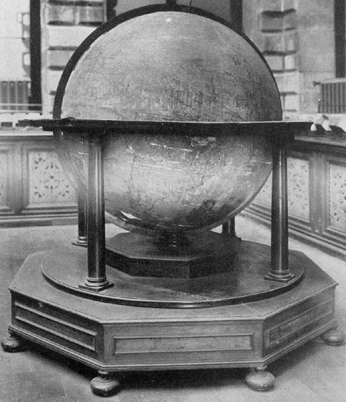
Fig. 112. Terrestrial Globe of P. Vincenzo Coronelli, 1688.
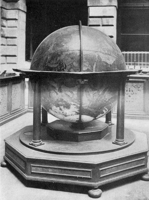
Fig. 113. Celestial Globe of P. Vincenzo Coronelli, 1688.
It appears that Coronelli’s terrestrial globe gores of the year 1688, which were frequently reissued, were but little altered in the several editions. His celestial globe in successive issues seems to have been much altered. France had specially honored the Venetian globe maker in giving to him every facility for the production of his great masterpieces, the Marly globes. The Société Gallica of Paris decided, in the year 1693, to add to his honors, and to give expression to an appreciation of his merits through the publication of a new edition of his globes, at least of the celestial, the Venetian terrestrial of 1688 being made to serve as a companion. In the following legend we have information concerning the date, and concerning the participants in its preparation: “Orbis coelesti typus. Opus a Coronelli Serenissimae Reipublicae Cosmographo inchoatum Societatis Gallicae sumptibus absolutum, Lutetiae Parisiorum. Anno N. S. MDCXCIII. Delin. Arnoldus Deuvez Regiae Acad. Pictor; Sculp. I. B. Nolin Reg. Chr. Calcographus.” “Representation of a celestial globe. A work begun by Coronelli, the cosmographer of the Venetian Republic; finished at the expense of the French Society at Paris in the year 1693. Drawn by Arnold Deuvez painter of the Royal Academy; I. B. Nolin Royal Cartographer, draughtsman.”
The Parisian Society did not find it necessary to substitute the French language in the legends for the language of the author, as appears in the address to the reader, which of course is not Coronelli phrasing. “Amico lettore. Rappresenta questa Globo le Costellazioni del Firmamento, quali agli occhi nostri compariscono e non come negli altri esposte, poichè nel centro loro bisogna immaginarsi d’essore per intenderle. Le stelle d’esso calcolate all’Epoca 1700 sono 113pubblicati. Quelle comprese dalle Costellazioni di Baiero, come le più cognite, perchè con maggiore facilità si possino colle nostre confrontare, sono accompagnate cogli caratteri greci e latini da es so usati. Le stelle, ch’ appresso Baiero, restano informi, sono, da noi segnate di giallo; le Nuove colorite di minio; le osservate dal P. Antelmo di verde, quelle dell’ Hallei di pavonazzo, l’altre di Hevelio di lacca; le corrette da Baiero di Cinabro, e l’osservazioni fatte dagli altri autori si distinguono nel nostro Epitome Cosmografico, stampato in Venetia nel 1693. In questo pure vengono dilucidati gli Numeri, Caratteri, le Frezze, che passano diametralmente per le stelle, la loro Obliquità, Lunghezza, l’Acume, gli Pianeti che l’accompagnano; il moto diario delle Comete, disegnate di molti secoli, ed ogni altro perticolare che per l’angustia del sito non è permesso esprimere senza il di cui libra non possono avere uso gli Globi presenti che pure restano descritti nel nostro Atlante Veneto non però così diffusamente.” “Dear reader. This globe represents the constellations of the firmament as they appear to our eyes and not as shown by others, since it is necessary to imagine that one is in their center in order to conceive them. The stars of the globe are represented as calculated for the year 1700. Those included in the constellations of Bayer, as the best known, in order that they, with greater ease may be compared with ours, are designated by the Greek and Latin characters used by him. Stars, which according to Bayer remain undetermined, are indicated by us as yellow; the new ones colored with red; those observed by P. Antelmo, with green, those of Halley with violet, the others of Hevelius with lake color; the stars corrected by Bayer with cinnabar; and the observations made by other authors are distinguished in our Cosmographical Epitome, printed in Venice in 1693. In this also are elucidated the numbers, characters, the lines that pass diametrically through the stars, their obliquity, length, extremity, the planets that accompany them, the daily movement of the comets, traced for many centuries, 114and every other particular which because of the limitations of space it is not here permitted to express,—without which book it is not possible to make use of the present globes, which are also described in our Venetian Atlas, but not so detailed.”
Pairs of his globes are very numerous which include the terrestrial of the year 1688, now and then with some modifications, and the celestial of the year 1693, these being usually, but not in all instances dated, the latter being the Paris issue or apparently a slightly modified Venetian edition of the same. It must be admitted that it is not easy to classify the copies of his globes which followed his first issue of the year 1688, but which have the same dimensions. In not a few of these provision was made for a special dedication, the cartouch for such dedication being often left blank, to be filled when occasion seemed to offer for the bestowal of the special honor. Some of these globes containing such special dedication are known, to which reference is made below.
Examples of Coronelli’s work belonging to this group may be found in the following libraries or museums: In the Landesmuseum of Zürich (Fig. 114); in the Seminario Vescovile of Aversa; in the Biblioteca Comunale of Bologna; in the Archivo di Stato of Bologna; in the Biblioteca Privato of Professor Liuzzi of Bologna; in the Convento dell’ Osservanza of Bologna; in the Museo di Strumenti Antichi of Florence; in the Museo Civico of Genoa; a copy of the celestial in the British Museum of London; in the Biblioteca Brancacciana of Naples; in the Biblioteca Nazionale of Naples; in the Biblioteca Nazionale of Palermo; in the Biblioteca Antoniana of Padua; in the Bibliothèque Nationale of Paris; in the Biblioteca Classense of Ravenna; in the Biblioteca Lancisiana of Rome; in the Accademia delle Scienze of Turin; in the Seminario Patriarcale of Venice; in the Biblioteca Comunale of Vicenza; of the terrestrial in the Royal Library of Madrid. The Vicenza examples,115 also those in the Archivo di Stato of Bologna and in the Biblioteca Nazionale of Palermo, are dedicated to the “Eminentissimo e reverendissimo Principe” Cardinal Pietro Ottoboni. The interesting brief legend, reading “Alexander a Via Veronensis sculpsit” on the celestial globe, gives us clearly to understand that there were Venetian issues of that edition which made its first appearance in Paris under the auspices of the Société Gallica. The gores of this issue Coronelli printed in his ‘Atlante Veneto,’ Volume XI.
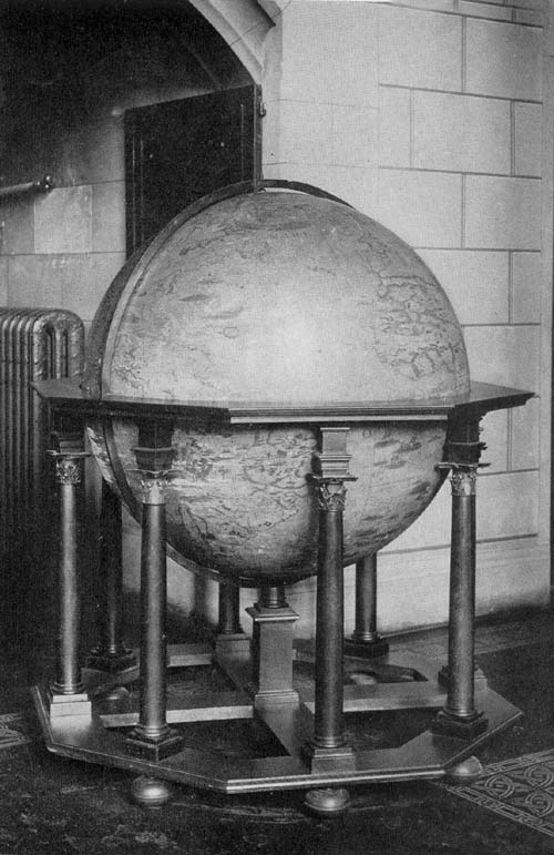
Fig. 114. Terrestrial Globe of P. Vincenzo Coronelli, 1688.
In the year 1696 Coronelli made an extensive European tour which carried him as far as England, an account of which he published in Venice in the following year under the title ‘Viaggio de Venezia fino in Inghilterra.’ In this work the author describes an edition of his globes which he referred to as having a diameter of “un piede e mezzo,” or about 48 cm., prepared in London and dedicated to the English King William III, of which it has been possible to locate several examples. A particularly fine copy of the terrestrial may be found in the collection of The Hispanic Society of America (Fig. 115), agreeing in all its details with the other copies, in so far, at least, as the information obtained seems to indicate. In an elaborately decorated cartouch near the south polar region is the dedicatory inscription, reading “Globum hujusmodi Terraqueum Guglielmo invictissimo ac potentissimo Magnae Britaniae etc. Regi Dicat, Vocat. consecrat. Pater, Magister Vincentius Coronelli Mon. Con. S. Francisci Serenissimae Venetorum Reipublicae Cosmographus MDCLXXXXVI. Londini.” “This terrestrial globe, Father and Master Vincentio Coronelli, Brother of the Franciscan Order and Cosmographer of the Venetian Republic, dedicates, names and consecrates to William III, the Invincible and Mighty King of Great Britain.” Not far from the above is a somewhat elaborate representation of the king’s coat of arms with the motto “Hony soit qui mal y pense. Je maintienderay.” Its mounting consists of a narrow graduated meridian circle of wood which is116 made to pass, in the usual manner, through a horizon circle of wood, the outer edge of which is octagonal. The upper surface of this horizon circle is covered with an engraved horizon sheet giving within concentric circles the names of the zodiacal constellations, names of the months with the names of the prominent saints, the names of the principal winds, and of the principal directions in Italian. It has a supporting base of four artistically turned columns with binding crossbars extending from each post to a central circular plate 17 cm. in diameter, carrying the post through a slot in which the meridian circle is made to pass. The north pole is topped with a thin pasteboard hour circle and pointer. The globe map is composed of twelve gores which are truncated in latitude 80 degrees both north and south, the polar spaces being covered with circular discs, and are cut on the line of the equator. The sphere is exceedingly light in weight, being composed of papier-mâché. In every particular the globe is one remarkably well preserved, and is one of the finest examples of early globe making in the society’s collection.
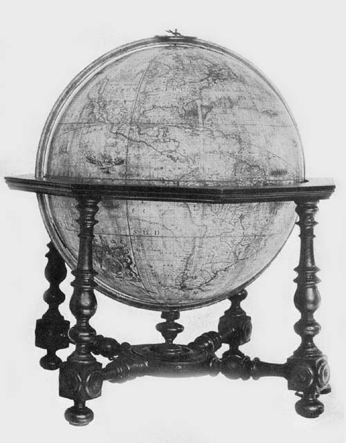
Fig. 115. Terrestrial Globe of P. Vincenzo Coronelli, 1696.
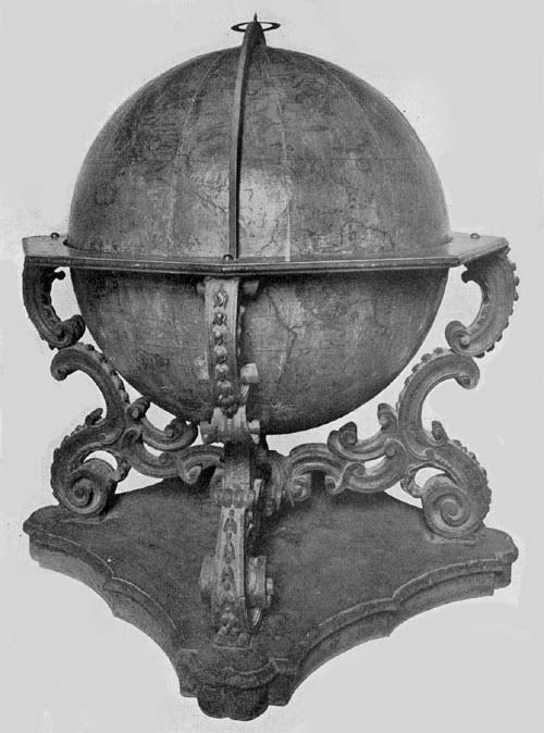
Fig. 115a. Terrestrial Globe of P. Vincenzo Coronelli, 1693.
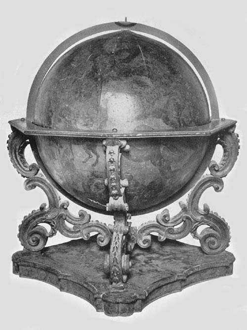
Fig. 115b. Celestial Globe of P. Vincenzo Coronelli, 1693.
In geographical names the map records are very full, these being given either in Italian, Spanish, Latin, Dutch, English, or in the native language of the country in which they appear. Curiously enough in many instances the author appears to give his own peculiar spelling, approaching therein, to the best of his ability, the spelling suggested by the pronunciation of the several names. Legends are exceedingly numerous, many of them recording incidents relating to certain expeditions or to certain discoveries, such as the expedition of Magellan; early expeditions along the west coast of North America, including reference to Cortes, Ulloa, Alarçon, Cabrillo, Guzman, Drake; expeditions to the East Indies, including that of Le Maire, Hoorn, Van Diemen, Chaumont, and others. Boundary lines of local regions, in both the Old and the New World are exceedingly numerous, which fact in itself gives a somewhat unique value to the 117map as of geographical and historical value. California appears as an island, and a great stretch of ocean appears between northwest North America and northeast Asia wherein is located land with indefinite outline marked, “Terra de Jesso ó Jeco, Yedco, Esso et Sesso Scoperta dagli Hollandesi l’anno 1643.” The map of North America is particularly of interest and value, especially for the region of the United States.
Pictures of ships sailing the ocean, those of the oriental peoples as well as those of the occidental are numerous, as are also pictures representing seal fishing, and pictures representing the methods of capturing polar bears and whales. It is interesting to note that loxodromic lines or sailing lines have disappeared from such maps, that the map and the chart are here seen to merge.
The celestial globe of this edition has practically the same dedication as the terrestrial, the word “Terraqueum” alone being changed to “Coelestem.” There is on this the following address: “Amico Lettore. Oltre ai molti Globi delineati dal P. Cosmografo Coronelli per Sovrani diversi di varie e vaste misure, ne ha ultimamente composti e stampati di cinque grandezze a pubblico beneficio, fra i quali i più comodi ed esatti sono i presenti. I numeri che accompagnano le stelle calcolate all’epoca del 1700; così l’altre notizie, ad uso dei medesimi Globi, vengono nel suo Epitome Cosmografico diffusamente spiegati.” “Dear reader. Besides the many globes delineated by the cosmographer P. Coronelli, for divers Sovereigns, he has recently composed and printed some in five sizes for the use of the public, among which the most convenient and exact are the present ones. The numbers that accompany the stars are calculated for the epoch 1700; moreover the other particulars for the use of these same globes are extensively developed in his Epitome Cosmografico.”
In the reference to the several constellations there is repeated, with but slight alteration, the statements made on118 his larger globes, the position of the fixed stars being referred to the year 1700.
Examples of the 1696 edition of Coronelli’s globes may be found in the Seminario Vescovile of Finale; in the Biblioteca Franzoniana of Genoa; in the Germanisches Nationalmuseum of Nürnberg; in the Biblioteca Comunale of Perugia; in the Museo Civico of Trieste; a copy of the terrestrial in the Biblioteca Nazionale of Florence, and one in the Certosa of Pisa; the unmounted gores of the celestial in the Museo Astronomico of Rome.
The globes of the year 1696 were reissued in the year 1699, with certain unimportant alterations. It may be noted that as in certain copies of the 1693 edition the cartouch designed for a dedicatory inscription was left blank, that the author might insert the name of the recipient whom he might choose to honor. So in his globes of the year 1699 he left a like blank space, but in the terrestrial globe he inscribed what he evidently felt he should want to insert in each instance—a dedication in blank, as it were, reading “D. D. D. Pater Magister Vincentius Coronelli Mon: Con: Francisci Serenissimae Venetorum Reipublicae Cosmographus MDCLXXXXIX.” One example has been located in which the name of the honored individual has been inserted, reading, in addition to the author and date as above, “Illustrissimo et Praexcelso Nobili Viro D. D. Comiti Aloysio Paoluccio Militiae Sanctae Apostolicae Sedis in Piceno Praefecto,” this copy being in the Biblioteca Privato of Sr. Remigio Salotti of Modena. Copies of each of the 1699 issue may also be found in the Biblioteca Marucelliana of Florence; in the Biblioteca Vittorio Emanuele of Rome; in the Biblioteca of the Marquis Piero Bargagli of Rome; a copy of the terrestrial in the Museo Astronomico of Rome, a copy of the same in the Biblioteca Nazionale of Florence, and a copy in the Certosa of Pisa.
In one of his own publications issued in Venice in the year 1697 Coronelli tells us of an edition of his celestial globe 119which he was preparing.101 He announces “To the Public” that the large celestial globe, three and one half feet in diameter, which he was then having reëngraved and which would exhibit all of the artistic features of the Paris edition of 1693, would be one of superior excellence. He adds that the many corrections and additions, as the parts already completed clearly indicate, would make it one very exact, and its completion was promised before the end of the year 1698. This celestial globe was issued in Venice in the year 1699, edited, according to an inscribed legend, by Coronelli and the Academy of the Argonauts. We cannot with certainty locate a copy of this globe. Perhaps it may be found in one of the undated examples, now known, of the size designated.
The Abbot Gimma, to whom reference has been made, informs us that Coronelli constructed other globes, the same having diameters respectively six, four, and two inches, and in the ‘Epitome Cosmografica’ of the author, under the paragraph heading, “Opere stampate dal Padre Coronelli,” we read that he constructed celestial and terrestrial globes three inches in diameter for the pocket. In Volume X of the ‘Atlanta Veneto,’ under the title “Globi del Coronelli,” the gores of these globes are reproduced, and from these reprints we are able to get certain information concerning them. But one pair of his six-inch globes has been located and none of the smaller size, this one pair being the unmounted gores, twelve in number for each globe, to be found in the British Museum. The terrestrial has the following dedication: “Hos Globos Terraqueum ac Coelestem dicat et donat R. m̄o P. D. Sigismundo Pollitio a Placentia Praeposito Generali Monarchorum Ermitorum S. Hyeronimi Congreg. Lombardiae P. M. Coronelli Cosmographus P.” “These globes, a terrestrial and a celestial P. M. Coronelli gives and dedicates to the Rev. P. D. Sigismund Pollitus head of the congregation of Hermit Monks of St. Jerome of Lombardy. At Placentia.” And the celestial has the following, “R. m̄o P. D. Sigismundo120 Pollitio Praep. Generali Mon. Erem. S. Hyeron.” “To the Rev. P. D. Sigismund Pollitus. General of the Hermit Monks of St. Jerome.” Three other inscriptions of the celestial globe read respectively “Auct. P. Vincentius Coronelli Cosmog. Publ.,” “Stellae supput. fuerunt ad annum 1700,” and “Venetiis. In Academiae Cosmog. Argon.”
Fiorini makes brief mention of a rather remarkable armillary sphere, cut out of a solid block of alabaster, now belonging to the Museo Civico of Siena.102 It is neither signed nor dated, but was probably constructed toward the close of the seventeenth century.
It has two meridian circles, circles representing the tropics whose outer circumference is 66 cm., polar circles having a circumference of 21 cm., and circles representing the solstitial colures and the equator, the latter having an outer circumference of 72 cm. All circles are graduated, but in the case of the polar circles the numbers of the degrees are not marked. In addition to the above-mentioned circles, there is one representing the zodiac which is exceedingly heavy, on which have been cut the signs of the several constellations and the names of the months.
This assemblage of armillae is adjusted to revolve within a brass circle, the whole resting upon a base of alabaster. At the common center is a small ball mounted on a metallic rod which passes through the poles of the circles. This small terrestrial sphere has a diameter of 8 cm., and around it are two small circles probably intended to represent the path of the moon and of the planet Mercury.
Word has been received of another armillary sphere of about 1700, though undated, constructed by Vitale Giordani (1633-1711), a mathematician of some note in his day. This sphere belongs to the Biblioteca Lancisiana of Rome, which, as noted above, possesses one by Barocci of the year 1570.103
The idea of constructing large manuscript globes, such as 121were those of Benci and of Moroncelli, was taken up by Giuseppe Scarabelli of Mirandola, who appears to have won special distinction in his day as an engineer.104 Although the large globes, terrestrial and celestial, three braccia (ca. 200 cm.) in diameter, which he is known to have made, assisted by his son Massimo, cannot now be located, we are told that they were of such size and quality that their equal could not be found “in Milan, in Venice, or in Rome.”
In what has been stated above concerning globe makers of Italy in the late seventeenth century and the early eighteenth, it has been noted that a number of those most prominent were members of some one or other of the many monastic orders. Benci and Moroncelli were of the Silvestrin Congregation; Coronelli was a Minorite, being honored with an election to the office of General of the Franciscan Order. It was in the late seventeenth century that Giovanni Battista da Cassine,105 a Capuchin monk, began to achieve distinction as a map and globe maker, in particular, however, through the maps he drafted of the various provinces of his order which he described in his ‘Descrizione cosmografica della Provincie e dei Conventi de FF: Min. Cappuccini di S. Francesco.’106 He was a native of Cassine in the district of Alessandria, and entered in early life into the Convent of the Immaculata Concezzione of Milan. He tells us, in his introduction to his work noted above, that he constructed two globes for the library of his convent in Milan, a terrestrial and a celestial, adding, “Quondam aedificabam, simul et delineabam pro Bibliotheca nostra Immacolatae Conceptionis duos satis grandes Globos nimirum coelestem unum, terrestrem alium.” “I once designed and constructed for our library of the Immaculate Conception, two large globes, one a terrestrial, the other a celestial.” We do not know the exact date of the construction of these globes, but it probably was near 1700.107 It is further probable that these globes were examples of Italy’s best productions within this field. They, however, cannot now be located, having disappeared122 at the time of the dissolution of the convent in the year 1810.
George Christopher Eimmart (1638-1705), a native of Ravensburg, was one of Germany’s most famous mathematicians of the seventeenth century.108 He is reported to have been for some time associated with Erhard Weigel in the University of Jena, where he won distinction for himself in his mathematical and law studies. It was about the year 1658, after the death of his father, that he became especially interested in the art of copper engraving, and in the year 1660 he established himself in this business in the city of Nürnberg. The study of mathematics, however, continued to interest him, and we soon find him giving especial attention to astronomical science, to the construction of astronomical instruments, such as quadrants, sextants, telescopes, astronomical clocks, and celestial spheres. In one of the fortifications of the city he erected a small observatory, in which he carried on his astronomical studies, evincing, as the months passed, much interest in giving practical instruction to many of the young students of the city, among whom may be named Johannes Philipp Würzelbauer, who later was ennobled by Emperor Leopold on account of his scientific attainments, and who at the time of the reception of this honor changed his name to Wurzelbau. Eimmart counted among his friends, with whom he was in constant communication, Leibnitz, Cassini, La Hire, Flamsteed, Hevel, and others. His correspondence with these distinguished men of science, together with his numerous papers relating to his mathematical and astronomical studies, are still preserved in manuscript, filling no less than fifty-seven volumes.109 In the year 1695 he published a description of an armillary sphere which he had constructed to represent the Copernican system, but this cannot now be located.110 In the year 1705, the year of his death, he issued a pair of globes, an example of each being now kept in the Museo Astronomico of Rome. These spheres of papier-mâché, each having a diameter of123 about 30 cm., are supplied each with a base of wood, consisting of four turned columns, which support a horizon circle of wood, on which are the usual engraved concentric circles bearing respectively the names of the principal directions or winds, the names of the zodiacal constellations, with their respective figures, the names of the principal festivals, and names of the saints. They are made to revolve within a graduated meridian circle which is adjusted to move within the horizon circle. The globe balls are covered with engraved gore maps, each consisting of twelve sections cut at the equatorial line and in latitude 80 degrees, the polar areas being covered with a circular disc, having the necessary radius of ten degrees.
On the terrestrial globe we find the following author and date legend: “Cum geographica Orbis Terrarum descriptio secundum long. et lat. non nisi vel per peregrinationes marittimas vel observationes coelestes emendatior in dies prodeat, istud autem per experimenta propria (quo ad exiguam saltem partem) perfecisse, e’ mille, vix uni contigat; Oportuit nos Recentiorum accuratissimis observationibus insistore et quatenus cum veritate congruant vel discrepent exactiori tuo judicio relinquest. Nos eadem loca bona fide, nihil immutantes, prout ab auctoribus novissimis accepimus usui tuo exhibibemus. Norimbergae apud G. C. Eimmartum Ao Christi 1705.” “Since the geographical description of the earth according to latitude and longitude, both by maritime voyages and by celestial observations becomes more accurate day by day, it happens to scarcely any one man to perfect (a globe) by his own observations for these can be partial only. Therefore it behooves us to make use of the most accurate modern observations. In so far as they agree with the truth or depart from it it is left for you with your more exact judgment to decide. We, for our part, exhibit for your use the places in all good faith, as we have received them from the latest authorities and have changed nothing. Nürnberg. By G. C. Eimmart, 1705.”
124Meridians and parallels are represented at intervals of five degrees, the ecliptic and the equator being graduated. Compass roses are numerous, from which radiate numerous loxodromic lines. The several compass roses are located on the equator, and at latitude 35 degrees and 70 degrees both north and south, where these parallels are crossed by the prime meridian and the meridians of 90 degrees, of 180 degrees, and of 270 degrees.
In the southern hemisphere of the celestial globe is the following inscription: “Loca stellarum coelesti huic Globo insertarum a Jo. Hevelio astronomo insigni ad ann. 1700 complet. sum̄o studio ac diuturnis vigiliis restituta sunt; quae in hujusmodi Typum ad perpetuam Coeli conformitatem juxta modum quem Problema inferius adjectum praescribit noviter redacta a G. C. Eimmarto.” “The position of the stars inscribed on this celestial globe were determined by J. Hevelius, renowned astronomer, and completed to the year 1700 through deep study and nightly vigils. And these observations on this globe are made perpetually to conform, according to the method which is described below, and these have been revised by G. C. Eimmart.”
Attention is called to the stars of the various magnitudes up to the seventh by an appropriate illustration of each placed in a small but artistically designed wreath. Latin names are given to the several constellations and to a number of the individual stars, though one finds an occasional Arabic name. Among the several constellations one notes certain modern names such as “Scutum Subiescianum.”
In addition to the pair referred to above, a copy of the celestial globe may be found in the Biblioteca Civico of Bergamo.
Joseph Moxon (1627-1700) (Fig. 116) was an English mathematician and hydrographer of great distinction.111 His earliest business, dating from about 1655, was that of a maker and vender of mathematical instruments, but he later turned his attention toward the designing of letters 125and the making of printing types, achieving, for his work in this field, a very remarkable reputation. It was in his early years, when especially interested in making mathematical instruments in his shop in Russell Street, at “The Sign of the Atlas,” that his thought was turned toward geography, astronomy, and navigation; at any rate, he published in the year 1657 an edition of Edward Wright’s ‘Certain errors in navigation detected and corrected.’112 In 1659 he published in London the first edition of his important work which he called ‘A Tutor to Astronomy and Geography, or an easie and speedy way to know the Use of both the Globes, Celestial and Terrestrial.’ This work, frequently reissued during his lifetime, was followed at intervals by a number of publications chiefly relating to the art of printing.113 As to the importance he attached to his own knowledge of globes, he states on the title-page of his book on their uses that he explains therein “More fully and amply than hath yet been set forth, either by Gemma Frisius, Metius, Hues, Wright, Blaeu, or any others that have taught the Use of the Globes: and that so Plainly and Methodically, that the meanest Capacity may at first Reading apprehend it, and with a little Practice grow expert in these Divine Sciences.” In his address “To the Reader,” appearing as an introduction to this same work, he gives us further word not only concerning his own globes, but an interesting insight into what a globe maker of that time conceived as essential points to be noted when directing attention to his own special work. Though somewhat lengthy, it is here quoted as an interesting early statement. He observes in his introductory paragraph that he is writing not “to expert Practitioners but to Learners; to whom Examples may prove more Instructive than Precepts.
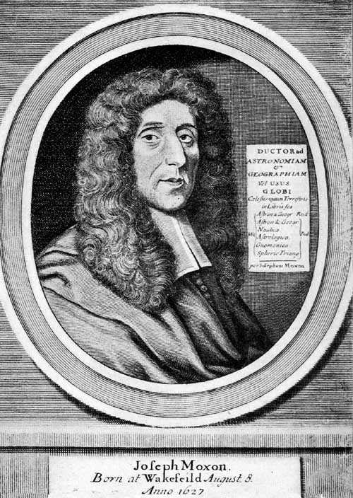
Fig. 116. Portrait of Joseph Moxon.
“Besides,” he states, “I hope to encourage those by an ample liberal plainness to fall in love with the Studies, that formerly have been disheartened by the Crabbed brevity of those Authors that have in Characters as it were rather writ126 Notes for their own Memories, than sufficient Documents for their Readers Instructions.
“The Globes for which this Book is written are new Globes that I set forth, which as I told you in my Epistle to the Reader of Blaws Book differ somewhat from other Globes; and that both the Celestial and the Terrestrial; mine being the latest done of any, and to the accomplishing of which, I have not only had the help of all or most of the best of other Globes, Maps, Plates, and Sea-drafts of New discoveries that were then extant for the Terrestrial Globe, but also the Advice and directions of divers able Mathematicians both in England and Holland for Tables and Calculations both of Lines and Stars for the Celestial; upon which globe I have placed every Star that was observed by Tycho Brahe and other Observers, one degree of Longitude farther in the Ecliptick than they are on any other Globes: so that whereas on other Globes the places of the Stars were correspondent with their places in Heaven 69 Years ago, when Tycho observed them, and therefore according to his Rule want almost a degree of their true places in Heaven at this Time: I have set every Star one degree farther in the Ecliptick, and rectified them on the Globe according to the true place they had in Heaven in the Year 1671.
“On the Terrestrial Globe I have inserted all the New Discoveries that have been made, either by our own Forraign Navigators, and that bothe in the East, West, North, and South parts of the Earth. In the East Indies we have in the latter Times many spacious places discovered, many Islands inserted, and generally the whole Draught of the Country rectified and amended, even to the Coast of China, Japan, Giloli &c. In the South Sea between the East and West Indies are scattered many Islands, which for the uncertain knowledge former Times had of them are either wholly left out of other Globes, or else laid down so erroneously that little of credit can be attributed unto them. California is found to be an Island, though formerly supposed127 to be part of the main Continent, whose North-West shoar was imagined to thrust itself forth close to the Coasts of Cathaio, and so make the supposed Straights of Anian. The Western Shoars of the West Indies are more accurately described than formerly, as you may see if you compare my Terrestrial Globe: that I have lately set forth with the Journals of the latest Navigators: And if you compare them with other Globes you will find 5, 6, yea 7 degrees difference in Longitude in most Places of these Coasts. Magellanica which heretofore was thought to be part of the South Continent called Terra Incognita is now also found to be an Island. All that Tract of Land called Terra Incognita I have purposely omitted, because as yet we have no certainty whether it be Land or Sea; unless it be of some parts lately found out by the Dutch, who having a convenient Port at Batavia in Java, have from there sent forth Ships Southward, where they have found several very large countries; one whereof they have called Hollandia Nova, another Zelandia Nova, another Anthoni van Diemans Land; and divers others; some whereof lie near our Antipodes; as you may see by my terrestrial Globes. Again, Far to the Northwards there are some New Discoveries, even within six degrees of the Pole: The Drafts to the North Eastwards I have laid down even as they were described by the Searchers of those parts for a passage into the East Indies. And also the Discoveries of Baffin, Captain James, and Capt. Fox (our own Country-men) that attempted the finding a passage that way into the South Sea.
“I also told you what difference there is in several Authors about placing the first Meridian, which is the beginning of Longitude; that Ptolemy placed it at the Fortunate Islands, which Mr. Hues pag. 4. chap. 1. in his Treatise of Globes proves to be the Islands of Cabo Verde, and not those now called the Canary Islands; because in his Time they were the farthest place of the Discovered World towards the setting of the Sun; Others placed it at Pico in128 Teneriffa; Others at Corvus and Flora; because under that Meridian the Compass had no Variation, but did then duly respect the North and South; Others for the same Reason begin their Longitude at St. Michaels; and Others between the Islands of Flores and Fayal: And the Spaniards of late by reason of their great Negotiation in the West Indies, have begun their Longitude at Toledo there, and contrary to all others account it Westwards.
“Therefore I, seeing such diversity among all Nations, and as yet an Uniformity at home, chose with our own Country-men to place my First Meridian at the Ile Gratiosa, one of the Iles of Azores.
“By the different placing of this first Meridian it comes to pass that the Longitude of Places are diversely set down in different Tables; For those Globes or Maps that have their first Meridian placed to the Eastwards of Gratiosa, have all places counted Eastwards from the Meridian of Gratiosa, and their first Meridian in a greater number of degrees of Longitude, and that according as the Arch of Difference is.”
At the conclusion of this work we find printed a catalogue of his books, maps, and instruments, including globes celestial and terrestrial of all sizes, and, what is of considerable interest and value, the price of each given.114
We know that the Chinese, very many centuries ago, manifested a considerable interest in astronomy; nor was there wanting with them an interest in geography. It was, however, especially in the former science they may be said to have made contributions of real value. An unreliable record, telling us of the interest exhibited by the Emperor Shun, reigning more than two thousand years before the beginning of the Christian era, notes that he made use of an armillary sphere in his study of the stars. Little is there to assure us that prior to the time of Kúblai Kaan (1216-1294) there were those who turned their attention to the construction of globes. That great Mongol Emperor’s129 astronomer Ko-Shun-King, having demonstrated the superiority of his astronomical wisdom, was directed to institute reforms in Chinese chronology and to construct for purposes of scientific investigations such instruments as he thought to be necessary. Accordingly he removed from the old observatory “an armillary sphere dating from 1049,” substituting in its place a number of large and small instruments, two of which have survived to our day—an armillary sphere and a celestial globe, which may be said to date from about the year 1274. These instruments of the astronomer Ko-Shun-King had place in an observatory which he had erected on the site of an ancient structure at the southeast corner of the Tartar city wall, being raised above the parapet. There they remained until the year 1673 when the Jesuit astronomer Father Ferdinand Verbiest judged them to be useless and persuaded the Emperor to pull them down and put up new ones of his own contriving.115 The old instruments were stored away at the foot of the terrace, and of these, as before noted, but two now remain.
Le Comte refers to the celestial globe as one well cast, and having a diameter of about three feet, the degrees and minutes being marked both “longitudinally and latitudinally.” An early description tells us that its equator is in the center, equidistant from the two poles, in each case a quarter of a circumference. The ecliptic is elevated above and depressed below the equator, in each case barely twenty-four degrees. The elevations and depressions of the moon in its orbit being variable, a bamboo hoop, divided into degrees equally throughout, is used to verify the intersections with the ecliptic and accordingly is moved from time to time. The globe rests on a square box, the north and south poles being respectively above and below the surface fully forty degrees, half of the globe being visible and half concealed. Toothed wheels, set in motion by machinery concealed within the box, are so adjusted as to cause the globe to revolve.
The armillary sphere (Fig. 117) stands at the east end130 of the court. It is an instrument of huge dimensions being described in early records somewhat as follows, in each reference there being allusion to its beautiful workmanship, and to its design as possessing remarkable excellence. The supporting base of the piece has a mythological significance. The four dragons, which play such a part in the Chinese geomancy, are here represented as chained to the earth, while upholding the spheres. Its substantial horizon circle, crossed at right angles by a double ring representing an azimuth circle, forms the outer supporting framework. The upper surface of the horizon circle is divided into twelve equal parts, marked by the several Chinese cyclical characters applied to the twelve hours into which the day and night was divided. Around the outside of this horizon circle these twelve characters appear again, with the Chinese names for the several points of the compass. On the inside of this circle one finds the names of the twelve States into which the ancient Empire was divided, each State being thought of as under the influence of a particular quarter of the heavens.
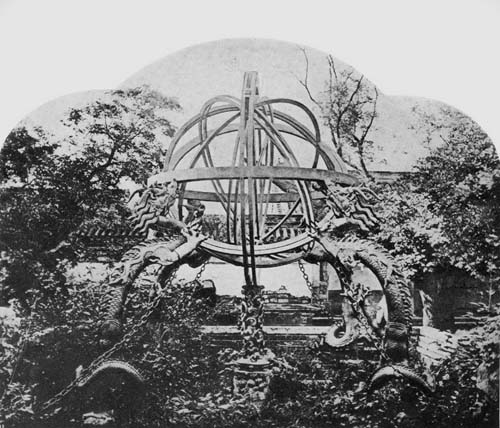
Fig. 117. Ancient Mongolian Armillary Sphere, ca. 1274.
Inside this frame is placed an equatorial circle within which is a series of movable circles made to turn on polar pivots attached to the azimuth circle. These movable circles consist of an equatorial circle, a double ring ecliptic, an equinoctial colure, and a double ring solstitial colure. The equator is divided into twenty-eight unequal portions marked by the names of as many constellations of very ancient origin. The ecliptic is divided into twenty-four equal parts according with the divisions of the year. Within the circles just described there is a double revolving meridian with a double axis and within this a fixed tube for taking sights.
All the circles of this armillary sphere are divided into 365¼ degrees corresponding to the days of the year and each degree is divided into hundreds. At the corners of the base outside the dragons are four miniature rocks in bronze, 131with the respective inscriptions “Keen Shan,” northwest or celestial mountain; “Kwan Shan,” southwest or terrestrial mountain; “Seuen-Shan,” or southeast mountain; “Kan Shan,” northeast mountain.
When the astronomer Père Ferdinand Verbiest (1623-1688),116 undertook the survey and management of mathematics for the Emperor he, like his predecessor Ko-Shun-King four hundred years before, began his task, as noted above, by ordering the removal of the old instruments from the observatory and the construction of new ones. Six of these are referred to in the records of the period as possessing especial merit, including a zodiacal armillary sphere six feet in diameter, an equinoctial armillary sphere six feet in diameter, a horizon azimuth likewise six feet in diameter, a quadrant having a radius of six feet, a sextant with a radius of eight feet, and a celestial globe having a diameter of six feet.
The armillary spheres have each but four circles, being of excellent workmanship, and having mountings of elaborate Chinese designs.
That which especially interests us here is the celestial globe (Fig. 117a) which Le Compte describes somewhat in detail. “This in my Opinion,” he says, “is the fairest and best fashioned of all the Instruments. The Globe itself is brazen, exactly round and smooth; the Stars well made, and in their true places, and all Circles of proportional breadth and thickness. It is besides so well hung, that the least touch moves it, and tho’ it is above two thousand weight, the least Child may elevate it to any Degree. On its large concave Bases are placed opposite four Dragons, whose Hair standing up on end, support a noble Horizon commendable for its breadth, its several Ornaments, and the delicacy and niceness of the Work. The Meridian in which the Pole is fixed rests upon Clouds that issue out of the Bases, and slides easily between them, its Motion being facilitated by some hidden Wheels, and moves with it the whole Globe to give132 it the required Elevation. Besides which, the Horizon, Dragons and two brazen Beams, which lie cross in the Center of the Bases Concavity, are all moved at pleasure without stirring the Bases which still remain fixed; this facilitates the due placing of the Horizon, whether in respect of the Natural Horizon, or in respect of the Globe. I wonder how Men who live six thousand Leagues from us could go through such a piece of Work; and I must own, that if all the Circles which are divided, had been corrected by some of our Workmen, nothing could be more perfect in this kind.” This piece, it may be noted, was carried away to Potsdam at the close of the Boxer Rebellion, copies of them being left in the old observatory. The Treaty of Versailles directed that the originals should be returned to their early home.
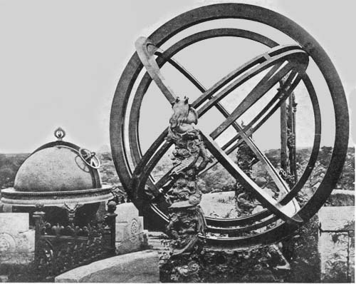
Fig. 117a. Armillary Sphere and Celestial Globe of Ferdinand Verbiest, 1673.
NOTES
62 Coronelli, V. Epitome Cosmografica. Colonia, 1693. pp. 330-331.
63 Allgemeine deutsche Biographie, “Olearius”; Varenius, B. Geographia generalis. Cambridge, 1672. Bk. III, chap. xxxii; Moller, G. I. Cimbria literata. Hanniae, 1744. Vol. I, p. 195:
Moller says: “Nec silentio sunt involvenda duo admiranda orbis authomata astronomico-cosmographica, juxta delineationem ipsius ingeniosissimam A. 1654 et seqq. ab And. Boschio Mechanico Dedalaeo et in Mathesi versatissimo, dirigente laborem Ad. Oleario, Principis hujus sui etiam mathematici, fabrefacta, quibus similis Europam, imo orbem majorem universum, non vidisse, praeter Olearium Heun. Heuningi et D. G. Morphosius sunt persuasi....” Weidler, J. F. Historia astronomiae. Wittenberg, 1741, p. 541.
Weidler says: “Globum a. 1654 Fredericus dux Holsatiae, dirigente opus Adamo Oleario, e cupro fabrefieri et in arce Gortorpiensi curaverat. Diameter ejus 10½ pedes capiebat, totusque globus rotis, flumine circumjactis movebatur.”
64 Günther-Fiorini. Erd- und Himmelsgloben, p. 83; Royal Geographical Journal. London, 1901. p. 219.
65 Bartholomaei, F. Erhard Weigel; ein Beitrag zur Geschichte der mathematischen Wissenschaften auf den deutschen Universitäten im XVI133 Jahrhundert. (In: Zeitschrift für Mathematik und Physik. Leipzig, 1868. Sup. Heft. pt. 1.); Allgemeine deutsche Biographia, “Weigel, Erhard.”
66 Schimpfer was a native of Nürnberg and active in his profession about the middle of the seventeenth century.
67 Bartholomaei, op. cit.
68 Bartholomaei, referring to the popularity of Weigel as a lecturer, states that some of his lectures were given in the open because there was no available room sufficiently large to accommodate his hearers.
69 Weigel, E. Sphaerica Euclidea methodo conscripta; accessit globorum heraldicorum ipsiusque pancosmi descriptio et usus. Jenae, 1688; Wolf, Geschichte der Astronomie, pp. 420-427. In a very early day the Venerable Bede had suggested a change from the heathen names of the several constellations to Christian names. See in this connection Schiller, J. Coelum stellatum christianum. Augsburg, 1627.
Schiller was a pupil of the famous astronomer, Johannes Bayer, from whom he probably received his impulse to inaugurate a reform in the matter of naming the constellations. Schiller felt much annoyed that heathen names for stars and star groups should be retained by Christian peoples, and it was probably with Bayer that he worked out his scheme for a new nomenclature. To the twelve signs of the zodiac, for example, he gave the names of the twelve apostles. For the constellation Perseus he proposed the Apostle Paul, for the Great Bear the Ship of Peter, for Hercules the Three Kings, for Cassiopeia the name Maria Magdalena, for Auriga Saint Jerome; he further proposed to change the name Ophiuchus to Pope Benedict, Pegasus to the Angel Gabriel, Orion to Joseph, Canis Major to King David, the Ship Argo to the Ark of Noe, the Centaur to Abraham, the Peacock to Eve.
It was proposed to change the name Sun to Christ, the Moon to Maria, Saturn to Adam, Jupiter to Moses, Mars to Joshua, Venus to John the Baptist, and Mercury to Elias.
The suggestions of Schiller, of Bayer, and of their contemporaries, or near contemporaries, Schickard, Bartsch, and Harsdörfer, with the added support of Weigel, seem to have found little favor among astronomers.
70 Weigel, E. Universi corporis pansophici prodromus. Jena, 1672; same author. Beschreibung der verbesserten Himmels- und Erdgloben. Jena, 1681.
71 Coronelli, op. cit., pp. 331-332; Wolf, op. cit., pp. 426-427, n. 16; Günther-Fiorini, op. cit., p. 85, n.
72 Fiorini, op. cit., pp. 308-310.
73 Quoted by Fiorini, op. cit., pp. 306-307.
74 Practically the only information we have concerning Moroncelli, aside from that which may be gained from his globes, is contained in a manuscript preserved in the Biolioteca Municipale of Fabriano, titled, “Vite dei Monaci Illustri di S. Benedetto in Fabriano,” by the Monk Feliziani, who died in the year 1683. Extracts from this have courteously been sent the author in reply to letters of inquiry. See also Fiorini, op. cit., p. 310.
75 Letter from the director, Dr. G. Coggiola, dated January 4, 1914.
77 Fiorini, op. cit., p. 323.
78 Christina, daughter of Gustavus Adolphus; succeeded her father as ruler of Sweden. In the year 1654 she abdicated the throne, became a devout Catholic and passed a considerable part of her remaining years in Rome,134 residing at first in the Palazzo Farnese, and later in the Palazzo Riario, bringing together in the latter place of residence a large collection of books and objects of art. Much of her collection later passed to the Vatican.
79 Fiorini, op. cit., p. 323.
81 Coronelli, op. cit., pp. 325-330; Dictionary of National Biography, “Palmer, Roger” (Count of Castlemaine), to which is appended a somewhat lengthy list of bibliographical references.
82 Moxon, J. The English globe, being a stabil and immobil one, performing what the ordinary globes do, and much more. Invented and described by the Right honorable, the Earl of Castlemaine. The second edition corrected by J. Moxon. London, 1696.
83 Coronelli, op. cit., p. 333.
84 It has been impossible to locate a copy of this work or to get further information concerning Treffler.
85 Fiorini, op. cit., p. 376.
86 Fiorini, op. cit., p. 377.
87 Briefly described in a letter received by the author from the Biblioteca Estense of Modena.
88 Fiorini, M. Vincenzo Coronelli ed i suoi globi cosmografici. (In: Annuario Astro-Meteorologico. Roma, 1893.); Rigobon. Biografia e studi del P. Vincenzo Coronelli. (In: Archivo Veneto, Vol. III, pt. i, p. 267.); Ginanni, P. P. Memorie storico critiche degli scrittori Ravennati. Faenza, 1769. Vol. I, p. 162; Pasolini, S. Huomini illustri di Ravenna antica ed altri degni professori di lettere ed armi. Bologna, 1703. p. 63.
89 Among his more important works the following may here be cited: Atlante Veneto, nel quale si contiene la descrittione ... degl’ Imperij. Regni, Provincie, e Stati dell’ Universo. Venetia, 1691-1696. 3 Vols. in 4 pts.; Biblioteca universale sacro-profano, antico-moderna. Venezia, 1701-1706. Vols. I-VIII, but not completed beyond “Caque”; Epitome Cosmografica, o compendiosa introduttione all’ Astronomia, Geographia, et Idrografia. Colonia, 1693; Viaggi del P. C. Venetia, 1697: The Royal Almanack: containing a succinct account of the remarkable actions of K. William III: with the year and the day of the month when each happened. Tr. from Italian into English. London, 1696. See also Giannini, G. Titoli della opere ... stampate dal anno 1704, dal P. M. C. ... publicate dall’ Accademia degli Argonauti in aggiunta dell’ indice già dato in luce. Venetia, 1708.
90 Not until the following century does it appear that such societies were organized north of the Alps.
91 See list given by Coronelli, Epitome, in introductory pages under heading “Catalogo ...”
92 See Coronelli. Epitome.
93 This privilege is quoted by Coronelli, Epitome, in introductory pages.
94 Coronelli. Epitome, pp. 334-342.
95 La Hire, P. de. Description et explication des Globes qui sont placés dans les pavillons du Château de Marly par ordre de Sa Majesté. Paris, 1704.
96 Born September 16, 1638.
97 Ludolf, H. Jobi Ludolfi ... ad suam historiam Aetiopicam ante hac editam commentarius. Francforti ad Moenum, 1691. p. 22.
99 This château was erected in the year 1693.
100 Cited by Fiorini, op. cit., p. 338.
101 Viaggi, del P. C. p. 28. He gives us in this work a statement of prices for his globes as follows:
| “Globes of various sizes. | ||
|
Celestial and terrestrial three and one half feet in diameter, with the addition of many stars and of newly discovered lands, painted and varnished, without supports, 100 ducats |
L.260: | |
|
The same with their supports and with meridian of brass |
1240: | |
|
The same one foot and a half in diameter with their pedestals and with brass meridians |
155: | |
|
The same six and a half inches diameter with feet and with meridisns |
L.31: | |
|
The same four and a half inches in diameter with their feet and with meridians |
24:16: | |
|
The same two and a half inches in diameter with their feet and with meridians |
18:12” | |
102 Fiorini, op. cit., p. 378.
103 Fiorini, op. cit., p. 379.
104 Fiorini, op. cit., p. 370.
105 Porena, F. Un cartografo italiano del principio del secolo XVIII. (In: Memorie della Società geog. ital. Roma, 1895. Vol. V, pt. 1, p. 45.)
106 Published in Mediolani, 1712.
107 Bernardo, F. da Bologna. Biblioteca Scriptorum Ordinis Minorum S. Francisci Capucinorum. Venetiis, 1747.
108 Doppelmayr, op. cit., p. 127.
109 Laland states that these fifty-seven came into the possession of the Jesuit College of Polotzk in Russia.
110 Eimmarto, G. C. Sphaerae armillaris a Georgio Christophoro Eimmarto ex aurichalco constitutae, interius systema planetarum ex mente Copernici repraesentatis, brevis elucidatio, Ed. Jo. Christ. Sturmio-Altdorfii, 1695.
111 Dictionary of National Biography, Vol. XXXIX, p. 242.
112 This work was first published in London in the year 1599.
113 As a result of Moxon’s interest in this field we have from him one of the most satisfactory of the early manuals of typography, bearing the title ‘Mechanick Exercises or the Doctrine of Handy-Works applied to the Art of Printing,’ London, 1683. This work was reprinted, “line-for-line and page-for-page” of the original, with preface and notes by Theodore L. Devinne. New York, 1896. 2 Vols.
114 It is from the last-mentioned work that the following citations are made:
“Books. Moxon, J. A Tutor to Astronomy and Geography, or the Use of both the Globes, Celestial and Terrestrial; by Joseph Moxon, A Member of the Royal Society, and Hydrographer to the Kings most Excellent Majesty. Price 5s.
The Use of the Copernican Spheres, teaching to solve the Phaenomena by them, as easily as by the Ptolomaick Spheres; by Joseph Moxon, &c. Price 4s.
The Use of Astronomical Playing Cards, teaching an ordinary capacity by them to be acquainted with all the Stars of Heaven; to know their places, Colours, Natures and Bignesses. Also the Poetical Reasons for every Constellation.136 Very useful, pleasant and delightful for all lovers of Ingeniety. By Joseph Moxon, &c. Price 6d.
The Astronomical Cards. By Joseph Moxon, &c. Price plain 1s. Coloured 1s. 6d. best coloured, and the Stars Gilt, 5s.
Geographical Playing Cards, wherein is exactly described all the Kingdoms of the Earth, curiously engraved. Price Plain 1s. Coloured 2s. best Coloured and Gilt 5s. the Pack.
The English Globe, invented by the Right Honourable, the Earl of Castlemaine (and of which this Book shews the use) containing about a Foot in Diameter, are made by Joseph Moxon. Price ordinary made up 40s. and with the projection described in Section 6. of this Book. Price 50s.
To the above is added the following interesting information:
A Catalogue of GLOBES, Celestial and Terrestrial, Spheres, Maps, Sea-Plates, Mathematical Instruments, and Books, with their prizes, made and sold by Joseph Moxon, on Ludgate-Hill, at the Sign of Atlas.
GLOBES 26 Inches Diameter. The price 20l. the Pair.
GLOBES near 15 Inches Diameter. The Price 4l.
GLOBES 8 Inches Diameter. The price 2l.
GLOBES 6 Inches Diameter. The price 1l. 10s.
CONCAVE HEMISPHERES of the Starry Orb, which serves for a Case to a Terrestrial Globe of 3 Inches Diameter, made portable for the pocket. Price 15s.
SPHERES, according to the Copernican Hypothesis, both General and Particular, 20 Inches Diameter. Price of the General 5l. of the Particular 6l. of both together 10l.
SPHERES, according to the Ptolomaick System, 14 Inches Diameter. Price 3l.
SPHERES, according to the Ptolomaick System, 8 Inches Diameter. Price 1l. 10s.”
115 The following works may be cited for further reference to these early Chinese globes of Peking: Wylie, A. Mongol astronomical instruments in Peking. (In: Chinese Researches, Shantung, 1897, Part III, pp. 1-20.); Le Comte, L. D. Memories and Observations. London, 1699; Du Halde, J. B. Description géographique de l’empire de la China. Paris, 1735; Yule, H. Travels of Marco Polo. London, 1893. Vol. I, pp. 448-456, with four illustrations.
116 Carton, Abbé C. Biographique sur le Père Ferdinand Verbiest. Bruges, 1839; Thompson, J. Illustrations of China and its people. London, 1874. Vol. iv.
Chapter XII
Globes and Globe Makers of the First Half of the Eighteenth Century—from Delisle to Ferguson
Activities of Guillaume Delisle.—Jean Dominique Cassini and his reforms.—Vincenzo Miot.—The globes of Gerhard and Leonhard Valk.—Activities of John Senex.—Nicolas Bion.—The armillary sphere of Carmelo Cartilia.—Mattheus Seutter of Augsburg.—Robert Morden.—Jean Antoine Nollet.—Johann Gabriel Doppelmayr of Nürnberg.—Terrestrial globe of Cusani.—Terrestrial globes of Siena.—The work of the monk Pietro Maria da Vinchio.—James Ferguson of Scotland.
AMONG the numerous globe makers of the eighteenth century, there are few, if any, entitled to rank with Blaeu or Hondius, with Greuter or Coronelli of the seventeenth. There was much written during the period, it is true, on the value of globes in geographical and astronomical studies, and there were many globes constructed, of which a very considerable number still have a place in our libraries, museums, and private collections.
With the improvements in scientific map construction, improvements amounting to a complete reformation, and ushered in during the closing years of the seventeenth century and the opening years of the eighteenth, by such men as Riccioli, Picard, Cassini, and Delisle, not to mention a number of their distinguished immediate predecessors and contemporaries, the last above-named working through the138 patronage of the Royal Academy of Science of France,117—with these improvements there appears to have been a decline in the relative value which the late sixteenth and the seventeenth centuries set upon globes. Once regarded as an essential part of a seaman’s instruments for use in navigation, they gave place, just as the portolan chart of the earlier day gave place, to an improved sailor’s chart. Globe makers, however, of this period, such as Delisle and Bion, as Gerhard and Leonhard Valk, as Vaugondy and Fortin, as Ferguson and Adams, have an honorable place in the history of globes and of globe construction.
France was leading at the turn of the seventeenth century in the field of geographical and astronomical science, a fact in part due to the generous subsidy allowed by royalty. Guillaume Delisle (1675-1726), perhaps the greatest among the reformers active in these years in improving the methods of map construction, was a native of Paris, in which city he passed practically his entire life.118 The father, Claude Delisle, famous as a teacher of history and geography, inspired in his son a particular love for the latter subject, or perhaps this may the better be referred to as a love for historical geography. The period was one in which there was much emphasis placed upon the relationship existing between the two branches of study, and it is interesting to note that this phase of geographical study is again coming into favor.119
Doubtless it was in part the influence of Cassini’s teaching which found expression in Delisle’s lifelong efforts to eliminate the numerous errors which he had found existing in the maps of his day, efforts which even in his early life won for him distinction as a map maker. In the year 1700, when he was but twenty-five years of age, there appeared under his name a world map and likewise maps of the several continents.120 In these there was exhibited much originality, they being constructed in the main on the basis of astronomical observations which had been made at the Royal 139 Academy. Hitherto the Ptolemaic cartography had exerted an overpowering influence. Errors in the location of places still remained on the maps, attributable in large part to that ancient cosmographer, who continued for so long a period a most influential teacher of geography and map making after the renaissance of his ‘Cosmographia’ in the early fifteenth century. Among the greatest errors still to be found in the maps in Delisle’s day was the excessive length given to the Mediterranean, this being about sixty-two degrees of longitude instead of its correct length, which is about forty-two, and the extension of Asia much too far to eastward, together with other errors following upon these.121 Delisle, having the support of the Royal Academy, and of the King himself, was able to carry through the reforms in map construction, the fundamental principles of which, it is true, had been suggested before his day, based upon such astronomical observations as were those of Cassini, Picard, and La Hire, wherein there had been an attempt to determine the exact location in longitude of important places on the earth’s surface and wherein they had been aided by the use of the telescope. Through the employment of this instrument they were able to fix the exact time of eclipses and determine the time of the transit of the moons of Jupiter.122 In the ‘Journal des Savants’ of the year 1700 is given a letter addressed to the engraver and map maker, Nolin, and signed “Delisle.” In this there is reference to a manuscript globe of the year 1696, the implication being that Guillaume was its author.123 The probability is that we have here a letter written by Claude, the father, it being hardly probable that the son drafted a globe map at the age of twenty-one. We, however, know, as before stated, that he achieved great distinction through the maps he published in the year 1700, when he was but twenty-five, and we are also informed that even at the age of eight he attracted attention to himself through the maps he drew to illustrate ancient history.
In the same year that he published his epoch-making maps140 he issued the first edition of his globes, those having a diameter of about 31 cm. and those having a diameter of about 15 cm. The globe balls were constructed of papier-mâché covered with plaster over which were pasted the gore maps, each map composed of twelve parts with the usual polar discs. The engraver, we are told, in a brief legend on the terrestrial globe, was Carolus Simonneau, “Car. Simon. del. et sculpsit.” On the larger of the terrestrial globes is the title legend “Globe terrestre dressé sur les observations de l’Académie Royale des sciences et autres mémoires,” and a dedication reading, “À Son Altesse Royale Monseigneur Le Duc de Chartres. Par son très humble et très obéissant serviteur G. De l’Isle Géographie. Berey sculpsit.”
The celestial globe bears the title, “Globe céleste calculé pour l’an 1700. Sur les observations les plus récents. Par. G. De l’Isle Géographe,” and is dedicated “À Son Altesse Royale Monseigneur le Duc de Chartres. Par son très humble et très obéissant Serviteur De l’Isle,” with the following reference to the privilege “À Paris Chez l’Auteur sur le Quai de l’Horologe à la Couronne de Diamans. Avec Privilége du Roy pour 20 ans. 1700.”
While it has not been possible to obtain a detailed description of Delisle’s globe maps, they are referred to as giving practically the same information as his plane maps, many of the latter to be found in our important library collections, and cannot be considered rare.124
The several constellations which he has represented on his celestial globes are those of Ptolemy to which have been added two in the northern hemisphere and thirteen in the southern, and the year chosen for the representation of the position of the stars is 1700. In general the names chosen for the several constellations are French, though a few are in Latin.
A pair of Delisle’s globes may be found in the Königliches Museum of Cassel, dated 1709; a pair dated 1700 in the Museo di Strumenti Antichi of Florence, and a terrestrial 141globe dated 1700 in the Real Biblioteca of Madrid (Fig. 118).
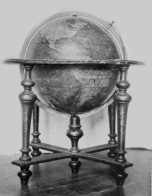
Fig. 118. Terrestrial Globe of Guillaume Delisle, 1700.
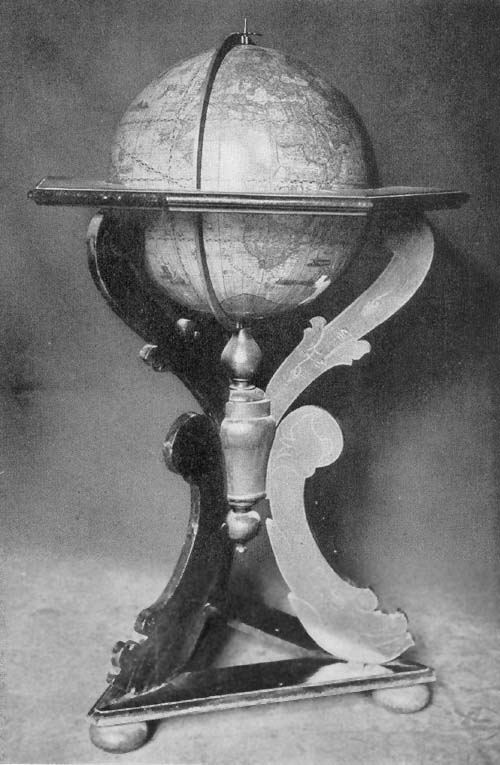
Fig. 118a. Terrestrial Globe of Johann Ludovicus Andreae, 1717.
Weigel, Castlemaine, Coronelli, and Treffler, as has been noted, represented a tendency in globe construction in their day which we have referred to as the ultrapractical. It was impossible that their ideas should find anything like a general acceptance and approval. A globe eleven or fifteen feet in diameter, in the better judgment of astronomers and geographers, could not be counted as possessing superior scientific value, and globes of such dimensions seem only to have won the praise of the novelty-loving contemporaries, and the same general criticism may be passed upon the smaller globes of Castlemaine and Treffler. Perhaps, however, one may well add that in all this a desire was expressing itself for improvement in globe construction.
In this connection attention may be called to a plan for reform in globe making proposed by Jean Dominique Cassini (1625-1712), one of the most famous astronomers of the period.125 Cassini was a native of Périnaldo, Italy (Fig. 119). Early in life he became interested in the study of astronomy, and at the age of twenty-five received an appointment as professor of this science at the University of Bologna. Recommended by Colbert as one worthy his royal master’s patronage, Cassini in 1669 accepted the invitation of Louis XIV to fill the chair of astronomy in the Collège de France, a position once held by Pierre Gassendi.126 In 1671 he became the director of the Royal Observatory of Paris, a position held in succession by four generations of his family. To him we owe the determination of the rotation periods of Jupiter, Venus, and Mars, the discovery of four of Saturn’s satellites and the determination of their periods of revolution. He devoted much time and study to the problem of the obliquity of the ecliptic, to the precession of the equinoxes,127 and to the determination of the latitude and longitude of places.128 This precession, he found, could not be represented on a celestial globe such as hitherto142 had been constructed, and he set himself to the task of devising one on a new plan. The position of the constellations, as indicated on the ordinary celestial globe, he, as others, noted would soon be found to be inaccurate. What he proposed was a globe capable of such adjustment as to obviate this difficulty; in other words, he proposed the construction of a globe by means of which this perpetual change might be indicated, or one which would serve to indicate the position of the several constellations at any time, past, present or future.
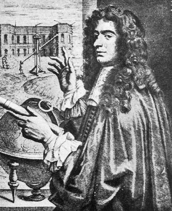
Fig. 119. Portrait of Jean Dominique Cassini.
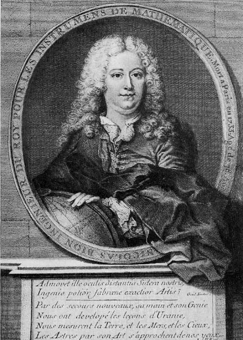
Fig. 123. Portrait of Nicolas Bion.
It was to Nicolas Bion, map and globe maker of Paris that the astronomer Cassini entrusted the manufacture of such an instrument, and it is from him that we have a brief description of its peculiar features.129 He tells us that the sphere on which the several constellations were represented was enclosed within a number of armillae representing the celestial circles, that is, the colures, the ecliptic, the tropics, the equator, and the polar circles. This inner sphere was attached to a meridian circle at the poles of its equator, within which circle it turned as the ordinary sphere, and it was also attached to the same meridian at the poles of the ecliptic. Around this polar axis of the ecliptic the sphere, with the attached meridian, could be made to revolve, the pole of the equator in its revolution tracing a circle having a radius of twenty-three and a half degrees, a complete revolution being made to represent a period of twenty-five thousand two hundred years, or the time required for the complete precession of the equinox according to his reckoning. This pole in its circle of revolution could be immovably set at any desired point to represent any time past or future, and the sphere then revolved around the pole of the equator. The several stars or constellations could thus be represented in their proper position for the time selected. Bion’s reference to this globe seems to assure us that he completed its construction, yet no trace of it has been left, unless we have such in a record to be found in the history of the Royal 143Academy for the year 1727. In this we find that a globe constructed on the principle laid down by Cassini was presented to the Academy, in the year designated, by Outhier, a priest of Besançon.130 This globe, which has disappeared, had the double movements, one about the axis of the equator and one about the axis of the ecliptic. It was a globe which would represent the daily and annual movements of the sun, the difference between the true and the mean time, the movements of the moon and its phases, the eclipses, and the passing of the several fixed stars across the meridian.
Vincenzo Miot, a little-known Italian globe maker of the early eighteenth century, holds a place among the men who were interested in this field, through one extant example of his work, this being a small celestial, having a diameter of about 17 cm.131 Its author and date legend reads, “Sphaera Mundi majoribus et minoribus circulis distincta praecipuisque stellis in nostro Horizonte conspicuis ornata ad annum 1710. Studio et opera D. Vincentio Miot.” “World globe marked by large and small circles, and adorned with the principal stars visible in our horizon calculated for the year 1710. By the learning and labor of D. Vincentio Miot.” The sphere is covered with an engraved map showing the several constellations and the principal celestial circles. Its twelve segments are fashioned to terminate at the poles of the ecliptic, instead of at the poles of the equator, a practice not uncommon. The globe has a simple mounting of wood, is reported to be in good condition, and may be found in the Liceo Marco Foscarini of Venice, to which library it came, in the year 1807, from the Convent of S. Georgio Maggiore.
It is not a little surprising that our information is so meager concerning men as active in the field of map and globe making as were Gerhard and Leonhard Valk in the latter part of the seventeenth and early eighteenth century. We cannot be certain of their relationship; apparently they were not brothers, as has been sometimes stated. If there is not left to us a biographical word by any admiring or appreciative144 contemporary of these praiseworthy Netherlanders, there is extant a very considerable amount of their work which warrants our giving them rank well toward the van of those interested in their particular field. Of the two, Gerhard seems to have been the more prominent, his name very frequently appearing as the engraver or maker of many of the maps one finds in the collective atlases of the early eighteenth century.132 With Leonhard he was the maker of globes, large and small, ranging from about 7 cm. to 46 cm. in diameter, of which a very considerable number may still be found in our libraries and museums.
In an undated work published by Gerhard on the uses of celestial and terrestrial globes,133 he tells us of the improvements he introduced, noting that he had attempted to give the location of the stars on his celestial globe as late as 1700, while on those issued prior to his own, the dates selected were in general 1640 or 1660. The suggestion contained herein is that he at least began the construction of his globes as early as 1700, although none are now known bearing date so early.134 There appears to be an example of his work in the University Library of Ghent, dated 1707, but a description of this it has not been possible to obtain. The date most commonly found on the Valk globes is 1750, all of which, if correctly dated, were issued long after their death.
The Hispanic Society of America possesses three pairs of the Valk globes, each apparently dated 1750, though in some instances, as noted below, these dates have been altered by skilfully cutting out the last two figures of the original and inserting the number 50. The diameter of each of the largest pair is 46 cm. (Fig. 120). Each is supplied with a graduated meridian circle of brass, the celestial being furnished with a brass hour circle and pointer, and the terrestrial with a brass quadrant of altitude. Each is further furnished with a broad horizon circle of wood on which has been pasted an engraved paper giving the names of the signs of the zodiac, the various chronological signs, such as golden 145numbers, epacta, and dominical letters, the names of the months, and points of the compass, including both the old and the new nomenclature for the directions of winds, as “Borro Lybicus” or “Noord-West,” “Zephyrus” or “West.” The under supports of the globes consist in each instance of four turned columns attached at their lower extremities by crossbars on which rests a circular turned plate 42 cm. in diameter. From the center of these plates rises a post 10 cm. in length through a notch in which the brass meridian circle is made to pass in moving the globes to an adjustment for any desired altitude. The gores of each are twelve in number, those of the terrestrial globe having an equatorial mounting while those of the celestial globe have an ecliptic mounting, that is, the meridian lines pass from pole to pole of the ecliptic instead of from pole to pole of the equator. In each, the gores have been truncated twenty degrees from the poles, the polar space being covered by circular discs. The engraving of both the terrestrial and the celestial map is exquisitely done, and much of the color originally applied by hand yet remains. The several figures representing the constellations are copies of the figures as represented by Hevelius in his ‘Prodromus Astronomiae,’ and reference to this great astronomer is made in the title legend quoted below. These figures are among the most artistic representations to be found on any of the globes of the period, which the author is preparing to reissue in facsimile as a by-product of these globe studies. (Fig. 120a.)
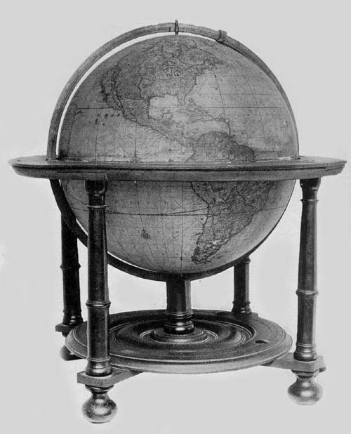
Fig. 120. Terrestrial Globe of Gerhard and Leonhard Valk, 1750 (?).
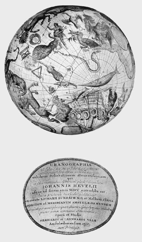
Fig. 120a. Southern Hemisphere of Celestial Globe by Gerhard and Leonhard Valk, with Author and Date Legend, 1750 (?).
Between the constellations “Cetus” and “Phoenix” on the celestial globe is a cartouch which appears to have been pasted over an older title, reading, “Uranographia Syderum et Stelarum in Singulis Syderibus conspicuarum, exhibens Delineatonem accuratissimam qua ex observationibus Astronomi plane Singularis Johannis Hevelii usque ad finem anni MDCC emendata est. Nova praeterea methodo additus est ex mente Lotharii Zumbach M.D. et Mathem. Cearis Horizon ad Meridianum Amstelaedamensem accurate per annos146 plures quam ducentos Lunae Syzygias indicans praeter annos communes et bissextiles. Opera et Studio Gerhardi et Leonhardi Valk Amstelaedamensium 17[50].” “Uranography of the constellations and of the single stars, exhibiting an accurate delineation (of the same) corrected from the observations of the renowned astronomer Johannes Hevelius, and conformed to the year 1700. Besides a new method is added, the invention of Lothar Zumbach, M. D., and a renowned mathematician, accurately exhibiting the horizon on the meridian of Amsterdam for more than 200 years, also the changes of the moon in addition to the common years and leap years. By the learning and the labor of Gerhard and Leonhard Valk, citizens of Amsterdam, 1750.”
Near the constellation Argo appears the dedication to the Burgomaster of Amsterdam and President of the East India Company, Johannes Trip J. U. D. (1664-1732). In this there is, of course, conclusive evidence that the globe must have been made before the year 1732. The dedication reads, “Viro amplissima dignitate ac meritorum Splendore, conspicuo Johanni Trip J. U. D. Reipublicae Amstelaedamensis Consuli Gravissimo, Societatis Indiae Orientalis Moderatori integerrimo Toparchae in Berkenroden iustissimo & hanc Universi Orbis Terrarum Faciem eâ quâ par est reverentia D. D. D. Gerhardus et Leonhardus Valk.” “To John Tripp J. U. D., Consul of the Amsterdam Republic, President of the East India Company, the upright and honorable magistrate of Berkenrode, a man conspicuous by reason of his great worth and the splendor of his achievements, this globe is dedicated with reverence which is befitting by Gerhard and Leonhard Valk.”
Near the first legend has been pasted the following brief printed statement, “Propter motum, Stellarum fixarum versus ortum post annum 1750 additione 3/4 gr. Correctio Longitudinum ut instituatur monendus Uranophilus.” “Because of the movement of the fixed stars toward the east since the year 1750, the student of astronomy is advised to correct the 147longitude by the addition of 3/4 of a degree.” The terrestrial globe map, composed of eighteen gores, is filled with interesting geographical details, with geographical names and brief explanatory legends, being a fine example of the superior cartographical work published in that century in the Netherlands. There is something of an exaggeration in the representation by waving line of the several coasts and river courses, all of which appears to have been done for artistic effect rather than for a desire to be strictly accurate. In the New World we find such regional names as “Penn-Sylvania,” the first part of the name being north of Lake Ontario, also “Carolina,” “Virginia,” “Belgia Nova,” “Anglia,” “Scotia Nova.” Many provincial names are given in South America with boundary lines drawn. California is represented as an island, stretching northward to “Fretum Aniani.” To the west of this stretches as far as the northeast coast of Asia, through about seventy-five degrees of longitude with definitely drawn southern coast line but extending indefinitely northward, a continental region bearing the legend “Terra incognita sive terra Esonis.” Loxodromic lines are represented as on the best globes of the period radiating from numerous compass roses located along the meridians 0 degrees, 180 degrees, and 270 degrees. Frobisher’s Strait is strangely duplicated at the southern extremity of Greenland. The title legend of this terrestrial globe, placed in the southern Pacific, reads, “Universi Orbis Terrarum Facies cum industria ac fide Secundum certissimas et novissimas Praestantissimiorum Geographorum Observationes denuo luci exposita; cuique praeterea longitudinis et latitudinis gradus Secundum Uranographiam novam, ac proinde &c. rei veritate sunt inscripti per Gerhardum et Leonhardum Valk, Amstelaedamenses 1750, cum privilegio.” “A representation of the land of the whole earth exhibited with industry and accuracy according to the most reliable and the most recent observations of the most renowned geographers, on which, in addition the degrees of latitude and longitude148 according to a new method and also in accord with truth, have been inserted by Gerhard and Leonhard Valk. Amsterdam. 1750. With privilege.”
In the second pair of Valk globes belonging to The Hispanic Society of America (Fig. 121), both terrestrial and celestial have diameters of about 30 cm. The mounting of these globes is practically the same as that in the larger pair. An author and date legend appearing in the Pacific to the west of South America reads: “Cosmotheore. Coelesti nostro Globo, Par et plane Novus. Hic Terrestris Ut existeret: certo facias: Errore Veterum Sublatô, Non tantum Utrisque Orbis Longitudines ac Latitudines, per reiteratas Neotericorum Observationes. Hiccè esse restitutas; Sed et nullum typis Emendatiorum pro diisse, Hoc igitur Novissimô tam diu fruere, Donec, sub Majori forma, Meō aere Alios excudemus. Ger. et Leon. Valk Calcographi Amstelaedami. Revis. Ao 1750 Cum Privilegio.” “Cosmotherium. That this terrestrial globe might equal (be a companion to) our celestial globe and entirely new, be assured that after correcting the errors of those who have preceded us, not only the longitudes and latitudes of each sphere have been corrected by the repeated observations of later astronomers, but likewise no (globe) has appeared more carefully corrected in the printing. This most recent globe therefore make use of until in a larger form at my own expense we Gerhard and Leonhard Valk, engravers shall construct others. Amsterdam. Revised to the year 1750. With privilege.”
Fig. 121. Terrestrial Globe of Gerhard and Leonhard Valk, 1750 (?).
A dedication, such as appears on the first pair referred to, is wanting. There is no particular improvement to be noted in this revision. California is still laid down as an island. The uncertainty as to the outline of “Holandia Nova” is a striking feature, as is the omission of an austral continent. Geographical details are less numerous than in the larger pair, but in the matter of the engraving of the map it exhibits practically the same characteristics.
The celestial globe map has the author and date legend 149placed near the constellation “Cetus.” It reads, “Uranographia Coelum omne hic Complectens, illa pro ut aucta, et ad annum 1750 Completum MAGNO ab HEVELIO correcta est; ita ejus ex Prototypis, sua noviter haec Ectypa veris Astronomiae cultoribus exhibet et consecrant GER. et LEON. VALK, Amstelaedamenses. Cum Privilegio.” “Star-Map comprising the entire heavens according as it has been corrected to the end of the year 1750 by the Great Hevelius; so from his prototype Gerhard and Leonhard Valk present and dedicate these their own recent copies to the true lovers of astronomy. With privilege.”
Near this legend, now appearing as a part of the original engraving, is that which, in the larger globe referred to above, had been pasted on as a separate slip, reading “Propter motum ... Uranophilus.” Near the constellation “Hydra” is the legend reading “Monitum Novis hisce Sphaeris Novissimus. Ex praescripto Lotharii Zum-Bach Med. Doct. unus, et alter additus Horizon: Quorum Is, qui huic Caelesti singularis, Praeter Communes atque Bissextilem, Ut exactior, Luminarium indigetur Locus ad Meridianum Amstelodamens. Plus quam per Ducentos Annos, Suis Mensium Diebus Appositas Lunae Syzygias, Mediô Tempore Medias, Ingeniosâ Methodō et eruit, et exhibet.” “Notice. To these our spheres, in accord with the directions of Lothar Zum-Bach, Doctor of Medicine, there has been added one very recent, and also a second horizon; of these two the one which belongs to the celestial globe has in addition the common and bissextile years, in order that the location of the stars may the more exactly be discovered; it both works out and exhibits by an ingenious method, according to the meridian of Amsterdam, over a space of more than two hundred years the syzygies of the moon placed opposite their proper days of the month, the middle ones being in the middle time.”
Each of these globes is well preserved, the colors originally applied remaining particularly bright in the southern150 hemispheres, these being better protected from light and from injuries incident to the more exposed upper surfaces.
In the third pair of Valk globes belonging to The Hispanic Society (Fig. 121a) the diameter of each is about 23 cm. In geographical details, in legends, etc., each of these agrees with the preceding second pair. It is, however, to be noted that the date on the terrestrial globe has the figure 50 appearing in the date 1750 skilfully inserted after the removal of the original, and that the loxodromic lines are on this more numerous; indeed, it is one of the most interesting globes examined for the representation of these lines, which become curiously, but necessarily, somewhat intricate in their crossings as they approach the poles. Of the three pairs of these globes referred to above, this third pair seems to be the best preserved; the only injury to be especially noted is that appearing on the celestial, this being a crack in the surface extending from pole to pole. The original colors in each are particularly well preserved.
In addition to the examples of Valk globes referred to above as belonging to the University of Ghent and to The Hispanic Society of America, a pair may be found in the Königliches Museum of Cassel, said by Gerland to be dated 1715, and to have each a diameter of 45 cm., also a terrestrial globe in the same museum said to be dated, though doubtless erroneously, 1700, and to have a diameter of 23 cm., also a celestial globe of the same date having a diameter of 30 cm. In the Mathematische Salon of Dresden is a celestial globe having a diameter of 30 cm., and a pair in the Museo di Fisica of Bologna, the diameter of each being about 46 cm. The date has not been ascertained. In the Germanisches Nationalmuseum of Nürnberg may be found a well-preserved pair of the Valk globes said to be dated 1700 and to have each a diameter of 31 cm.
Fig. 121a. Celestial Globe of Gerhard and Leonhard Valk, 1750 (?).
John Senex, a noted English cartographer and engraver (d. 1749),135 appears to have given some attention to the construction of globes, which were sold at his establishment 151in Salisbury Court, London. In the year 1714 we find his name associated with that of John Maxwell in the issue of ‘The English Atlas,’ and in 1721 he appears as the editor of ‘A New General Atlas.’ It was in the year 1720 that he made a representation to the House of Commons on the subject of “A New Globular Projection,” with the thought of eliciting encouragement for the employment of better methods in map construction. He became a Fellow of the Royal Society in 1728, and in 1738 read before that society a noted paper on his “Contrivance to make the Poles of the Diurnal Motion in a Celestial Globe pass round the Poles of the Ecliptic.” This globe was to be “so adjusted as to exhibit not only the risings and the settings of the stars in all ages and in all latitudes, but the other phenomena likewise, that depend upon the motion of the diurnal axis round the annual axis.” From what is stated in this paper one is led to associate his idea with that of Cassini, to which attention was directed above. If, however, such a globe was constructed as that referred to in this scientific address it is not now known. Five of his globes have been located, two of them undated, and three of them dated 1793, which, if the correct date of issue, it will be noted, is more than fifty years after his death. A pair of his globes may be found in the Bibliothèque Nationale of Paris undated. These are reported as having a diameter of about 40 cm. They are furnished with brass meridian circles, with horizon circles of wood, and each with a wooden base. The dedication reads: “Philosopho ac Geometrae summo Do Isaaco Newton, equiti, Regalis Societatis Londini, ad scientias promovendas institutae, Praesidi dignissimo, ejusdemque consilio et sodalibus hos Globos qua par est humilitate D.D. C. Johannes Senex. London.” “To the great philosopher and geometrician Sir Isaac Newton, Knight, most worthy President of the Royal Society of London, for the promotion of knowledge, and to the Committee and Members of the same Society these globes with befitting humility are dedicated by C. John Senex. London.”152 Further descriptive details of these globes it has not been possible to obtain.
The Biblioteca Real of Madrid possesses a terrestrial globe by Senex (Fig. 122), which bears the title legend, “A new and most correct Globe of the Earth laid down from the latest observations from the most judicious astronomers, navigators, & travelers, by John Senex, F. R. S. Now made and sold by Dudley Adams (only)136 with all the latest discoveries together with many new improvements etc. 1793.” This globe has a diameter of about 40 cm., is furnished with a broad band which serves as a horizon circle, a meridian circle of brass within which it is made to revolve, and a tripod base. Its three fluted support columns are strengthened in their position by three curved iron braces which carry at their juncture a short carved post, through a slot in which the brass meridian is movable. While the surface of the sphere is somewhat injured, being crossed by numerous cracks, the engraved map is fairly legible in all of its parts.
Fig. 122. Terrestrial Globe of John Senex, 1793.
The British Museum likewise possesses one of Senex’s terrestrial globes, which seems to be practically like that to be found in the Madrid Library.
It will have been noted that many of those reputed to have been globe makers in these early years did not actually apply themselves to the constructive mechanical work, this being passed over to skilled artisans, to workers in metal and wood, to engravers and to mathematical instrument makers, who, if possessing generally recognized ability, often insisted on having their names associated in the author legends with the real authors of the globes. Nicolas Bion (1652-1733) may be cited as an excellent example of such a skilful workman, achieving in his day great distinction as a globe maker.137 He seems not to have thought of himself as one meriting special honors as geographer, cartographer or astronomer (Fig. 123). By reason of his marked abilities, exhibited in the manufacture of mathematical instruments, 153he was honored by his royal patron with the title Engineer of the King for Mathematical Instruments. Through his principal work,138 a treatise on the construction and uses of globes in which the subject is treated in both a theoretical and a practical manner, he is entitled to rank with the leaders of the century in this particular field of scientific endeavor. True to the spirit of the age Bion gave much thought to the idea of reform in the matter of globe construction, especially in the matter of fashioning globe gores and their attachment to the surface of the sphere. He seems to have prospered in his business, and we are told by his son that he constructed numerous armillary spheres, likewise many terrestrial and celestial globes of various sizes. Reference is made above to a task assigned to him by the great astronomer, Cassini.139
A few of the globes of this distinguished man have been located. Fiorini reports140 that one of his celestial globes may be found in the private library of Count Malvezzi de’ Medici of Bologna, having a diameter of about 32 cm. Its twelve gores have been cut at latitude 70 degrees both north and south, the polar spaces being covered by four sectors instead of by the usual circular disc. The globe is made to revolve on its equatorial axis, not on the axis of the ecliptic. It has a simple mounting, including a meridian circle of brass and a horizon circle of wood. Star names are given in French and in Latin. The dedication reads, “Dédié et présenté à Monseigneur le Dauphin par son très humble et très obéissant Bion,” but there appears to be some uncertainty about the date, which is probably between 1700 and 1710. There is one of Bion’s terrestrial globes dated 1712 and dedicated to “Monseigneur le Duc de Berry,” in the Istituto tecnico of Florence, which is reported to be in a good state of preservation. Loxodromic lines are drawn on the map in accord with the best practices of the time, which radiate from wind or compass roses, one being placed on the equator and one at latitude 35 degrees south. A third terrestrial154 globe made by Bion may be found in the Osservatorio Astronomico of Rome, which is wanting both dedication and place of publication.
The Osservatorio Astronomico also possesses a fine armillary sphere, the work of Carmelo Cartilia,141 the diameter of whose largest or meridian circle is about 26 cm. It is described by a former director of the observatory as being made of brass, and a companion of a globe constructed by Bion, having a similar mounting. The equatorial circle, the tropics, and the colures have the usual graduation. The ecliptic consists of a band 4 cm. in width, having engraved on its surface the signs of the zodiac and the days of the months. At the north pole is attached an hour circle with index. At the common center of the circles is a small ball 27 mm. in diameter representing the earth, through which the axis of the ecliptic passes. Around this small ball is adjusted a circle on which is engraved the word “Luna.” There is an additional small circle which represents the course of the sun, and attached to this is a silvered ball to represent that luminary. Circles are provided representing the planets, on which we find such names as “Marti,” “Giove,” “Saturno,” and circles around the sun representing the course of the planets Mercury and Venus. On one of the supporting arms of the sphere is the author and date legend, reading, “Carmelus Cartilia et Francalancia Siculus fecit Taurini anno dñi 1720.”
Mattheus Seutter (1678-1756) was a map and globe maker of this period, whose activities centered in the city of Augsburg.142 His early training as engraver was received in the establishment of Johann Baptista Homann in the city of Nürnberg, but in the year 1707 he established himself in his native city, Augsburg, setting up an independent business for the production of maps, globes, and mathematical instruments. Seutter holds his place in the history of cartography not so much by reason of the high quality of the work done as by reason of the quantity.143 The number of 155maps, large and small, battle plans and city plans, charts geneological, chronological, and heraldic, which he published may be counted by the hundreds, the majority being modified copies of maps and charts which others had previously issued. As a reward for the dedication of his large atlas to the Emperor Charles VI, issued in the year 1725, he was named “Imperial Geographer,” a title which had been held by Homann until his death in the year 1727.
Following the practice of the more prominent map makers of the period, Seutter turned his attention to globe construction, and not a few examples of his work can still be found. Some of his globes were of large size, having a diameter of about 160 cm. The terrestrial as well as the celestial globe balls he covered with twelve engraved sections, or twice twelve, these being cut at the line of the equator, and at latitude sixty-seven both north and south, the polar space being covered, as was usual, with a circular cap or disc. The mountings of these globes consist of a wooden meridian circle and a graduated wooden horizon circle, having each on the upper surface the usual concentric rings with the names of the months, the names and signs of the zodiacal constellations, and the names of the principal winds, the whole being supported by two semicircles attached below to a single columnar base 28 cm. in length. A brief author legend reads, “Globus terrestris juxta recentissimas observation: et navigation: peritissimor: Geograph: delineat. cura et sumptibus Matth. Seutteri Calcogr: August.” “Terrestrial globe according to the most recent observations and voyages of the most skilled geographers. Made by the labor and at the expense of Mattheus Seutter renowned engraver.”
The maps on these globes present no features of special scientific value, the author following in the main the best contemporary geographical and astronomical records. It should, however, be noted that he introduced an improvement in the construction and printing of the circular polar discs. To the end of remedying the difficulty in attaching156 this part of the covering, having observed, as others, that the paper would expand with the application of paste, and could therefore not be adjusted with the strictest accuracy and nicety, he conceived the idea of cutting from this disc a very small section or small sections, so that when it was applied to the sphere after being moistened with the paste the amount of stretching was sufficient to cover the space. In other words, he made his circular disc one of 350 degrees instead of one having the full 360 degrees. In this connection, it might be noted that the quality of the paper was an element always to be taken into account in calculating the amount of expansion after moistening.
A pair of Seutter’s globes may be found in the Biblioteca Comunale of Macerata. A copy of the terrestrial is reported in 1892 to have been in the private library of Professor Maximilian Tono of Venice, a pair in the Museo Astronomico of Rome (Figs. 124, 125) and also in this museum may be found a complete set of the gores for one of his terrestrial as well as a set for one of his celestial globes, but which by Professor Jacoli of Venice have been thought to be reprints and not originals. A copy of the celestial globe may be found in the Biblioteca Universitario of Urbino.
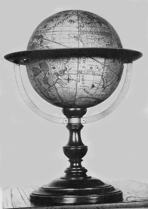
Fig. 124. Terrestrial Globe of Mattheus Seutter, 1710.
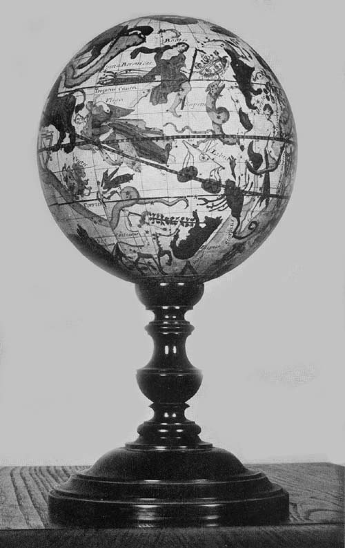
Fig. 125. Celestial Globe of Mattheus Seutter, 1710.
Fig. 125a. Terrestrial Globe of Van Lauen Zonen, 1745.
Robert Morden,144 active in London in the closing years of the seventeenth and early years of the eighteenth century as map and globe maker, seems, however, not to have won for himself a place of particular prominence, his maps not being held in especially high repute. He was for some time associated with Thomas Cockrill at “The Sign of the Atlas” in Cornhill. Morden, however, published a small work on geography and navigation in the year 1702, in which he attempted to set forth the value attaching to globes for those interested in the general subject of which he treated in his work.145 While his map publications are numerous, it has been possible to locate only the gores of one of his globes, which gores may be found in the British Museum. Of the twelve sections which made up a complete set for 157covering a sphere about 35 cm. in diameter, but nine remain, three having disappeared.
Jean Antoine Nollet, a French physicist (1700-1770), was a man of science held in high esteem in his day.146 In his early years he entered the College of Clermont, later studied philosophy at the University of Paris, where, against the wishes of his parents, he finally turned his attention to the study of the natural sciences, particularly to experimental physics. Early in his career he was honored with membership in the Royal Academy of Sciences of Paris and in other similar organizations in Europe. In the year 1739 he was called to the Court of Sardinia, where he gave lessons in physics to the Duke of Savoy. Later he was called to the University of Turin, and was here especially honored by having his name associated with those who were the founders of the institution. In the year 1753 he was called to the chair of physics at the College of Navarre, which position he so acceptably filled that he received the title Master of Physics and of Natural History for the Royal Children of France. His published works, which are very numerous, treat of his studies in the physical sciences, particularly in the field of electricity.
Nollet’s instruments, made for use in the study of the physical sciences, included terrestrial and celestial globes, six of which have been located, dated 1728 and 1730. The spheres are of papier-mâché, having each a diameter of about 35 cm.147 The engraved maps covering the spheres are composed of twelve gores, which are cut at the line of the equator but extend to the poles, omitting therefore the usual polar circular discs. Each is furnished with a horizon circle of wood, on the surface of which is the usual paper covering with the names of the principal directions, of the zodiacal constellations, and of the names of the months in concentric circles. Each also has a graduated meridian circle, the whole resting on a base of four turned and rather artistically fashioned columns.158
His terrestrial globes have the following title: “Globe terrestre dressé sur les observations les plus nouvelles et le plus exactes approuvées par Mrs de l’Académie Royale des sciences. À Paris avec privilège du Roi. Monté par l’auteur.” “Terrestrial globe made according to the most recent and the most exact and approved observations by the Royal Academy of Sciences. Paris, with the approval of the King. Made by the author.” The dedication reads “Dédié et présenté à S. A. Madame La Duchesse du Maine par son très-humble et très-obéissant serviteur Nollet Lic. en Théologie. 1728.” “Dedicated and presented to Her Highness the Duchess of Maine by her very humble and very obedient servant Nollet Licentiate in Theology. 1728.” Numerous inscriptions relate to well-known geographical discoveries. Meridian and parallel circles are drawn on the globe at intervals of five degrees, the principal ones, including the equator, the tropics, and polar circles, being made especially prominent. The prime meridian, passing through the Island of Ferro, is designated “premier méridien de l’Isle Fer. Déclaration du Roi Louis XIII du Juil. 1634.”
The celestial globe is titled “Globe céleste calculé pour l’année 1730 sur les observations les plus nouvelles et les plus exactes. À Paris avec privilège du Roi. Bailleul le jeune sculpsit. Monté par l’auteur.” “Celestial globe calculated to the year 1730 according to the most recent and the most exact observations. Paris, with the privilege of the King. Bailleul the younger engraver. Constructed by the author.” It is dedicated “Dédié et présenté à S. A. S. Monseigneur le Comte de Clermont par son très-humble et très-obéissant serviteur Nollet de la Société des Arts. 1730.” “Dedicated and presented to His Most Serene Highness Seigneur The Count of Clermont by his very humble and very obedient servant Nollet of the Society of Arts. 1730.” The equatorial circle and the ecliptic, as represented on the map, are graduated, but the tropics and the polar circles are merely drawn as continuous black lines. The figures representing the several159 Ptolemaic constellations are artistically drawn and retain much of their original color, which was added by hand at the time of construction.
Of Nollet’s globes a pair may be found in the Biblioteca Maldotti of Guastalla, a pair in the Seminario Vescovile of Mondovi, a copy of the terrestrial in the Archivo Fenaroli of Brescia, and a copy of the celestial in the Museo Astronomico of Rome.
Johann Gabriel Doppelmayr (1671-1750) was one of Nürnberg’s famous eighteenth-century mathematicians who was especially distinguished as writer, translator, editor, and teacher.148 A part of his early training he received at the Egedian Gymnasium of his native town, where from 1704 to the time of his death he was actively engaged as teacher of mathematics and physics. In the year 1696 we find him registered as a student of law at the University of Altdorf, though turning betimes with much enthusiasm to the study of mathematics under the direction of Joh. Christoph Sturm. In the year 1700, after some months passed at the University of Halle, he determined to add to his equipment for his life work such experience as could be gained through travel; accordingly he visited in turn the more important cities of his own country and those of Holland and England, spending in his travels a period of ten years. Among his more important publications may be mentioned a translation of the ‘Astronomy’ of Thomas Street,149 a work by Bion in a German translation from the French, which at the same time he enlarged.150 His ‘Einleitung zur Geographie,’ appearing as an introduction to Homann’s ‘Atlas’ issued in the year 1714, and his ‘Atlas Coelestis,’ issued in the year 1742, are among his more important works original in character, which he published on the subject of geography and astronomy. His principal work is his ‘Notes’ on the mathematicians and artists of Nürnberg.151
It was doubtless through his connection with the cartographical establishment of Homann that he felt induced to160 undertake the construction of his globes, examples of which exist dated 1728. In the collection belonging to The Hispanic Society of America (Fig. 126) there may be found a fine example of his terrestrial globes, which has a diameter of about 32 cm. Over a carefully prepared hollow wooden ball twelve gores, cut at the line of the equator and five degrees from each pole, have been pasted. The small polar spaces lying between latitudes 85 degrees, both north and south, are covered by circular discs, having a diameter of but ten degrees, on the one is engraved “Polus Arcticus” and on the other “Polus Antarcticus.” The globe is furnished with a narrow graduated meridian of brass within which the sphere turns on its polar axis, a horizon circle of wood, circular on its inner edge but octagonal on the outer. The engraved paper strip containing the zodiacal figures, calendar, and directions, has practically disappeared. The base support consists of four small turned columns of wood, attached at their lower extremities by crossbars over which is a circular plate, provision having been made for insertion into its surface of a compass, which instrument, however, has disappeared. Excepting slight damage to its horizon circle the globe may be said to be in an excellent state of preservation. In a neat cartouch in the North Pacific is the title legend reading, “Globus terrestris in quo locorum insigniorum situs terraeque facies secundum praecipuas celeberrimorum nostri aevi Astronomorum et Geographorum observationes opera Joh. Gabr. Doppelmaieri Mathem. Prof. Publ. Norib. exhibentur, concinnatus a Joh. Georg. Puschnero Chalcographo Norib. A. C. 1728.” “Terrestrial globe on which the position of the principal places on the surface of the earth are shown according to the principal observations of the most celebrated astronomers and geographers of our times by the labor of John Gabriel Doppelmayr, mathematician, professor and publisher of Nürnberg. Engraved by John George Puschner, engraver of Nürnberg152 in the year 1728.” An interesting legend in the South Pacific tells us 161“Exprimit Globus hic noster quicquid Geographia recens ex Observationibus fide dignis suppeditat tam in situ locorum plurium, quam in terrarum novarum etiam mariumque ambitu. Meridianus primus per Insulam Fer inter Canarias (quae olim Fortunatae dicebantur) occidentalissimam ductus a quo Parisiensis Meridianus Probatissimarum Observationum testimonio 20 Gradibus, Noribergensis vero 28 Gr. 40 Min: distat.” “This globe of ours shows that which the latest geographical information furnishes from the trustworthy observations both as regards the location of new places and the extent of the new lands and seas. The first meridian passes through the Island of Ferro in the Canary Islands (called the Fortunate Islands), which is the most western point and from which the meridian of Paris, according to the testimony of the most approved observations differs by 22 degrees, while that of Nürnberg differs by 28 degrees and 40 minutes.” Around this legend are the engraved portraits of famous explorers, “Mart. Bohemus Norimbegus,” “Americus Vesputi,” “Franc. Draco,” “Schouten,” “Georg Spilbergius,” “R. P. Tachard,” “Wilh. Dampier,” “Mon. de la Salle,” “Thomas Candisch,” “Olivirius a Nord,” “Ferdin. Magellanicus,” “Christ. Columbus.”
Fig. 126. Terrestrial Globe of Johann Gabriel Doppelmayr, 1728.
While the representation of the world is not so detailed in certain respects as we find, for example, on the Valk globes, there nevertheless is the evidence that the author wished to include such information as in his judgment should be recorded. There are records of interest in the newly explored regions of America. California is laid down as a peninsula. In about latitude 41 degrees there appears a Drake record reading “Pt. F. Drack.” “Fretum Anian” is represented at latitude 45 degrees. Sixty degrees to the west of this is the somewhat indefinitely indicated coast line of “Terra Borealis incognita detecta Dom. Ioh. de Gama,” this being separated from the coast of “Kamtzadalia Terra Jedso” by “Fretum Vries.” The recently explored regions in the Far East,162 as in Australia, New Zealand, Van Diemen’s Land,—each, however, being represented as imperfectly known,—are made very prominent. There are scarcely any map records of the period more interesting than are those to be found on this globe of Doppelmayr’s. The routes of Magellan, 1519; Nord, 1600; Roggeveen, 1722; Dampier, 1700; Tasman, 1624; Loys, 1708; Lemaire, 1616, are all laid down. In latitude 60 degrees south and longitude 300 degrees we find, “Port detecta per Fr. Drack,” and again in latitude 67 degrees south and longitude 310, “I. deton detecta per F. Drack.”
To accompany his terrestrial globe, Doppelmayr issued a celestial globe bearing the same date. A title legend on the latter reads, “Globus coelestis novus Stellarum fixarum loca secundum celeberrimi astronomi Dantiscicani Joannis Hevelii Catalogum ad annum 1730 compl. sistens opera Joh. Gabr. Doppelmaieri M. P. P. exhibitus a Johanne Georgio Puschnero Chalcographo Noribergensi. A. C. 1728.” “A new celestial globe giving the location of the fixed stars according to the record of the celebrated Danish astronomer Johannes Hevelius conforming to the year 1730, by the labor of Johannes Gabriel Doppelmayr, mathematician, professor, publisher, engraved by Johannes George Puschner, engraver of Nürnberg, in the year 1728.” In size and in general features of construction these globes seem to agree, being scientifically and carefully constructed. A pair of these globes may be found in the Biblioteca Capitolare of Verona, a pair in the Geographisches Institute of Göttingen, a copy of the celestial in the Mathematical Salon of Dresden, a copy of the terrestrial in the Museo di Fisica of Pavia, a pair dated 1728 in the Germanisches Nationalmuseum of Nürnberg, a pair dated 1736, 20 cm. in diameter, and three copies each of his globes issued in 1730, 20 cm. in diameter, and a celestial globe dated 1730 and 20 cm. in diameter, in Dresden. (Fig. 126a.)
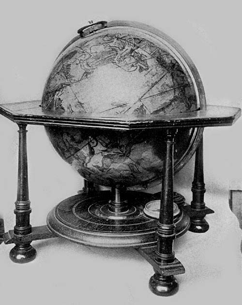
Fig. 126a. Celestial Globe of Johann Gabriel Doppelmayr, 1728.
Fiorini notes the existence of a large terrestrial globe belonging163 to the Marquis Luigi Cusani,153 which probably was constructed in the early eighteenth century, perhaps before 1730, by order of Cardinal Agostino Cusani. The globe, unsigned and undated, is of papier-mâché, having a diameter of about 120 cm. The paper gores with which the sphere is covered are not all of like form, but all are cut at the line of the equator and at latitude 80 both north and south, the usual circular disc being provided for covering the polar areas. On its surface the map has been drawn by hand, and practically all of the geographical names recorded are in the Italian language. The globe is mounted on a solid base, having a heavy horizon circle of wood, which is graduated, and on its surface are the names and the signs of the several zodiacal constellations, the names of the months and of the principal winds or directions. The meridian circle, within which the sphere revolves, is of brass and is graduated. It is reported to be in a good state of preservation.
The Biblioteca Comunale of Siena possesses two anonymous terrestrial globes, according to report of Fiorini, the one having a map in manuscript, the other having an engraved map.154 The first of these, unsigned and undated, probably of the second quarter of the century, has a diameter of about 120 cm. The sphere is of wood, the surface of which is covered with mastic or varnish, and on this the map has been drawn. It is constructed to revolve within its simple mounting of wood by means of a crank. The title legend reads “Globe terrestre Dressé selon les observations de l’Acad. Royale de Paris et des autres Acad. plus célébrés d’Europe.” “Terrestrial globe constructed according to the observations of the Royal Academy of Paris and of other Academies the most celebrated in Europe.” In addition to the above legend one finds the following inscription: “On a pris la longitude des villes principales des Tables de Mur Philippe de La Hire. Les autres villes ou il n’ a point d’observations sont icy places en la même distance des villes principales dans la quelle on les voit dans les cartes de M.164 Guillaume de l’Isle.” “The longitudes of the principal towns have been taken from the tables of Mur Philippe de La Hire.155 The other towns which have not been located from observation are placed at the same distance from the principal towns as they are located on the maps of M. Guillaume de l’Isle.”
It seems probable that this globe was constructed in France, and from the particular references to La Hire and Delisle one may infer, as noted above, that it belongs to the early eighteenth century. Parallels and meridians are drawn on the surface of the globe at intervals of ten degrees, and one conspicuous wind rose with sixteen radiating lines is placed in latitude 30 degrees north and longitude 350 degrees counting from the prime meridian, which passes through the Island of Ferro. This globe, it is thought, came to the Siena Library about the year 1810, at the time of French rule in Tuscany, together with the library of the Convent of S. Augustine, but how it came to have place in the Augustine convent is unknown.
The second Sienese terrestrial globe, like the one just described, probably belongs to about the same date.156 It has the following legend conspicuously placed: “Globo terracqueo corretto et accresciuto secondo le nuove scoperte. Anno 1744. In Roma nella Calcografia del R:C:A: al Piè di Marmo.” “Terrestrial globe corrected and enlarged according to recent discoveries. 1744. In Rome in the engraving establishment of R. C. A. at the foot of the marble.” The globe ball is of wood, having a diameter of about 50 cm. Additional information concerning this globe it has not been possible to obtain. Copies of it may be found in the Biblioteca Comunale of Imola, in that of Osimo, in that of Savignano, and in the Seminario Vescovile of Ivrea.
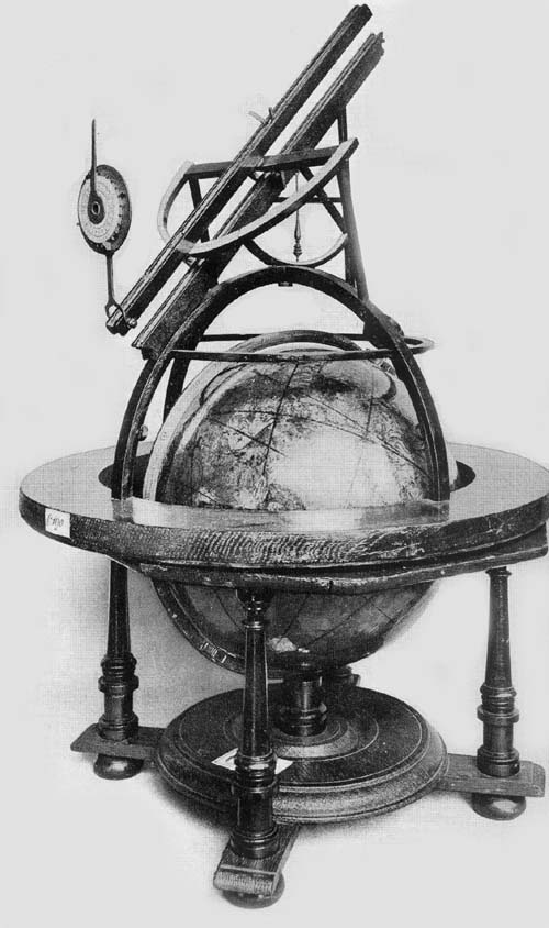
Fig. 126b. Celestial Globe of Johann Puschner, 1730.
In the Museo di Strumenti Antichi of Florence there is a well-preserved armillary sphere,157 having the usual large circles the outer one measuring about 15 cm. in diameter, of four lesser ones and of these there are two small ones 165representing the sun and the moon. The meridian and the equator are graduated, as is likewise the ecliptic, having engraved on its surface the names of the principal winds in the Italian language, and the ecliptic having engraved in Latin on its surface the names of the signs of the zodiac. On one of the arms which supports the horizon circle is the author and date legend, reading, “Joseph Torricelli F. Florentiae 1739.” Fiorini thinks it probable that Joseph was a relative of Evangelista Torricelli, inventor of the barometer.
Pietro Maria da Vinchio, a monk of the order of St. Francis, deserves a word of special praise for the skill with which he labored as a map and globe maker about the middle of the eighteenth century.158 He seems to have followed in the main the work of Moroncelli, and that of the unknown maker of the Cusani globe, yet he should be counted a workman possessing greater technical ability. His first pair of globes have a diameter of about 60 cm. The mounting consists of a meridian and a horizon circle of wood, the whole resting on a somewhat elaborate wooden base. The gores with which he covered his spheres are in each instance eighteen in number, but each gore has been cut into three sections—at the parallel of 40 degrees, both north and south, and also at the parallel of 80 degrees, the polar spaces having the usual circular disc covering. The terrestrial globes have represented on their surfaces the polar and the tropical circles, also the ecliptic and the equator, together with the several parallels and meridians at intervals of ten degrees. Artistic wind roses are placed at each of the equinoctial points, each with points representing the eight principal directions. The title legend reads, “Globus terrestris juxta geographicas mappas novissime editas accurate descriptus, in quibus, exactiori observatione praemissa, errores multiplices sunt emendati, qui in veteri geographia detinebantur impressi. F. Petri Mariae a Vinchio opus et labor 1739.” “Terrestrial globe accurately delineated according to the most recent geographical maps in which, by more exact166 observations, numerous errors are corrected which continued to be printed in the old geography. Fra Peter Maria a Vinchio, his work and labor, 1739.”
The celestial globe, similar in its construction in practically every respect to the preceding, has its system of circles represented according to the equatorial system instead of the ecliptic system. All of the Ptolemaic constellations are represented, the figures of the several constellations being very artistically painted. Its dedication reads, “Ill̄mo ac Rev̄mo D. D. Petro Hieronymo Caravadossi Episcopo Casalensi Ordinis Praedicatorum parvum hoc Firmamentum dicatum a F. Petro Maria de Vinchio Ord. Min. Stric. Obser. operis auctor. 1745.” “Dedicated to the Illustrious and Reverend D. D. Peter Hieronymus Caravadossi Bishop of Casale of the Preaching Friars, by Fra. Peter Maria de Vinchio of the Strict Minorite Order, who is the author of this work, in the year 1745.” The pair just described may be found in the Biblioteca Seminario Maggiore of Casale Monferrato. Fiorini is of the opinion that these globes, presented to the learned Father Pietro Girolamo Caravadossi of the Preaching Friars, Bishop of Casale, must have been given by him to the seminary library, that they might serve in the education of the priests. It is even probable that the two globes came to the library by a direct clause in the will of the bishop, since it is known that he bequeathed to the same library all of his books and an annual sum, that the library might be used not only by the members of the seminary but by the general public as well.
Not long after the completion of the pair just described, da Vinchio undertook the construction of a second and larger pair. These he began in the year 1746 and completed in the year 1751. These globes have a diameter of about 105 cm. Like the preceding they are of papier-mâché. Each is furnished with a meridian and a horizon circle of wood, and a somewhat elaborate supporting base. On the parchment covering of the spheres the maps have been drawn by167 hand. On the terrestrial globe the meridians and the parallels are represented at intervals of ten degrees. Place names, the names of the seas and of the rivers are in the Italian language or in the language of the country claiming possession. Very many of the discoveries are referred to in appropriate legends. The title and date legend reads “D. O. M. Globus terraqueus Juxta geographicas mappas novissime editas accurate descriptus, in quibus, exactiori observatione praemissa, longitudinum, latitudinumque punctis verius universe compertis, errores multiplices sunt emendati, qui in veteri geographia detinebantur impressi. Inferius scripti mens, labor, ars, et opus. F. Petrus Maria a Vinchio. In Conventu S. M. de Templo Casalis annis 1746-1747-1748.” “D. O. M. Terrestrial globe accurately described according to the latest geographical maps in which by a more exact observation and by a truer location of the points of longitude and latitude many errors have been corrected which continued to be printed in the old geographies. What follows is the work and labor of Fra. Peter Maria a Vinchio, made in the Convent of Santa Maria at the Temple in Casale in the years 1746-1747-1748.”
The celestial globe is similarly mounted, having a title legend which reads “Globus coelestis Circa quem spectabiliores, magisque obviae stellae juxta dispositionem et situm, longitudinis scilicet ac latitudinis gradū, in quo ab Auctore Universi in Firmamento sunt positae, dispositae inspiciuntur; singulis tamen figuris a Poetis ideatis, ab Astromomis diductae, et assignatae novissime auctus. F. Maria a Vinchio O. M. S. O. Anno 1750.—Opifex.—1751.” “Celestial globe in which are to be seen more clearly and more distinctly set forth the stars according to their places and positions, that is, their degrees of longitude and latitude where they have been placed in the firmament by the Creator of the Universe. To which have been added the figures of the constellations idealized by the poets, brought to earth and assigned their true168 places by astronomers. F. Maria a Vinchio of the Strict Order of the Minorites maker. In the year 1750-1751.”
The figures of the constellations are well drawn and are colored, the names of these constellations being given in Latin. This pair of Maria’s globes may be found in the Biblioteca Municipale of Alessandria, in which town he probably lived at the time of their construction, and probably at the convent of the Capuchin monks.
Prefixed to his ‘Select Mechanical Exercises,’ first issued in the year 1773, James Ferguson (1710-1776), Scotch experimental philosopher, physicist, and astronomer (Fig. 127), gives us a most interesting specimen of autobiography.159 It is a remarkable story of native genius and of self-instruction. Herein he tells us how the child of poor parents, with an unquenchable desire for scientific knowledge, proceeded in his early years, step by step, until at length he attained to a position of great renown, not only in his own country but as well in other lands. He tells of his early interest in simple mechanical problems and of his attempts at the solution of the same, but what is of special interest here, he relates how it was he became interested in geography and in the construction of globes and orreries. From a description of a globe he had found in ‘Gordon’s Geographical Grammar,’ as he tells us, “I made a globe in three weeks turning the ball thereof out of a piece of wood.” This he covered with paper and delineated thereon the map of the world. He was happy to find, as he says, “that by using the globe, which was the first I ever saw, I could solve the problems.” In his second attempt at globe making, his boyish ingenuity particularly exhibited itself. Finding two large globular stones on the top of a neighbor’s gate-posts, he painted on one of these, with oil colors, a map of the terrestrial globe, and on the other a map of the celestial, from a planisphere of the stars which he had copied on paper from a celestial globe belonging to a neighboring gentleman. “The poles of the painted globes stood toward the poles of the heavens. On 169each the twenty-four hours were placed around the equinoctial so as to show the time of day when the sun shone out, by the boundary where the half of the globe at any time enlightened by the sun was parted from the other half in the shade: the enlightened parts of the terrestrial globe answering to the like enlightened parts of the earth at all times: so that whenever the sun shone on the globe one might see to what place the sun was then rising, to what place it was setting, and all the places where it was then day or night, throughout the earth.”
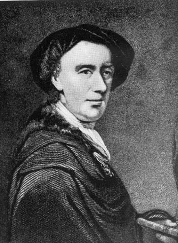
Fig. 127. Portrait of James Ferguson.
Turning his attention especially to the movements of the stars, he contrived an orrery to show the motions of the earth and the moon, of the sun and the planets, both diurnal and annual, and it was in his first literary attempt, published in the year 1746, that he described ‘The Use of a New Orrery.’ Ferguson published many works on scientific subjects, lectured extensively before learned societies, was honored with the royal bounty of King George III, and became a member of the Royal Society without initiatory or annual fees.
Of globes constructed by Ferguson other than those he contrived in his boyhood days, eight copies are known. In the collection of The Hispanic Society of America (Fig. 127a), there appears to be a unique example of his first published globe work, constructed perhaps as early as the year 1750, since it records the route followed by the Englishman, George Anson, in circumnavigating the earth in his expedition or expeditions of the years 1740-1744, and omits reference to the expeditions of Captain Cook. The terrestrial globe, a solid wooden ball, 7 cm. in diameter, is enclosed in a black leather covering, on the inner surface of which is pasted an engraved gore map of the celestial sphere. It appears to be constructed as were those referred to by Moxon in his catalogue of globes which were “made and sold by himself on Ludgate Hill,” that is, “concave hemispheres of the Starry Orb which serve for a case to a Terrestrial Globe of 3 inches170 in diameter, made portable for the Pocket.” The covering of this Ferguson globe is made to open on the line of the celestial equator. In a neat cartouch placed in the North Pacific is the author and title legend reading, “A New Globe of the Earth by James Ferguson.” The meridians are drawn at intervals of fifteen degrees, the prime meridian passing through Greenwich, and the parallels are drawn at intervals of ten degrees, being graduated on the meridian of 145 degrees west, excepting the tropics and the polar circles, which are drawn in their proper latitudes, respectively 23½ degrees from the equator and 23½ degrees from the poles. Ferguson followed such geographical records as were laid down by Hondius in his world map of the year 1611, or by Greuter in his globe map of the year 1632 in the North Pacific region, indicating there the existence of a great expanse of ocean, between northwest North America and northeast Asia. “Anian St.” is marked as separating a somewhat indefinitely outlined coast from America. The Antarctic continent is altogether omitted; the only inscription appearing in that region is “The South Pole.” Geographical names are as numerous as one could expect to find them on a globe of such small dimensions.
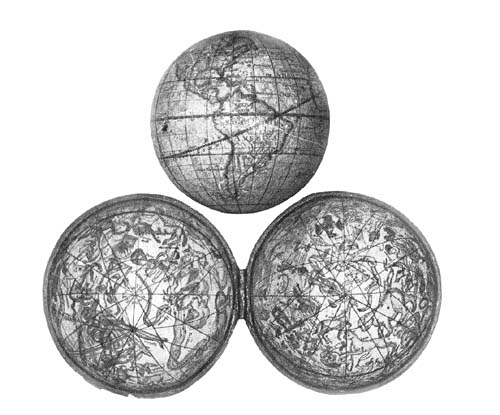
Fig. 127a. Pocket Globe of James Ferguson, 1750 (?).
The figures on the celestial map pasted on the inner surface of the terrestrial globe covering representing the several constellations have been very artistically drawn. Both the terrestrial and the celestial parts of this combination globe are remarkably well preserved. A second and later example of this Ferguson globe may be found in the Harvard University Library, once belonging to Ebenezer Storer of the class of 1747. It came into the possession of the University in the year 1914. In addition to the globes of Ferguson, just described, two pairs are known, dated each 1782, subsequent to the author’s death, it will be noted, each having a diameter of 30 cm. These are mounted in the usual manner with wooden horizon and brass meridian circles, with support base columns of wood. On the terrestrial globes English
is the language employed, while all names of the constellations on the celestial globes are in Latin. As on the small terrestrial globe in The Hispanic Society’s collection, the route of Admiral Anson is indicated, omitting that of Captain Cook, and numerous brief legends are given referring to various geographical discoveries. One pair of these globes may be found in the Biblioteca Comunale of Palermo and the other pair in the Osservatorio Meteorico of Syracuse.
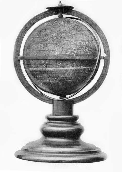
Fig. 127b. Terrestrial Globe of Herman Moll, 1705.
NOTES
117 This society was founded in the year 1666 by Louis XIV, after the model of the Royal Society of London. It was liberally endowed and supported, its members devoting themselves to the science of physics, mathematics, astronomy, botany, zoology, and medicine. The observatory, founded in the year 1667, was an adjunct of the society.
118 Niceron, J. F. “Delisle.” (In: Mémoires pour servir à l’histoire des Hommes illustres dans la république des lettres. Paris, 1729. Vol. 1, p. 214.); Fontenelle, B. le B. de. Éloge des académiciens. À la Haye, 1731. Vol. II, pp. 324-339; Sandier, C. Die Reformation der Kartographie um 1700. München, 1905. pp. 14-21.
119 Not that there is less of interest in physical, in commercial, in descriptive geography, but that there is a decided tendency in this day to stress what is sometimes called human geography, which consists in emphasizing the relation of geographical study to real life.
120 This work appears to have established his reputation. In the year 1702 he became a member of the Academy, not as a geographer—this department was not established until the year 1730—but as an astronomer under Cassini. Sandler, loc. cit.; Vivien de Saint-Martin, M. Histoire de la géographie. Paris, 1875. p. 423. This last-named author says: “La Mappemonde de Guillaume Delisle et ses cartes particulières des quarte partiée du monde, publiées en 1700, remenèrent enfin pour la première fois à leurs véritables places et à leurs dimensions réelles les parties orientales de l’ancien continent. Quelle que fussent les améliorations de détail que dût recevoir par la suit la carte du monde,—et ces améliorations etaient immens,—l’honneur d’en avoir apéré la réforme radical suffit pour éterniser le nom Guillaume Delisle.”
121 Sandler, op. cit. This was an error having its origin in Ptolemy’s geography, as set down in the Ptolemy maps. The two most significant errors in the Ptolemaic cartography were (a) the representation of the Indian Ocean as an enclosed sea; (b) the too great extension in longitude given to the Mediterranean Sea. A correction of the first of these errors followed quickly after the discovery of the sea route to the Indies of the East. As a result incident to the second error the Asiatic regions were extended much172 too far eastward, the maps as late as the seventeenth century showing the coast of China to lie at least twenty-five degrees too far in that direction. The invention of the telescope in the first decade of the seventeenth century and of the pendulum clock about the middle of the century made possible a more accurate determination of the location of places, and an improvement in map construction soon followed. See also Wolf, Geschichte, pp. 355-362; 369-373.
122 Wolf, op. cit., pp. 400-403. This came to be but one of the many methods employed in the effort to determine longitude. One of the most interesting and most recent is that in which wireless telegraphy has been called into service. See Hoogewerff, Capt. J.A. Washington-Paris Longitude by radio signals by F.B. Littell and G.A. Hill. (In: Astronomical Journal. Albany, 1915.)
123 See “Nolin” and “Delisle.” (In: Mémoire pour l’histoire des sciences et des beaux arts. Trévoux, 1702. p. 166.); “Nolin.” (In: Nouvelle biographie.); Lelewel. Géographie du moyen âge, II. p. 202; Sandler, op. cit., p. 15.
124 Sandler, op. cit., reproduces Delisle’s world map of 1700, pl. iv.
125 Wolf, op. cit., pp. 449-452; Mémoires pour servir a l’histoire des sciences et a celle de l’observatoire royal de Paris. Paris, 1810. pp. 255-309; “Cassini, Jean-Dominique.” (In: Nouvelle biographie.) In this last article may be found a long list of Cassini’s publications.
126 “Gassendi, Pierre.” (In: Nouvelle biographie.) Gassendi achieved distinction for his works on astronomical subjects. In the year 1645 he was appointed Professor of Mathematics in the Collège Royal of Paris, a position he held with interruptions until his death.
127 The term “Precession of the Equinoxes,” as used in astronomy, refers to the slow retrograde motion of the equinoctial point to the west, or contrary to the order of the signs of the zodiac, this precession being estimated by Hipparchus to be one degree in one hundred years; in sixty-nine years by Ptolemy; in sixty-six years by Albategnius; in seventy years by Cassini, but it is now estimated to be one degree in about seventy and one half years. For one complete revolution of this equinoctial point through the twelve signs of the zodiac Hipparchus estimated a period of 36,000 years would be required; according to Ptolemy a period of 24,840 years; according to Albategnius 23,760 years; according to Cassini 25,200 years; whereas the period is now estimated to be a little more than 25,800 years. An important consequence of the precession of the equinoxes lies in the fact that the zodiacal constellations do not agree with the signs with which they coincided in ancient times, i.e., in the beginnings of astronomical science. The first star of Aries, which at the time of Eudoxus was at the intersection of the equator and the ecliptic, or at the equinoctial colure, has continued to increase its position in longitude. At the time of Ptolemy this was 6 degrees 40 minutes. Its longitude is now about 31 degrees, which places it entirely out of its original sign.
128 Among the more important works of Cassini bearing upon this particular subject may be mentioned, Méthode pour trouver la différence des longitudes des lieux par les observations correspondantes des phases des éclipses de soleil 1670. (In: Histoire de l’Académie Royale des Sciences. Paris, 1733. Vol. I, p. 133.); La méthode de déterminer les longitudes des lieux de la terre par les observations des satellites de Jupiter. (In: Mémoires de l’Académie. Paris, 1743. Vol. X, p. 569.); De la méthode de déterminer173 les longitudes des lieux de la terre par les observations des satellites de Jupiter. (In: Observations physiques et mathématiques. Paris, 1688. pp. 232-278.); Les hypothèses et les tables des satellites de Jupiter, réformees sur de nouvelles observations. (In: Mémoires de l’Académie, 1693. Paris, 1730. Vol. VIII, p. 363.); Méthode de déterminer les longitudes des lieux de la terre par des étoiles fixes et des planètes par la Lune. (In: Mémoires de l’Académie. Paris, 1703.)
130 Histoire de l’Académie Royale des Sciences. Paris, 1727.
131 Fiorini. Sfere terrestri e celesti. pp. 401-402.
132 Zedler, J. H. Groses universallexikon aller Wissenschaften und Kunste. Leipzig-Halle, 1745. Vol. 46, p. 153; Günther, Erd- und Himmelsgloben, p. 107, n. 1, reports that two of his Atlases, one of which is a particularly fine example of work representing astronomical geography, may be found in the K. Hof und Staatsbibliothek of München. More than one hundred and twenty-five maps of Gerhard and Leonhard Valk are listed by Phillips in his excellent work on Atlases in the Library of Congress. See index.
133 Praxis astronomiae utrisque ut et geographiae exercita per usum Globi coelestis et terrestris tum et Planetolabii. Amstelodami, sumptibus Gerhardi Valk Calcographi apud quem prostant una globis et Planetolabio. n. d.
134 There is considerable doubt as to the date assigned to the Valk globes in the Königliche Museum of Cassel, and to those in the Germanisches Nationalmuseum of Nürnberg. See reference to these above, p. 150.
135 “Senex, John,” with appended short bibliographical list. (In: Dictionary of National Biography.)
137 “Bion, Nicolas,” with portrait. (In: Nouvelle biographie. Paris, 1853.)
138 Bion, Nicolas. Usage des globes célestes et terrestres, et des sphères, suivant les différents systèmes du monde. Paris, 1699. This work was reissued no less than six times before 1751, there being added to the title in the sixth edition, “Précédé d’un Traité de Cosmographie. Sixième édition, revue et corrigée par le Sieur N. Bion, ingénieur du Roi pour les instruments de Mathématique, sur le Quai de l’Orloge du Palais, au Soleil d’or, où trouvé des Sphères et des Globes de toutes façons”; same author. Traité de la construction et des principaux usages des instruments de mathématique. Paris, 1752. Bion’s work was translated into English by Edward Stone and published in London, 1723, under the title ‘Bion’s construction and principal use of mathematical instruments.’
140 Fiorini, op. cit., pp. 402-405.
141 Fiorini, op. cit., pp. 430-431.
142 “Seutter, Mattheus.” (In: Allgemeine deutsche Biographie.); Sandler, C. Mattheus Seuter und seine Landkarten. (In: Mitteilungen des Vereins für Erdkunde zu Leipzig. Leipzig, 1894. pp. 5-38.) This article contains a brief biography, a list of his several map publications, his colaborers, and a special consideration of his landkarten.
143 See the list as given by Sandler, op. cit.
144 “Morden, Robert.” (In: Dictionary of National Biography.)
145 Morden, R. An introduction to astronomy, geography, navigation, etc., made easy by the description and uses of the coelestial and terrestrial globes,174 in seven parts. London, 1702. A list of his maps and principal geographical works is given in the article referred to in note 28. See also British Museum Catalogue of Printed Books and Maps.
146 l’Éloge de l’Abbé Nollet. (In: Histoire de l’Académie Royale des Sciences. Paris, 1773. p. 121.); Querard, J. M. La France Littéraire. Paris, 1826-1842. 10 vols. Vol. VI, p. 444; “Nollet, l’Abbé, Jean Antoine.” (In: Nouvelle biographie.)
147 Fiorini, op. cit., pp. 407-409.
148 “Doppelmayr, Johann Gabriel.” (In: Allgemeine deutsche Biographie.)
149 Street, T. Astronomia Carolina. A new theory of the celestial motions. London, 1661.
150 This was a translation of Bion’s Traité de la construction et des principaux usages des instruments de mathématique, to which he gave a general title ‘Neueröfnete mathematische Werkschule.’ Leipzig, 1713. To the title of a later edition of this translation was prefixed, “Dritte Eröfnung,” Nürnberg, 1741. The reference is to a technical school of Nürnberg.
151 Doppelmayr, Johann Gabriel. Historische Nachricht von nürnbergischen Mathematiscis und Künstlern. Nürnberg, 1730.
152 Doppelmayr, op. cit.
153 Fiorini, op. cit., p. 394.
154 Fiorini, op. cit., pp. 414-415.
155 A noted French geometrician, professor of mathematics at the Collège Royal de France, and at l’Académie d’Architecture, 1640-1718.
156 Fiorini, op. cit., p. 415.
157 Fiorini, op. cit., pp. 431-432.
158 Fiorini, op. cit., pp. 410-414.
159 Ferguson, James. Select mechanical exercises with a short account of the life of the author by himself. London, 1773; “Ferguson, James.” (In: A biographical dictionary of eminent Scotsmen, originally edited by Robert Chambers, revised by Rev. Thos. Thompson. London, 1856.); “Ferguson, James.” (In: Dictionary of National Biography.) The last two articles contain extensive references to Ferguson’s works, many of which are of a high order of merit.

Chapter XIII
Globes and Globe Makers of the Second Half of the Eighteenth Century
Few globe makers of striking distinction in this period.—An apparent decrease in scientific interest in globes, but an apparent increase in popular interest.—Gilles and Didier Robert de Vaugondy.—The work of Desnos.—Globes of Gian Francesco Costa the Venetian.—Globes of Akerman and Akrel.—The French globe makers Rigobert Bonne and Lalande.—Charles Messier and Jean Fortin.—Globes of George Adams the Elder, of George Adams the Younger, and of Dudley Adams.—Small globes of Nathaniel Hill.—The work of Innocente Alessandri and Pietro Scaltaglia.—Charles Francis Delamarche.—Manuscript globes of Vincenzo Rosa.—Geographer and globe maker Giovanni Maria Cassini.—Globes of William Cary.
DURING the second half of the eighteenth century there is a continued interest in globe construction, yet the period is not one which is at all striking by reason of the good quality of the work done in this field. Since the latter part of the sixteenth century and the early part of the seventeenth, when, as has been noted, globes were so generally thought to be an essential part of a seaman’s outfit of navigating instruments, there had been a remarkable improvement in the construction of sailors’ charts resulting from carefully devised methods for the determination of geographical position and the employment of the results in map construction. The plane or sheet chart176 was again regarded as a more convenient, a more handy guide in navigation than was the globe. If plane chart making had improved so had plane map making. There must, however, have been a considerable popular interest in globes, judging from the number which we know were constructed, and from the number of publications issued which were intended to point out the particular value attaching to globes in geographical and astronomical instruction, to explain their construction, and to indicate the character of the problems which, by their use, could be easily solved. The interest in such objects in this period, perhaps we may say, was rather more extensive than intensive, having more of a popular than of a scientific character.
Among the most prominent French map and globe makers of this period were Gilles Robert de Vaugondy (1688-1766) and Didier Robert de Vaugondy (1723-1786), father and son, reference usually being made to these men in geographical literature under the name “Robert” or “Vaugondy.”160 Gilles, the grandson of Nicolas Sanson,161 who had achieved first rank among geographers in his day for his maps and atlases, proved himself to be a worthy member of the family. He doubtless owed his earliest enthusiasm for geographical science to an inheritance of the maps, atlases, and other geographical publications of the grandfather, many of which he reissued, adding to the same his own valuable and independent work. Didier seems to have possessed talents none the less brilliant than were those exhibited by the father, and upon him, in succession, the king conferred the title Royal Geographer. In addition to his issue of maps and atlases, the father, often referred to simply as Robert de Vaugondy, became interested in the construction of globes, issuing his first pair, which must have been of small size, in the year 1751, in which work he doubtless was assisted by the son. The king, it appears, being so well pleased with these, directed the construction of others of larger dimensions, and in the same year a pair was issued, each globe177 having a diameter of about 48 cm.162 In the same preface163 it is stated that the king gave orders for a terrestrial globe with map in manuscript, the same to have a diameter of about six feet, and the author further notes that “when this work shall have been completed and presented to His Majesty, I shall give an explanation of the work which I shall have been obliged to put upon the mechanical construction of the ball, also a description of the allegorical ornaments which will adorn the globe support, and a description of the geographical labor I shall have expended.” There appearing no later reference to this particular work, it seems hardly probable that it was ever actually undertaken. Delamarche gives us to understand that the king could not have been altogether pleased with Vaugondy’s first work, observing that while “it was done to the satisfaction of the Prince, he would have received the compensation due his talents and painstaking labor if the order of the king had been followed.”164 Wherein he failed we do not know. It may have been this fact which discouraged him in his thought of undertaking the larger work.
In the construction of his globes having a diameter of 48 cm. he was assisted by the engravers, De la Haye and Gobin, the results being the production of a terrestrial and a celestial globe map of superior excellence.
While it has not been possible to obtain photographs of any of the Vaugondy globes, his map of the world dated 1751 is doubtless much the same as his globe map, presenting geographical records as he thought proper to present them, including a representation of the route of a number of the recent exploring expeditions.
Copies of his globes of the year 1751 cannot now be located, but reproductions of the same, the terrestrial dated 1773 and the celestial dated 1764, may be found in the Biblioteca Governativa of Lucca, in the Biblioteca Real of Caserta, and a copy of the celestial in the Osservatorio Patriarcale of Venice. Shortly after the first issue of the178 globes in the year 1751 Vaugondy constructed other pairs, each having a diameter of 23 cm. These are dated 1754, copies of which may be found in the Biblioteca Palatina of Parma (two copies of the celestial), in the Pinacoteca Quirini of Venice, and a pair in the Palazzo of the Marquis of Spinola of Tassarolo.
L. C. (Pierre-Joseph ?) Desnos, a contemporary and an intimate friend of Didier Robert de Vaugondy, was a Danish geographer of distinction, winning for himself in early life the favor of his king and the title Geographical Engineer.165 A considerable number of his maps are known, and especially worthy of note is his atlas, titled ‘Atlas Général et Élémentaire,’ dated Paris, 1778, there being other editions of the same with modifications. It has been possible to locate a few of his globes. The first, a celestial, appears to have been issued as early as the year 1750, a copy of which may be found in the Liceo of Reggio, as there may also be found in the same collection a Desnos terrestrial globe dated 1760. These have each a diameter of about 22 cm. and are reputed to be in an excellent state of preservation. On the brass meridian circle of the second, one reads, “Se fait et se vendre chez Desnos rue St. Julien le pauvre 1753,” which legend suggests an issue of the same as early as the date given, and this idea finds support in an engraved legend referring to this particular issue as being one revised and corrected. There is additional support for the belief that a pair was issued in the year 1753 in the fact that this date appears on the base of the celestial globe. The Desnos maps are all well engraved and, like others of the period, much was made of indicating the routes of many of the famous explorers, including a reference to the success of Bering as follows, “Les Moscovites ont recouvré ici en 1743 sur les terres basses.” In this we have one of the very early references to the Russian successes in this region.
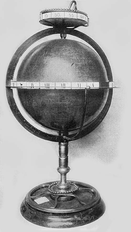
Fig. 129a. Globe of L. C. Desnos, 1782.
In the year 1754 Desnos issued a pair of globes somewhat larger in size, giving to them a diameter of about 26 cm. 179Copies of these globes may be found in the private library of the Marquis Lalatta Costerbosa of Parma. In their general features they resemble the previous edition, with every evidence that the author wished to bring his records to date and to make them quite as full as his space would allow, noting in one of his inscriptions, “Nous n’avons tracé que par des points la figure des terres que l’Admiral De Fonté détaille dans se lettre que Mr. Delisle a rédu publique, en attendant l’authenticité de cette lettre, se que les relations des nouvelles découvertes rendent probable.” In the year 1772, it appears, he issued a third edition, noting that he had made use of the most recent observations of the Royal Academy of Sciences of Paris, bringing his star records down to the year 1770. Copies of this edition are in Piacenza.
Gian Francesco Costa, a Venetian engineer, architect, and engraver, gave some attention to the construction of globes.166 In the year 1754 he prepared and issued, for the Venetian Academy, a terrestrial and a celestial globe, each about 24 cm. in diameter, basing the former on the work of Delisle and the latter on the observations and records of the English astronomer, John Flamsteed.167 There is little of special value attaching to the globes of Costa. They give merely the well-known geographical and astronomical records of the day. Copies of his celestial globe may be found in the Biblioteca Municipale of Cagli and in the Osservatorio Astronomico of Rome. Fiorini refers to a copy of the terrestrial as belonging to the Biblioteca Universitorio of Urbino, and to one in the private library of Canon Ettore Fronzi of Senigallia.
There is said to be a fine manuscript terrestrial globe, dated 1756, in the private library of Professor Maximilian Tono, director of the Osservatorio Patriarcale di S. Maria della Salute in Venice. The ball is of wood, over which is a coating of varnish, and on this a world map has been drawn by hand. It appears to have been constructed merely for the personal use of the maker, P. Francesco Grandi.
In Andrea Akerman we find a native of Sweden interested180 in the matter of globe making. Observing him to be one in possession of commendable talents, the Academy of Sciences of Stockholm, about the year 1750, granted to him a subsidy for the establishment of a workshop in Upsala. Here he undertook the construction of a terrestrial and of a celestial globe. So successful was his enterprise that, we are told, his productions found favor not only among those interested in his field within his own country, but among those similarly interested in Denmark, Germany, and Russia. Lalande makes mention of his work published through the Geographical Society of Upsala, dated 1776, noting that they had a diameter of about 22 inches.168 A copy of his celestial globe may be found in the Osservatorio Astronomico of Milan, having a diameter of about 59 cm. It has an author and date legend, reading “Globus coelestis ex Catalogo Brittanico et De la Caillii observationibus ad annum 1800 cura Soc. Cosmog. Upsal. delineatus ab Andrea Akerman Reg. S. S. Apt. sculptore 1766.”
A pair of Akerman’s globes may also be found in the Geographisches Institut of Göttingen, the terrestrial dated 1759, and the celestial dated 1760 and dedicated to the President of the Academy of Sciences by the Geographical Society of Upsala. His globes, it appears, were reissued by Frederick Akrel,169 an engraver who had assisted him in his work. The reissue of the Akerman globes dated 1779 contained corrections and additions which brought them to date, a fact which is noted in the following legend: “Globus terraqueus cura Societatis cosmographicae Upsalensis, editus ab Andr. Akerman Nunc emendatus.... opera Frederici Akrel 1779.” “Terrestrial globe issued under the auspices of the Cosmographical Society of Upsala, edited by Andrea Akerman, now corrected.... the work of Frederick Akrel 1779.”
The Biblioteca Universitario of Bologna possesses a very interesting manuscript terrestrial globe (Fig. 128), the work of P. D. Pietro Rosini, an Olivetan monk. Word from the 181librarian with photograph kindly sent170 gives us the information that this splendid globe was constructed in the year 1762, that it is a fine example of the period and is in an excellent state of preservation. It has a diameter of about 150 cm., being one of the largest constructed in Italy. The sphere is constructed of wooden plates securely braced. It has a meridian circle of heavy brass, a horizon circle of wood, having on its upper surface the usual representations referring to the constellations of the zodiac, the names of the months, and the principal directions. The circle on its inner edge is fashioned to receive the sphere, but it has an outer edge which is octagonal. Over the surface of the ball irregular pieces of paper were pasted and on this the geographical map was drawn by hand. Practically all geographical names are in the Italian language, as are the few geographical legends. The author and date legend in Latin reads, “D. Petrus Rosini de Lendinara Monus Olivus fecit ann: 1762.” “D. Petrus Rosini of Lendinara, an Olivetan monk made this in the year 1762.” Fiorini cites a reference to a letter written by Rosini wherein he is referred to as a professor, noting that other information concerning him seems to be unobtainable. From the fact of his having constructed a terrestrial globe and of his reference in his letter to an eruption of Mount Vesuvius, one would obtain the impression that he was a lover of scientific studies, and especially of geography.
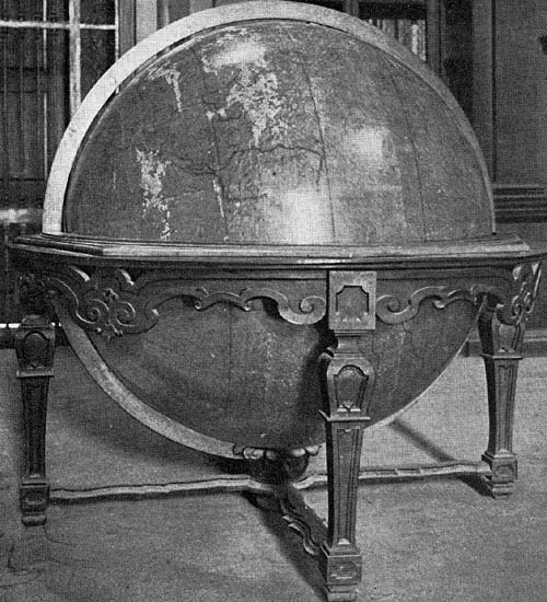
Fig. 128. Terrestrial Globe of Pietro Rosini, 1762.
Rigobert Bonne (1727-1794), a distinguished French hydrographer and engineer, achieved likewise a very considerable reputation as a geographer and cartographer; indeed, the great majority of his scientific publications were within the field of geography.171 With Joseph Jérôme Le Français de Lalande (1732-1807), one of the most famous of French astronomers,172 he undertook the construction of a terrestrial and a celestial globe on which it was proposed to record in particular all of the most recent discoveries in both the field of geography and that of astronomy. To these182 globes they gave a diameter of about 31 cm., following, in constructing the gore maps with which each sphere was covered, the method of Bion, giving very careful consideration to the fact that the paper on which the maps were printed would expand somewhat unevenly when moistened with the paste used in the mounting. It seems probable that Bonne completed the terrestrial globe about the year 1771, and Lalande the celestial about the year 1775, and that the engraving of the maps was entrusted to Lattré, who had at this time a place of marked distinction in the profession he represented. Lalande says of the first issue of their work: “M. Lattré, Graveur ordinaire de Mgr. le Dauphin et de M. le Duc d’Orleans, publiera vers la fin de cette année 1771, deux globes d’un pied de diamètre, faites avec le plus grand soin, et sur les observations les plus récentes dessines avec une nouvelle exactitude; M. Bonne s’est chargé du globe terrestre, et je suis occupé actuellement du globe céleste. Ces globes seront en même temps réduits à 8 pouces et à six; chaque assortissement aura des sphères du même diamètre. Les prix seront annoncés dans les journaux.” A short time later these globe makers issued a publication in which they especially described their work, and Lalande noted in his ‘Bibliographie astronomique’ under the year 1775: “On trouve dans le Globe céleste toutes les étoiles alors connues, toutes les constellations nouvelles de la Caille, celle que j’avais introduite sous le nom de Messier, et toutes les découvertes géographiques obtenues depuis quelques années par plusieurs voyages autour du monde. On trouve ces globes chez Lamarche, rue du Foin.” While it has not been possible to locate a pair of the first edition of these globes, there may be found in the Osservatorio Astronomico of Palermo an undated terrestrial globe by Bonne and a celestial, clearly intended as a companion piece, dated 1779. In all probability they are but reprints of the first edition, having the same diameters, that is, about 31 cm. Each is furnished with a graduated horizon circle of wood,183 a graduated horizon circle of brass, and a small brass hour circle marked from I to XII, the whole being supported by three turned columns. They are reported as being well preserved. A pair has likewise been located in the Geographisches Institut of Göttingen.
The British Museum possesses a small terrestrial globe 7 cm. in diameter, signed N. Lane and dated 1776. Over a sphere of wood has been pasted the engraved gore map, which gives but little geographical information. It has not been possible to obtain a biographical reference to this globe maker, who probably was an unimportant printer of maps in London at this time.
Charles Messier (1730-1817), a French astronomer, map, and globe maker, was a native of Lorraine.173 In the year 1751 he went to Paris, where he soon became associated with Delisle, first as his secretary, during which period he gave striking proof of his abilities, and later as his trusted assistant. His fame quickly extended to other lands, and he became a member of the Academy of Sciences of Berlin, also of the Academy of Sciences of St. Petersburg, each of which organizations published a considerable number of his scientific papers. It appears that his fame as an astronomer rested chiefly on his investigations of the nature and the movements of comets, becoming known as “le furet des comètes.” Messier’s contemporary and intimate associate was Jean Fortin (1750-1831), whose fame as a scientist rests primarily upon his work as a maker of mathematical instruments. Like Bonne and Lalande, who labored jointly in the construction of terrestrial and celestial globes, Messier and Fortin were active in the same field. In the year 1780 they placed on sale at the shop of Fortin in Rue de la Harpe pairs of their globes, each having a diameter of about 31 cm. Lalande refers to them as “Globes d’un pied de diamètre. Chez Fortin. Paris 1780. Le Globe céleste par Messier: Les étoiles réduites à 1800, d’après les tables que j’avais faites pour mon Globe. Le Globe terrestre par Fortin d’après184 les nouvelles découvertes géographiques.” It has not been possible to locate a copy of Fortin’s terrestrial globe, but an example of Messier’s celestial may be found in the Osservatorio Meteorico of the University of Parma, in the Istituto di Fisica of the University of Siena, in the Biblioteca S. Scolastica e S. Benedetto in Subiaco, and in the Liceo Machiavelli of Lucca. Copies of a celestial globe by Fortin, each about 22 cm. in diameter, may be found in the Convento dei Frati della Missione of Chieri, in the Biblioteca Comunale of Correggio, and in the Liceo Andrea Doria of Novi.
The Hispanic Society of America possesses a good example of Fortin’s work (Fig. 129), this being an armillary sphere, having at the common center of its system of circles a terrestrial globe about 5 cm. in diameter. It is without date, but probably was constructed about the year 1780. In the South Pacific within a cartouch is the inscription “A Paris chez le Sr. Fortin. Rue de la Harpe.” This example is 41 cm. in height, having a graduated horizon circle 31 cm. in diameter, supported on a turned wooden base by four arms or quadrants. The terrestrial globe map of twelve gores is much darkened with age but gives in good outline the several continents with a few geographical names. Its armillae are of pasteboard, consisting of a supporting meridian circle within which the several celestial circles can be revolved on the extended polar axis of the terrestrial globe. These celestial circles represent the zodiac, on the surface of which are given the names of the several zodiacal constellations and the names of the months, the meridian circles, the tropics, the equator, the two polar circles with an hour circle at the north pole, all of these being so attached as not to permit of independent motion. Attached to one of the meridian circles is a device for representing eclipses, the one of the sun and the other of the moon.
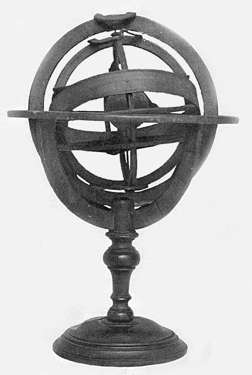
Fig. 129. Armillary Sphere of Jean Fortin, 1780.
George Adams, the elder (fl. 1760), maker of mathematical instruments and optician to His Majesty George III of England, won great distinction for himself as a maker of 185terrestrial and celestial globes, and as a writer on geographical and astronomical subjects. With him in his work were associated his sons George (1750-1795) and Dudley, to whom, after the death of the brother, fell the management of the business. We know of Dudley’s success in his work, which he must have carried on well into the first quarter of the nineteenth century, though we know neither the date of his birth nor of his death. In the year 1766 the elder Adams issued the first edition of a very useful work on globes, including a consideration of their construction and their uses.174 In the year 1810 appeared the thirtieth edition of this work, with a preface and additions by the son, Dudley. The title of the work suggests that the first issue was prepared as a description of globes which the author had just put upon the market, but globes of his bearing a date so early seem to be unknown. None have been located which appear to have been issued earlier than the year 1772, after which time we know there were repeated issues signed either “G. Adams” or “D. Adams.” A pair of the date 1782 may be found in the Museo Astronomico of Rome. These appear to be in a fair state of preservation (Fig. 130). Each has a diameter of about 46 cm., being furnished with a graduated brass meridian circle within which the sphere revolves, a graduated horizon circle of wood, having pasted thereon the usual records referring to the zodiacal constellations and to the time reckoning. This horizon circle rests upon four supporting arms or quadrants, which in turn are carried by a tripod base of wood. The spheres are of pasteboard with plaster of Paris covering, on which the respective maps have been pasted, each map being composed of twenty-four gores or biangles, or of twice twenty-four, since each is cut on the line of the equator to facilitate mounting. The geographical records given on the terrestrial globe map are practically such as one could find on the best plane maps of the period, always, however, in this connection remembering that those regions which had not been visited or carefully186 charted by explorers gave to the map maker considerable latitude for a play of his imagination. It is interesting, for example, here to note that Adams appears to have been very uncertain about his information relative to the western and southwestern part of the present United States. He seems to have caught from some explorer’s account that the Colorado River flows westward, emptying directly into the Pacific, and he so marks it, giving, however, to the river the name St. Bartholomew. The celestial globe revolves on the axis of the equator, the gores being made to terminate at the poles of the ecliptic. Constellations are represented so far as they have been named by astronomers to date, the several figures being artistically drawn, on which color has been somewhat sparingly employed. Each constellation is given its old name with an English translation; star names, when given, are frequently in Arabic, Latin or Chinese, and are distinguished by Greek letters. Recently discovered stars are so marked as to be easily distinguished.
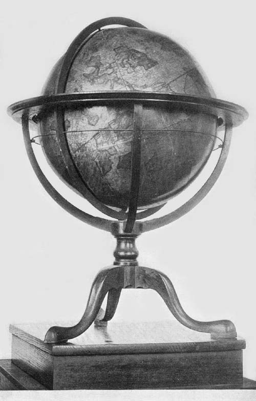
Fig. 130. Terrestrial Globe of George Adams, 1782.
In addition to the above, a pair of Adams globes may be found in the Osservatorio Astronomico of Naples and a pair in the Biblioteca Classense of Ravenna. A copy of the terrestrial may be found in the Seminario Vescovile of Padua. A copy of the terrestrial dated 1785 may be found in the Biblioteca Real of Madrid, agreeing in general with the preceding except in the mounting. The author and date legend appears in a neat cartouch in the North Pacific, reading: “Britanniarum Rigi Augustissimo Georgio Tertio Scientiarum Cultori pariter et praefidio Globum hunc Terrestrem. Omnes hactenus exploratios terrarum tractus. Ad Observationes Navigantium Itinerantium et Astronomorum recentiores, accuratissime descriptos exhibentem Grati animi et pietatis monumentum D. D. Q. Omni cultu et officio devinctissimus. G. Adams. Londini apud G. Adams artificem regium in vico (?) Fleet Street, 1785.”
The American Geographical Society possesses a pair of the Adams globes, the gift of Mrs. Thomas F. Byrnes, dated 1871797, and made by “Dudley Adams Globe Maker to the King, Inst. Maker to his Majesty & Optician to H. R. H. the Prince of Wales. No. 60 Fleet Street, London.” They are in a fair state of preservation, the celestial, however, being somewhat damaged through attempts to turn the sphere, which does not move freely on its axis within the meridian and the horizon circle. These are mounted on a high tripod base and are movable right or left, just as they are movable for elevation or depression of the pole in the usual manner. It does not appear that additions or corrections were made for this issue.
Nathaniel Hill of London, active as a map engraver about the middle of the eighteenth century, likewise turned his attention to the construction of globes.175 Those of his make now known, however, are very small, consequently they present but meager geographical details. Like certain productions of James Ferguson, the Hill globes might be referred to as pocket globes.
The New York Public Library possesses a fine example of his work (Fig. 130a), bearing the title and author legend placed in the North Pacific, “A New Terrestrial Globe by Nath. Hill 1754.” This globe has a diameter of 7 cm. It is furnished with a graduated meridian circle, surmounted at the north pole with an hour circle and pointer. The graduation is somewhat unusual, beginning as it does with 0 degrees at either pole and marked by tens on the right half of the circle through 90 degrees or to the equator, and with 90 degrees at either pole and marked by tens on the left to 0 degrees at the equator. The horizon circle of wood has represented on its surface the names of the zodiacal constellations, the names of the months, and the thirty-two compass directions, and rests upon a base of four branching arms or quadrants, which in turn are supported by three widely spreading feet, this base being fashioned and carved in the Chippendale style. The sphere is covered with the usual twelve gores truncated in latitude both north and south at about 68188 degrees and has the polar spaces covered by circular discs. The entire piece, including the map, is remarkably well preserved. The Pacific is called “The Great South Sea,” while just off the coast of “S. America” we read “Pacific Sea.” Between “N. America” and “Asia” is a great open sea, Alaska being omitted. We find such names given as “Florida,” “Virginia,” “Carolina,” “Maryla”: the Missouri River is called the “Long R.” The meridian on which the graduation in latitude is represented is 150 degrees west, passing through the Pacific slightly to the west of California. In “S. America” there are numerous regional names given, including “Brazil,” “Peru,” “Terra firma,” “Chili.” In the East Indies we find “New Holland,” “New Zeeland,” neither with completed coast line. An attached card tells us that this globe was “Presented to the New York Public Library by Mrs. Henry Draper, Oct. 9, 1908.”
There likewise may be found in the British Museum a copy, presumably of this same globe, dated 1754, and a copy in the Bibliothèque Nationale of Paris, signed and dated. This Paris copy is furnished with a cover opening along the line of the equator and having on its inner surface a representation of the celestial sphere which is neither signed nor dated, but which is in a good state of preservation.
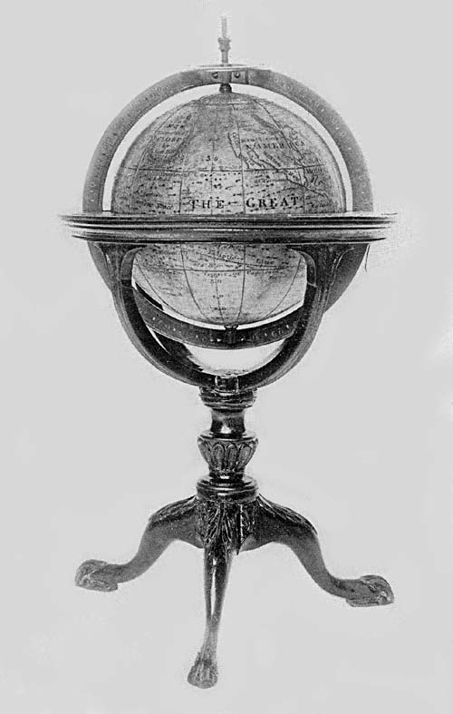
Fig. 130a. Terrestrial Globe of Nathaniel Hill, 1754.
Fiorini refers to certain pairs of globes being apparently copies of the work of Gian Francesco Costa without credit being noted. These globes, inferior in the matter of engraving to the work of Costa, were issued as the work of Innocente Alessandri and Pietro Scaltaglia.176 The terrestrial globe bears the inscription, “Nova et accurata descrizione del Globo Terracqueo dirizzato sopra le più recenti Osservazioni del Sigr Delisle e degli ultimi viaggiatori. Per uso dell’ Accademia Veneta. Composto da Innocente Alessandri e Pietro Scaltaglia incisori in rame. L’ anno 1784. Matteo Viani in Campo S. Bartolamio. Venezia.” “New and accurate description of the Terrestrial globe based on the most 189recent observations of Sr. Delisle and the latest explorers. For the use of the Venetian Academy. Composed by Innocente Alessandri and Pietro Scaltaglia, copper engravers. In the year 1784. Mattio Viani in Campo S. Bartolamio. Venice.” A legend very similar to that on the terrestrial globe appears on the celestial, reading, “Globo celeste nel quale sono accuratamente descritte le stelle fisse col loro preciso numero e Magnitudini secondo il Catalogo Brittanico del Sigr Flamstadio. Per uso dell’ Accademia Veneta. Composto da Innocente Alessandri e Pietro Scaltaglia incisori in Rame. L’anno 1784. Matteo Viani in Campo S. Bartolamio. Venezia.” “Celestial Globe in which is accurately described the fixed stars with their precise number and magnitude according to the British Calendar of Sr. Flamsteed. For the use of the Venetian Academy. Composed by Innocente Alessandri and Pietro Scaltaglia copper engravers. In the year 1784. Matteo Viani in Campo S. Bartolamio. Venice.” A copy of the terrestrial globe belongs to the Biblioteca Comunale of Cagli, likewise one may be found in the office of the Eredità Bottrigari of Bologna. Copies of the celestial may be found in the Museo Astronomico of Rome, in the Seminario Vescovile of Brescia, in the Tipolitografia Roberto of Bassano. Somewhat later it appears that the bookdealer Viani reissued the terrestrial globe, undated, perhaps with the thought of bringing them to date, that they might not be crowded out of the market by the recently constructed globes by Giovanni Maria Cassini. The inscription on this globe reads, “Nova et accurata descrizione del Globo Terracqueo dirizzato sopra le più recenti Osservazioni del Sigr dell’ Isle e degli ultimi viaggiatori e del Cap. Cook negli ultimi suoi viaggi. In Vena appo Mattio Viani in Campo S. Bartolomeo.” “New and accurate description of the Terrestrial globe based on the most recent observations of Sr. Delisle and on the records of the most recent navigators and of Captain Cook in his last voyages. In Venice by Mattio Viani in Campo S. Bartolomeo.” Copies190 of this issue may be found in the Museo Astronomico of Rome, in the library of the artist Giuseppe Bortognoni of Bologna, in the library of Sr. Fenaroli of Brescia, in the Biblioteca Vescovile of Rimini, and in the Tipolitografia Roberto of Bassano.
Among the geographers of this period who were contributing to French leadership may be named Charles Francis Delamarche (1740-1817). He was a native of Paris, in which city, under the patronage of King Louis XV, he carried on his activities as map and globe maker, conducting at the same time a shop for their distribution. He seems to have patterned his globe work largely after that of Gilles and Didier Robert de Vaugondy, giving to his completed products practically the same dimensions and mounting. His earliest examples bear the date 1785, of which only one copy, a celestial globe, has been located, this now belonging to the Osservatorio Meteorico of Venice. In the year 1791, he constructed a pair of globes each having a diameter of about 18 cm., only the terrestrial being dated, and in the same year he issued his treatise which doubtless was intended to serve as an explanatory text for these globes, at the same time advertising and popularizing his productions.177 Examples of this issue may be found in the Biblioteca di Brera of Milan, and in the Liceo Carlo Alberto of Novara. A copy of the terrestrial may be found in the Istituto Nautico of Palermo, and a copy of the celestial in the Convento dei Frati della Missione of Chieri. It could not have been long after this issue of 1791 that he undertook the construction of a terrestrial globe about 31 cm. in diameter, a copy of which may be found in the Istituto di Fisico of the University of Siena.
We know that like his contemporary, Fortin, he also constructed armillary spheres, one example of which it has been possible to locate. Fiorini thus refers to it, his citation being given in free translation.178 It is a Copernican sphere, that is, having a representation of the sun placed at the common191 center of the armillae instead of a representation of the earth as in the Ptolemaic sphere. It may be found in the palace of Sr. Scaramucci in S. Maria a Monte in the province of Florence. Attached to a base of wood about 20 cm. in height is an iron rod 35 cm. long. This rod passes through the several rings, about which they can be revolved, each being in its movement independent of the others. The first circle about the central sun represents the orbit of Mercury, and has written upon it “Éloigné du Soleil 8537, incliné 7 degr., fait sa révolution en 87 jours, 23 heures, 50 m.” The second represents the orbit of Venus, having written upon it the distance 15928½ diameters of the earth, inclination 3 degrees and 22 minutes; it completes its revolution in 2224 days 16 hours and 41 minutes. In a space much larger than that which separates the other circles, there is the orbit of the earth, upon which is written that this planet passes over the ecliptic in 365 days 5 hours and 49 minutes, and that it is 22000 diameters distant from the sun. This ring representing the orbit of the earth is opened for the insertion of a representation of the moon, adjusted to revolve on an adjusted pivot. Armillae have been provided representing the orbits of Mars, of Jupiter, and of Saturn with statements concerning their respective distances from the sun and their respective periods of revolution. The outer and larger armillae represent the colures, the ecliptic, and the horizon, and on the last the inscription, “À Paris chez Delamarche Géog. Rue du Foin Saint Jacques au Collège de Mre Gervais.”
In the year 1793 Vincenzo Rosa, a little-known Italian cosmographer, constructed two terrestrial globes, the maps of which being in manuscript. The spheres are of papier-mâché covered with a light coating of plaster. Each of these globes has a diameter of about 100 cm. An inscription in Italian reads, “Vincenzo Rosa fece nel 1793 n. 24. La geografia è quasi tutta delle carte di Robert del Vaugondy e di De-la-Marche.” “Made by Vincent Rosa in the year 1793 n. 24. The geographical information is almost entirely from192 the maps of Robert de Vaugondy and of Delamarche.” One copy may be found in the Biblioteca Universitario of Pavia, and the other in the Liceo Foscolo of the same city. Fiorini notes that the “n. 24.” of the first is given as “n. 21.” in the second.179
The last important globe maker of the eighteenth century in Italy was Giovanni Maria Cassini (fl. 1790), an engraver, and a geographer of distinction, to the truth of which statement his excellent work gives testimony. As evidence of his interest in the matter of globe construction we have the introduction to his ‘Nuovo atlante geografico universale ...,’ wherein he gives carefully devised rules for the construction of globe gores, and in addition we still find a number of his completed globes, particularly in Italian museums and libraries. These globes (Fig. 131), dated, the terrestrial 1790, and the celestial 1792, have each a diameter of about 35 cm., each covering map being composed of twelve gores cut at latitude 80 degrees both north and south, the polar space having the usual circular disc covering. Each is furnished with a brass meridian circle within which the sphere may be revolved, an hour circle, a horizon circle, on the surface of which are the usual concentric circles with the names of the several zodiacal constellations, the names of the months, and the principal directions. The terrestrial globe has an author and date legend reading, “Globo terrestre delineato sulle ultime osservazioni con i viaggi e nuove scoperte del Cap. Cook inglese. In Rome.”
Fig. 131. Terrestrial Globe of Giovanni Maria Cassini, 1790.
In The Hispanic Society’s collection is a terrestrial globe (Fig. 132), being a solid wooden ball 21 cm. in diameter, over which has been pasted the gore map composed of twelve sections, each cut at the parallel of 70 degrees both north and south, the polar space being covered with circular discs each forty degrees in diameter. It is neither signed nor dated but is clearly of German origin, since practically all geographical names and legends are in the German language. The title, placed within a circle to the west of Australia, 193“Neu Holland,” reads “Die Erde nach den neusten Entdeckungen und besten Charten entworfen.” Its date cannot be far from 1800, perhaps a little later, seeing that it assigns the name “Nord Amerikanischer Staat” to the region east of the Mississippi River, except to “Florida” which extends westward to this river. We find but one actual date given, this referring to the discovery of a small group of the “Gesellschafts Inseln,” reading “Inseln welche die Spanier entdekt haben sollen 1773.” It is constructed to revolve within a graduated meridian circle of brass and an octagonal horizon of wood, on which are indicated in picture the twelve signs of the zodiac, the calendar, and the thirty-two winds or directions, the whole resting on four plain supports of wood strengthened below by light crossbars.
Fig. 132. Anonymous Terrestrial Globe, ca. 1800.
The map is one well drawn for the period, and the engraving of the several names and legends has been most skilfully done. Regional names are numerous, but there has not been an overcrowding of the map with minute details. On the west coast of North America, for example, we find such names as “Norfolk,” “Neu Cornwallis,” “Neu Hanover,” “Neu Georgia,” “Neu Albion,” “Neu Navarre,” “Mexico oder Neu Spanien.” Central America with the West Indies is called “Mittel America oder West Indien.” In South America we find “Neu Granada,” “Peru,” “Chili,” “Brasilien,” but “Prasilisches Meer.” Certain localities are especially distinguished by the addition of color, as the coast of Australia except the southern coast, which is marked with a dotted line. Many of the East Indian islands and the islands of the Indian Ocean are outlined in color, as also the coast of “Vorder Indien,” and “Hinter Indien,” the coast of “Arabien,” and certain other sections. The geography of the interior of Africa is not as well represented as on many an earlier map, a fact particularly noticeable with reference to the Nile River. The prime meridian is made to pass through Cape Verde, to the west of which, stretching194 practically along its entire length, we read “Der Amerikanische Ocean.”
Among the globe makers of the eighteenth century whose work carries us over into the nineteenth may be named William Cary (1759-1825).180 At first associated with Ramsden, a renowned mechanic, he established himself in an independent business in London in the year 1790. He is reputed to have constructed the first transit circle made in England, which circle had a diameter of two feet and was provided with a reading microscope. One of his circles of the above date, 41 cm. in diameter, is reported as belonging to the Observatory of Zürich. In addition to the altitude, azimuth, sextant, reflecting and refracting telescopic, and microscopic instruments made by him, he interested himself in the construction of terrestrial and celestial globes. Those examples of his to which reference may here be made do not appear to be of the highest order, perhaps due to the fact that he was primarily an instrument maker and not a geographer or an astronomer. Further, the majority of his globes which have been located bear dates subsequent to the year 1800, and therefore do not properly call for reference here.
In the private library of Sr. Vittorio Bianchini of Macerata four of the Cary globes may be found, three celestial and one terrestrial dated 1799. A celestial globe of the same date may be found in the Osservatorio Astronomico of Rome, but its companion, a terrestrial globe, bears the date 1815. Extant Cary globes of the early nineteenth century may be considered numerous.
NOTES
160 Nouvelle biographie générale, “Robert de Vaugondy, Gilles,” “Robert de Vaugondy, Didier,” with references to their works.
161 Sanson was the author of numerous maps and atlases. His works are 195extensively referred to by Phillips in his List of Geographical Atlases. See also list of his works in Britannica, “Sanson, Nicolas.”
162 These are referred to in the preface of a work titled ‘Usages des Globes céleste et terrestre, faits par ordre du Roi, par le S. Robert de Vaugondy, fils.’ Paris, 1751.
163 See work referred to in preceding note.
164 Cited by Fiorini, Sfere terrestri e celesti, p. 417, n. 2.
165 Fiorini, op. cit., p. 419.
166 Fiorini, op. cit., p. 421.
167 John Flamsteed (1646-1719) was the first astronomer royal, author of ‘Atlas Coelestis’ and other works treating of astronomical subjects. The figures of the several constellations appearing in this atlas were drawn by James Thornhill. Artistically they are not equal to those appearing in Hevelius’ Prodromus astronomiae.
168 Akerman, A. Globes céleste et terrestre de vingt-deux pouces. Upsala, 1766.
169 Poppe. Ausfürliche Geschichte der Anwendung aller krummen Linien in mechanischen Künsten und in der Architektur. Nürnberg, 1882. p. 65.
170 Letter and information from the Librarian dated Jan. 14, 1914.
171 Reference to his publications in Nouvelle biographie, “Bonne, Rigobert.”
172 Nouvelle biographie, “Lalande, Joseph Jerome.” This is an excellent article with references to his numerous publications. His ‘Bibliographie astronomique,’ Paris, 1803, has been of particular value in the preparation of this work. See also Nouveaux globes, céleste et terrestre, d’un pied de diamètre par M. De la Lande et M. Bonne, avec l’explication en une brochure in-12. Paris, 1775. Lalande, op. cit., refers to a work titled ‘Usage du Planétaire ou sphère mouvante de Copernic, qui se trove chez Fortin, ingénieur-mécanicien du Roi.’ Paris, 1773. Fortin issued a French edition of Flamsteed’s Atlas under the title ‘Atlas céleste de Flamsteed approuvé par l’Académie Royale des Sciences. Seconde édition par M. J. Fortin Ingénieur-Mécanicien du Roi et de la Famille Royale pour les Globes et les Sphères.’ Paris, 1776.
173 Nouvelle biographie, “Messier, Charles,” with a very long list of his publications.
174 Adams, G. A treatise describing and explaining the construction and the use of new celestial and terrestrial globes, designed to illustrate in the most easy manner the phenomena of the earth and heavens, with a great variety of astronomical and geographical problems. London, 1766; A treatise on the construction of globes. London, 1769; Geometrical and geographical essays, containing a description of mathematical instruments. London, 1791; Astronomical and geographical essays. London, 1795.
175 We find that Nathl. Hill engraved the title-page and maps in an atlas by Lewis Morris. Plans and Harbours, etc. London, 1748.
176 Fiorini, op. cit., p. 439.
177 Delamarche, C. F. Les usages de la Sphère et des Globes céleste et terrestre. Paris, 1791.
178 Fiorini, op. cit., p. 432.
179 Fiorini, op. cit., p. 441.
180 Dictionary of National Biography, “Cary, William”; Wolf, Geschichte der Astronomie, pp. 562, 563.
Chapter XIV
The Technic of Globe Construction—Materials and Methods
General problems to be met.—Development from the simple armilla to the complex sphere.—The references of Ptolemy, Leontius Mechanicus, Alfonso.—Behaim’s leadership in practical globe making.—Materials employed.—Experiments in map projection.—The beginning and rapid development of globe-gore construction.—Various examples of early gore maps.—Equatorial polar and ecliptic polar mountings.—Special features of celestial globe maps.—Globe mountings.—Varying sizes of globes.—The uses of globes.—Moon globes and planetariums.
IN this concluding chapter it is not proposed to consider in detail the technical features of globe construction, as these features have presented themselves in the long period which has been under review; the rather to give, somewhat in the nature of a summary, a general word as to the development of the simple armilla of the ancients, “in continued succession, receiving ripeness and perfection” in such celestial spheres as were those of Mohammed ben Helal, of Tycho, of Hondius, or of Blaeu; into the terrestrial spheres of Schöner, of Mercator, of Greuter, or of Coronelli.
We have seen that during these years there were problems mechanical, mathematical, and artistic continually arising, in the solution of which talent of a high order was often exhibited; problems having to do with the kind of material to be employed, with the shaping and the graduation of the197 rings or circles, with the construction of the supporting bases which entered into the completed product, with the engraving of the map on the surface of the metal sphere, or with the designing and the engraving of the plates for the printing of the map to be used in covering the prepared ball, and the fitting of the same to its curved surface.
The principal astronomical instrument employed by such ancient astronomers as Eudoxus, Timocharis, and Hipparchus appears to have been at first but a single metal ring, perhaps of brass. At any rate their instruments must have been exceedingly simple, perhaps the simplest form of the astrolabe (Fig. 133), yet they sufficed as aids in the solution of such astronomical problems as suggested themselves in that early day. The addition of a second ring to the198 simple instrument gave further aid to the observer in his efforts to determine the declination and the right ascension of any of the heavenly bodies. These rings came to be considered, the first as a celestial meridian circle, the second as a celestial horizon circle, and in the passing years others were added to represent the ecliptic, the colures, the tropics, the polar circles, and the orbits of the several planets, until we have the fully developed armillary sphere of a Vopel or a Santucci.181
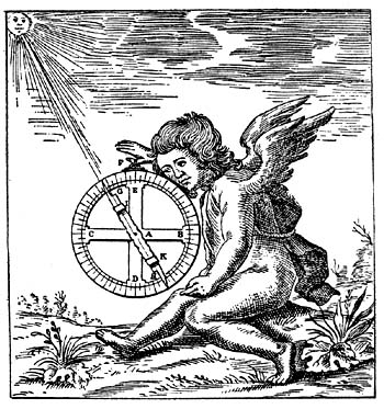
Fig. 133. Astrolabe.
Relative to globes proper in antiquity, it will have been noted that in general there is an element of uncertainty as to their exact character, which speaks out in the numerous allusions to them. None has survived to our day save the Atlante Farnese. This globe of marble is not so mounted as to permit its revolution, resting as it does upon the shoulders of the mythical Atlas, yet in its representation of the figures of the several constellations, then recognized by astronomers, it differs practically but little from the celestial globes, that is, solid spheres, constructed a millennium and a half later.182 We cannot, however, draw the conclusion from this one example that such globes were generally looked upon as practical instruments for use in astronomical studies, yet there clearly were those who did so regard them.
Doubtless the globe or globes to which Ptolemy alludes were intended to be of practical value. He tells us they should be constructed of brass, and as before noted, he describes the use and the construction of such instruments. Like the maps he probably made, though none survives, it is not difficult, from his description, to reconstruct them. Such celestial globes as Ptolemy may have prepared were doubtless adjustable, but were not made to revolve by mechanical device such as we frequently meet with in globes of the seventeenth and the eighteenth centuries, nor were they like the mechanical contrivance of Archimedes, clearly intended to represent the movements of the celestial bodies,199 and perhaps their movements relative to the earth. No description of Archimedes’ mechanism survives by means of which it could now be reproduced with anything like a satisfactory degree of certainty.
The allusions of Leontius Mechanicus, referred to in Chapter III, read like a globe maker’s instructions of the eighteenth century. He knew his Ptolemy whom he followed in the main, but he wrote as one who clearly did not sense the approaching decline of interest in the physical sciences.
And what can be said of the methods and the materials for globe making during the period of the so-called middle ages? The survivals, and these are only of the later years of the period, are of Arabic origin, which, without exception, appear to have been intended primarily for use in astronomical studies. They are either armillary spheres, or metal balls, on the surface of which are the engraved representations of the starry heavens, with the figures of the several constellations. Without a known exception these are of small size, and if furnished at all with mounting, only that of a simple character. There is reason for thinking that such astronomical instruments were made in great numbers, and that they were to be found in practically all Arabic observatories.183
The interesting allusions in King Alfonso’s ‘Libros del Saber de Astronomia,’ from which citations may be found in our Chapter IV, give us information concerning both methods and materials which might be employed in globe construction in his day. It is not there stated that the author had information concerning the actual use of the more than twenty named materials which might be chosen for their manufacture. He does, however, lead us to infer that there may have been experiments by his contemporaries in which trial was made of the fitness of the several materials named, his conclusion being that wood or brass was the most suitable.
It has previously been noted that globes appear to have200 been made now and then for use in the monastic schools, but we find no detailed description of their special character. Here and there, it is true, may be found reference to the adjustability of their parts, and to their rings which made them serviceable for furthering astronomical studies. The inference is fair that the globes of these Christian schools were armillary spheres, and were not solid or hollow balls on the surface of which the starry firmament or the earth had been depicted.
Behaim’s globe of the year 1492 seems to represent a radical departure in globe construction. His idea appears to have been novel. He employed a mould in the making of his globe ball, and over the surface of this completed ball pasted irregular strips of parchment which furnished a suitable ground for the draughting of the map with its geographical outlines and its artistic adornments in color. Behaim’s globe mounting was of the simplest character, consisting of a metal meridian circle within which the sphere could be revolved, a horizon circle of like material, the whole resting upon a tripod base. Although effort was made to establish in Nürnberg an institute wherein globe making might be taught especially, the plan seems not to have carried, and such as were later produced in this city were merely the output of the mathematical instrument maker’s shop or of the geographical establishments.
Throughout all the early years of the modern period, metal globes continued to find favor, to the making of which skilled workmen in the thriving industrial centers of Southern Germany, Southeastern France, Northern Switzerland, and Northern Italy set themselves. Brass, copper, silver, and gold were employed very frequently in their construction, the last-named metals being used in the making of globes primarily for ornamental purposes.184 Globes with manuscript maps, as before noted, seemed to find especial favor in Italy, in the making of which much artistic skill was displayed. The spheres for such globes201 were usually of wood either solid or hollow, of well-fashioned strips of wood, canvas covered, the whole carefully glued and braced that the spherical shape might not be affected with time. In the preparation of the sphere to receive the manuscript map, workmen proceeded much as did Behaim, pasting over its surface irregular strips of parchment or paper, adding occasionally a groundwork of paint suitable for taking the sketch of the draughtsman. As the years passed, and the engraved map found increasing favor, practically all globe balls, with exceptions as noted above, were made either of plaster shot through and through with a binding material, usually of fiber, and fashioned over a mould, or of a preparation of papier-mâché.
The increasing interest in globes and globe making manifesting itself in the early years of the sixteenth century led to the devising of methods for their more rapid construction. If the opening years of the sixteenth century witnessed a rapid expansion of geographical knowledge, none the less did they witness an improvement in the making of maps wherein this expanding knowledge could fittingly be recorded. It is interesting to note how rapidly change was made from one method of map draughting to another in the search for a projection which might prove itself to be altogether suitable. As a result of this striving we have for example the projection of Donnus Nicolas Germanus employed in his maps of the geographer Ptolemy, and often referred to as the Donis projection.185 Then we find the stereographic meridional186 and the stereographic polar,187 the cordiform single and double188 which seem to have been a development from the orthographic projection well represented in the map of Johannes Stabius (Fig. 45) who appears to have been the first to give the method prominence. In addition to the projections mentioned there were many modifications, to suit the notions of the draughtsmen, which were employed in the early sixteenth century.189 With the fuller realization of the fact that the earth is a sphere, the202 desire accurately to represent in the maps its spherical surface continued to seek for expression, an expression that would do least violence to the fact that the degrees of latitude and longitude vary in length, particularly those of longitude as one passes from the equator toward the poles or from the poles toward the equator. If the earth is a sphere then why could a map so draughted as truly to represent the surface of a sphere not be counted the most acceptable? This must have been the argument of those who especially applied themselves to the designing of maps suitable for a spherical surface, that is, for application to a globe ball.
Who first conceived the idea of fashioning globe gore maps we do not know. Fiorini cites evidence190 that Francesco Rosselli (1445-1510), a printer of large and small maps in Florence, included in his productions gore maps to be used in globe construction, and this probably before the year 1507, but none of his work of this character has come down to us. The so-called Waldseemüller gores are the oldest known, of which but one copy is extant.191 By some they are thought to have been constructed for his globe to which he refers in his ‘Cosmographiae Introductio,’ but they are unsigned and undated. They are somewhat crude and much manipulation would be required to fit them to the surface of a sphere. Before the first quarter of the sixteenth century had passed other globe gore maps made their appearance, such as those undoubtedly the work of Schöner or of the Schönerian school, or such as the gores of Boulengier192 exquisitely engraved and printed, though so far as we know never used in covering the surface of a sphere.
The artist Albrect Dürer (1471-1528), as we are informed, was one of the earliest to set himself to the solution of the problem having to do with the development of a spherical surface into a flat surface, yet he never seems to have thought an exact mathematical solution possible. It was a problem, he realized, in which there could be but203 an approximate solution. In trying to illustrate what he thought to be the nearest approach to the same he found himself led to the idea of the globe gore.193 Of his illustration, he said, “Die sphera oder ein Kugel wenn man sie durch jr mittag linien zerschneydet, und in Planum legt, so gewinnt sie ein Gestalt eines Kam, wie ich das hie hat auffgerissen.” “Should one divide the sphere or ball on the204 line of the equator and lay this out as a plane, one has the figure of a comb, as is here shown.” Dürer worked out a simple rule for the construction of the globe biangles,194 which rule served measurably well for the purpose intended. While it would not be inappropriate to give here a résumé of his formula, as well as the formulae of others who set themselves to a like task, we should in so doing be carried into a field rather more technical than seems fitting for our purpose.195
Two years after Dürer had published his observations on this subject Henricus Loriti Glareanus (1488-1551) issued a small treatise on geography,196 devoting his Chapter XIX bearing title ‘De inducendo papyro in globo’ to globe-gore construction. He proposed the employment of twelve gores or biangles (Fig. 134) so arranged for printing that the shorter diameter of each should represent 30 degrees of longitude, the sum therefore representing 360 degrees or the equatorial circumference of the globe they were intended to cover; the longer diameter of each gore representing the semicircumference of the globe and extending from pole to pole, that is, a meridian. We do not know that his formula for gore construction was closely followed by any globe maker of the period, nor does Glareanus himself appear to have attempted a practical application of his method, at least we have no evidence that he ever actually attempted to construct a globe. He, however, had made an important contribution toward the solution of the problem of how best to multiply these instruments which were increasingly recognized as of great value in geographical and astronomical studies. The general method of gore map making rapidly found favor despite such practical difficulties, for example, as arose from the peculiarity inseparable from the quality inherent in any and all paper, that is, its irregular expansion when moistened. This difficulty the globe makers, of course, were continually seeking to overcome or reduce to a minimum, as the years passed, through a careful selection of205 paper to be used, through a more skilful manipulation of the paper made moist by the application of the paste or glue employed in attaching the map to the surface of the sphere,197 and through a more careful working out of the mathematical problem having to do with the proper proportions of each of the gores.
Fig. 134. Globe Gores of Henricus Glareanus, 1527.
Dürer had proposed the employment of sixteen segments, Waldseemüller, Schöner, Boulengier, and Glareanus had thought twelve a more suitable number. As the years passed we find a preference manifesting itself now for twelve, now for sixteen, now for eighteen, twenty-four, or thirty-six with a more common preference for the smaller number. The several biangles for the maps alluded to above were fashioned to extend from pole to pole in what we may call the equatorial system; Mercator, as has been noted, introduced the novel idea of truncating his gores twenty degrees from each pole, preparing as a covering for the remaining polar space a circular disc, having the required diameter of forty degrees.198 This plan he proposed for the practical reason that a paper covering for a sphere so constructed could be applied with greater ease and with greater accuracy than one consisting of complete biangular figures, remembering the tendency of the paper to expand and the difficulty in avoiding folds.
As there was much inclination among map makers to experiment in the matter of map projection so there was an inclination to experiment, as the years passed, in the matter of design for the globe gores. In the so-called Da Vinci gores we find them drawn in two groups of four each (Fig. 135), and instead of the globe biangle we have the globe equilateral triangle. Their application to a spherical surface could only have been made with difficulty, if at all; indeed we cannot be certain that in so outlining a map of the world the draughtsman’s intention was to use it in globe construction. The plan seems never to have been followed by any of the other map makers, or by any globe maker. We find an206 207interesting early instance in which the gore map construction was clearly employed merely as a method for plane map making, a method having certain very commendable features (Fig. 136). The author of this map is unknown.
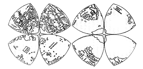
Fig. 135. Gore Map of Leonardo da Vinci, ca. 1515.

Fig. 136. Anonymous Globe Gores in Plane Map Construction, ca. 1550.
In referring to unusual forms in gore construction attention may again be called to the map of Alonso de Santa Cruz and to that of Antonius Florianus, in which maps the plan was hemispherical,199 the central point in the construction of each hemisphere, a northern and a southern, being the pole, the circumference of the circle in which the thirty-six gores were drawn, representing the equator. But again we do not know that such a gore map was ever employed in globe construction though the method, it seems, would lend itself to that end.
It can be readily understood that numerous modifications in the matter of globe-gore construction and their application to the surface of the sphere, more or less detailed in character, were introduced as the years passed, but the modifications were by no means at all times in the line of improvement.200 The technical skill of the present day does not surpass that which one occasionally finds exhibited in the work of some three hundred years ago.
In the matter of geographical record terrestrial globe maps stand with the plane maps of the same period. While they are by no means as numerous as the plane maps, there attaches to them an importance no less historically significant. Not infrequently they give us records not to be found elsewhere. In their general features, differences can hardly be said to exist between plane maps and globe maps. In the matter of adornment there is similarity; each following the practice of the time when constructed. As pictures and legends hold a place of prominence, particularly on mediaeval maps,201 so even to the close of the period we have had under consideration, that is, the end of the eighteenth century, these adornments have place on globe maps, sometimes few, sometimes many, the same, if in picture, exhibiting the208 inhabitants of land and sea, if merely a legend, giving information of geographical importance on the terrestrial globe and of astronomical importance on the celestial, these legends being often placed in an artistic cartouch.
To the printed or engraved globe map, color was generally added by hand with an effect often very artistic, in contrast with which the modern machine methods of color printing are deplorably crude.
On most terrestrial globe maps meridian circles are represented at intervals of ten, twenty, or thirty degrees, the prime meridian on which the degrees of latitude are marked being usually made very conspicuous, and to the close of the period under consideration usually made to pass through the Cape Verde Islands or the Canaries, a point always to be carefully noted in attempting to get a reading for the longitude of any particular place. Parallels are usually drawn at intervals similar to those of meridians, the equator on which the degrees of longitude are marked, the tropics, and the polar circles being always conspicuous. The ecliptic or zodiac is usually indicated encircling the globe from the solstitial point on the tropics, intersecting the equator at the two opposite equinoctial points, through which as through the solstitial points the colures are made to pass.
Hues states that “Those lines which a ship, following the direction of the Magnetic Needle, describeth on the surface of the Sea, Petrus Nonius calleth in the Latin Rumbos, borrowing the appellation of his Countrymen the Portugals; which word, since it is now generally received by learned writers to express them by, we also will use the same,” that is, rhumbs or rhumb-lines.
These were represented on the globe, first by Mercator, by greater or lesser circles or “winding lines,” and were intended to be of aid to seamen in navigating from port to port across the great oceans. In their representation on the globe map cognizance was taken of the fact that all meridians of all places pass through both poles, crossing the 209equator therefore at right angles and all other circles parallel to it, and that if the navigator’s course is in any other direction than toward one of the poles he is continually changing his horizon and his meridian. The rhumbs as drawn were made to cut all meridians of all places at equal angles and to respect the same quarters of the world, that is, direction, whatever the horizon. Rhumbs can represent great circles only when they coincide with the equator or with any meridian.202
In the matter of draughting, printing, and mounting celestial globe gore maps the method employed may in general be said to be identical with that followed in terrestrial globe construction. It should, however, be noted that in pasting the gores on the surface of the sphere they were often so applied as to have their points or angles meet at the pole of the ecliptic, in what may be called the ecliptic system, instead of applying them to meet at the poles of the equator, the globe itself being generally so mounted as to revolve in the equatorial system, its poles of revolution being attached to the meridian circle.203
The figures of the several constellations were usually drawn with care, occasionally with high artistic taste, as those drawn by Hevelius (Fig. 137) and copied by Gerhard and Leonhard Valk for their celestial globes (Fig. 138). The several stars represented on the map, the majority of them being either lettered or named, were usually from the first to the sixth magnitude, each represented in its proportional size, while an explanatory table for the several magnitudes was usually given on some one of the gores. The stars and the figures of the several constellations, let it be noted, were not made to appear on the surface of the sphere, with rare exceptions, in their relative location as they appear to the observer who beholds them from his position on the surface of the earth, but are reversed. To the astronomer the earth is but a point in space, to the layman, so far as mere appearance is concerned, it is the center210 about which the starry heavens appear to revolve. With the pole (north for us in the northern hemisphere) as the center of the dial face the stars appear to move in a direction the reverse of that in which the hands of a clock are made to move. The astronomer, that is, the celestial globe maker, thinks of himself as placed beyond the vaulted heavens in which the stars appear to be located, and as looking down upon this vaulted dome as on the surface of his celestial globe. An illustration may here well serve us. As one observes serves Ursa Major on any starry night, which constellation we commonly call the Great Dipper, the bowl of the dipper, which is located in the body and flank of the bear, leads in its apparent motion around the pole star, being followed by the handle of the dipper or the tail of the bear (Fig. 139). On the surface of the celestial sphere, however, the position of bowl and handle was usually reversed, the constellation appearing as it would to the beholder who finds himself beyond the stars. Naturally the planets could not be represented on the surface of a solid celestial sphere; only in the armillary sphere or the orrery could they find place. In these instruments we generally find them represented, each211 with its circle or orbit properly given, and relatively properly placed.
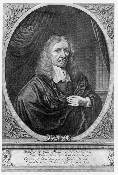
Fig. 137. Portrait of Johann Hevelius (Hevel).
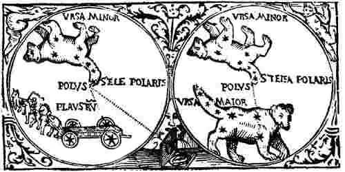
Fig. 138. Constellation Ursa Major.
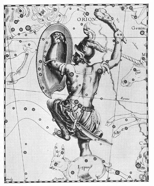
Fig. 139. Constellation of Orion by Hevelius.
In the geographical records as they appear on the several terrestrial globe maps, it is to be admitted that the authors, with rare exceptions, undertook to set down what they thought to be fact, shall we say the real tangible geographical fact or facts. The maker of the star map, on the contrary, clearly gave his imagination play, not in his attempt to mark in the proper location the several stars as they came to be known and catalogued, but in the draughting of the figures of the several constellations. The imaginative figures of the ancients, of Eudoxus, of Aratus, of Ptolemy and others survived throughout the period we have had under consideration, and to the forty-eight constellations of Ptolemy others from time to time were added until more than one hundred have been named and figured. In general the several constellations, as the various astronomers and makers of star maps have conceived them, may be said to be identical, while some of the names which have been proposed have been accepted but for a time only and then rejected. Some of the groups to which names have been given have later been divided, thus giving rise to a new group name and to the draughting of an appropriate figure for this new group.204
Attention has been called to certain suggested changes in the names of constellations as given by the ancients, as for example those suggested by the Venerable Bede, by Johannes Bayer, by Julius Schiller proposing that biblical or Christian names should be substituted for pagan names, and for these changes there was of course suggested an appropriate change in the figures for the several constellations. The proposal of Erhard Weigel has likewise been noted urging a substitution of the several coats of arms or heraldic devices of the European dynasties for the figures which had been so long and so generally accepted. There seems scarcely212 to be the need of stating that the names and figures of the ancients remain.205
A comparison of the work of the several artists who have set their hand to the draughting of figures for the numerous constellations is not without interest. Attention may here be directed in passing to the decidedly oriental cast of these figures as they appear on Arabic globes.206
It is to be regretted that in the present very practical or scientific day the star map, wanting the figures of the constellations or giving them in but the faintest outline, has come to supplant the artistic and not unscientific creations of earlier years.
The earliest references we have to globes, that is, to solid balls or spheres, make mention of their mountings, that is, to their encasing circles and their bases. The simplest mounting consisted of but a meridian and a horizon circle with probably a simple supporting base. The earliest spheres were doubtless made to revolve just as the globes of today, around their polar axes which turn within sockets firmly attached to the meridian circle. This meridian circle of brass or wood was usually graduated from one to ninety degrees, that is, from the equator to the poles, and being adjustable relative to the horizon circle, a globe could be set with a polar elevation for any desired latitude. Those who have had occasion to refer to the construction and the uses of the globe more or less in detail, make mention of what they call its threefold position. In the first of these positions either pole may be at the vertical point, the equator and the horizon being parallel or coinciding. This they termed a parallel sphere. In the second position the equator and the horizon circle are set at right angles. This they called a right sphere. In the third position, which was called an oblique sphere, the pole could be set at any elevation from zero to ninety degrees, counting from the horizon circle. In illustration of this third position it may be said that for the latitude of New York City, the north pole 213More conspicuous by reason of its width and importance in the mounting of the globe than the meridian is the horizon circle. It is through notches in this circle at the north and south points that the meridian circle passes, the notches also serving as gauges to keep the meridian from inclining more to the one side of the horizon circle than to the other. On the upper surface of this circle there were usually represented several concentric circles, the same being either engraved thereon, if it were of metal, and printed or pasted thereon if of wood, just as the globe map proper which covered the surface of the sphere. The number of concentric circles, and the information carried in each, varied, nor was the order of the circles invariably the same. Those globes giving fullest information exhibit ten or more of these circles. That one which was innermost and next to the body of the globe was divided into twelve parts, each part carrying the name of one of the signs of the zodiac with its character, and each divided into thirty equal parts or degrees, these being numbered by tens, as 0, 10, 20, 30. Next to the circle of signs, always remembering that the order might vary, was that containing the calendar including the names of the months, as January, February, March, etc., the days of the week being either distinguished by numbers or names. The old calendar was likewise usually given and so represented as to show the beginning of each month ten days earlier than in the new calendar. Here also were given the names of the church festival days. In the next circle were the names of the winds or directions, and first the Greek, Latin or Italian names of the eight, twelve or sixteen winds, as Greco, Libeccio, Ponente, Maestro, and next the names or initials of the thirty-two compass directions, the same generally in English or Dutch abbreviations. It may further be noted that a compass was often fixed in the horizon circle’s upper face.214 of the globe should be elevated 40 degrees 48 minutes above this circle.
A complete globe was further furnished with a quadrant of altitude, ninety degrees in length, this being attached at one end to the meridian circle, yet movable to any degree of the meridian, though commonly set at the zenith. This quadrant served for measuring altitudes or for finding amplitudes or azimuths.
The small hour circle,207 fitted to the meridian, its center being the pole and for us the north, was marked with the twenty-four hours of the day, each hour being again divided into halves and quarters. An index attached to the axis of the globe pointed out successively the hours as the globe was revolved. The use of this hour circle was to indicate the time of the successive mutations, including the rising and the setting of the celestial bodies and the time of their passing successively the meridians.
As a compass was often set into the horizon circle so also we frequently find a large or small compass set into that plate which in certain globes was employed as a support, tying together, as it were, the lower extremities of the base columns.208
It will have been noted that the globes referred to in the preceding pages varied greatly as to size, from the small ball representing the earth, and but a few centimeters in diameter, to be found in the center of those armillary spheres representing the Ptolemaic geocentric system, to the great globe of Coronelli fifteen feet in diameter constructed for Louis XIV of France. With rare exceptions metal globes were made small in size. Those globe balls or spheres, in the construction of which a mould was employed, usually had a diameter under 50 cm., although we find some of them twice this size. Such spheres had the advantage of lightness though often were frail in structure and liable to lose their perfect sphericity.


Fig. 140. Terrestrial Globe Gores by Johannes Oterschaden, ca. 1675.
In the matter of special ornamentation or decoration, to be observed in globe mountings, individual taste was given unlimited freedom to express itself, and in certain instances 215it will have been noted that these mountings were exceedingly elaborate.
Primarily we may say that globes were constructed for the useful purpose of promoting geographical and astronomical studies, generally recording the latest and best geographical or astronomical information and in form superior to that which could be set down on the plane map, but they also had a place of importance, secondary we may call it, on account of their decorative value. They came to be considered almost essential as adornments for the libraries of princes, of prosperous patricians, and of plodding students, and their mountings were often especially fashioned for the places they were to occupy. They seemed to lend an air of scholarly respectability; to suggest that their possessors wished to pay, certainly a modicum of homage to the sciences which globes were calculated to promote.
A brief concluding word may well be added touching those globes which may of course be classed as celestial, but which are known as moon globes and planetariums or orreries. There could be no practical value in an attempt to set forth a map of the surface of the stars, nor of the planets while our knowledge is so limited, although Schiaparelli has undertaken, with measurable success, to map the surface of Mars,209 and it would be next in order to construct a Mars globe. Of the surface of our moon much is known and maps of it have been constructed, as indeed have been moon globes. We are informed that about the middle of the seventeenth century the Danish astronomer, Hevelius, who designed so successfully star maps, entertained the idea of constructing a moon globe,210 but we do not know that he set his hand to the work. A century later it appears that the French astronomer La Hire actually completed a moon globe,211 but it has been possible to obtain only the briefest reference to it.
Tobias Mayer of Nürnberg, a contemporary of La Hire, set himself to the draughting of gore maps212 intended for use216 in the manufacture of moon globes. Mayer found employment in the Homann establishment of Nürnberg, being regarded as an exceedingly skilful draughtsman, able to sketch on his draughting sheet that which he saw through his telescope. His plan contemplated the making of twelve gores or segments, six for the northern half of the moon and six for the southern. His plan, of course, would enable him to represent but one side of the moon,—that turned toward the earth,—although it appeared that he contemplated the addition of two segments on which, in at least a fragmentary manner, he was to represent what we may call the border of the opposite side of the moon. Mayer seems not to have completed his work, since we find nowhere an example of his finished product.
It was not until near the close of the eighteenth that we again meet with an attempt to construct a moon globe and it seems that the task was accomplished by the Englishman, John Russel. It was in the year 1796 that he proposed to raise by subscription the necessary funds for making his undertaking a success. His globe has a diameter of 12 inches,213 and was furnished with the necessary adjustable shield that the moon’s waxing and waning could be represented. That this moon globe was actually constructed, although no copy has been located, we are informed by Wolf. Such attempts as were made in the nineteenth century with a good measure of success do not here call for consideration.
It has been previously noted that the so-called globe of Archimedes may have been a sort of planetarium, and that during the middle ages such instruments were constructed and employed in astronomical instruction. None, however, have come down to us out of those early years. Astronomers of the seventeenth and eighteenth centuries, as we know, made frequent use of planetariums, such for example as were constructed by the Dutch astronomer, Christiaan Haygens (1629-1695) for the illustration of planetary 217motion according to the Copernican system. Each of the planets was represented in his machine by a small ball, attached to an arm, which could be made to move through an orbit around the sun. In the more complicated machines the several planetary moons, such as the moons of Jupiter, were represented and were made to perform their proper motions.


Fig. 141. Celestial Globe Gores by Johannes Oterschaden, ca. 1675.
Fig. 142. Engraved Sections for Globe Horizon Circle by Johannes Oterschaden, ca. 1675.
In the eighteenth century the instrument maker, George Graham (1675-1751), constructed a complicated planetarium, in honor of Charles Boyle, Earl of Orrery (1676-1731), which he called an orrery. His machines, varying much in the character of construction, were especially popular in the eighteenth century. The nineteenth century saw them frequently in use for purposes of instruction and the regret may well be expressed that for serious purposes they seem to have lost favor.
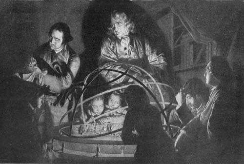
Fig. 143. The Orrery.
NOTES
183 Consult the ‘Fihrist’ referred to in Chap. III, n. 4.
184 Note such examples as the globe of Robertus de Bailly, I, 108, the Lenox globe, I, 72, the Nancy globe, I, 102, and the Morgan globe in the Metropolitan Museum, I, 200.
187 See Apianus’ Cosmographicus liber.
188 As for example the World map of Mercator of the year 1538, an original copy of which may be found in the New York Public Library, also a copy in the Library of The American Geographical Society.
189 D’Avezac, M. A. P. Coup d’oeil historique sur la projection des cartes de géographie. (In: Bulletin de la Société de Géographie de Paris. Paris, 1863, pp. 274 ff.); Breusing, A. Das Verebnen der Kugeloberfläche. Leipzig, 1892; Zondervan, H. Allgemeine Kartenkunde. Leipzig, 1891; Fiorini, M. Le projezioni delle carte geografiche. Bologna, 1881. The literature relative to map projection is very extensive.
190 Fiorini. Sfere terrestri e celesti. pp. 93-102.
193 Dürer, A. Underweysung der Mesung mit dem Zirkel und Richtscheyd, in Linien ebnen und ganzen Corporen. Nürnberg, 1525.
194 Buchlein, pp. 5 ff.
195 Consult Günther. Erd- und Himmelsgloben. pp. 72-73; Kästner. Geschichte der Mathematik. Vol. I, p. 684.
See Günther, op. cit., chaps, vii, x, xii, xiii, xiv, with numerous references.
196 Henrici Glareani poetae laureati de geographia liber unus. Basileae, 1527.
197 There is an interesting bit of information given by Coronelli in his ‘Epitome Cosmografica’ relative to the making of an adhesive material for use in the mounting of globe maps.
200 Such, for example, as might consist of zonal strips, one for the torrid, one for each of the temperate, and one for each of the polar zones. Such strips perhaps could not properly be termed gores.
201 Pictures are a particularly striking feature of the cloister maps of the middle ages. The idea of such adornments may have come down from Greek or Roman days. Plutarch tells us in his ‘Theseus’ that “Geographers crowd into the edge of their maps parts of the world about which they have no knowledge, adding notes in the margins to the effect that only deserts full of wild beasts and impassable marshes lie beyond.” Jonathan Swift, humorously referring to maps of the early period, writes:
The early map makers as illustrators should be an interesting theme for a special monograph.
202 Nonius, P. De arte atque ratione navigandi. Conimbriae, 1573, lib. II, c. xxi, xxiv; Hues. Tractatus de Globis (Hakluyt Soc. Pub.). pp. 127-147.
204 Burritt, L. H. The geography of the heavens. New York, 1833; Allen, R. H. Star names and their meanings; Wolf. Geschichte der Astronomie. pp. 188-191, 420-427; Olcott, W. T. Starlore of all ages. New York. 1911.
205 The literature relating to this particular branch of astronomy is extensive. Wolf, loc. cit., with references.
209 Wolf, R. Handbuch der Astronomie, ihre Geschichte und Litteratur. Zürich, 1893. pp. 451 ff.; Frobesius. Bibliographie Selenographorum. Helmstädt, 1718.
210 Hevelius, J. Selenographiae sive Lunae descriptio. Danzig, 1647. pp. 492 ff.; Béziat, L. C. La vie et les travaux de Jean Hévélius.
211 Lalande. Bibliographie astronomique, “La Hire.”
212 Mayer, T. Abhandlung über die Umwälzung des Mondes um seine Achse und die scheinbare Bewegung der Mondflecke. Nürnberg, 1750; same, Bericht von den Mondskugeln, welche bei der kosmographischen Gesellschaft219 in Nürnberg aus neuen Beobachtungen verfertigt werden. Nürnberg, 1750.
213 Russel, J. A description of the selenographia, an apparatus for exhibiting the phaenomena of the moon; together with an account of some of the purposes to which it may be applied. London, 1797. In his effort to obtain funds for the construction of his globe he issued an announcement which he called a “Proposal for publishing by subscription a Globe of the Moon.”

Bibliographical List
THE following bibliographical list includes the works referred to in the body of the foregoing pages, with certain additions of those touching incidentally globe making and globe makers. It is a suggestive list, not one that can be called exhaustive. Practically all those works in which the subject of geography and of astronomy has been treated historically may be consulted with interest and profit.
- Aa, A. J. v. d. Biographisch Woordenboek der Nederlanden. Haarlem, 1852-1878.
- Abraham Ben Chijah. Liber de Sphaera. 1105. MS.
- Abulfeda, I. E. I. Takwim al Boldan (Geography). Tr. by M. Reinaud into French. Paris, 1848-1883.
- Adams, G. A. treatise describing and explaining the construction and the use of new celestial and terrestrial globes, designed to illustrate in the most easy manner the phenomena of the earth and heavens. London, 1766.
- Astronomical and geographical essays. London, 1795.
- A treatise on the construction of globes. London, 1769.
- Geometrical and geographical essays, containing a description of mathematical instruments. London, 1791.
- Akerman, A. Globes céleste et terrestre de vingt-deux pouces. Upsala, 1766.
- Albertus Magnus (Albert of Bollstädt). Opera omnia. Ed. by P. Jammy. Leyden, 1651. 21 vols.
- Alfonso X. Libros del Saber de Astronomia del Rey D. Alfonso X de Castilla. Ed. by Don Manuel Rico y Sinobas. Madrid, 1863-1867. 5 vols.
- Allen, R. H. Star names and their meanings. New York, 1899.
- Allgemeine Deutsche Biographie. Leipzig.
- Allgemeine Geographische Ephemeriden. See Zach, F. v.
- Amari, M. Storia dei Musulmani di Sicilia. Firenze, 1868.
- American Scenic and Historic Preservation Society. Fifteenth Annual Report. New York, 1910.
- Andrea, M. J. L. Zweifache Sternkugel oder Himmelskugel. n. p., 1724.
- Annales de Géographie. Paris, 1891—.
- Annuario Astro-Meteorologico con efemeridi nautichi. Venezia, 1882—.
- Anonymous. Treatise of the use of globes celestial and terrestrial. London, 1647.
- 221
- Anonymous. W. J. Blaeus Antheil an der Bestimmung der Erdlangen. Stuttgart, 1875.
- Portraits des hommes et des femmes illustrés par renaissance, n. p., 1792.
- Aratus. The Phaenomena and Diosemia of Aratus. Tr. by J. Lamb. London, 1847.
- Archaeologia. London, 1865.
- Archer, G. M. Henry Hudson, the Navigator. (In: Hakluyt Society Publications. London, 1860.)
- Arco, C. de. Delle arti e degli artifici di Mantova. Mantova, 1857.
- Aristotle. De Coelo. Tr. by T. Taylor, with title On the Heavens from the Greek with copious elucidations. London, 1807.
- Arx, J. V. Geschichte des Kantons St. Gallen. St. Gallen, 1810.
- Aschbach, J. Die Wiener Universität und ihre Humanisten im Zeitalters Kaiser Maximilians I. Wien, 1877.
- Assemani, G. Globus coelestis cufico-arabicus Veliterni Musei Borgiani. Patavii, 1790.
- Ausland, Das. Stuttgart, 1828—.
- Averdunk, H. And Muller-reinhard, J. Gerhard Mercator und die Geographen unter seinen Nachkommen. (In: Petermanns Mitteilungen. Gotha, 1914. Ergänzungsheft, Nr. 182.)
- Avezac, M. A. P. de. Notice des découvertes faites au moyen âge dans l’Ocean Atlantique. Paris, 1845.
- Coup d’oeil historique sur la projection des cartes. (In: Bulletin de la Société de Géographie. Paris, 1863.)
- Martin Hylacomylus Waltzemüller, ses ouvrages et ses collaborateurs. Paris, 1867.
- Sur un globe terrestre trouvé à Laon, antérieur à la découverte de l’Amérique. (In: Bulletin de la Société de Géographie. Paris, 1860.)
- Azurara, G. E. de. The Chronicle of the discovery and conquest of Guinea done into English by C. R. Beazley and E. Prestage. (In: Hakluyt Society Publications. London, 1896-1899. 2 vols.)
- Bacon, R. Opus Maius. Oxford, 1897.
- Badia, J. del. Egnazio Danti cosmografo e matematico. Firenze, 1882.
- La bottega di Alesandro di Francisco Rosselli merciaje e stampatore (1525). Firenze, 1894.
- Del Badia, J. Egnazio Danti cosmografo e matematico. Firenze, 1882.
- Baglione, G. Le vite de pittori, scultori, architetti et intagliatori dal pontificato di Gregorio XIII del 1572 fino a tempo di Papa Urbano VIII nel 1642. Napoli, 1733.
- Bailly, F. The catalogues of Ptolemy, Ulug Beigh, Tycho Brahe, Halley, Hevelius deduced from the best authorities. London, 1843.
- Bartholomaei, F. Erhard Weigel: ein Beitrag zur Geschichte der mathematischen Wissenschaften auf den deutschen Universitäten im XVI Jahrhundert. (In: Zeitschrift für Mathematik und Physik. Leipzig, 1868.)
- 222
- Baudet, P. J. H. Leven en werken van Willem Jansz. Blaeu. Uitgegeven door het provincial Utrechtsch genootschap van kunsten en wetenschappen. Utrecht, 1871.
- Notice sur la part prise par Willem Jansz. Blaeu dans le détermination des longitudes terrestres. Utrecht, 1875.
- Bauer, L. A. Principal facts relating to the earth’s magnetism. (In: United States Magnetic Declination Tables and Isogonic Charts. Washington, 1902.)
- Baumgärtner, J. Zwei alte Globen von Blaeu: Erdkugel von 1599 und Himmel-Globen von 1603. (In: Das Ausland. Stuttgart, 1885.)
- Bayer, J. Uranometria, sive omnium asterismorum schemata quinquaginta et unum in totidem tabulis nova methoda delineata. Augustae Vindel, 1603.
- Beazley, C. R. The Dawn of Modern Geography. London, 1897-1906. 3 vols.
- Globe of 1593. (In: Royal Geographical Journal. London, 1904.)
- Prince Henry the Navigator. New York, London, 1895.
- See Gomez, E.
- See Azurara, G. E.
- Beda. Opuscula scientifica. Ed. by J. A. Giles. London, 1843.
- Beigel, W. Nachricht von einer Arabischen Himmelskugel mit Kufischer Schrift welche im Chürfurstlichen Mathematischen Salon zu Dresden aufbewahrt wirt. (In: Bodes Astronomisches Jahrbuch für das Jahr 1808. Berlin, 1808.)
- Berger, H. Die geographischen Fragmente des Eratosthenes. Leipzig, 1880.
- Entwickelung der Geographie der Erdkugel bei den Hellenen. (In: Grenzboten. Leipzig, Jahrgang 39.)
- Geschichte der wissenschaftlichen Erdkunde der Griechen. Leipzig, 1903.
- Die geographischen Fragmente des Hipparchus. Leipzig, 1869.
- Bernardo, F. Biblioteca scriptorum Ordinis Minorum S. Francisci Capucinorum. Venetia, 1747.
- Berthoud, F. Histoire de la mesure du temps par les horologes. Paris, 1802.
- Bertolotti, A. Artisti in relazione coi Gonzaga Signori di Mantova. Modena, 1885.
- Beste, G. A true discourse of the late voyages of discovery, for the finding of a passage to Cathaya, by the northweast undeer the conduct of Martin Frobischer Generall. London, 1578.
- Beyer, J. Descriptio globi coelestis et terrestris nova ratione composuiti. Hamburgi, 1718.
- Béziat, L. C. La vie et les travaux de Jean Hevelius. Rome, 1876.
- Bion, N. L’usage des globes céleste et terrestre, et des sphères suivant les differens systémes du monde. Ed. by N. Bion (son). Paris, 1751.
- The construction and principal uses of mathematical instruments. Tr. from the French by Edmond Stone. London, 1723.
- 223
- Bion, N. Traité de la construction et des principaux usages des instruments de mathématique. Paris, 1752.
- Blaeu, G. (W. J.) Institution astronomique de l’usage des globes et sphères. Amstelodami, 1642.
- Guilielmi Blaeu institutio astronomica de usu globorum & sphaerarum caelestium ac terrestrium. Amsterdam, 1655. Ed. by J. Blaeu.
- Tafelen van de declinatie der sonne, ende der voornaemste vaste sterren. Amsterdam, 1625.
- Blaeu, J. Le Grande Atlas ou Cosmographie Blaviane. Amsterdam, 1663-1671. 12 vols.
- Blagrave, J. The Mathematical Jewel. London, 1585.
- Blau, M. Mémoires de la Société Royal de Nancy. Nancy, 1836.
- Blundeville, T. Mr. Blundeville his Exercises. London, 1594.
- Bode, J. E. Astronomisches Jahrbuch. Berlin, 1781-1826.
- Bollettino della Società Geografica Italiano. Roma, 1868.
- Bourgeat, J. B. Études sur Vincent de Beauvais. Paris, 1856.
- Bourne, E. G. Spain in America. New York, 1904.
- Brahe, T. Astronomiae instauratae mechanica. Noribergae, 1682.
- Tychonis Brahe mathim: eminent: Dani opera omnia. Ed. by J. G. Schonvetteri. Francofurti, 1648.
- Epistolarum astronomicarum libri. Uraniburgi, 1596.
- Brandstätter, F. A. Hevel’s Leben und seine Bedeutsamkeit. Danzig, 1861.
- Brehaut, E. An Encyclopedist of the Dark Ages, Isidore of Seville. (In: Studies in History, Economics and Public Law, Columbia University. New York, 1912.)
- Breusing, A. Gerhard Kremer, genannt Mercator, der deutsche Geograph. Duisbourg, 1869.
- Leitfaden durch das Wiegenalter der Kartographie bis zum Jahre 1600. Frankfurt, 1883.
- Das Verebnen der Kugelfläche. Bremen, 1893.
- Brion, M. Tablettes astronomique ou abrégé élémentaire de la sphère et des différens systèmes, avec l’usage des globes. Paris, 1774.
- British Museum Catalogue of Printed Books. London, 1841—.
- Britten, F. J. Old clocks and watches and their makers. London, 1899.
- Brown, A. The genesis of the United States. Boston and New York, 1891.
- Büdinger, M. Ueber Gerberts wissenschaftliche und politische Stellung. Kassel, 1851.
- Bulletin of the American Geographical Society. New York, 1852—.
- Bulletin de la Société de Géographie d’Anvers. Anvers, 1876—.
- Bulletin de la Société de Géographie de Paris. Paris, 1822—.
- BUlletin de Géographie Historique et Descriptive. Paris, 1894—.
- Bunbury, E. H. History of Ancient Geography. London, 1883. 3 vols.
- Burritt, L. H. The geography of the heavens. New York, 1833.
- Campano da Novara, G. Liber de Sphaera; de modo fabricandi Sphaeram solidam; de compositione quadrantis; de quadratura circuli. MSS. 13th Century. See Lalande. Bibliographie astronomique.
- 224
- Cantor, M. Vorlesungen über Geschichte der Mathematik. Leipzig, 1894.
- Cardella, L. Memorie storiche di Cardinali della Sancta Romana Chiesa. Roma, 1792-1797. 9 vols.
- Cartwright, J. Isabella d’Este. London, 1903.
- Cassini, G. M. Nuovo atlante geografico universale. Roma, 1792-1801. 3 vols.
- Cassini, J. D. Méthode pour trouver la différence des longitudes des lieux par les observations correspondantes des phases des eacute;clipses de soleil, 1670. (In: Histoire de l’Académie Royale des Sciences. Paris, 1733.)
- La Méthode de déterminer les longitudes des lieux de la terre par les observations des satellites de Jupiter, 1676. (In: Mémoires de l’Académie. Paris, 1743.)
- Les hypothèses et les tables des satellites de Jupiter reformées sur de nouvelles observations, 1693. (In: Mémoires de l’Académie. Paris, 1730.)
- Méthode de déterminer les longitudes des lieux de la terre par des eacute;toiles fixes et des planètes par la Lune, 1703. (In: Mémoires de l’Académie. Paris, 1703.)
- Castellani. Catalogo rageonato delle più rare o più importanti opera geografiche a stampa che si conservano nella Biblioteca del Collegio Romano. Roma, 1876.
- Catalogue Général des Manuscrits des Bibliothèques Publiques de France. Paris, 1897.
- Catalogus Librorum, tam impressorum, qua, manuscriptorum, bibliothecae publicae universitatis Lugduno-Batavos. Lugduni apud Batavos, 1716.
- Ceradini, G. A propositio dei due globi Mercatoriani, 1541-1551. Milano, 1894.
- Céspedes, G. de. See Garcia de Céspedes.
- Chabas, F. Ouvres diverses publiées par G. Maspero. Paris, 1902.
- Chambers, R. (revised by T. Thompson). A biographical dictionary of eminent Scotsmen. London, 1856.
- Chatel, M. Note sur une globe terrestre—de la succession de Titon du Tillet. (In: Mémoire lus à la Sorbonne. Paris, 1865.)
- Cheyneius, J. De sphaerae seu globi coelestis fabrica brevis praeceptio. Douay, 1575.
- Chytraeus, S. De nova stella. Rostock, 1577.
- Cicero, M. T. De Republica. Tr. by G. G. Hardingham. London, 1884.
- Epistolae ad Atticum. Lugduni, 1548.
- Clemens, C. Musie, sive bibliothecae tam privatae quam publical extructis. Lugduni, 1635.
- Clement, D. Bibliothèque curieuse, historique et critique. Göttingen, 1750-1760.
- Coester, A. Ueber die grosse astronomische Künstler in den Kasseler Museum. (In: Zeitschrift des Vereins für Hessische Geschichte und Landeskunde. Kassel, 1874.)
- Columbus, F. v See Ulloa, A.
- 225
- Compt-Rendu, Congrès des Americanistes. Paris, 1877.
- Coote, C. H. (Ed.) Johann Schöner, a reproduction of the globe of 1523 long lost: his dedicatory letter and the “De Moluccis Maximilianus Transylvanus,” with a new translation and notes on the globe. With an introduction and bibliography. London, 1888. See Stevens, H. Johann Schöner.
- Copernicus, N. De revolutionibus orbium coelestium. Noribergae, 1543.
- Coronelli, V. Epitome Cosmografica. Cologne, 1693.
- Atlante Veneto. Venetia, 1691-1696. 3 vols.
- Biblioteca universale sacro-profano, antico-moderna. Venezia, 1701-1706.
- Viaggi del P. C. Venetia, 1697.
- The Royal Almanack containing a succinct account of the remarkable actions of K. William III; with the year and the day of the month when each happened. Tr. from Italian into English. London, 1696.
- Cosmas Indicopleustes. Topographia Christiana. Tr. by J. M. McCrindle as Christian Topography. (In: Hakluyt Society Publications. London, 1897.)
- Costard, G. A History of Astronomy with application to Geography, History and Chronology, occasionally exemplified by the Globe. London, 1767.
- Covens, C. Handleiding tot de kennis en het gebruik der hemelen aard-globen. Amsterdam, 1802.
- Cuneiform Texts from Babylonian Tablets, &c., in the British Museum. London, 1906. Pt. xxii, plate 48.
- Dahlgren, E. W. Map of the World by Alonzo de Santa Cruz. Text and facsimile of map. Stockholm, 1892.
- D’Arco, C. Delle arti e degli artefici di Mantova. Mantova, 1857.
- Dasypodius, K. Horologii astronomici argentorati in summo templo erecti descriptio. Strassburg, 1580.
- Warhafftige Auslegung des astronomischen Uhrwerkes zu Strassburg. Strassburg, 1578.
- D’avezac, M. A. P. See Avezac, M. A. P. de.
- Davis, J. The Worldes Hydrographical Discription. London, 1595.
- Davis, J. Manual to accompany the star globe, containing a complete course of problems and illustrations of the fundamental principles of geography. Allegheny City, 1884.
- De Costa, B. F. The globe of Ulpius, with a view of the globe, Portrait of Pope Marcellus II, and text Illustrations. (In: Magazine of American History. New York, 1879.)
- Verrazano the explorer. (In: Magazine of American History. New York, 1881.)
- The Nancy Globe. (In: Magazine of American History. New York, 1881.)
- The Lenox Globe. (In: Magazine of American History. New York, 1879.)
- De la Hire, P. See La Hire, P. de.
- 226
- Delamarche, C. F. Les usages de la sphère, et des globes célestes et terrestres, selon le hypothèses de Ptolémée & de Copernic. Paris, 1791.
- Delambre, J. B. J. Histoire de l’astronomie ancien. Paris, 1817.
- Del Badia, J. See Badia, J. del.
- Delphinus, J. A. Tractatus de globis coelestibus et motibus. Bologna, 1559.
- De Morgan, A. The globes celestial and terrestrial. London, 1845.
- Denza, P. F. Globi celesti della Specola Vaticana. Torino, 1894.
- Desimoni, C. Intorno al Fiorentino Giovanni Verrazzano. Genova, 1881.
- Desjardins, E. La Table de Peutinger d’après l’original conservé à Vienne. Paris, 1896.
- Deutsche Geographische Blätter. Bremen, 1877—.
- Deutsche Rundschau für Geographie und Statistik. Leipzig, 1882.
- Dictionary Of National Biography. London, 1885—.
- Didier, R. de V. Usages des globes célestes et terrestres faits par ordre du Roi par le S. Robert de Vaugondy, fils. Paris, 1751.
- Dilworth, T. A new and complete description of the terrestrial and celestial globes, with their several uses. London, 1794.
- Diodorus. The historical library of Diodorus the Sicilian, in fifteen books. Tr. by G. Booth. London, 1814.
- Doppelmayr, J. G. Historische Nachrichten von den Nürnbergischen Mathematicis und Künstlern. Nürnberg, 1730.
- Tractatus de fabrica et usu instrumentorum astronomicorum, Nic. Bion, en Allemand. Nürnberg, 1721.
- Dorn, B. Description of an Arabic celestial globe. (In: Transactions of the Royal Asiatic Society. London, 1829.)
- Drei in der kaiserlichen öffentlichen Bibliothek zu St. Petersburg befindliche astronomische Instrumente mit arabischen Inschriften. (In: Mémoires de l’Académie-Imperiale des Sciences de St. Pétersbourg. St. Pétersbourg, 1865.)
- Dozy, C. M. Willem Janszoon Blaeu. (In: Tijdschrift van het Nederlandsch Aardrijkskundig Genootschap, gevestigt to Amsterdam, 1887. 2de Serie.)
- Drach, K. A. V. Die zu Marburg im mathematisch-physikalischen Institute befindliche Globusuhr Wilhelm IV von Hessen. Marburg, 1894.
- Drake, Sir F. The world encompassed; with introduction by W. S. W. Vaux. (In: Hakluyt Society Publications. London, 1854.)
- Drechsler, A. Katalog der Sammlung des Königl.-Mathematisch-Physikalischen Salon zu Dresden. Dresden, 1874.
- Der arabische Himmelsglobus angefertigt zu Maragha. Dresden, 1873.
- Dreyer, J. L. E. Tycho Brahe, a picture of scientific life and work in the sixteenth century. Edinburgh, 1890.
- Dröber, W. Kartographie bei den Naturvölkern Erlangen, 1903.
- Dryander (Enzinas), J. Sphaerae materialis sive globi coelestis descriptio. Neuss, 1581.
- Dubois, P. Histoire de l’horologerie depuis son origine jusqu’à nos jours. Paris, 1849.
- 227
- Dummler, E. Ekkehart IV von St. Gallen. Berlin, 1869.
- Dürer, A. Underweysung der Mesung mit dem Zirkel und Richtscheyd in Linien, Ebnen und ganzen Corporen. Nürnberg, 1525. See Thausing, M.
- Eames, W. A list of the editions of Ptolemy’s Geography, 1475-1730. New York, 1886.
- Eckert, J. Tycho Brahe und seine Planetensystem. Basel, 1846.
- Elter, A. De Henrico Glareano geographo et antiquissima forma “Americae” commentatio; Festschrift der Bonner Universität. Bonn, 1896.
- Enciclopedia Universal Illustrada. Madrid.
- Eratosthenes. See Berger, H.
- Erhard, H. A. Geschichte der Wiederaufblühens wissenschaftliche Bildung, vornehmlich in Teutschland bis zum Anfange der Reformation. Magdeburg, 1827.
- Espada, J. de la. Relaciones geograficas de Indias. Madrid, 1885.
- Estreicher, T. Ein Erdglobus aus dem Anfange des XVI Jahrhundert, in der Jagellonischen Bibliothek. (In: Bulletin International de l’Academie des Sciences de Cracovie. Cracovie, 1900.)
- Fanning, M. A treatise upon the uses of globes both celestial and terrestrial. London, 1760.
- Feliziani. Vite dei Monaci Illustri di S. Benedetto in Fabriano. (MS. in Biblioteca Municipale, Fabriano, ca. 1680.)
- Fellner, R. Kompendium der Naturwissenschaften an der Schule zu Fulda. Berlin, 1879.
- Fenning, D. A new and easy guide to the use of the globes. Dublin, 1787.
- Ferguson, J. Lectures on select subjects in mechanics, hydrostatics, pneumatics, optics, and astronomy. New edition, by C. F. Partington. London, 1843.
- Select mechanical exercises with a short account of the life of the author by himself. London, 1773.
- Fink, K. Pomponius Mela und seine Geographie. Rosenheim, 1881.
- Fiorini, M. Le projezioni cordiformi nella cartografia. (In: Bolletino della Societa Geografica Italiano. Roma, 1889.)
- Le sfere cosmografichi e specialmente le sfere terrestri. (In: Bolletino della Societa Geografica Italiano. Roma, 1893-1894.)
- Sfere terrestri e celesti di autore italiano oppere fatte o conservate in Italia. Roma, 1898.
- Gerardo Mercatore e le sue carte geografiche. (In: Bolletino della Societa Geografica Italiana. Roma, 1890.)
- Le projezioni delle carte geografiche. Bologna, 1881.
- Vincenzo Coronelli ed i suoi globi cosmografici. (In: Annuario Astro-Meteorologico. Roma, 1893.)
- Erd- und Himmelsgloben, ihre Geschichte und Konstruction. Nach dem 228 italienischen Matteo Fiorinis frei bearbeitet von Siegmund Günther. Leipzig, 1895.
- Fischer, J. The Discovery of the Northmen in America with special relation to their early cartographical Representation. Translated from the German by B.H. Soulsby. London, 1903.
- The globe-goblet of Wolfegg. (In: United States Catholic Historical Society Historical Records and Studies. New York, 1913.)
- Flamsteed, J. Atlas céleste de Flamsteed approuvé par l’Académie Royal des Sciences. Ed. by M.J. Fortin. Paris, 1776.
- Fontenelli, B. le B. de. Éloge des académiciens. À la Haye, 1731.
- Foppens, J. F. Bibliotheca Belgica. Brussels, 1739.
- Forbiger, A. Handbuch der alten Geographie, nach den Quellen bearbeitet. Leipzig, 1842-1848.
- Fortin, J. Usage du planitaire ou sphère mouvante de Copernic, qui se trouvé chez Fortin, ingéniéur-mécanicién du Roi. Paris, 1773.
- Fox. See Voyages of.
- Friedrich, R. Materialien zur Begriffsbestimmung des orbis terrarum. Leipzig, 1887.
- Frisius, G. De principiis astronomiae et cosmographiae. Antwerp, 1530.
- Fritzsche, O. F. Glarean, sein Leben und seine Schriften. Frauenfeld, 1890.
- Fumano, A. Hieronymi Fracastorii Veronensis opera omnia. n. p., n. d.
- Funks, C. B. Anweisung zur Kentnis der Gestirne auf zwei Planiglobien und zwei Sternkugeln nach Bayer und Vaugondy. Leipzig, 1777.
- Gaedechens, O. C. Die Antiken des Fürstlich Waldechen Museums zu Arolsen. Arolsen, 1862.
- Gallois, L. Les Géographes allemands de la Renaissance. Paris, 1890.
- De Orontio Finaeo Gallico Geographo. Paris, 1890.
- Le Gymnase Vosgien. (In: Bulletin de la Société de Géographie de l’Est. Paris, 1900.)
- Améric Vespuce et les Géographes de Saint-Dié. Firenze, 1899.
- Gallucci, G. P. De fabrica et usu hemisphaerii Uranici tractatus. Venezia, 1569.
- Garcaens, J. De tempore sive de ortu et occasu stellarum fixarum, de usu globi coelestis. Wittenberg, 1565.
- Garcia de Céspedes. Regimiento de navigation. Madrid, 1606.
- Gardner, E. G. Princes and Poets of Ferrara. London, 1904.
- Garthe, C. Beschreibung des Kosmosglobus. München, 1830.
- Gassendi, P. Tychonis Brahei Vita, accessit Nicolai Copernici, Georgii Peurbachii et Johannis Regiomontani Vita. Pariciis, 1654.
- Tychonis Brahei equitis Dani astronorum coryphaei Vita. Hagae, 1655.
- Opera Omnia. Leipzig, 1658.
- Gayangos, P. de. History of the Mohammedan Dynasties in Spain. London, 1853. 2 vols.
- 229
- Gemma Phrysius. De principiis astronomiae et cosmographiae, de usu globi, de orbis divisione ac insulis. Antwerp, 1530.
- Génard, P. M. N. J. Les globes de Guillaume Blaeu. (In: Bulletin de la Société Géographie d’Anvers. Anvers, 1883.)
- Les Globes du géographe Arnould Florent van Langren et de Guillem Blaeu. (In: Bulletin de la Société Géographie d’Anvers, 1883.)
- Geographische Zeitschrift. Leipzig, 1895—.
- Gerbert. Letters, publiée avec une introduction et des notes par J. Havet. Paris, 1889.
- Gerland, E. Beiträge zur Geschichte der Physik. (In: Leopoldiana. Leipzig, Heft 18.)
- Ghillany, F. W. Geschichte des Seefahrers Ritter Martin Behaim, nach den ältesten vorhandenen Urkunden bearbeitet. Nürnberg, 1853.
- Der Erdglobus des Martin Behaim von 1492 und der des Johann Schöner von 1520. Nürnberg, 1842.
- Ghymmius, G. Vita celeberrimi clarissimiq viri Gerardi Mercatoris. (In: Atlas Gerardo Mercatore. Dusseldorpii, 1595.)
- Gilbert, W. De magnete. London, 1600. Tr. and reissued, London, 1893.
- Ginanni, G. Titoli della opere stampate dal anno 1704, dal P.M.C. (Coronelli), publicate dall’ Academia degli Argonauti in aggiunta dell’ indice gia dato in luci. Venetia, 1708.
- Memoria Storico critiche degli Scrittori Ravennati. Faenza, 1769.
- Giornale di Litterati d’ Italia. Venezia, 1719.
- Glareanus, H. Henrici Glareani poetae laureati de geographia liber unus ab ipso autore recognitus. Friburguni Brisgaudiae, 1530.
- Globus Mundi. Declaratio, sive descriptio mundi et totius orbis terrarum globulo rotundo comparati ut sphaera solida. Strassburg, 1509.
- Gmelin, L. Untersatz eines Globus von Philipp Apian. (In: Stuttgärter Gewerbhalle. Stuttgart, 1885.)
- Gomez, E. De. Chronicle of the Discovery and Conquest of Guinea. Tr. by C.R. Beazley and E. Prestage. London, 1896. 2 vols.
- Gori-Gandellini, G. Notizie storiche degl’ intagliatori. Siena, 1771.
- Notizie istoriche degl’ intagliatori di Giovanni Gori Gandellini. Siena, 1808.
- Göttingische Gelehrte Anzeigen. Göttingen, 1802—.
- Graf, J. H. Ein Astrolabium mit Erdkugel aus dem Jahre 1545, von Kaspar Vopellius. (In: Jahresbericht der Geographischen Gesellschaft zu München. München, Heft 15.)
- Grant, R. History of Physical Astronomy. London, 1852.
- Gravier, N. F. Histoire de Saint-Dié. Epinal, 1836.
- Grenzboten, die. Leipzig, Berlin, 1873—.
- GRimm, J. L. Erläuterungen zu dem pneumatisch-portativen Erd-Globus. Berlin, 1832.
- Grunert, J. A. Loxodromische Trigonometrie. Leipzig, 1869.
- Gummere, S. R. Definitions and elementary observations in astronomy; also problems on the globes. Philadelphia, 1822.
- 230
- Günther, S. Die Lehre von der Erdkrümmung und Erdbewegung bei den Oxidentalen im Mittelalter. Halle, 1877.
- Die kosmographischen Anschauungen des Mittelalters. (In: Deutsche Rundschau für Geographie und Statistik. Leipzig, 1882.)
- Peter und Philipp Apian. Zwei deutsche Mathematiker und Kartographen. Prag, 1882.
- Die münchner Globen Philipp Apianus. (In: Jahrbuch für Münchner Geschichte. München, 1888.)
- Erd- und Himmelsgloben, ihre Geschichte und Construction. Nach dem italienischen Matteo Fiorinis frei bearbeitet. Leipzig, 1895.
- Johann Werner von Nürnberg und seine Beziehungen zur mathematischen und physikalischen Erdkunde. (In: Studien zur Geschichte der mathematischen und physikalischen Geographie. Halle, 1878.)
- Geschichte des mathematischen Unterrichtes im deutschen Mittelalter bis zum Jahre 1525. Berlin, 1887.
- Geschichte der loxodromischen Kurve. (In: Studien zur Geschichte der mathematischen und physikalischen Geographie. Halle, 1879.)
- Die Lehre von Erdrundung und Erdbewegung im Mittelalter bei den Arabern und Hebräern. (In: Studien zur Geschichte der mathematischen und physikalischen Geographie. Halle, 1877.)
- Martin Behaim. Bamberg, 1890.
- Die mathematische Sammlung des Germanischen Museums zu Nürnberg. (In: Leopoldiana. Jena, Heft 14.)
- Habrecht, I. Tractatus de planiglobis coelestis et terrestris. Strassburg, 1628.
- Hadradauer, C. V. Die Feldzeugmeister Ritter v. Hauslabsche Kartensammlung. (In: Mitteilungen der k. k. Geographischen Gesellschaft zu Wien. Wien, 1886.)
- Hahn, E. Jakob Stampfer, Goldschmied, Medailleur und Stempelschneider von Zürich. (In: Mitteilungen der Antiquarischen Gesellschaft. Zürich, 1915.)
- Hahn, F. G. Die Klassiker der Erdkunde und ihre Bedeutung für die geographische Forschung der Gegenwart. (In: Königsberger Studien.)
- Hakluyt, R. The principal Navigations, Voyages and Discoveries of the English Nation. London, 1589.
- A Discourse concerning Western Planting. Ed. by C. Dean. (In: Documentary History of the State of Maine. Cambridge, 1877.)
- Hakluyt Society Publications. London, 1847—.
- Hall, C. F. Life among the Esquimaux. New York, 1864.
- Hall, E. H. Gerard Mercator, his Life and Work. (In: Journal of The American Geographical Society. New York, 1878.)
- Giovanni Verrazzano and his Discoveries in North America. (In: Fifteenth Annual Report of the American Scenic and Historical Preservation Society. New York, 1910.)
- Halma, N. Les Phénomenes d’Aratus de Soles et de Germanicus Caesar 231 avec les Scholies de Théon, les Catasterismes d’Eratosthènes et la Sphère de Leontius traduit pour la première fois en Français sur les manuscrits de la Bibliothèque du Roi. Paris, 1821.
- Halma, N. Commentaire de Théon d’Alexandrie sur le premier livre de la composition mathématique de Ptolomée traduit pour la première fois du grec en Français, sur les manuscrits de la Bibliothèque du Roi. Paris, 1821.
- Examen des monumens astronomiques des anciens. Paris, 1830.
- Hamburgische Festschrift zur Erinnerung an die Entdeckung von Amerika. Hamburg, 1892.
- Hantsch, V. Die deutschen Geographen der Renaissance. (In: Geographische Zeitschrift. Leipzig, 1897.)
- Hardingham, G. G. See Cicero.
- Harris, J. The Description and the Use of the Globes, and the Orrery. London, 1751.
- Astronomical dialogue between a gentleman and a lady wherein the doctrine of the sphere, the uses of the globe and the elements of astronomy and geography are explained in a pleasant and familiar way. London, 1719.
- The description and use of the celestial and terrestrial globe. London, 1703.
- Harrisse, H. Jean et Sébastien Cabot. Paris, 1862.
- Découverte et Évolution cartographique de Terre-Neuve. Paris, London, 1900.
- Bibliotheca Americana Vetustissima. A Description of the Works relating to America published between the years 1491 and 1551. New York, 1866.
- Bibliotheca Americana Vetustissima. Additions. Paris, 1872.
- Fernand Colomb, sa vie, ses oeuvres. Paris, 1872.
- Le Voyage de Verrazzano. Paris, 1876.
- Un nouveau globe Verrazanien. Paris, 1895.
- Les Corte-Real et leurs Voyages au Nouveau-Monde. Paris, 1883.
- Notes pour servir à l’histoire, à la bibliographie et à la cartographie de la Nouvelle France et des pays adjacents, 1545-1700. Paris, 1872.
- The Discovery of North America. Paris, London, 1892.
- Havemann, M. H. Astrea, in qua de hypothesibus astronomicis disseritur, coelestis globus probe explicatur. Rostock, 1624.
- Havet, J. See Gerbert.
- Heeren. Eine japanische Erdkugel. (In: Mitteilung der Gesellschaft für Erd- und Volkerkunde Ostasiens. Vol. I.)
- Heis, E. Neuer Himmels-Atlas. Coeln, 1872.
- Heitze, E. Zur Geschichte der alten Strassburger Universität. Strassburg, 1885.
- Hellmann, C. Über die Kentniss der magnetischen Deklination vor Christopher Columbus. (In: Meteorologische Zeitschrift. Braunschweig, 1896.)
- Herodotus. Historia. Tr. by G. C. McCaulay with the title The History of Herodotus. London, 1890. 2 vols.
- Herrera, A. de. Historia General de los hechos de los castellanos en 232 las Islas i tierra firme del Mar oceano. Madrid, 1601. New edition ed. by A. G. Barcia. Madrid, 1730.
- Herrera, A. de. See Stevens, J.
- Hevelius, J. Prodromius astronomiae sen novae tabulae Solares.
- Selenographiae sive Lunae descriptio. Danzig, 1647.
- Heyer, A. Drei Mercator Karten in der Breslauer Stadtbibliothek. (In: Zeitschrift für Wissenschaftliche Geographie. Weimar, 1890.)
- Drei Karten von Gerhard Mercator. Europa-Britische Inseln-Weltkarte. Facsimile-Lichtdruck nach Originalen der Stadtbibliothek zu Breslau. Berlin, 1891.
- Heynfogel, C. Sphaera materialis geteuscht durch Conrad Heynfogel von Nuremberg, eyn anfangk oder fundament deryhenen die da lust haben zu der Kunst der Astronomie. Köln, 1519.
- Hire, P. de la. See De la Hire, P.
- Histoire de l’Académie de Paris. Paris, 1699.
- Hock. Gerbert oder Papst Sylvester II und sein Jahrhundert. Wien, 1837.
- Hocker, J. L. Einleitung zur Erkentnis und Gebrauch der Erd- und Himmelskugeln. Nürnberg, 1734.
- Hoefler, A. Netze, Oberfläche und Kubikinhalt des Zylinderstutzes und der Kugel. (In: Zeitschrift für mathemat. und naturwissenschafts Unterricht. 18 Jahrgang.)
- Homer. Iliad. Various editions.
- Odyssey. Various editions.
- Hondius, J. Tractatus de globis coelesti et terrestri eorumque usu. Amsterdam, 1617.
- Tractaet afte Handelinge van gebruijck der Himelscher ende Aertscher Globe. Amsterdam, 1612.
- Honter, J. Rudimentorum cosmographicorum Joan Honteri coronensis, libri III cum tabellis geographicis elegantissimis. Tiguri, 1549.
- Hood, D. The use of both the globes, celestial and terrestrial, most plainly delivered in form of a dialogue. London, 1592.
- Hortensius, M. Onderwiis van de hemelsche end aerdsche Globen. Amsterdam, 1620.
- Hues, R. A learned treatise of Globes both coelestiall and terrestriall, with their several uses. Written first in Latin by Mr. Robert Hues, afterward illustrated with notes by Io. Isa. Pontanus. And now lastly made English by J. Chilmead. London, 1639.
- Tractatus de globis coelesti et terrestri eorumque usu. Amstelodame, 1617.
- Tractatus de Globis et eorum Usu. A treatise descriptive of the Globes constructed by Emery Molyneux, and published in 1592. Ed. by C. R. Markham. (In: Hakluyt Society Publications. London, 1889.)
- Hultsch, F. “Archimedes.” (In: Real-enzyklopaedie der Klassischen alterthums Wissenschaft von Paulys Wissowa. Stuttgart, 1894—.)
- Über den Himmelsgloben des Archimedes. (In: Zeitschrift für Mathematik und Physik. Bd. 22. Leipzig.)
- 233
- Humboldt, A. Examen Critique. Paris, 1836-1839. 5 vols.
- Kritische Untersuchungen. Berlin, 1852.
- Humius, J. Sphères de Copernic et de Ptolomée avec l’usage et construction des tables spheriques de Regiomontanus. Paris, 1637.
- Iconografia di uomini sommi nelle science e arti italiane. Napoli, 1854.
- Ideler, L. Untersuchungen über den Ursprung und die Bedeutung den Sternnamen. Berlin, 1809.
- Historische Untersuchung über die astronomischen Beobachtungen der Alten. Berlin, 1806.
- International Congress Of Americanists. London, 1895.
- Irving, W. The life of Christopher Columbus. New York, 1892. 3 vols.
- Isaac ben Lateph. Liber de figura mundi. n. p., 1280. MS.
- Isaiah. The Book of the Prophet Isaiah.
- Isidorus. Etymologiae. Ed. W. M. Lindsay. Oxford, 1911. (In: Patrologiae. Migne, J. P. Vols. 81-94. Paris, 1862-1878.)
- De natura rerum. Ed. Becker, G. Berolini, 1857.
- Israel, A. B. A new treatise on the use of the globes. Saint Louis, 1875.
- Jahrbuch für Münchner Geschichte. München, 1887-1894.
- Jahresbericht der Geographischen Gesellschaft zu München. München, 1869-1904.
- Jahresbericht des Vereins für Erdkunde zu Dresden. Dresden, 1865-1891.
- Jameson, J. F. Willem Usselinx, Founder of the Dutch and Swedish West India Companies. New York, 1887.
- Jennings, D. An introduction to the use of the globe and orrery. London, 1752.
- Jomard, E. F. Les monuments de la géographie ou receuil d’anciennes cartes européennes et orientales, publiées en facsimile de la grandeur des originaux. Paris, 1854.
- Jonge, J. K. J. de. Opkomst van het Nederlandesch gezag in Oost-Indie, 1595-1610. Gravenhaag, 1862.
- Joppi, V. I pittori e scultori cornici e i loro discendenti. (In: Miscellanea publicata dela R. Deputazione Veneta sopra gli studi di storia patria. Venezia, 1881. 5 vols.)
- Jourdain. Mémoire sur l’observatoire de Maragha. Paris, 1810.
- Journal of the American Geographical Society. New York. See Bulletin of the American Geographical Society.
- Journal of the Royal Geographical Society. London, 1830—.
- Kästner, A. G. Geschichte der Mathematik seit der Wiederherstellung der Wissenschaften bis an das Ende des achtzehnten Jahrhunderts. Göttingen, 1796-1800. 4 vols.
- Keith, T. Problèmes amusans d’astronomie et de sphère: suivis de leur solutions. Paris, 1825.
- 234
- Kepler, J. Astronomia Nova. Prague, 1609.
- Joannis Kepleri Opera Omnia. Ed. Frisch. Frankfurt, 1858.
- King, C. W. Antique Gems and Rings.
- Kobalt, A. M. Bairisches Gelehrten-Lexikon. Landshut, 1795.
- Kohl, J. G. Die beiden ältesten General-Karten von Amerika. Ausgeführt in den Jahren 1527 und 1529 auf befehl Kaiser Karl V. Im Besitz der grossherzoglichen Bibliothek zu Weimar. Weimar, 1860.
- History of the Discovery of Maine. (In: Documentary History of the State of Maine. Portland, 1869.)
- Korth, L. Die Kölner Globen des Kaspar Vopelius. (In: Globus. Braunschweig, 1883.)
- Kraft, G. W. Kurtze Einleitung zur mathematischen und natürlichen Geographie, nebst dem Gebrauch der Erdkugel und Landkarten. St. Petersburg, 1783.
- Kramm, C. De Leven en Werken der Hollandische en Vlaamsche Kunstenaars. Amsterdam, 1857-1861.
- Kretschmer, K. Die Entdeckung Amerikas in ihrer Bedeutung für die Geschichte des Weltbildes. Berlin, 1892. 2 vols.
- Die physische Erdkunde im christlichen Mittelalter. Wien, 1889.
- Der Globus Johannes Schöner von Jahre 1520. Berlin, 1898.
- Krumbacher, K. Geschichte der byzantinischen Litteratur von Justinian bis zum Ende des oströmischen Reiches (527-1453). München, 1897.
- Künssberg. Der Astronom, Mathematiker, und Geograph Eudoxus von Cneidus. Dinkelsbühl, 1888.
- Lach. Anleitung zur Kentniss der Sternnamen. Leipzig, 1796.
- Lacroix, S. F. Introduction à la connaissance de la sphère. Paris, 1832.
- Lactantius. Institutiones divinae. Ed. Cellarius, 1698.
- La Hire, P. de. Description et explication des Globes qui sont placés dans les pavillons du château de Marly par ordre de Sa Majesté. Paris, 1704.
- Lalande, J. J. le F. Bibliographie astronomique, avec l’histoire de l’astronomie depuis 1781 jusqu’à 1802. Paris, an XI.
- Bibliographie astronomique. Paris, 1803.
- Astronomie. Paris, 1764. 2 vols.
- et Bonne, M. Nouveaux globes, d’un pied de diamètre, avec explication en une brochure. Paris, 1775.
- Lamarche, M. Les usages de la sphère et des globes céleste et terrestre, selon les hypothèses de Ptolémée et de Copernic, successeur de Fortin pour la construction des globes, sphères, etc. Paris, 1790.
- Lamb, J. See Aratus.
- Lapage, H. Les globes du Lorrain Jean L’Hosti. (In: Mémoires de la Société d’archéologie Lorraine. Nancy, 1883.)
- Las Casas, B. de. Historia de las Indias. Madrid, 1875-1876.
- Laurenberg, P. G. Astrea, sive de genuino globi coelestis usu et officiis liber III in quibus universae apparentiae mobilis pri mi per globum demonstrantur. Leyden, 1609.
- 235
- Lelewel, J. Géographie du moyen âge. Bruxelles, 1857. 3 vols.
- La géographie des Arabes. Paris, 1851.
- Lenquick, C. B. Hevelius oder Anekdoten und Nachrichten von diesem berühmten Manne. Danzig, 1780.
- Leopoldina. Halle, 1859.
- Leybourn, W. An introduction to astronomy and geography being a plain and easie treatise of the globes. London, 1675.
- Linden, H. V. Alexander VI and the demarcation of the maritime and colonial domains of Spain and Portugal, 1493-1494. (In: American Historical Review. New York, 1916.)
- Linschoten, J. H. v. Itinerarium ofte schipvaert naer dost ofte Portugaels Indien. Groningen, 1614.
- Litta, P. La famiglie celebri d’Italia. Milano, 1819.
- Lobdell, B. S. The atlas globe manual: a guide to the study of terrestrial globes. Chicago, 1904.
- Lockyer, J. N. The dawn of Astronomy. New York, 1894.
- Lowitz, G. M. Description complete ou second avertisement sur les grands globes, célestes et terrestres, auxquels la société cosmographique establié à Nürnberg, fait travailler. Nürnberg, 1749.
- Commentatis de figura et divisione segmentorum, quibus magni globi coelestes et terrestres abducuntur. (In: Comment. Soc. Reg. Scient. Gött. Ant. Göttingen, 1778.)
- Homannischer Bericht von Verfertigung grosser Weltkugel. Nürnberg, 1746.
- Lud, G. Speculum Orbis. Strassburg, 1507.
- Ludolf, H. Jobi Ludolfi ... ad suam historiam Aetiopicam ante hac editam commentarius. Francforti, 1691.
- Luksch, M. J. Zwei Denkmale alter Kartographie. (In: Mitteilung der k. k. Geographischen Gesellschaft zu Wien. Wien, 1886.)
- Mabillon, J. Veterum analectorum. Paris, 1676.
- McCaulay, G. C. See Herodotus.
- McCrindle, J. M. See Cosmas Indicopleustes.
- MacNutt, F. A. Letters of Cortes to Charles V. New York, 1908. 2 vols.
- Macrobius. Commentarii in somnium Scipionis. Ed. by Gronovius. Liège, 1670.
- Mädler, J. H. V. Geschichte der Himmelskunde von der ältesten bis auf die neuste Zeit. Braunschweig, 1873. 2 vols.
- Magini, A. Italia di Gio: Al Serenissimo Ferdinando Gonzaga duca di Mantova e di Monferrato, cum privilegio. Bononiae, 1620.
- Major, R. H. Memoir on a mappemonde by Leonardo da Vinci, being the earliest map hitherto known containing the name America; now in the Royal Collection at Windsor. London, 1865.
- The life of Prince Henry of Portugal surnamed the Navigator. London, 1868.
- 236
- Marcel, G. Reproduction de cartes & de globes relatifs à la découverte de l’Amérique de XVIº au XVIIIº siècle. Paris, 1893.
- Note sur une sphère terrestre faite en cuivre à la fin du XVIº siècle. Rouen, 1891.
- Note sur une mission géographique en Suisse par Gabriel Marcel. (In: Bulletin de la Société de Géographie. Paris, 1899.)
- Louis Boulenger d’Alby. (In: Bulletin de Géographie, Historique, et Descriptive. Paris, 1896.)
- François de Mongenet, géographe franc-comtois. (In: Bulletin de Géographie, Historique, et Descriptive. Paris, 1889.)
- Les Portugais dans l’Africe Australe. (In: Revue de géographie. Paris, 1890.)
- Un globe manuscrit de l’école de Schöner. Paris, 1890.
- Marchese, R. Memoire dei più illustri pittori, scultori, ed architetti Dominicani. Bologna, 1879.
- Marcou, J. Sur l’origine du nom Amérique. (In: Bulletin de la Société de Géographie. Paris, 1822.)
- Margry, P. La conquête des îles Canaries. Paris, 1896.
- Marinelli, G. La geografia e di padri della chiesa. Roma, 1883.
- Die Erdkunde bei den Kirchenvätern. Tr. by L. Neumann. Leipzig, 1884.
- Venezia nella storia di geografia. Venezia, 1889.
- Martin, B. An essay on the nature and the utility of Globes. London, 1758.
- The description and use of the orrery of a new construction. London, 1771.
- Maurolico, F. D. Francesco Maurolyci abbatis Messanensis opuscula mathematica nunc primum in lucem edita. Venetiis, 1575.
- Maury, R. M. Martin Behaim’s Globe, and his influence upon geographical science. (In: Journal of The American Geographical Society. New York, 1873.)
- Mayer, E. Geschichte des ersten Meridians. Triest, 1878.
- Mayer, T. Bericht von den Mondskugeln, welche bei der cosmographischen Gesellschaft in Nürnberg aus neuen Beobachtungen verfertigt werden. Nürnberg, 1751.
- Abhandlung über die Umwalzung des Mondes um seine Achse und die scheinbare Bewegung der Mondflecke. Nürnberg, 1750.
- Mayer, T. (d. jung.) Vollständige und grundliche Anweisung zum Verzeichnen der Land-, See- und Himmelscharten, und der Netze zu Conoglobien und Kugeln. Erlangen, 1794.
- Mead. The construction of maps and globes. London, 1717.
- Medina, P. Art de Navigar. Valladolid, 1545.
- Mémoires pour l’Histoire des sciences et des beaux arts. Trévoux, 1702.
- Mémoires de la Société Royal de Nancy. Nancy, 1836.
- Mémoires de l’Academie de St. Petersburg. St. Petersburg, 1725—.
- Mémoires pour servir à l’histoire des sciences et a celle de l’Observatoire royal de Paris. Paris, 1810.
- 237
- Merbitz, J. Sphaera armilaris. Lipsiae, 1702.
- Mercator, G. Declaratio insigniorum utilitatum, quae sunt in globi terrestri, coelesti et annulo astronomico. Ed. by J. v. Raemdonck. St. Nicolas, 1888.
- Atlas, sive cosmographiae meditationes de fabrica mundi et fabricati figura. Duisburg, 1595.
- Orbis imago. Louvain, 1538.
- Globus terrae. Louvain, 1541.
- Globus coeli. Louvain, 1551.
- Nova et aucta orbis terrae descriptio ad usum navigatium emendate accommodata. Duisburg, 1569.
- Merlo, J. J. Nachrichten vom Leben und den Werken kölner Kunstler. Köln, 1850.
- Meteorologische Zeitschrift. Braunschweig, 1884.
- Metius, A. De usu utriusque globi tractatus. Franeker, 1624.
- Meucci, F. La Sfera armillare di Tolomeo construita da Antonio Santucci. Firenze, 1876.
- Il globo celeste arabico del seculo XI esistente nel Gabinetto degli Strumenti Antichi di Astronomia, di Fisica di Mathematica del R. Istituto di studi Superiori illustrato de F. Meucci. Firenze, 1878.
- Michow, H. Caspar Vopell, ein kölner Kartenzeichner des XVI Jahrhunderts. (In: Hamburgische Festschrift zur Erinnerung an die Entdeckung von Amerika. Hamburg, 1892.)
- Miller, C. See Voyages of Fox and James.
- Miller, K. Die Weltkarte des Beatus, 776 nach Christus. Stuttgart, 1895.
- Die Weltkarte des Castorius, genannt Peutingersche Tafel. Ravensburg, 1887.
- Mappae Mundi, die ältesten Weltkarten. Stuttgart, 1896-1898.
- Mitteilungen der k. k. Geographischen Gesellschaft zu Wien. Wien, 1857—.
- Mitteilungen der Naturforschenden Gesellschaft zu Bern. Bern, 1843.
- Mitteilungen der Geographischen Gesellschaft zu Hamburg. Hamburg, 1876—.
- Mitteilungen der Antiquarische Gesellschaft in Zürich. Zürich, 1915.
- Molineaux, T. A concise introduction to the knowledge of the globes; with problems, examples and a series of occasional exercises. London, 1846.
- Moleti, G. Discorso, nel quale con via facile e brave si dichiarono e insegnano tutti i termini e tutte le regole appartenenti alla Geografia. Venezia, 1573.
- Moll, J. C. A. Johannes Stöffler von Justingen, ein Characterbild aus dem ersten Halbjahrhundert der Universität Tübingen. Lindau, 1877.
- Moller, G. I. Cimbria literata. Hanniae, 1744.
- Mollinger, J. B. Lehrbuch der wichtigsten Kartenprojectionen mit besonderer Berucksichtigung der sterographischen Bonneschen und Mercator Projection. Zürich, 1882.
- 238
- Mollweide, S. Beschreibung der kunstlichen Erd- und Himmelsglobus. Leipzig, 1830.
- Montucla, J. E. Histoire des mathematiques. Paris, 1799-1802.
- Morden, R. An introduction to astronomy, geography, navigation &c. made easy by the celestial and terrestrial globes. London, 1702.
- More, E. A supplement to the treatise of the use of globes. London, 1751.
- Moriggia, R. P. F. La nobilità di Milano. Milano, 1595.
- Moxon, J. A tutor to astronomy and geography, or an easie and speedy way to know the use of both the globes, coelestial and terrestrial. London, 1670.
- The English Globe, being a stabil and immobil one, performing what the ordinary globes do, and much more. Invented and described by the Right Honourable and Earl of Castlemaine. London, 1665.
- Müllenhoff. (In: Deutsche Alterthumskunde. Berlin, 1895. p. 248.) The author refers to Crates’ globe as the outcome of a controversy.
- Muller, E. Catalogue de Geographie, Cartographie, Voyages, No. 93. Amsterdam, 1891.
- Mullinger, J. B. The Schools of Charles the Great. New York, 1911.
- Munsterus, S. Globi compositio Jo. Schoneri. Antuerpiae, 1584.
- Murphy, H. C. Inquiry into the authenticity of Verrazano’s claims. New York, 1903.
- Murr, C. G. v. Diplomatische Geschichte des portuguesischen berühmten Ritter Martin Behaim aus Originalurkunden. Nürnberg, 1778.
- Myritius, J. Opusculum geographicum rarum. Ingolstadii, 1590.
- Nachrichten von der Gesellschaft der Wissenschaften zu Göttingen. 1894.
- Narrien, J. An historical account of the origin and progress of astronomy. London, 1850.
- Navarrete, M. F. de. Noticia biografia de Alonso de Santa Cruz. Madrid, 1835.
- Collecion de los Viages. Madrid, 1825.
- Neale, M. Description of a new globe. London, 1751.
- Nettin. Description d’un globe céleste dont les poles peuvent être transposée. Haarlem, 1757.
- Newton, W. The use of the globes. London, 1854.
- Niceron, J. F. “Delisle.” (In: Mémoires pour servir à l’histoire des hommes illustres dans la république des lettres. Paris, 1729.)
- Nicolas, A. Biblioteca Hispana. Roma, 1672.
- Niebuhr, C. Beschreibung von Arabien. Kopenhagen, 1772.
- Nordenskiöld, A. E. Facsimile Atlas. Stockholm, 1889.
- Periplus. Stockholm, 1897.
- Om en marklig globkarta fran Borian of sextonde seklet. Stockholm, 1884. (See also translation by V. A. Elfwing, under the title, “A remarkable globe map of the sixteenth century, with facsimile,” and published in Journal of the American Geographical Society. New York, 1884.)
- Nouvelle Biographie. Paris, 1852-1870.
- 239
- Nuñez, P. Trado da Sphera. Lisbon, 1537.
- De arte atque ratione navigandi. Conimbricae, 1573.
- Oberhummer, E. Zwei handschriftliche Karten des Glareanus in der Münchener Universitäts Bibliothek. (In: Jahresbericht der Geographischen Gesellschaft zu München. München, 1892.)
- Leonardo da Vinci and the art of the renaissance in its relations to geography. (In: Royal Geographical Journal. London, 1909.)
- Olcott, W. T. Starlore of all ages. New York, 1911.
- Oldham, Y. H. The English Globe by the Right Honourable the Earl of Castlemaine, made and sold by F. Moxon.
- Ortelius, A. Theatrum orbis terrarum. Antwerp, 1570.
- Ortroy, F. V. Bibliographie de l’oeuvre de Pierre Apian. Besançon, 1902.
- L’oeuvre géographique de Mercator. Brüssel, 1893.
- Palmer, R. (Count Castlemaine). The English Globe, being a stabil and immobil one performing what ordinary globes do and much more. London, 1679.
- Pantaleon, H. Prosographia heorem atque illustrorum visorum. Basel, 1565.
- Pappus. Collectionum mathematicae. Tr. into German by C. J. Gerhardt. Halle, 1871.
- Collectionum mathematicae. Ed. by F. Commandino. Urbino, 1588.
- Pasolini, S. Huomini illustri di Ravenna antica ed altri degni professori di lettere ed armi. Bologna, 1703.
- Passeri, G. B. Atlas Farnesianus Marmoreus insigne vetustatis monumentum. (In: Goris Thesarus Gemmarum antiquarum astriferarum. Firenze, 1750. Vol. III.)
- Peschel, O. Geschichte der Erdkunde bis auf C. Ritter und A. v. Humboldt. Berlin, 1877.
- Petrus, N. Des globes célestes et terrestres. Amsterdam, 1588.
- Peurbach, G. De fabrica et usu globorum coelestium.
- Phillips, P. L. List of Geographical Atlases in the Library of Congress, with bibliographical notes. Washington, 1909. 3 vols.
- Descriptive list of maps of the Spanish Possessions in the United States, 1502-1820. Washington, 1912. (The Lowery Collection.)
- Picard, M. Voyage d’Uranibourg, ou observations astronomiques fait en Dannemarck. (In: Mémoires de l’Académie Royale des Sciences de Paris depuis 1666 jusqu’à 1699. Paris, T. VII.)
- Piccolomini, A. Della grandezza della terra el dell’ acqua. Venetia, 1558.
- Della sfero del mondo. Venetia, 1552.
- Pigafetta, A. Magellan’s Voyage around the World. The original text of the Ambrosian MS. with English translation, notes, bibliography and index. Ed. by J. A. Robertson. Cleveland, 1906. 3 vols.
- Pigeon, J. Description d’une sphère mouvante d’un globe monte d’une façon particulière, d’un nouveau planisphere pour les distances et les grosseur des planètes; le tout selon l’hypothèse de Copernic. Paris, 1714.
- 240
- Plato. Phaedo.
- Plinius, C. Historia Naturalis. Paris, 1771-1782. (Also in numerous editions.)
- Plutarch. De facie in orbe lunae.
- Poggendorff, J. C. Biographisch-literarisches Handwörterbuch. Leipzig, 1863.
- Polidori, P. De vita gestis et moribus Marceli II, Pontificis Maximi commentarius. Romae, 1744.
- Poppe. Ausfürliche Geschichte der Anwendung aller krummen Linien in mechanischen Kunsten und in der Architektur. Nürnberg, 1882.
- Porena, F. La Geografia in Roma e il mappamondo Vaticano. (In: Bolletino della Societa Geografica Italiana. Roma, 1888.)
- Un cartografo italiano del principio del secolo XVIII. (In: Bolletino della Societa Geografica Italiano. Roma, 1895.)
- Orbis Picta d’Agrippa. Roma, 1883.
- Prince, C. L. Phenomena. A literal translation of the astronomy and meteorology of Aratus. Lewes, 1895.
- Ptolemeus, C. Almagest (Syntaxis). Ed. by Halma. Paris, 1813. Also numerous editions.
- Geographia. (Various editions.) See Eames, W., also Stevens, H. N.
- Quad, M. Deutscher Nation Herlichkeit. Köln, 1609.
- Europae universalis et particularis Descriptio, ein Beitrag zur Geschichte der deutschen Kartographie. Frankenthal, 1892.
- Querard, J. M. L’Éloge de l’Abbé Nollet. (In: Histoire de l’Académie Royale des Sciences, Année 1770. Paris, 1773.)
- Quetelet, L. A. J. Histoire des sciences mathématiques et physiques chez les Belges. Brussel, 1871.
- Raemdonck, J. v. De groote Kaart van Vlaanderen vervaardigd in 1540 door G. Mercator. Antwerp, 1882.
- Gérard de Cramer ou Mercator, Géographe Flamand. Réponse à la Conférence du Dr. Breusing ... tenue à Duisbourg, le 30 mars, 1869. St. Nicolas, 1870.
- Gérard Mercator sa vie et ses oeuvres. St. Nicolas, 1869.
- La Géographie ancienne de la Palestine. Lettre de Gérard Mercator, mai 22, 1567. St. Nicolas, 1884.
- Les sphères terrestre et céleste de Gérard Mercator (1541-1551). St. Nicolas, 1874.
- Orbis Imago. (In: Annales du Cercle Archéologique du Pays de Waas. St. Nicolas, 1882.)
- Sur les exemplaires des grandes cartes de Mercator; Orte de Flandre de Mercator; Relations entre ... Mercator et ... Plantin. St. Nicolas, 1884.
- Ramusio, G. B. Navigationi et viaggi. Venezia, 1550.
- Raumer, F. V. Geschichte der Hohenstaufen und ihre Zeit. Leipzig, 1878.
- 241
- Ravenstein, E. G. The voyages of Diego Cão and Bartholomeu Diaz. (In: Journal of the Royal Geographical Society. London, 1900.)
- Martin Behaim, his Life and his Globe. London, 1908.
- Raynaud, A. Le continent austral, hypothèses et découvertes. Paris, 1893.
- Regiomontanus, J. Epytome in almagestum Ptolemaei. Venezia, 1496.
- Reinganum. Geschichte der Erd- und Länderabbildungen der Alten, besonders der Griechen und Römer. Jena, 1839.
- Restout, J. Galaerie française. Paris, 1771-1772. 2 vols.
- Rico y Sinobas. See Alfonso X.
- Rigobon. Biografia e studi del P. Vincenze Coronelli. (In: Archivio Veneto. Venezia. Vol. III.)
- Robert De Vaugondy, D. Usages des globes céleste et terrestre, fait par ordre du Roi. Paris, 1751.
- Description et usages de la sphère armillaire suivant le systéme de Copernic. Paris, 1771.
- Robertson, J. A. See Pigafetta.
- Rommerick. Sphärologia, oder kurtze Übersicht, wie sowohl die Himmel- als die Erdkugel beschaffen und zu gebrauchen. Lemgo, 1745.
- Rosenthal, L. Catalogue No. 100. München, 1893.
- Auktions Katalogue der Bibliothek Lebris. München, 1895.
- Royal Asiatic Society Publications. London, 1823.
- Ruge, S. Aus der Sturm- und Drangperiode der Geographie. (In: Zeitschrift für Wissenschaftliche Geographie. Wien, 1885.)
- Abhandlungen und Vorträge zur Geschichte der Erdkunde. Dresden, 1888.
- Ruge, W. Ein Globus von Gemma Frisius. (In: Internationaler Amerikanisten-Kongress, vierzehnte Tagung. Stuttgart, 1904.)
- Ruscelli, G. La Geografia di Claudio Tolomeo Alessandrino nuovamente tradotto di greco in italiano. Venezia, 1561.
- Espositioni et introduttioni universali sopra tutta la Geografia di Tolomeo. Venezia, 1561.
- Russel, J. A description of the selenographia. London, 1797.
- Sacco, B. De italicarum rerum varietate et elegantiae. Papiae, 1565.
- Sacrobosco. See Chap. IV, n. 23.
- Sandersonus, G. Tractatus de globis et eorum usu. London, 1594.
- Sandler, C. Die Reformation der Kartographie um 1700. München, 1905.
- Die Anianstrasse und Marco Polo. (In: Zeitschrift der Gesellschaft für Erdkunde zu Berlin. Berlin, Vol. 29.)
- Johan Baptista Homann, ein Beitrag zur Geschichte der Kartographie. (In: Zeitschrift der Gesellschaft für Erdkunde zu Berlin. Berlin, Vol. 21.)
- Mattheus Seutter und seine Landkarten. (In: Mitteilungen des Vereins für Erdkunde zu Leipzig. Leipzig, 1894.)
- 242
- Santarem, V. de. Atlas composé de mappemondes et de cartes hydrographique et historique depuis le XIº jusqu’ au XIIIº siècle.
- Santarem, V. de. Notice sur plusieurs monuments géographiques inedits. (In: Bulletin de la Société de Géographie. Paris, 1847.)
- Sanuto, L. Geografia di Livio Sanuto distinta in XII libri. Venezia, 1588.
- Saverien, M. Dictionaire universel de mathématique et physique. Paris, 1753.
- Description et usage de la sphère et des globes. Paris, 1750.
- Schanz, M. Geschichte der römischen Litteratur bis zum Gesetzgebungswerk des Kaisers Justinian. München, 1890.
- Schedler, J. An illustrated manual for the use of the terrestrial and celestial globes. New York, 1875.
- Schefer, C. H. A. Le discours de la navigation de Jean et Raoul Parmentier. Paris, 1884.
- Scheibel. Erläuterungen und Zusätze zu den vollständigen Unterricht vom Gebrauch der künstlichen Himmels- und Erdkugel. Breslau, 1785.
- Scheik. Über die Himmelsgloben des Anaximander und des Archimedes. Hanau, 1843.
- Schier. Globus coelestis arabicus. (In: Zeitschrift für Allgemeine Erdkunde. Vol. 16.)
- Schiller, J. Coelum stallatum Christianum, ad majorum Dei omnipotentis sanctaeque ejus ecclesiae gloriam, obductis gentilium simularis eidem domino et creatori suo, postliminio quasi restitutum sociali opera Jo. Bayeri. Augustae, 1627.
- Schmidt, C. Histoire littéraire de l’Alsace à la fin du XVº et au commencement du XVIº siècle. Paris, 1879.
- Schmidt, M. C. P. Zur Geschichte der geographischen Literature bei Griechen und Römern. Berlin, 1887.
- Schnitzler. Tractatio astronomica de globo coelesti. Wittenbergi, 1661.
- Schöner, J. Luculentissima quaeda terrae totius descriptio. Noribergae, 1515.
- Solidi ac spherici corporis sive Globi Astronomici Canones Usum & expeditã praxim eiusde expromêtes. Nurenbergae, 1517.
- Appendicis Joannis Schöner Charolipolitani in Opusculum Globi Astriferi nuper ab eodē editū. Nurenbergae, 1518.
- De Nuper sub Castiliae ac Portugaliae Regibus Serenissimis repertis Insulis ac Regionibus, Joanis Schöner Charolipolitani Epistola & Globus Geographicus, seriem navigationum annotantibus. Timiripae (Kirchehrenbach), 1523.
- Globisteliferi sive sphaerae stellarum fixaru usus, & explicationes, quibus quicquid de primo mobili demonstrari solet, id universum prope continentur, Directionum ante ipsarum quas vocant, ratio accuratiss, est exposita. Norimbergae, 1533.
- Joannis Schöneri Carlostadii Opusculum Geographicum ex diversorum libris ac cartis summa cura & diligentia collectum, accommodatum ad recenter elaboratum ab eodem globum descriptiones terrenae. Ex urbi Norica, 33 (1533).
- Opera Mathematica Joannis Schöneri Carlostadii in unum volumen congesta. Norinbergae, 1551.
- 243
- Schöner, J. Tabulae astronomicae, quas vvlgo, quia omni difficultate & obscuritate carent Resolutas vocant. Noribergae, 1561. pt. 1 No. 2 Globi Stelliferi, sive sphaerae stellarum fixarum usus, et Explicationes.
- Schonvetteri, J. G. See Brahe, T.
- Schoot, K. Cursus mathematicus seu absoluta omnium mathematicarum disciplinarum Encyclopaedia. Würzburg, 1661.
- Schreiber, H. L. Glareanus seine Freunde und seine Zeit. Freiburg, 1837.
- Schricker, A. Z. Zur Geschichte der Universität Strassburg. Strassburg, 1872.
- Schroter. Anweisung zur rechtigen Anfertigung einer Himmels- und Erdkugel. (In: Bodes Astronomisches Jahrbuch für 1783. Berlin, 1786.)
- Schuller, R. R. Arcerca del “Yslario General” de Alonso de Santa Cruz. (In: Proceedings of the XVIII Session of the International Congress of Americanists. London, 1913.)
- Schwilgué, C. Description abrégée de l’horologe astronomique de la cathédrale de Strasbourg. Strasbourg, 1856.
- Scoti, J. C. De sphaerae seu globi coelestis fabrica praeceptio. Douay, 1575.
- Sedillot, L. A. Matériaux pour servir à l’histoire comparée des sciences mathématiques chez les grecs et les orientaux. Paris, 1845.
- Histoire des Arabes. Paris, 1854.
- Mémoire sur les instruments astronomiques des Arabes. Paris, 1841.
- Seidlitz, W. V. Allgemeines historisches Porträtwerk. München, 1894. 5 vols.
- Simoni, de. See Desimoni.
- Smit, P. Cosmographia of Verdeelinge van de gehele wereld. Amsterdam, 1689. (2d edition, 1720.)
- Solinus, J. Collectanea. Ed. by T. Mommsen. Berlin, 1895.
- Collectanea. Tr. by A. Golding into English. London, 1587.
- Soulsby, B. H. See Fischer, J.
- Specht, F. A. Geschichte des Unterrichtswesens in Deutschland von den ältesten Zeiten bis zur Mitte des XIII Jahrhunderts. Stuttgart, 1885.
- Sprenger. Succinta praxis et usus globi coelestis et terrestris. Frankfurt, 1665.
- Stackhouse, T. The rationale of the globes, or a development of the principles on which the operations of these useful instruments are founded. London, 1805.
- Stanley of Alderley, Lord. The first voyage around the world by Magellan. (In: Hakluyt Society Publications. London, 1874. Tr. of Pigafetta’s account.)
- Steinhauser, A. Stabius redivivus, eine Reliquie aus dem 16ten Jahrhundert. (In: Zeitschrift für Wissenschaftliche Geographie. Weimar, 1885.)
- Stevens, H. Historical and Geographical Notes. New Haven, 1869.
- Johann Schöner, Professor of Mathematics in Nürnberg. A Reproduction of his Globe of 1523 long lost, his Dedicatory Letter to Reymer von Streytperk and the “De Moluccis” of Maximilianus Transylvanus, with new translation and notes on the Globe by Henry Stevens. Ed. with an Introduction and Bibliography by C. H. Coote. London, 1888.
- 244
- Stevens, H. (Son). Ptolemy’s Geography, a brief account of all the printed editions down to 1730. London, 1908.
- Stevenson, E. L. Martin Waldseemüller and the early Lusitano-Germanic Cartography of the New World. (In: Bulletin of The American Geographical Society. New York, 1904.)
- Maps illustrating early Discovery and Exploration in America, 1502-1530; reproduced by photography from the original manuscripts. Twelve maps on one hundred and twenty-four sheets, each map in the size of the original, with explanatory text and key maps. New Brunswick, 1906.
- Map of the World by Jodocus Hondius, 1611. Facsimile of the unique original, measuring 160 x 246 cm., in the Library of His Highness Prince Max von Waldburg zu Wolfegg-Waldsee, with explanatory text. Issued jointly with Professor J. Fischer. New York, 1907.
- Marine World Chart of Nicolo de Canerio Januensis (ca.) 1502. Facsimile of the unique original, measuring 115 x 225 cm., in the Archives du Service Hydrographique de la Marine, with critical text. New York, 1908.
- Early Spanish Cartography of the New World with special reference to the Wolfenbüttel-Spanish Map and the work of Diego Ribero. (In: Proceedings of the American Antiquarian Society. Worcester, 1909.)
- Genoese World Map, 1457. Facsimile of an original parchment manuscript measuring 42 x 81 cm., in the Biblioteca Nazionale Centrale of Florence, with critical text. New York, 1912.
- Willem Janszoon Blaeu. A sketch of his life and work, with an especial reference to his large World Map of 1605 reproduced in facsimile of the unique original measuring 134 x 244 cm., in the Library of The Hispanic Society of America. New York, 1914.
- Facsimiles of Portolan Charts, including sixteen charts with explanatory text. New York, 1916.
- Portolan Charts, their origin and characteristics. New York, 1911.
- Stobnicza, J. Introductio in Ptholomei Cosmographiam. Krakow, 1512.
- Stoffler, J. De artificiosa globi terrestris compositione. Marburg, 1537.
- Stower, C. The Printer’s Grammar. London, 1808.
- Strabo. Geographia. Tr. by H. L. Jones. The Geography of Strabo. New York, 1917. 8 vols.
- Street, T. Astronomia Carolina: a new theory of celestial motions. London, 1661.
- Stricker, A. Z. Zur Geschichte der Universität Strassburg. Strassburg, 1872.
- Sturm, J. C. Sphaerae armillaris a Georgio Christoph. Eimmarto ex auro-chalco constitutae. Altdorfii, 1695.
- Susemihl. Geschichte der griechischen Litteratur der alexandriner Zeit. Leipzig, 1891.
- 245
- Suter, H. Die Mathematiker und Astronomen der Araber und ihre Werke.
- Das Mathematischenverzeichnis im Fihrist des Ibn Ali Ja’kub an Nadim, zum erstenmale volständig ins deutsch übersetzt und mit Anmerkungen versehen. (In: Abhandlungen zur Geschichte der Mathematik. Leipzig, 1892.)
- Taisnier, J. Liber de usu sphaerae materialis. Coloniae, 1559.
- Tannery, P. Recherches sur l’histoire de l’astronomie ancienne. Paris, 1893.
- Tarducci, F. Di Giovanni e Sebastiano Caboto. Venezia, 1892.
- Tessier, A. Di Cesare Vercellio e de suoi dipinti e disegni in una collezione di libri dei secoli XV e XVI. Roma, 1876.
- Thatcher, J. B. Christopher Columbus. New York, 1903. 3 vols.
- Thausing, M. Dürer, Geschichte seines Leben und seiner Kunst. Leipzig, 1876.
- Thevet, A. Les vrais portraits et vies des hommes illustres. Paris, 1584. 2 vols.
- Thiele, P. A. Leven en werken van Willem Jansz. Blaeu door P. J. Baudet. (In: De Gids. Amsterdam, 1872.)
- Nederlandsche bibliographie van Land- en Volkerkunde. Amsterdam, 1884.
- T. R. A brief treatise of the use of the globe celestiall and terrestriall. London, 1647.
- Tiraboschi, G. Storia della litteratura italiana. Roma, 1782-1785. 4 vols.
- Tozer, H. F. A history of ancient Geography. Cambridge, 1897.
- Transylvanus, M. De Moluccis insulis. Colonae, 1523.
- Trithemius. Epistolae familiares. Haganoae, 1536.
- Ulloa, A. Histoire del S. D. Fernando Colombo nella quali s’ha particulare e vera relazione della vita e de’ fatti dell’ Ammiraglio D. Christoforo Colombo suo padre. Venice, 1571.
- Uzielli, G. L’epistolario Colombo-Toscanelliano e di Danti. (In: Bolletino della Società Geografica Italiana. Roma, 1889.)
- e Amat di S. Filippo, P. Studi biografici e bibliografici sulla storia della geografia in Italia. Roma, 1882. 2 vols.
- Valk, G. Praxis astronomiae utriusque ut et geographiae exercita per usum Globi coelestis et terrestris tum et planetolabii. Amstelodami. n. d.
- Varnhagen, F. A. de. Jo. Schöner e P. Apianus (Benewitz) influencia de um e outro e de varios de seus contemporaneos na adopçâo do nome America. Vienne, 1872.
- Van Ortroy, F. See Ortroy, F. v.
- Varenius, B. Geographia generalis. Amstelodami, 1650. Cambridge, 1672.
- Vasari, G. Lives of the painters. Tr. by Mrs. J. Foster. London, 1850-1855. 5 vols.
- Vaugondy, R. de. Essai sur l’histoire de la Géographie. Paris, 1775.
- Vespucci, A. Quatuor navigationes. See Waldseemüller, M. Cosmographiae introductio.
- 246
- Vignaud, H. Histoire critique de la Grande Entreprise de Christophe Colomb. Paris, 1911. 2 vols.
- Toscanelli and Columbus. London, 1902.
- Vincent Of Beauvais. Speculum Maius.
- Vincent, R. P. Histoire de l’ancienne image miraculeus de Nôtre Dame de Sion. Nancy, 1698.
- Violier. L’usage de la sphère du globe, et des cartes, pour la géographie. Genève, 1704.
- Visconte, P. E. Nota intorno un antico globo celeste scolpito in marmo porino conservato presso Monsignore G. de Marchesi Zacchia uditore della S. Rota romano. Roma, 1835.
- Vivien de Saint-Martin. Histoire de la Géographie et des découvertes géographiques depuis les temps les plus reculés jusqu’à nos jours. Avec atlas. Paris, 1873.
- Nouveau Dictionaire de Géographie Universelle. Paris, 1879-1900. 10 vols.
- Vogelin, J. Der hymelischen Sphern. Vienna, 1530.
- Vossius, G. J. De universae mathesos natura et constitutione liber, cui subiungitur coronologio mathematicorum. Amstelodami, 1650.
- Voyages of Fox and James. Ed. by C. Miller. (In: Hakluyt Society Publications. London, 1894.)
- Wachsmuth. De Cratete Mallota. Leipzig, 1860.
- Wagenaer, L. J. Spieghel der Zeevaert van de navigatie der westersche Zee. Leyden, 1584.
- Wagner, H. Lehrbuch der Geographie. Leipzig, 1903.
- Die dritte Weltkarte Peter Apians vom Jahr 1531 und die psudo-Apianische Weltkarte von 1551. (In: Nachrichten von der K. Gesellschaft der Wissenschaften zu Göttingen. Göttingen, 1892.)
- Die Weltkarte des Paolo Toscanelli. (In: Nachrichten von der Gesellschaft der Wissenschaften zu Göttingen. Göttingen, 1894.)
- Waldseemüller, M. Cosmographiae introductio cum quibusdam geometriae ac astronomiae principiis ad eam rem necessariis. Insuper quatuor Americi Vespucci navigationes. Universalis Cosmographie descriptio tam in folido qȝ plano eis etiam insertis que Ptholomeo ignota a nuperis reperta sunt. Deodate, 1507.
- The Cosmographiae Introductio of Martin Waldseemüller in facsimile, followed by the Four Voyages of Amerigo Vespucci with their Translation into English. Ed. by C. G. Herbermann. (In: Catholic Historical Society Publications. New York, 1907.)
- Wallace, J. A new treatise on the use of the globes, and practical astronomy. New York, 1812.
- Wauvermans, H. E. Histoire de l’école cartographique belge et anveroise au XVI siècle. Anvers, 1895.
- Weidler, J. F. Historia astronomiae. Vitembergae, 1741.
- Weigel, E. Pancosmus, sive machina nova, totius mundi superioris phaenomena velut ad vivium experimens. Jenae, 1691.
- 247
- Weigel, E. Sphaerica euclidea methodo conscripta: accessit globorum heraldicorum ipsiusque pancosmi descriptio et usus. Jenae, 1688.
- Descriptio novorum globorum, coelestis et terrestris. Jenae, 1712.
- Universi corporis pansophici prodromus. Jenae, 1672.
- Beschreibung der verbesserten Himmels- und Erdgloben. Jena, 1681.
- Euclidea methodo conscripta: accessit globorum heraldicorum ipsiusque pancosmi descriptio et usus. Jena, 1688.
- Werner, K. Gerbert von Aurillac, die Kirche und die Wissenschafte seiner Zeit. Wien, 1878.
- West, A. F. Alcuin and the rise of Christian Schools. New York, 1892.
- White, A. D. A History of the Warfare of Science with Theology in Christendom. New York, 1895-1897. 2 vols.
- Wieder, F. C. De Globe van Langren Aº 1612. Amsterdam, 1915.
- De Wereldkaart van Petrus Plancius in het Colegio del Corpus Cristi te Valencia. Leiden, 1915.
- Wieser, F. R. v. Der verschollen Globus des Johannes Schöner von 1523. (In: Sitzungsbericht der kaiserliche Akademie der Wissenschaften in Wien. Wien, 1888.)
- Die Karte des Bartolomeo Columbo über die vierte Reise des Admirals. Innsbruck, 1893.
- Die Karten von Amerika in den Islario General des Alonso de Santa Cruz, Cosmografo Mayor des Kaisers Karl V mit der spanischen Original Texte und einer kritischen Einleitung. Innsbruck, 1908.
- Magalhâes-Strasse und Australkontinent auf den Globen des Johannes Schöner. Innsbruck, 1881.
- Williamson, H. A manual of problems on the globe. New York, 1886.
- Wilson, J. Trigonometry: with an introduction to the use of both Globes, and projection of the sphere in plano. Edinburgh, 1714.
- Winship, G. P. Cabot Bibliography. London, 1900.
- Winsor, J. Narrative and Critical History of America. Boston, 1889. 8 vols.
- Christopher Columbus and how he received and imparted the spirit of discovery. Boston and New York, 1892.
- Witty, J. Treatise of the sphere. London, 1714.
- Wolf, R. Notizen zur Geschichte der Mathematik in der Schweiz, “Conrad Dasypodius.” (In: Mitteilungen der naturforschenden Gesellschaft zu Bern. Bern, 1845.)
- Geschichte der Astronomie. München, 1877.
- Johannes Keppler und Joost Bürgi. Zürich, 1872.
- Wolkenhauer, A. Beiträge zur Geschichte der Kartographie und Nautik des 15 bis 17 Jahrhundert. München, 1904.
- Wollweber. Globuskunde. Freiburg, 1885.
- Wright, E. The correction of certain errors in navigation. London, 1599.
- The description and use of the sphere. London, 1613.
- Wright, G. The description and Use of both the Globes, the Armillary 248 Sphere, and Orrery exemplified in a variety of problems in Astronomy. London, 1783.
- Wright, T. The Use of the Globes or the general doctrine of the Sphere. London, 1740.
- Yule, H. The Book of Sir Marco Polo, the Venetian, concerning the Kingdoms and Marvels of the East. London, 1903. 2 vols.
- Zach, F. v. Monatliche Korrespondence. Gotha, 1806.
- Allgemeine geographische Ephemeriden. Weimar, 1800-1830.
- Zedler, J. H. Grosses Universal-Lexikon aller Wissenschaften und Kunste. Leipzig-Halle, 1745.
- Zeitschrift der Gesellschaft für Erdkunde zu Berlin. Berlin, 1866—.
- Zeitschrift für Mathematik und Physik. Leipzig, 1856—.
- Zeitschrift des Vereins für Hessische Geschichte und Landeskunde. Kessel, 1834—.
- Zeitschrift für Wissenschaftliche Geographie. Weimar, —--.
- Ziegler, A. Martin Behaim, der geistige Entdecker Amerikas. Dresden, 1859.
- Regiomantanus, ein geistiger Vorläufer des Columbus. Dresden, 1874.
- Zieglerus, J. De sphaerae solidae constructione. Basilae, 1536.
- Zimmermann, J. J. Coniglobium nocturnale stelligerum seu conus Actrolabicus geminus. Hamburg, 1704.
- Zimmermann, M. Coniglobium. Le Globe céleste transporté sur deux cones. Hambourg, 1770.
- Hans Müelich und Herzog Albrecht V. München, 1885.
- Zöckler, O. Geschichte der Beziehungen zwischen Theologie und Naturwissenschaft. Gutersloh, 1877.
- Zondervan, H. Allgemeine Kartenkunde. Leipzig, 1901.
Index of Globes and Globe Makers
TABLE including alphabetical list of globe makers, the location of individual examples, the kind of globe indicated by asterisk (*) whether terrestrial (Ter.), celestial (Cel.), armillary sphere (Arm.), the date of the globe (Date), the diameter expressed in centimeters (Diam.), and where mention has been made in the text, a reference to volume and page (e.g., II, 185).
| Ter. | Cel. | Arm. | Date | Diam. |
|
Adams, Dudley (fl. 1797), II, 185. |
||||||
|
American Antiquarian Society, Worcester, II, 186 |
* | * | 1797 | 46 | ||
|
American Geographical Society, New York, II, 186 |
* | * | 1797 | 46 | ||
|
Adams, George, Sr. (fl. 1760), II, 184 |
||||||
|
British Museum, II, 185 |
* | * | 1769 | 46 | ||
|
British Museum, II, 185 |
* | * | 1772 | 46 | ||
|
Adams, George, Jr. (1750-1795), II, 185 |
||||||
|
University Library, Bologna, II, 186 |
* | 1782 | 46 | |||
|
Royal Library, Madrid, II, 186 |
* | 1782 | 46 | |||
|
Capodimonte Observatory, Naples, II, 186 |
* | * | 1782 | 46 | ||
|
Episcopal Seminary, Padua, II, 186 |
* | 1782 | 46 | |||
|
Classense Library, Ravenna, II, 186 |
* | * | 1782 | 46 | ||
|
Astronomical Museum, Rome, II, 185 |
* | * | 1782 | 46 | ||
|
Akerman, Andrea (1718-1778), II, 179 |
||||||
|
Geographical Institute, Göttingen, II, 180 |
* | 1759 | 30 | |||
|
Geographical Institute, Göttingen, II, 180 |
* | 1779 | 30 | |||
|
Astronomical Observatory, Milan, II, 180 |
* | 1766 | 59 | |||
|
Alberti, Gian Battista (fl. 1675), II, 96 |
||||||
|
Atheneum, Brescia, II, 96 |
* | 1688 | ? | |||
|
Alsufi Abul Hassan (ca. 1000) |
||||||
|
See reference in text, I, 28 |
* | ? | ? | |||
|
Andreae, Johann (fl. 1720) |
||||||
|
City Historical Museum, Frankfurt, II, 140 |
* | * | 1717 | 45 | ||
|
Royal Museum, Cassel |
* | 1725 | 25 | |||
|
Hiersemann, Karl, Leipzig (Cat. 483) |
* | * | 1726 | 14 | ||
| 250
Anonymous (not otherwise listed—arranged alphabetically according to locality). |
||||||
|
Royal Museum, Cassel |
* | * | 1725 | 7 | ||
|
Royal Museum, Cassel |
* | 1725 | 5 | |||
|
Cusani Palace, Chignolo, II, 163 |
* | 1725 | 120 | |||
|
References in the ‘Fihrist,’ I, 28 |
* | * | ? | ? | ||
|
Laurentian Library, Florence, I, 166 |
* | 1575 | 32 | |||
|
Laurentian Library, Florence, I, 166 |
* | 1575 | 23 | |||
|
Laurentian Library, Florence, I, 166 |
* | ? | ? | |||
|
Laurentian Library, Florence, I, 166 |
* | ? | ? | |||
|
National Library, Florence, I, 166 |
* | 1575 | 10 | |||
|
National Library, Florence, I, 166 |
* | * | 1575 | 5 | ||
|
Musée Ariana, Geneva |
* | * | 1600? | ? | ||
|
Communal Library, Imola, II, 164 |
* | 1744 | 50 | |||
|
Episcopal Seminary, Ivrea, II, 164 |
* | 1744 | 50 | |||
|
British Museum, London |
* | 1590 | 25 | |||
|
Record Sixth International Geographical Congress, London |
* | * | * | 1580 | ? | |
|
Library Sir A. W. Franks, London |
* | 1569 | ? | |||
|
Ambrosiana Library, Milan, II, 66 |
* | 1650 | 15 | |||
|
Royal Estense Library, Modena, II, 97 |
* | 1689 | ? | |||
|
Royal Estense Library, Modena, II, 97 |
* | ? | ? | |||
|
Royal Bavarian Court and State Library, Munich, I, 177 (numerous examples) |
* | * | * | ? | ? | |
|
Library W. R. Hearst, New York, II, 92 |
* | 1700? | 90 | |||
|
The Hispanic Society of America, New York, II, 192 |
* | 1800 | 21 | |||
|
Metropolitan Museum, New York, I, 201 |
* | 1575 | 8 | |||
|
Library Professor David E. Smith, New York (Italian) |
* | 17c | 16 | |||
|
Library Professor David E. Smith, New York (French) |
* | 17c | 8 | |||
|
Library Professor David E. Smith, New York (Italian) |
* | 17c | 11 | |||
|
Library Professor David E. Smith, New York (Arabic) |
* | 17c | 21 | |||
|
Library Professor David E. Smith, New York (Arabic) |
* | 17c | 15 | |||
|
Library Professor David E. Smith, New York (German) |
* | 18c | 9 | |||
|
Library Professor David E. Smith, New York (French) |
* | 18c | 6 | |||
|
Library Professor David E. Smith, New York (Hindu) |
* | 18c | 10 | |||
| 251
Library Professor David E. Smith, New York (Italian) |
* | 18c | 9 | |||
|
Library Professor David E. Smith, New York (Japanese) |
* | 18c | 22 | |||
|
German National Museum, Nürnberg |
* | 16c | 14 | |||
|
German National Museum, Nürnberg |
* | 1686 | 11 | |||
|
German National Museum, Nürnberg |
* | 17c | 42 | |||
|
National Library, Paris, I, 106 |
* | 1575 | 12 | |||
|
National Library, Paris, I, 107 |
* | 1575 | 21 | |||
|
Astronomical Observatory, Peking, II, 129 |
* | 1074 | ? | |||
|
Victor Emanuel Library, Rome, II, 165 |
* | * | 1575 | 70 | ||
|
Communal Library, Siena, II, 164 |
* | * | 1744 | 45 | ||
|
Collection John Wanamaker, New York |
* | 17c | 150 | |||
|
Collection John Wanamaker, New York |
* | 17c | 30 | |||
|
Communal Library, Savignano, II, 164 |
* | 1744 | 50 | |||
|
Communal Library, Siena, II, 163 |
* | 1730 | 120 | |||
|
Communal Library, Siena, II, 120 |
* | 1690 | 66 | |||
|
Library Professor Tono, Venice, II, 179 |
* | 1756 | ? | |||
|
Library Admiral Acton, I, 79 |
* | ? | ? | |||
|
Apianus (Benewitz), Peter (1495-1552), I, 176. |
||||||
|
See reference in text, I, 176 |
* | * | ? | ? | ||
|
Apianus (Benewitz), Philip (fl. 1575), II, 178. |
||||||
|
Royal Bavarian Library, Munich, II, 178. |
* | * | 1576 | 118 | ||
|
Archimedes (287-212 B. C.). |
||||||
|
See reference in text, I, 15. |
* | ? | ? | |||
|
Atlante Farnese (250 B. C. ca.). |
||||||
|
National Museum, Naples, I, 15 |
* | ? | ? | |||
|
Bailly, Robertus (fl. 1525), I, 105. |
||||||
|
Library J. P. Morgan, New York, I, 106 |
* | 1530 | 14 | |||
|
National Library, Paris, I, 105 |
* | 1530 | 14 | |||
|
B. F. |
||||||
|
Math. Phys. Salon, Dresden, I, 215 |
* | 1600 | 12 | |||
|
Barrocci, Giovanni Maria (fl. 1560), I, 165. |
||||||
|
Lancisiana Library, Rome, I, 165 |
* | 1570 | 36 | |||
|
Basso (Pilizzoni or Pelliccioni), FRancesco (fl. 1560). |
||||||
|
National Library, Turin, I, 163 |
* | 1570 | 17 | |||
|
Battista, Giovanni, da Cassine (fl. 1560). |
||||||
|
See reference in text, II, 121. |
* | * | 1700? | ? | ||
|
Behaim, Martin (1459-1506), I, 47. |
||||||
|
German National Museum, Nürnberg, I, 48 |
* | 1492 | 50 | |||
| 252
Belga, Guilielmus Nicolo (fl. 1600). |
||||||
|
Bodel Nyenhuis, Leyden (gores) |
* | 1603 | ? | |||
|
Benci, Carlo (fl. 1660), II, 79. |
||||||
|
Palace Prince Massimo, Rome, II, 80 |
* | * | 1671 | 120 | ||
|
Bembo, Pietro (1470-1547). |
||||||
|
See reference in text, I, 120. |
* | 1547 | ? | |||
|
Beyer, Johann (fl. 1720). |
||||||
|
Royal Museum, Cassel |
* | * | 1718 | 30 | ||
|
Bion, Nicolas (1650-1733), II. 152. |
||||||
|
Malvezzi Library, Bologna, II, 153 |
* | 1710 | ? | |||
|
Technical Institute, Florence, II, 153 |
* | 1712 | ? | |||
|
Astronomical Museum, Rome, II, 154 |
* | 1712 | ? | |||
|
Blaeu, Willem Jansz. (1571-1638), II, 18-44. |
||||||
|
Muller, Frederick, Amsterdam, II, 27 |
* | 1599 | 34 | |||
|
Muller, Frederick, Amsterdam, II, 27 |
* | 1603 | 34 | |||
|
Communal Library, Fano, II, 27 |
* | 1599 | 34 | |||
|
Communal Library, Fano, II, 27 |
* | 1603 | 34 | |||
|
Library Dr. Baumgärtner, Göttingen, II, 26 |
* | 1599 | 34 | |||
|
Library Dr. Baumgärtner, Göttingen, II, 26 |
* | 1603 | 34 | |||
|
University Library, Göttingen, II, 26 |
* | 1599 | 34 | |||
|
Library Adam Kästner, Göttingen, II, 27 |
* | 1599 | 34 | |||
|
Library Adam Kästner, Göttingen, II, 27 |
* | 1603 | 34 | |||
|
University Library, Leiden, II, 27 |
* | 1599 | 34 | |||
|
University Library, Leiden, II, 27 |
* | 1603 | 34 | |||
|
German National Museum, Nürnberg, II, 27 |
* | 1599 | 34 | |||
|
German National Museum, Nürnberg, II, 27 |
* | 1599 | 34 | |||
|
German National Museum, Nürnberg, II, 27 |
* | 1603 | 34 | |||
|
German National Museum, Nürnberg, II, 27 |
* | 1603 | 34 | |||
|
Angelica Library, Rome, II, 27 |
* | 1599 | 34 | |||
|
Angelica Library, Rome, II, 27 |
* | 1599 | 34 | |||
|
Angelica Library, Rome, II, 27 |
* | 1603 | 34 | |||
|
Angelica Library, Rome, II, 27 |
* | 1603 | 34 | |||
|
Royal Museum, Cassel, II, 30 |
* | 1602 | 24 | |||
|
City Library, Nürnberg, II, 30 |
* | * | 1602 | 24 | ||
|
German National Museum, Nürnberg, II, 30 |
* | * | 1602 | 24 | ||
| 253
German National Museum, Nürnberg, II, 30 |
* | 1602 | 24 | |||
|
Concordia Academy, Rovigo, II, 30 |
* | * | 1602 | 24 | ||
|
City Library, Rüdlingen, II, 30 |
* | 1602 | 24 | |||
|
British Museum, London, II, 31 |
* | * | 1606 | 13 | ||
|
The Hispanic Society of America, New York, II, 30 |
* | 1606 | 13 | |||
|
The Hispanic Society of America, New York, II, 30 |
* | * | 1616 | 10 | ||
|
Muller, Frederick, Amsterdam |
* | * | 1616 | 10 | ||
|
Public Library, Aquila, II, 44 |
* | 1622 | 67 | |||
|
Astronomical Observatory, Bologna, II, 43 |
* | * | 1622 | 67 | ||
|
Royal Museum, Cassel, II, 44 |
* | 1622 | 67 | |||
|
Episcopal Library, Chioggia, II, 44 |
* | * | 1622 | 67 | ||
|
Communal Library, Como, II, 44 |
* | 1622 | 67 | |||
|
Astronomical Observatory, Florence, II, 41 |
* | * | 1622 | 67 | ||
|
Technical Institute, Florence, II, 44 |
* | 1622 | 67 | |||
|
Museum of Ancient Instruments, Florence, II, 44 |
* | * | 1622 | 67 | ||
|
Mission Brothers, Genoa, II, 44 |
* | 1622 | 67 | |||
|
Governmental Library, Lucca, II, 44 |
* | * | 1622 | 67 | ||
|
Royal Estense Library, Modena, II, 43 |
* | * | 1622 | 67 | ||
|
National Library, Naples, II, 44 |
* | * | 1622 | 67 | ||
|
The Hispanic Society of America, New York, II, 44 |
* | 1622 | 67 | |||
|
City Library, Nürnberg, II, 43 |
* | 1622 | 67 | |||
|
German National Museum, Nürnberg, II, 44 |
* | 1622 | 67 | |||
|
Library Reichsgraf Hans v. Oppersdorf, Oberglogau, II, 43 |
* | 1622 | 67 | |||
|
Communal Library, Palermo, II, 42 |
* | * | 1622 | 67 | ||
|
Gambalunga Library, Rimini, II, 42 |
* | * | 1622 | 67 | ||
|
Barbarini Library, Rome, II, 42 |
* | * | 1622 | 67 | ||
|
Chigi Library, Rome, II, 44 |
* | * | 1622 | 67 | ||
|
Scuole Pie, Savona, II, 44 |
* | * | 1622 | 67 | ||
|
Marco Foscarini Liceum, Venice, II, 44 |
* | * | 1622 | 67 | ||
|
City Museum, Venice, II, 44 |
* | 1622 | 67 | |||
|
Quirini Pinacoteca, Venice, II, 44 (2 copies) |
* | * | 1622 | 67 | ||
|
Library Count Francesco Franco, Vicenza, II, 44 |
* | * | 1622 | 67 | ||
|
Math. Phys. Salon, Dresden, II, 44 |
* | * | 1640 | 76 | ||
|
British Museum, London, II, 44 |
* | 1640 | 24 | |||
|
British Museum, London, II, 44 (gores) |
* | 1640 | 60 | |||
| 254
Geographical Institute, Utrecht |
* | 1640 | 67 | |||
|
Royal Library, Madrid |
* | * | 1640 | 67 | ||
|
Bode, Johann Elert (1747-1826). |
||||||
|
German National Museum, Nürnberg |
* | 1790 | 32 | |||
|
Bonne, Rigobert (1727-1795), II, 181. |
||||||
|
See reference in text, II, 181 |
* | 1771 | 31 | |||
|
Astronomical Observatory, Palermo, II, 181 |
* | * | 1779 | 31 | ||
|
Library Mrs. C. L. F. Robinson, Hartford |
* | 1779 | 31 | |||
|
Geographical Institute, Göttingen, II, 182 |
* | * | 1779 | 31 | ||
|
Bonifacius, Natoli (1550-1620). |
||||||
|
See Günther (E. u. H. Gl., p. 68) |
* | 1552? | ? | |||
|
Borsari, Bonifacius (fl. 1760). |
||||||
|
City Museum, Modena |
* | 1764 | 18 | |||
|
Boulengier, Louis (fl. 1515). |
||||||
|
Public Library, New York, I, 79 |
* | 1518? | 11 | |||
|
Boncompagni, Hieronymo de. |
||||||
|
See reference in text, I, 165 |
* | 1570 | 29 | |||
|
Brahe, Tycho (1546-1601), I, 183. |
||||||
|
See references in text, I, 185 |
* | * | 1584 | 150 | ||
|
Büchlin Globe (Waldseemüller?). |
||||||
|
See reference in text, I, 71. |
* | 1509 | ? | |||
|
Bühler, James A. (fl. 1790). |
||||||
|
Hiersemann, Karl, Leipzig (Cat. 483) |
* | 1795 | 10 | |||
|
Bünau, Henry. |
||||||
|
See reference in text, I, 67. |
* | 1507? | ? | |||
|
Bürgi, Jost (1552-1633). |
||||||
|
Royal Museum, Cassel, I, 196 (numerous examples) |
* | * | 1585 | ? | ||
|
Royal Museum, Cassel, I, 196 |
* | 1582 | 72 | |||
|
Royal Museum, Cassel, I, 196 |
* | 1592 | 72 | |||
|
Royal Museum, Cassel, I, 196 |
* | 1592 | 72 | |||
|
Busch, Andreas (fl. 1650). See also Olearius, Adam, and Gottorp, II, 73. |
||||||
|
National Museum, Copenhagen, II, 74 |
* | 1657 | 120 | |||
|
Tsarskoe Selo Castle, II, 74 |
* | * | * | 1664 | 441 | |
|
Cabot, John (fl. 1495). |
||||||
|
See reference in text, I, 53 |
* | 1497? | ? | |||
|
Caissar ben Abul Alcasem (fl. 1225). |
||||||
|
National Museum, Naples, I, 29 |
* | 1225 | 22 | |||
|
Campano, Giovanni da Novara (fl. 1300). |
||||||
|
See reference in text, I, 42 |
* | 1303? | ? | |||
|
Caraffa, Giovanni (fl. 1561). |
||||||
|
See reference in text, I, 152 |
* | 1575 | 68 | |||
| 255
Cartaro, Mario (fl. 1575), I, 167. |
||||||
|
Museum of Ancient Instruments, Florence, I, 168 |
* | 1577 | 16 | |||
|
Library Mr. Reed, New York, I, 168 |
* | 1577 | 16 | |||
|
Astronomical Museum, Rome, I, 168 |
* | * | 1577 | 16 | ||
|
Astronomical Museum, Rome, I, 168 |
* | 1577 | 16 | |||
|
Cartilia, Carmelo (fl. 1720). |
||||||
|
Astronomical Museum, Rome, II, 154 |
* | 1720 | 26 | |||
|
Cary, William (1759-1825), II, 194. |
||||||
|
Western Reserve Historical Society, Cleveland |
* | 1799 | 54 | |||
|
Library Lorenzo Novella, Loano |
* | * | 1799 | 54 | ||
|
British Museum, London |
* | 1799 | 54 | |||
|
Library Vittorio Bianchini, Macerata, II, 194 |
* | * | 1799 | 54 | ||
|
Library Vittorio Bianchini, Macerata, II, 194 (2 copies) |
* | 1799 | 54 | |||
|
Astronomical Museum, Rome, II, 194 |
* | * | 1799 | 54 | ||
|
Library Count Vespignani, Rome |
* | * | 1799 | 54 | ||
|
Cassini, Giovanni Maria (fl. 1790), II, 192 |
||||||
|
Communal School, Ancona |
* | 1790 | 34 | |||
|
Communal School, Ancona |
* | 1792 | 34 | |||
|
Liceum, Arpino |
* | 1790 | 34 | |||
|
Liceum, Arpino |
* | 1792 | 34 | |||
|
Maletesta Library, Cesena |
* | 1790 | 34 | |||
|
Maletesta Library, Cesena |
* | 1792 | 34 | |||
|
Communal Library, Crevalcuore |
* | 1790 | 34 | |||
|
Communal Library, Crevalcuore |
* | 1792 | 34 | |||
|
Collection John Wanamaker, New York |
* | * | * | 1792 | 34 | |
|
Cathedral Library, Perugia |
* | 1790 | 34 | |||
|
Cathedral Library, Perugia |
* | 1792 | 34 | |||
|
Nautical Institute, Palermo |
* | 1790 | 34 | |||
|
Nautical Institute, Palermo |
* | 1792 | 34 | |||
|
Episcopal Seminary, Rimini |
* | 1790 | 34 | |||
|
Episcopal Seminary, Rimini |
* | 1792 | 34 | |||
|
Astronomical Museum, Rome |
* | 1790 | 34 | |||
|
Astronomical Museum, Rome |
* | 1792 | 34 | |||
|
Episcopal Seminary, Vigevano |
* | 1790 | 34 | |||
|
Episcopal Seminary, Vigevano |
* | 1792 | 34 | |||
|
Castlemaine, Earl of (Roger Palmer) (1634-1705), II, 94. |
||||||
|
University Library, Cambridge, II, 94 |
* | * | 1679 | 29 | ||
|
Caucigh, R. P. Michael (fl. 1725). |
||||||
|
German National Museum, Nürnberg |
* | 1726 | 17 | |||
| 256
Celtes, Conrad (1459-1508). |
||||||
|
See reference in text, I, 54 |
* | * | 1495? | ? | ||
|
Chignolo Globe. |
||||||
|
Library Marquis Cusani, Chignolo |
* | 1731 | 120 | |||
|
Cocco, Jacomo (fl. 1575). |
||||||
|
See reference in text, I, 152 |
* | 1575 | 68 | |||
|
Columbus, Christopher (1451-1506). |
||||||
|
See reference in text, I, 52 |
* | 1480? | ? | |||
|
See reference in text, I, 52 |
* | 1501? | ? | |||
|
Columbus, Bartholomew (1460-1514). |
||||||
|
See reference in text, I, 53 |
* | 1480? | ? | |||
|
Coronelli, P. Vincenzo (1650-1718), II, 98. |
||||||
|
National Library, Paris, II, 100 |
* | * | 1683 | 475 | ||
|
Episcopal Seminary, Aversa, II, 114 |
* | * | 1688 | 110 | ||
|
City Library, Bergamo, II, 111 |
* | * | 1688 | 110 | ||
|
Communal Library, Bologna, II, 114 |
* | * | 1688 | 110 | ||
|
State Archives, Bologna, II, 114 |
* | * | 1688 | 110 | ||
|
Convent Osservanza, Bologna, II, 114 |
* | * | 1688 | 110 | ||
|
Library Professor Liuzzi, Bologna, II, 114 |
* | 1688 | 110 | |||
|
Royal Library, Brussels, II, 114 |
* | * | 1688 | 110 | ||
|
Math. Phys. Salon, Dresden, II, 111 |
* | * | 1688 | 110 | ||
|
Communal Library, Faenza, II, 111 |
* | * | 1688 | 110 | ||
|
Communal Library, Fano, II, 111 |
* | * | 1688 | 110 | ||
|
Museum of Ancient Instruments, Florence, II, 114 |
* | * | 1688 | 110 | ||
|
City Mission, Genoa, II, 114 |
* | * | 1688 | 110 | ||
|
British Museum, London, II, 114 (gores) |
* | 1688 | 110 | |||
|
Gonzaga Library, Mantua, II, 111 |
* | * | 1688 | 110 | ||
|
Astronomical Observatory, Milan, II, 114 |
* | * | 1688 | 110 | ||
|
Brancascia Library, Naples, II, 114 |
* | * | 1688 | 110 | ||
|
National Library, Naples, II, 114 |
* | * | 1688 | 110 | ||
|
University Library, Naples, II, 111 |
* | * | 1688 | 110 | ||
|
National Library, Palermo, II, 114 |
* | * | 1688 | 110 | ||
|
Antonian Library, Padua, II, 114 |
* | * | 1688 | 110 | ||
|
Library Count Manin, Passeriano, II, 111 |
* | * | 1688 | 110 | ||
|
Classense Library, Ravenna, II, 114 |
* | * | 1688 | 110 | ||
|
Cathedral Library, Reggio, II, 114 |
* | 1688 | 110 | |||
|
Victor Emanuel Library, Rome, II, 118 |
* | 1688 | 110 | |||
|
Lancisiana Library, Rome, II, 114 |
* | * | 1688 | 110 | ||
|
Academy of Sciences, Turin, II, 114 |
* | * | 1688 | 110 | ||
|
Marciana Library, Venice, II, 111 |
* | * | 1688 | 110 | ||
|
Patriarchal Seminary, Venice, II, 114 |
* | 1688 | 110 | |||
|
Civic Museum, Venice, II, 114 (3 copies) |
* | 1688 | 110 | |||
|
Communal Library, Vicenza, II, 114 |
* | 1688 | 110 | |||
| 257
Episcopal Seminary, Aversa, II, 114 |
* | 1693 | 110 | |||
|
City Museum, Genoa, II, 114 |
* | 1693 | 110 | |||
|
British Museum, London, II, 114 |
* | 1693 | 110 | |||
|
National Library, Paris, II, 114 |
* | * | 1693 | 110 | ||
|
Academy of Sciences, Turin, II, 114 |
* | 1693 | 110 | |||
|
Library of Congress, Washington, II, 112 |
* | 1693 | 110 | |||
|
Episcopal Seminary, Finale, II, 118 |
* | * | 1696 | 48 | ||
|
National Library, Florence, II, 118 |
* | 1696 | 48 | |||
|
Franzoniana, Genoa, II, 118 |
* | * | 1696 | 48 | ||
|
The Hispanic Society of America, New York, II, 115 |
* | 1696 | 48 | |||
|
German National Museum, Nürnberg, II, 118 |
* | * | 1696 | 48 | ||
|
Communal Library, Perugia, II, 118 |
* | * | 1696 | 48 | ||
|
Certosa, Pisa, II, 118 |
* | 1696 | 48 | |||
|
Certosa, Pisa, II, 118 |
* | 1696 | 48 | |||
|
Astronomical Museum, Rome, II, 118 |
* | 1696 | 48 | |||
|
City Museum, Trieste, II, 118 |
* | * | 1696 | 48 | ||
|
Hiersemann, Karl, Leipzig |
* | * | 1699 | 48 | ||
|
Marucellian Library, Florence, II, 118 |
* | 1699 | 48 | |||
|
Library Sr. Remigio Salotti, Modena, II, 118 |
* | * | 1699 | 48 | ||
|
Certosa Library, Perugia, II, 118 |
* | 1699 | 48 | |||
|
Astronomical Museum, Rome, II, 118 |
* | 1699 | 48 | |||
|
Library Giovanni Bargagli, Rome, II, 118 |
* | * | 1699 | 48 | ||
|
Hiersemann, Karl, Leipzig (gores) |
* | * | 1699 | 48 | ||
|
Victor Emanuel Library, Florence, II, 118 |
* | 1699 | 48 | |||
|
British Museum, London, II, 119 (gores) |
* | 1699 | 48 | |||
|
Royal Library, Madrid, See reference in text, II, 119 |
* | * | 1704 | 364 | ||
|
Atlante Veneto of Coronelli, II, 119 (small globes) |
* | * | ? | ? | ||
|
Costa, Gian Francesco (fl. 1775), II, 179. |
||||||
|
Communal Library, Cagli, II, 179 |
* | 1754 | 20 | |||
|
Astronomical Museum, Rome, II, 179 |
* | 1754 | 20 | |||
|
Library Sr. Fronzi, Senigallia, II, 179 |
* | 1754 | 20 | |||
|
University Library, Urbino, II, 179 |
* | 1754 | 20 | |||
|
Crates (fl. 150 B.C.). |
||||||
|
See reference in text, I, 7 |
* | 2c | ? | |||
|
Cruz, Alonso de Santa (1500-1572), I, 121. |
||||||
|
Royal Library, Stockholm, I, 121 (gores) |
* | 1542 | 39 | |||
|
Danti, Ignazio (1537-1586), I, 158. |
||||||
|
Museum of Ancient Instruments, Florence, I, 162 |
* | 1567 | 200 | |||
| 258
See reference in text, I, 162 |
* | 1567 | 200 | |||
|
Dasypodius, Conrad (1532-1600), I, 173. |
||||||
|
Strassburg Cathedral Clock, Strassburg, I, 175 |
* | * | 1574 | 82 | ||
|
De Bure. See Gilt Globe, I, 98. |
||||||
|
Delamarche, Charles François (1740-1817), II, 190. |
||||||
|
Patriarchal Observatory, Venice, II, 190 |
* | 1785 | 48 | |||
|
Hiersemann, Karl, Leipzig (Cat. 483) |
* | 1791 | 18 | |||
|
Mission Brothers Convent, Chieri, II, 190 |
* | * | 1791 | 18 | ||
|
National Library, Milan, II, 190 |
* | * | 1791 | 18 | ||
|
Charles Albert Liceum, Novara, II, 190 |
* | * | 1791 | 18 | ||
|
Nautical Institute, Palermo, II, 190 |
* | 1791 | 18 | |||
|
Palace Sr. Scaramucci, S. Maria a Monte, II, 191 |
* | 1791 | ? | |||
|
Physics Museum, Siena, II, 190 |
* | 1791 | 30 | |||
|
Patriarchal Observatory, Venice |
* | 1791 | 18 | |||
|
Delisle, Guillaume (1675-1726), II, 138. |
||||||
|
Museum of Ancient Instruments, Florence, II, 140 |
* | 1700 | 32 | |||
|
Royal Library, Madrid, II, 141 |
* | 1700 | 32 | |||
|
Royal Museum, Cassel, II, 140 |
* | * | 1709 | 16 | ||
|
De Mongenet, François (fl. 1550), I, 147. |
||||||
|
Library Count Pilloni, Belluno, I, 15 |
* | 1552 | 9 | |||
|
British Museum, London (12 gores), I, 150 |
* | * | 1552 | 9 | ||
|
New York Public Library, New York (12 gores), I, 148 |
* | * | 1552 | 9 | ||
|
German National Museum, Nürnberg, I, 148 |
* | 1552 | 9 | |||
|
British Museum, London (12 gores), I, 150 |
* | 1560 | 9 | |||
|
Library Prince Trivulzio, Milan, I, 150 |
* | 1560 | 9 | |||
|
National Library, Paris, I, 150 |
* | * | 1560 | 9 | ||
|
Astronomical Museum, Rome, I, 150 |
* | * | 1560 | 9 | ||
|
Astronomical Museum, Rome, I, 150 |
* | 1560 | 9 | |||
|
Desnos, L. C. (fl. 1750), II, 178. |
||||||
|
Spallanzani Liceum, Reggio Emilia, II, 178 |
* | 1750 | 22 | |||
|
See reference in text, II, 178 |
* | * | 1753 | ? | ||
|
Library Marquis Costerbosa, Parma, II, 179 |
* | * | 1754 | 26 | ||
|
Spallanzani Liceum, Reggio Emelia, II, 178 |
* | 1760 | 22 | |||
|
Library Alberoni College, Piacenza, II, 179 |
* | * | 1772 | 26 | ||
| 259
Deur, Johannes (fl. 1725). |
||||||
|
Frederick Muller (Cat. Maps and Atlases), Amsterdam |
* | * | 1720 | 6 | ||
|
Dondi, Giovanni (fl. 1350), I, 136. |
||||||
|
See reference in text, I, 136 |
* | 14C | ? | |||
|
Doppelmayr, Johann Gabriel (1671-1750), II, 159. |
||||||
|
Math. Phys. Salon, Dresden, II, 162 |
* | 1728 | 32 | |||
|
The Hispanic Society of America, New York, II, 160 |
* | 1728 | 32 | |||
|
City Library, Nürnberg, II, 160 |
* | 1728 | 32 | |||
|
German National Museum, Nürnberg, II, 160 |
* | * | 1728 | 32 | ||
|
Physics Museum, Pavia, II, 162 |
* | 1728 | 32 | |||
|
Cathedral Library, Verona, II, 162 |
* | * | 1728 | 32 | ||
|
Math. Phys. Salon, Dresden, II, 162 |
* | 1730 | 20 | |||
|
Geographical Institute, Göttingen, II, 162 |
* | * | 1730 | 20 | ||
|
German National Museum, Nürnberg (4 copies), II, 162 |
* | * | 1730 | 20 | ||
|
Library of Congress, Washington |
* | 1730 | 20 | |||
|
German National Museum, Nürnberg, II, 162 |
* | * | 1736 | 20 | ||
|
The Hispanic Society of America, New York, II, 160 |
* | * | 1736 | 20 | ||
|
Dürer, Albrecht (1471-1528). |
||||||
|
See reference in text, I, 88 |
* | * | 1515 | ? | ||
|
Edrisi (1099-1164). |
||||||
|
See reference in text, I, 27 |
* | 12C | ? | |||
|
Eimmart, George Christopher (1638-1705), II, 122. |
||||||
|
See reference in text, II, 122 |
* | 1695 | ? | |||
|
City Library, Bergamo, II, 124 |
* | 1705 | 30 | |||
|
Astronomical Museum, Rome, II, 122 |
* | * | 1705 | 30 | ||
|
Elcano, Sebastian (fl. 1520). |
||||||
|
See reference in text, I, 82 |
* | 1526 | ? | |||
|
Eudoxus (fl. 366 B.C.). |
||||||
|
See reference in text, I, 15 |
* | ? | ? | |||
|
Emmoser, Gerhard (fl. 1575), I, 179. |
||||||
|
Metropolitan Museum, New York, I, 179 |
* | 1579 | 13 | |||
|
Farnese, Atlante. |
||||||
|
National Museum, Naples, I, 15 |
* | 3c B.C. | 65 | |||
|
Faber, Samuel (1657-1716). |
||||||
|
German National Museum, Nürnberg |
* | 1705 | 48 | |||
| 260
Ferguson, James (1711-1776), II, 168. |
||||||
|
Harvard University Library, Cambridge, II, 171 |
* | * | 1782 | 7 | ||
|
Karl Hiersemann, Leipzig |
* | * | 1782 | 7 | ||
|
The Hispanic Society of America, New York, II, 169 |
* | * | 1782 | 7 | ||
|
Communal Library, Palermo, II, 171 |
* | * | 1782 | 7 | ||
|
Meteorological Observatory, Syracuse, II, 171 |
* | * | 1728 | 7 | ||
|
Ferreri, Giovanni Paolo (fl. 1600), II, 44. |
||||||
|
Barbarini Library, Rome, II, 44 |
* | 1602 | 23 | |||
|
Barbarini Library, Rome, II, 44 |
* | 1624 | 39 | |||
|
Filiberto, Emanuele (fl. 1575), I, 165. |
||||||
|
Astronomical Museum, Rome, I, 165 |
* | 1575 | 28 | |||
|
Florianus, Antonius (fl. 1550), I, 150. |
||||||
|
Harvard University Library, Cambridge, I, 152 (36 gores) |
* | 1555 | 25 | |||
|
Library Professor Giovanni Marinelli, Florence, I, 151 (36 gores) |
* | 1555 | 25 | |||
|
New York Public Library, New York, I, 152 (36 gores) |
* | 1555 | 25 | |||
|
British Museum, London (36 gores), I, 152 |
* | 1555 | 25 | |||
|
Library Baron Nordenskiöld, Stockholm, I, 152 (36 gores) |
* | 1555 | 25 | |||
|
Victor Emanuel Library, Rome (36 gores), I, 151 |
* | 1555 | 25 | |||
|
City Library, Treviso (36 gores), I, 151 |
* | 1555 | 25 | |||
|
State Archives, Turin (36 gores), I, 151 |
* | 1555 | 25 | |||
|
Marciana Library, Venice (36 gores), I, 151 |
* | 1555 | 25 | |||
|
Library of Congress, Washington (36 gores), I, 152 |
* | 1555 | 25 | |||
|
Fortin, Jean (1750-1831), II, 184. |
||||||
|
See reference in text, II, 184 |
* | ? | ? | |||
|
Convent of Mission Brothers, Chieri, II, 184 |
* | 1780 | 22 | |||
|
Communal Library, Corregio, II, 184 |
* | 1780 | 22 | |||
|
The Hispanic Society of America, New York, II, 184 |
* | 1780 | 22 | |||
|
Dorian Liceum, Novi, II, 184 |
* | 1780 | 22 | |||
|
Fracastoro, Girolamo (16th Cent.). |
||||||
|
See reference in text, I, 136 |
* | * | ? | ? | ||
| 261
Frisius, Gemma (1508-1565), I, 102. |
||||||
|
See reference in text, I, 102 |
* | 1530 | ? | |||
|
Francisceum Gymnasium, Zerbst, I, 103 |
* | 1530 | ? | |||
|
Francisceum Gymnasium, Zerbst, I, 105 |
* | 1537 | ? | |||
|
Furtembach, Martin (fl. 1525). |
||||||
|
See reference in text, I, 110 |
* | 1535 | ? | |||
|
Gerbert (Pope Silvester II) (fl. 1000). |
||||||
|
See reference in text, I, 38 |
* | * | 1000 | ? | ||
|
Gessner, Abraham (1552-1613), I, 199. |
||||||
|
Library S. J. Phillips, London, I, 218 |
* | * | 1595 | ? | ||
|
Museum des Cordeliers, Basel (3 goblets), I, 201 |
* | * | 1600? | ? | ||
|
Wolfegg Castle, Wolfegg, I, 199 |
* | * | * | 1600? | ? | |
|
National Museum, Zürich, I, 200 |
* | * | 1600? | ? | ||
|
Gianelli, Giovanni (fl. 1550), I, 135. |
||||||
|
Ambrosiana Library, Milan, I, 135 |
* | 1549 | 14 | |||
|
Gilt Globe. |
||||||
|
National Library, Paris, I, 98 |
* | 1527 | 23 | |||
|
Giordani, Vitale (1633-1711), II, 120. |
||||||
|
Lancisiana Library, Rome, II, 120 |
* | 1690 | ? | |||
|
Glareanus, Henricus (1488-1551), II, 203. |
||||||
|
See reference in text, II, 203 (globe gores) |
1527 | |||||
|
Globus Mundi. |
||||||
|
See reference in text, I, 72 |
* | 1509 | ? | |||
|
Gonzaga, Gurzio (fl. 1550), I, 154. |
||||||
|
See reference in text, I, 154 |
* | 1561 | 203 | |||
|
Goos, Abraham (fl. 1640), II, 66. |
||||||
|
Library Marquis Borromeo, Milan, II, 67 |
* | * | 1648 | 44 | ||
|
Gottorp Globe. |
||||||
|
See Busch, Andreas, and Olearius, Adam. |
||||||
|
Grandi, P. Francesco (fl. 1750), II, 179. |
||||||
|
See reference in text, II, 179 |
* | 1755 | 21 | |||
|
Green Globe. |
||||||
|
National Library, Paris, I, 76 |
* | 1515 | 24 | |||
|
Greuter, Mattheus (1564-1638), II, 54. |
||||||
|
Library Communal School, Ancona, II, 59 |
* | 1632 | 50 | |||
|
Library Communal School, Ancona, II, 59 |
* | 1636 | 50 | |||
|
Communal Library, Bassano, II, 60 |
* | 1632 | 50 | |||
|
Library Count Piloni, Belluno, II, 60 |
* | 1632 | 50 | |||
|
Library Count Piloni, Belluno, II, 60 |
* | 1636 | 50 | |||
|
Communal Library, Bologna, II, 59 |
* | 1632 | 50 | |||
|
Communal Library, Bologna, II, 59 |
* | 1632 | 50 | |||
|
Library General Antonio Gandolfi, Bologna, II, 60 |
* | 1632 | 50 | |||
| 262
Library General Antonio Gandolfi, Bologna, II, 60 |
* | 1636 | 50 | |||
|
Atheneum, Brescia, II, 60 |
* | 1632 | 50 | |||
|
Communal Library, Carmarino, II, 59 |
* | 1632 | 50 | |||
|
Communal Library, Carmarino, II, 59 |
* | 1636 | 50 | |||
|
Episcopal Seminary, Carpi, II, 59 |
* | 1632 | 50 | |||
|
Physics Museum, Catania, II, 60 |
* | 1632 | 50 | |||
|
Communal Library, Fabriano, II, 59 |
* | 1632 | 50 | |||
|
Communal Library, Fabriano, II, 59 |
* | 1632 | 50 | |||
|
Agabiti Museum, Fabriano, II, 59 |
* | 1632 | 50 | |||
|
Agabiti Museum, Fabriano, II, 59 |
* | 1636 | 50 | |||
|
Communal Library, Ferrara, II, 59 |
* | 1632 | 50 | |||
|
Communal Library, Ferrara, II, 59 |
* | 1636 | 50 | |||
|
Library Santa Maria Nuova, Florence, II, 59 |
* | 1632 | 50 | |||
|
Library Santa Maria Nuova, Florence, II, 59 |
* | 1636 | 50 | |||
|
Joseph Baer, Frankfurt, II, 59 |
* | 1632 | 50 | |||
|
Joseph Baer, Frankfurt, II, 59 |
* | 1636 | 50 | |||
|
Library Sr. Luigi Belli, Genga, II, 60 |
* | 1632 | 50 | |||
|
Communal Library, Gubbio, II, 59 |
* | 1632 | 50 | |||
|
Communal Library, Gubbio, II, 59 |
* | 1636 | 50 | |||
|
Governmental Library, Lucca, II, 59 |
* | 1632 | 50 | |||
|
Governmental Library, Lucca, II, 59 |
* | 1636 | 50 | |||
|
Gonzaga Library, Mantua, II, 59 |
* | 1632 | 50 | |||
|
Gonzaga Library, Mantua, II, 59 |
* | 1636 | 50 | |||
|
Private Library, Matelica |
* | 1632 | 50 | |||
|
Private Library, Matelica |
* | 1636 | 50 | |||
|
University Library, Messina, II, 59 |
* | 1632 | 50 | |||
|
University Library, Messina, II, 59 |
* | 1636 | 50 | |||
|
National Library, Milan, II, 59 |
* | 1632 | 50 | |||
|
National Library, Milan, II, 59 |
* | 1636 | 50 | |||
|
City Library, Modena, II, 59 |
* | 1636 | 50 | |||
|
City Library, Modena, II, 59 |
* | 1632 | 50 | |||
|
Ludwig Rosenthal, Munich |
* | 1632 | 50 | |||
|
The Hispanic Society of America, New York, II, 55 |
* | 1632 | 50 | |||
|
Physics Museum, Padua, II, 59 |
* | 1632 | 50 | |||
|
Physics Museum, Padua, II, 59 |
* | 1636 | 50 | |||
|
Episcopal Seminary, Padua, II, 59 |
* | 1632 | 50 | |||
|
Episcopal Seminary, Padua, II, 59 (2 copies) |
* | 1636 | 50 | |||
|
Communal Library, Palermo |
* | 1632 | 50 | |||
|
Communal Library, Palermo |
* | 1636 | 50 | |||
| 263
Palatin Library, Parma, II, 59 |
* | 1632 | 50 | |||
|
Palatin Library, Parma, II, 59 |
* | 1636 | 50 | |||
|
Capitulary Library, Reggio, II, 59 |
* | 1632 | 50 | |||
|
Capitulary Library, Reggio, II, 59 |
* | 1636 | 50 | |||
|
Astronomical Museum, Rome, II, 59 |
* | 1632 | 50 | |||
|
Astronomical Museum, Rome, II, 59 |
* | 1636 | 50 | |||
|
Victor Emanuel Library, Rome, II, 59 |
* | 1632 | 50 | |||
|
Victor Emanuel Library, Rome, II, 59 |
* | 1636 | 50 | |||
|
Mercantile Marine Library, Rotterdam |
* | 1632 | 50 | |||
|
Communal Library, Sanseverino, II, 59 |
* | 1632 | 50 | |||
|
Communal Library, Sanseverino, II, 59 |
* | 1636 | 50 | |||
|
Library Canon Luigi Belli, Treviso, II, 60 |
* | 1632 | 50 | |||
|
Library Canon Luigi Belli, Treviso, II, 60 |
* | 1636 | 50 | |||
|
State Archives, Venice, II, 60 |
* | 1632 | 50 | |||
|
Chigi Library, Rome, II, 59 |
* | 1636 | 50 | |||
|
Communal Library, Serra S. Quirico, II, 60 |
* | 1636 | 50 | |||
|
Library W. B. Thompson, Yonkers, II, 60 |
* | 1636 | 50 | |||
|
Private Library, Ancona, II, 61 |
* | * | 1638 | 50 | ||
|
Episcopal Seminary, Macerata, II, 61 |
* | 1638 | 50 | |||
|
Library Count Conestabile, Perugia, II, 61 |
* | 1638 | 50 | |||
|
Library Cav. Carlotti, Piticchio, II, 61 |
* | * | 1638 | 50 | ||
|
Episcopal Seminary, Toscanella, II, 61 |
* | * | 1638 | 50 | ||
|
Joseph Baer, Frankfurt |
* | * | 1695 | 50 | ||
|
Episcopal Library, Benevento, II, 63 |
* | * | 1695 | 50 | ||
|
Technical Institute, Casale Monserrate, II, 63 |
* | * | 1695 | 50 | ||
|
Communal Library, Ferrara, II, 63 |
* | 1695 | 50 | |||
|
Technical Institute, Florence, II, 63 |
* | * | 1695 | 50 | ||
|
Badia of Santa Maria, Gretta Ferrata, II, 63 |
* | 1695 | 50 | |||
|
Communal Library, Imola, II, 63 |
* | * | 1695 | 50 | ||
|
Episcopal Seminary, Ivrea |
* | 1695 | 50 | |||
|
The Hispanic Society of America, New York, II, 62 |
* | * | 1695 | 50 | ||
|
Communal Library, Osimo |
* | 1695 | 50 | |||
|
Communal Library, Palestrina |
* | * | 1695 | 50 | ||
|
Communal Library, Savignano, II, 63 |
* | 1695 | 50 | |||
|
Cathedral Library, Pescia |
* | * | 1695 | 50 | ||
|
Habrecht, Isaac (fl. 1625), II, 50. |
||||||
|
Communal Library, Asti, II, 53 |
* | * | 1619 | 21 | ||
|
Royal Museum, Cassel, II, 53 |
* | 1625 | 21 | |||
|
The Hispanic Society of America, New York, II, 50 |
* | 1625 | 21 | |||
| 264
German National Museum, Nürnberg, II, 53 |
* | 1625 | 21 | |||
|
Communal Library, Sondrio, II, 53 |
* | * | 1625 | 21 | ||
|
Hahn, P. G. (1739-1790). |
||||||
|
German National Museum, Nürnberg |
* | 1780 | ? | |||
|
Hartmann, George (fl. 1535), I, 117 |
* | * | ||||
|
Hauer, Johann (fl. 1625), II, 53. |
||||||
|
National Museum, Stockholm, II, 53 |
* | 1620 | ? | |||
|
Hauslab Globes. |
||||||
|
Library Prince Liechtenstein, Vienna, I, 75 (12 gores) |
* | 1515 | 37 | |||
|
Library Prince Liechtenstein, Vienna, I, 75 |
* | 1515 | 37 | |||
|
Heyden, Christian (1526-1576), I, 156. |
||||||
|
Math. Phys. Salon, Dresden, I, 156 |
* | 1560 | 7 | |||
|
Heroldt, Adam (fl. 1650), II, 64. |
||||||
|
Astronomical Museum, Rome, II, 65 |
* | 1649 | 13 | |||
|
Hill, Nathaniel (fl. 1750), II, 187. |
||||||
|
British Museum, London, II, 187 |
* | * | 1754 | 7 | ||
|
New York Public Library, New York, II, 188 |
* | 1754 | 7 | |||
|
National Library, Paris, II, 187 |
* | * | 1754 | 7 | ||
|
Hipparchus (fl. 160 B.C.). |
||||||
|
See reference in text, I, 19 |
* | 2c B.C. | ? | |||
|
Homann, Johann Baptista (1663-1727), II, 154. |
||||||
|
German National Museum, Nürnberg |
* | * | 1715? | 7 | ||
|
See reference in text, II, 154. |
||||||
|
Honter, Johann (fl. 1540). |
||||||
|
See reference in text, II, 93 |
* | 1542 | ? | |||
|
Hondius, Henricus (1580-1644), II, 18. |
||||||
|
Quirinal Library, Brescia, II, 18 |
* | * | 1640 | 53 | ||
|
Episcopal Seminary, Portogruaro, II, 18 |
* | * | 1640 | 53 | ||
|
City Museum, Vicenza, II, 18 |
* | * | 1640 | 53 | ||
|
Hondius, Jodocus (1546-1611), II, 4. |
||||||
|
German National Museum, Nürnberg, II, 4 |
* | 1592 | 60 | |||
|
Library Sr. Giannini, Lucca, II, 8 |
* | * | 1600 | 34 | ||
|
Library Henry E. Huntington, New York, II. 4 |
* | * | 1600 | 34 | ||
|
Municipal Museum, Milan, II, 9 |
* | * | 1601 | 21 | ||
|
Episcopal Seminary, Rimini, II, 11 |
* | 1601 | 21 | |||
|
Museum of Ancient Instruments, Florence, II, 13 |
* | 1613 | 55 | |||
|
Barbarini Library, Rome, II, 13 |
* | * | 1613 | 55 | ||
| 265
City Library, Treviso, II, 13 |
* | * | 1613 | 55 | ||
|
Library Sr. Lessi, Florence, II, 14 (Rossi) |
* | 1615 | 21 | |||
|
Astronomical Museum, Rome, II, 14 (Rossi) |
* | 1615 | 21 | |||
|
Private Dutch Collection, II, 68, n. 12 |
* | 1615 | 21 | |||
|
German National Museum, Nürnberg, II, 15 |
* | 1618 | 34 | |||
|
The Hispanic Society of America, New York, II, 14 |
* | 1618 | 21 | |||
|
Ibrahim Ibn Said-as-Sahli (fl. 1075), I, 28. |
||||||
|
Museum of Ancient Instruments, Florence, I, 28 |
* | 1080 | 20 | |||
|
Jaillot, Charles Hubert Alexius (1640-1712). |
||||||
|
German National Museum, Nürnberg |
* | 1700? | 41 | |||
|
Jagellonicus. |
||||||
|
Jagellonicus Library, Cracow, I, 74 |
* | * | 1510 | 7 | ||
|
Japanese Globe.. |
||||||
|
Library Professor David E. Smith, New York |
* | 1600? | 10 | |||
|
Jonssonius, Johann (fl. 1620), II, 66. |
||||||
|
Library Leiden University, Leiden, II, 66 (gores) |
* | 1621 | 12 | |||
|
See reference in text, II, 66 |
* | ? | ? | |||
|
Julius II, Pope (1503-1513). |
||||||
|
See reference in text, I, 62 |
* | 1504 | 95 | |||
|
Vatican Observatory, Rome, I, 62 |
* | 1504 | 95 | |||
|
Keulen, Johann van (fl. 1675), II, 66. |
||||||
|
Marine School, Rotterdam, II, 66 (Blaeu, 1599) |
* | 1682 | 34 | |||
|
Klinger, Johann George (fl. 1790). |
||||||
|
History Museum, Frankfurt |
* | 1792 | 25 | |||
|
Hiersemann, Karl, Leipzig (Cat. 483) |
* | 1790 | 32 | |||
|
Hiersemann, Karl, Leipzig (Cat. 483) |
* | 1792 | 32 | |||
|
Ko-Shun-King (fl. 1250). |
||||||
|
Astronomical Observatory, Peking, II, 129 |
* | 1274 | 194 | |||
|
Lane, N. (fl. 1775), II, 183. |
||||||
|
British Museum, London, II, 183 |
* | 1776 | 7 | |||
|
Laon Globe. |
||||||
|
City Library, Laon, I, 51 |
* | 1493 | 16 | |||
|
Lalande, Joseph Jérôme le Français (1732-1807), II, 181. |
||||||
|
Astronomical Library, Palermo, II, 182 |
* | 1779 | 32 | |||
| 266
L’écuy, Abbé. |
||||||
|
National Library, Paris, I, 188 |
* | 1578 | 25 | |||
|
Legrand, P. (fl. 1720). |
||||||
|
College of Dijon, Dijon (see Laland, Bib. Astr.) |
* | 1720 | 190 | |||
|
Lenox Globe. |
||||||
|
New York Public Library, New York, I, 74 |
* | 1510 | 13 | |||
|
Leontius Mechanicus (fl. 550). |
||||||
|
See reference in text, I, 21 |
* | ? | ? | |||
|
Libri, Francesco Dai. |
||||||
|
See reference in text, I, 100, 136 |
* | 1529 | ? | |||
|
Liechtenstein Globe. |
||||||
|
See reference in text, I, 77 |
* | 1515 | 37 | |||
|
Lud. Sem. (unknown). |
||||||
|
Library Sr. Lissi, Florence, II, 45 |
* | 1612 | 20 | |||
|
Maccari, Giovanni (fl. 1685), II, 96. |
||||||
|
Liceum, Reggio Emelia, II, 96 |
* | 1689 | 16 | |||
|
Magellan Globe. |
||||||
|
See reference in text, I, 81 |
* | 1519 | ? | |||
|
Maria, Pietro (fl. 1745), II, 165. |
||||||
|
Episcopal Seminary, Casale, II, 166 |
* | * | 1745 | 60 | ||
|
Municipal Library, Alessandria, II, 166 |
* | * | 1751 | 105 | ||
|
Martyr, Peter (1455-1526). |
||||||
|
See reference in text |
* | 1514 | ? | |||
|
Maurolico, Francesco (1494-1575). |
||||||
|
See reference in text, II, 167 |
* | 1575 | ? | |||
|
Mercator, Gerhard (1512-1594), I, 124. |
||||||
|
Convent Adamont, Adamont, I, 133 |
* | 1541 | 41 | |||
|
Royal Library, Brussels, I, 127 |
* | 1541 | ||||
|
Royal Library, Brussels, I, 131 |
* | 1551 | 41 | |||
|
Governmental Library, Cremona, I, 133 |
* | 1551 | 41 | |||
|
Governmental Library, Cremona, I, 133 |
* | 1551 | 41 | |||
|
German National Museum, Nürnberg, I, 133 |
* | 1541 | 41 | |||
|
German National Museum, Nürnberg, I, 133 |
* | 1551 | 41 | |||
|
Astronomical Observatory, Paris, I, 133 |
* | 1541 | 41 | |||
|
Astronomical Observatory, Paris, I, 133 |
* | 1551 | 41 | |||
|
Library Marquis Gherardi, Prato, I, 133 |
* | 1541 | 41 | |||
|
Library Marquis Gherardi, Prato, I, 133 |
* | 1551 | 41 | |||
|
Astronomical Museum, Rome, I, 134 (2 copies) |
* | 1541 | 41 | |||
|
Astronomical Museum, Rome, I, 134 |
* | 1551 | 41 | |||
| 267
City Archives, St. Nicolas, I, 133 |
* | 1541 | 41 | |||
|
City Archives, St. Nicolas, I, 133 |
* | 1551 | 41 | |||
|
Monastery Library, Stams, I, 133 |
* | 1541 | 41 | |||
|
Communal Library, Urbania, I, 134 |
* | 1541 | 41 | |||
|
Communal Library, Urbania, I, 134 |
* | 1551 | 41 | |||
|
Imperial Library, Vienna, I, 133 |
* | 1541 | 41 | |||
|
Imperial Library, Vienna, I, 133 |
* | 1551 | 41 | |||
|
Grand Ducal Library, Weimar, I, 133 |
* | 1541 | 41 | |||
|
Messier, Charles (1730-1817), II, 183. |
||||||
|
Machiavellian Liceum, Lucca, II, 184 |
* | 1780 | 31 | |||
|
City Library, Nürnberg, II, 184 |
* | 1780 | 31 | |||
|
Physics Museum, Siena, II, 184 |
* | 1780 | 31 | |||
|
Meteorological Observatory, Parma, II, 184 |
* | 1780 | 31 | |||
|
Monastic Library, Subiaco, II, 184 |
* | 1780 | 31 | |||
|
Miot, Vincenzo (fl. 1700), II, 143. |
||||||
|
Marco Foscarini Liceum, Venice, II, 143 |
* | 1710 | 23 | |||
|
Mohammed ben Helal (fl. 1275), I, 29. |
||||||
|
Royal Asiatic Society, London, I, 29 |
* | 1275 | ? | |||
|
Mohammed ben Muwajid al Ordhi (fl. 1275), I, 30. |
||||||
|
Math. Phys. Salon, Dresden, I, 30 |
* | 1279 | 14 | |||
|
Mohammed, Diemat Eddin (fl. 1575), I, 31. |
||||||
|
National Library, Paris, I, 31 |
* | 1573 | 15 | |||
|
Moll, Herman (fl. 1700). |
||||||
|
The Hispanic Society of America, New York, II, 170 |
* | 1703 | 8 | |||
|
Molyneux, Emery (fl. 1590), I, 190. |
||||||
|
Royal Museum, Cassel, I, 195 (Sanderson) |
* | 1592 | 66 | |||
|
Middle Temple, London, I, 190 |
* | * | 1592 | 66 | ||
|
Monachus, Franciscus (fl. 1525), I, 96. |
||||||
|
See reference in text, I, 96 |
* | 1525 | ? | |||
|
Morden, Robert (fl. 1700), II, 156. |
||||||
|
British Museum, London, II, 156 |
* | 1683 | 35 | |||
|
Moroncelli, Silvester Amantius (1652-1719), II, 83. |
||||||
|
Marciana Library, Venice, II, 83 |
* | * | 1672 | 200 | ||
|
Alessandrian Library, Rome, II, 84 |
* | 1679 | 89 | |||
|
Alessandrian Library, Rome, II, 84 |
* | 1680 | 89 | |||
|
See reference in text, II, 92 (2 or more) |
* | * | 1690 | 26 | ||
|
Etruscan Academy, Cortona, II, 92 |
* | 1710 | 27 | |||
|
Communal Library, Fermo, II, 86 |
* | 1713 | 194 | |||
|
Etruscan Academy, Cortona, II, 88 |
* | 1715 | 80 | |||
|
Etruscan Academy, Cortona, II, 88 |
* | 1715 | 80 | |||
| 268
Casanatense Library, Rome, II, 89 |
* | 1716 | 160 | |||
|
Casanatense Library, Rome, II, 90 |
* | 1716 | 160 | |||
|
M. P. |
||||||
|
Vallicellian Library, Rome |
* | * | 1600 | 55 | ||
|
Moxon, Joseph (1627-1700), II, 124. |
||||||
|
See reference in text, II, 126 |
* | * | 1700? | ? | ||
|
Royal Museum, Cassel |
* | * | 1700 | ? | ||
|
Muth Brothers (fl. 1720). |
||||||
|
Royal Museum, Cassel |
* | 1721 | 4 | |||
|
Nancy Globe. |
||||||
|
City Library, Nancy, I, 102 |
* | 1540 | 16 | |||
|
Newton, George (fl. 1780). |
||||||
|
Astronomical Observatory, Padua |
* | * | 1787 | 38 | ||
|
Nollet, Jean Antoine (1700-1770), II, 157. |
||||||
|
Library Count Fenaroli, Brescia, II, 159 |
* | 1728 | 35 | |||
|
Maldotti Library, Guastalla, II, 159 |
* | 1728 | 35 | |||
|
Maldotti Library, Guastalla, II, 159 |
* | 1730 | 35 | |||
|
Episcopal Seminary, Mondovi, II, 159 |
* | 1728 | 35 | |||
|
Episcopal Seminary, Mondovi, II, 159 |
* | 1730 | 35 | |||
|
Astronomical Museum, Rome, II, 159 |
* | 1730 | 35 | |||
|
Nordenskiöld Gores. |
||||||
|
Library Baron Nordenskiöld, Stockholm, I, 77 |
* | 1518 | 10 | |||
|
Olearius, Adam (1600-1671), II, 73. |
||||||
|
See Busch, Andreas, and Gottorp, II, 73. |
||||||
|
Otterschaden, Johann (fl. 1675). |
||||||
|
The Hispanic Society of America, New York, II, 214, 216 (gores), II, 214 |
* | * | 1675 | 12 | ||
|
Outhier (fl. 1725). |
||||||
|
See reference in text, II, 143 |
* | 1725? | ? | |||
|
Parmentier, Jean (fl. 1530). |
||||||
|
See reference in text, I, 99 |
* | ? | ? | |||
|
Plancius, Peter (1552-1622), II, 45. |
||||||
|
Stein Museum, Antwerp, II, 50 |
* | 1614 | 26 | |||
|
Astronomical Museum, Rome, II, 48 |
* | * | 1614 | 26 | ||
|
Francisceum Gymnasium, Zerbst, I, 140 |
* | 1614 | 26 | |||
|
See reference in text, II, 50 |
* | * | ? | ? | ||
|
Pilot Globe. |
||||||
|
See reference in text, II, 53 |
* | 1606 | ? | |||
|
Platus, Carolus (fl. 1580), I, 180. |
||||||
|
Museum of Ancient Instruments, Florence, I, 180 |
* | 1578 | 20 | |||
|
Barbarini Library, Rome, I, 180 |
* | 1598 | 14 | |||
| 269
Posidonius (fl. 260 B..C.) |
||||||
|
See reference in text (Ptolemy ‘Almagest’) |
* | ? | ? | |||
|
Praetorius, Johannes (1537-1616), I, 158. |
||||||
|
See reference in text, I, 158 |
* | * | 1566 | 28 | ||
|
Math. Phys. Salon, Dresden, I, 158 |
* | 1566 | 28 | |||
|
Math. Phys. Salon, Dresden, I, 158 |
* | 1568 | 28 | |||
|
German National Museum, Nürnberg, I, 158 |
* | * | 1566 | 28 | ||
|
Ptolemy, Claudius (fl. 150 A.D.), I, 5. |
||||||
|
See reference in text, I, 5, 19 |
* | * | * | 150 | ? | |
|
Public Library, Kahira, I, 28 |
* | ? | ? | |||
|
Puschner, Johann George (fl. 1730), II, 160. |
||||||
|
Math. Phys. Salon, Dresden, II, 162 |
* | 1728 | 28 | |||
|
Math. Phys. Salon, Dresden, II, 162 |
* | 1730 | 28 | |||
|
University Library, Göttingen, II, 162 |
* | * | 1730 | 28 | ||
|
Quirini Globe. |
||||||
|
See Green Globe, I, 76. |
||||||
|
Ramusio Globes. |
||||||
|
See reference in text, I, 137 |
* | * | 1540? | ? | ||
|
Ridhwan (fl. 1700). |
||||||
|
Imperial Library, Petrograd, I, 32 |
* | 1701 | 19 | |||
|
Rinaldi, Pier Vincenzo Dante (fl. 1550). |
||||||
|
See reference in text, I, 158 |
* | ? | ? | |||
|
Roll, George, and Reinhold, Johannes (fl. 1585). |
||||||
|
Math. Phys. Salon, Dresden, I, 181 |
* | 1586 | 35 | |||
|
Royal Library, Vienna, I, 181 |
* | 1588 | ? | |||
|
Astronomical Observatory, Naples, I, 182 |
* | 1589 | 21 | |||
|
Rosa, Vincenzo (fl. 1790), II, 191. |
||||||
|
University Library, Pavia, II, 192 |
* | 1793 | 98 | |||
|
Foscolo Liceum, Pavia |
* | 1793 | 98 | |||
|
Rosini, Pietro (fl. 1760), II, 180. |
||||||
|
University Library, Bologna, II, 180 |
* | 1762 | 150 | |||
|
Rosselli, Francesco (fl. 1526). |
||||||
|
See reference in text, I, 64 |
* | ? | ? | |||
|
Rossi, Dominico. |
||||||
|
See Greuter, Mattheus. |
||||||
|
Rovere, Giulio Feltrio dalla. |
||||||
|
See reference in text, I, 152 |
* | 1575 | 104 | |||
|
Rouen Globe. |
||||||
|
See L’écuy, Abbé, I, 188. |
||||||
|
Sanderson, William (fl. 1590). |
||||||
|
See Molyneux, Emery. |
||||||
|
Royal Library, Stockholm, I, 122 |
* | 1542 | ||||
|
Santucci, Antonio (fl. 1590), I, 212. |
||||||
|
Museum of Ancient Instruments, Florence, I, 213 |
* | 1593 | 22 | |||
|
Sanuto, Giulio (fl. 1560). |
||||||
|
See reference in text, I, 154 |
* | 1561 | ? | |||
|
Scarabelli, Giuseppe (fl. 1690). |
||||||
|
See reference in text, II, 121 |
* | * | 1690 | 188 | ||
|
Scaltaolia, Pietro (fl. 1780), II, 188. |
||||||
|
See also Viani, Mattio La Venezia. |
||||||
|
Roberti Tipografia, Bassano, II, 189 |
* | 1784 | 23 | |||
|
Eredità Bottrigari, Bologna, II, 189 |
* | 1784 | 23 | |||
|
Communal Library, Brescia |
* | 1784 | 23 | |||
|
Episcopal Seminary, Brescia, II, 189 |
* | 1784 | 23 | |||
|
Communal Library, Cagli, II, 189 |
* | 1784 | 23 | |||
|
Astronomical Museum, Rome, II, 189 |
* | 1784 | 23 | |||
|
Schiepp, Christoff (fl. 1525), I, 108. |
||||||
|
National Library, Paris |
* | 1530 | 24 | |||
|
Schöner, Johann (1477-1547), I, 82. |
||||||
|
City Library, Frankfurt, I, 84 |
* | 1515 | 27 | |||
|
Grand Ducal Library, Weimar, I, 84 |
* | 1515 | 27 | |||
|
Library Wolfegg Castle (gores) |
* | 1517 | ? | |||
|
German National Museum, Nürnberg, I, 86 |
* | 1520 | 87 | |||
|
See reference in text, I, 87 |
* | 1523 | ? | |||
|
Grand Ducal Library, Weimar, I, 108 |
* | 1533 | 27 | |||
|
See reference in text, I, 108 |
* | 1533 | 27 | |||
|
Senex, John (fl. 1740), II, 150. |
||||||
|
Hiersemann, Karl, Leipzig |
* | ? | 40 | |||
|
British Museum, London (12 gores) |
* | 1720 | 40 | |||
|
British Museum, London, II, 152 |
* | 1793 | 40 | |||
|
Royal Library, Madrid, II, 152 |
* | 1793 | 40 | |||
|
Royal Library, Madrid, II, 152 |
* | * | 1793 | 40 | ||
|
Settalla, Manfredo (1600-1680), II, 65. |
||||||
|
Ambrosiana Library, Milan, II, 65 |
* | 1646 | 18 | |||
|
Seutter, Mattheus (1678-1756), II, 154. |
||||||
|
Communal Library, Macerata, II, 156 |
* | * | 1710 | 23 | ||
|
Astronomical Museum, Rome, II, 156 |
* | 1710 | 23 | |||
|
Astronomical Museum, Rome, II, 156 |
* | * | 1710 | 23 | ||
|
See reference in text, II, 156 |
* | 1710 | 23 | |||
|
University Library, Urbino, II, 156 |
* | 1710 | 23 | |||
|
Library Professor Tono, Venice |
* | 1710 | 23 | |||
|
Library J.P. Morgan, New York, I, 201 |
* | 1593 | 8 | |||
|
Stampfer, Jacob (1505-1579). |
||||||
|
See illustration, I, 102 |
* | * | 1539 | ? | ||
|
Stöffler, Johannes (1452-1531), I, 53. |
||||||
|
Liceum Library, Constance, I, 53 |
* | 1499 | 48 | |||
|
German National Museum, Nürnberg |
* | 1499 | 48 | |||
|
Strabo (54 B. C.-24 A. D.). |
||||||
|
See reference in text, I, 8 |
* | ? | ? | |||
|
Theodorus, Peter (fl. 1590), II, 75. |
||||||
|
National Museum, Copenhagen, II, 75 |
* | 1595 | 23 | |||
|
Titon Du Tillet. |
||||||
|
See reference in text, I, 188 |
* | 1587 | ? | |||
|
Torricelli, Joseph (fl. 1730), II, 165. |
||||||
|
Museum of Ancient Instruments, Florence, II, 165 |
* | 1739 | 15 | |||
|
Toscanelli, Paolo (1397-1482). |
||||||
|
See reference in text, I, 52 |
* | 1474 | ? | |||
|
Transilvanus, Maximilian (fl. 1520). |
||||||
|
See reference in text, I, 52 |
* | 1522 | ? | |||
|
Treffler, Christopher (fl. 1680), II, 94. |
||||||
|
See reference in text, II, 95 |
* | * | 1683 | ? | ||
|
Ulpius, Euphrosinus (fl. 1540), I, 117. |
||||||
|
Library New York Historical Society, New York, I, 117 |
* | 1542 | 39 | |||
|
Valk, Gerhard (1626-1720), II, 143. |
||||||
|
Physics Museum, Bologna, II, 150 |
* | * | 1700 | 46 | ||
|
Royal Museum, Cassel, II, 150 |
* | 1700? | 23 | |||
|
Royal Museum, Cassel, II, 150 |
* | 1700 | 30 | |||
|
Math. Phys. Salon, Dresden, II, 150 |
* | 1700 | 30 | |||
|
German National Museum, Nürnberg, II, 150 |
* | * | 1700 | 30 | ||
|
University of Ghent, Ghent, II, 144 |
* | * | 1707 | 30 | ||
|
Royal Museum, Cassel, II, 150 |
* | * | 1715 | 46 | ||
|
Private Dutch Collection, Amsterdam |
* | 1745 | 62 | |||
|
The Hispanic Society of America, New York, II, 144 |
* | * | 1750 | 46 | ||
|
The Hispanic Society of America, New York, II, 144 |
* | * | 1750 | 30 | ||
|
The Hispanic Society of America, New York, II, 144 |
* | * | 1750 | 23 | ||
|
Frederick Muller, Amsterdam (Cat. maps and atlases) |
* | * | 1750 | 40 | ||
| 272
Frederick Muller, Amsterdam (Cat. maps and atlases) |
* | * | 1750 | 24 | ||
|
Valk, Leonhard (fl. 1700). |
||||||
|
See Valk, Gerhard. |
||||||
|
Van Langren, Arnold Florentius (fl. 1600), I, 204. |
||||||
|
See reference in text, I, 204 |
* | 1580 | 32 | |||
|
Astronomical Museum, Rome, I, 205 |
* | 1585 | 32 | |||
|
City Museum, Frankfurt |
* | 1594 | 29 | |||
|
Royal Geog. Society, Amsterdam, I, 208 |
* | 1612 | 53 | |||
|
City Museum, Zütphen, I, 212 |
* | 1612 | 53 | |||
|
University of Ghent, I, 210 |
* | 1616 | 53 | |||
|
Plantin-Moritus Museum, Antwerp, I, 211 |
* | * | 1625 | 53 | ||
|
National Library, Paris, I, 210 |
* | 1625 | 53 | |||
|
Hiersemann, Karl, Leipzig |
* | * | 1630? | 53 | ||
|
Van Langren, Jacob Florentius. |
||||||
|
See Van Langren, Arnold Florentius. |
||||||
|
Vaugondy, Giles Robert de (1688-1766), II, 176. |
||||||
|
See reference in text, II, 176 |
* | * | 1751 | 48 | ||
|
See reference in text, II, 177 |
* | * | ? | 182 | ||
|
Palatin Library, Parma, II, 178 |
* | * | 1754 | 23 | ||
|
Spinola Palace, Tassarolo, II, 178 |
* | * | 1754 | 23 | ||
|
Quirini Pinacoteca, Venice, II, 178 |
* | 1764 | 48 | |||
|
Patriarchal Observatory, Venice |
* | 1764 | 23 | |||
|
Royal Library, Caserta, II, 177 |
* | 1764 | 23 | |||
|
Royal Library, Caserta, II, 177 |
* | 1773 | 48 | |||
|
Governmental Library, Lucca, II, 177 |
* | 1764 | 23 | |||
|
Governmental Library, Lucca, II, 177 |
* | 1773 | 48 | |||
|
Veen, Adrian (fl. 1615). |
||||||
|
See Hondius, Henricus. |
||||||
|
Veldico, Willem (fl. 1510). |
||||||
|
See reference in text, I, 66 |
* | 1507 | ? | |||
|
Verbiest, Ferdinand (1623-1688), II, 131. |
||||||
|
Astronomical Observatory, Peking, II, 131 |
* | 1674 | 190 | |||
|
Astronomical Observatory, Peking, II, 131 |
* | 1674 | 300 | |||
|
Verrazano, Giovanni (fl. 1525), II, 98. |
||||||
|
See reference in text, II, 98 |
* | 1525 | ? | |||
|
Vespucci, Amerigo (1451-1512). |
||||||
|
See reference in text |
* | ? | ? | |||
|
Viani, Mattio di Venezia (fl. 1780), II, 188. |
||||||
|
See also Scaltaglia, Pietro. |
||||||
|
Roberti Tipografia, Bassano, II, 190 |
* | 1784 | 20 | |||
|
Studio Sr. Bortognoni, Bologna, II, 190 |
* | 1784 | 20 | |||
| 273
Library Sr. Fenaroli, Brescia, II, 190 |
* | 1784 | 20 | |||
|
Episcopal Seminary, Rimini, II, 190 |
* | 1784 | 20 | |||
|
Astronomical Museum, Rome, II, 190 |
* | 1784 | 20 | |||
|
Vinci, Leonardo da (1452-1519). |
||||||
|
Windsor Castle, I, 78 |
* | 1514 | ? | |||
|
Viseo, Cardinal (fl. 1545). |
||||||
|
See reference in text, I, 152 |
* | 1550 | 89 | |||
|
Volpaja, Girolamo Camillo (fl. 1560), I, 155. |
||||||
|
Museum of Ancient Instruments, Florence, I, 155 |
* | 1557 | 14 | |||
|
Museum of Ancient Instruments, Florence, I, 156 |
* | 1564 | 13 | |||
|
Volpi, Jos. Antonio (fl. 1680), II, 97. |
||||||
|
City Museum, Modena, II, 97 |
* | 1689 | ? | |||
|
Vopel, Caspar (1471-1561), I, 112. |
||||||
|
City Archives, Cologne, I, 113 |
* | 1532 | 28 | |||
|
City Archives, Cologne, I, 113 |
* | 1536 | 28 | |||
|
City Archives, Cologne, I, 113 |
* | 1542 | 28 | |||
|
National Museum, Copenhagen, I, 114 |
* | 1543 | 10 | |||
|
Library of Congress, Washington, I, 115 |
* | * | 1543 | 10 | ||
|
National Museum, Washington, I, 113 |
* | 1543 | 10 | |||
|
Library Jodoco del Badia, Florence, I, 11 |
* | 1544 | 10 | |||
|
City Museum, Salzburg, I, 116 |
* | 1544 | 10 | |||
|
Library Sr. Frey, Bern, I, 116 |
* | 1545 | 10 | |||
|
Vulpes, Jos. Antonius (fl. 1685). |
||||||
|
Estense Library, Modena, II, 97 |
* | 1689 | 15 | |||
|
Waldseemüller, Martin (ca. 1470-ca. 1522), I, 68. |
||||||
|
See reference in text, I, 70 |
* | 1507 | ? | |||
|
Weigel, Erhard (1625-1699), II, 75. |
||||||
|
See reference in text, II, 77, 78 |
* | * | * | ? | ? | |
|
Royal Museum, Cassel (silver) |
* | 1699 | 36 | |||
|
Royal Museum, Cassel (copper) |
* | 1699 | 36 | |||
|
Wellington, Lieutenant. |
||||||
|
Royal Museum, Cassel |
* | 1710 | 7 | |||
|
Weltkugel. |
||||||
|
See reference in text, I, 72 |
* | 1509 | ? | |||
|
Wooden Globe. |
||||||
|
National Library, Paris, I, 111 |
* | 1535 | 20 | |||
General Index
IT will be noted that a threefold index has been made for this work. The first part is the “Bibliographical List,” containing in alphabetical order the names of the authors cited, together with the titles of their respective works. The second part is the “List of Globes and Globe Makers,” which should be consulted especially for detailed biographical and descriptive references. In this third part, or “General Index,” reference has been made to a very considerable number of special items more or less fully touched upon in the foregoing pages, with particular reference to the several libraries, museums, and private collections in which globes may be found, the same being given under the name of the locality, as Florence, London, Nürnberg, Paris, Rome, with the name of the particular globe maker whose work is possessed given in brackets.
- Academy of Sciences, Berlin, II, 183
- Academy of Sciences, St. Petersburg, II, 183
- Academy of Sciences, Stockholm, II, 180
- Acciaioli, Zenobio, notes that Barnaba Canti possessed a globe, I, 65
- Acton, Admiral William, obtains two early globes from Count Piloni, I, 79-81
- Africa, interior of, well represented on Coronelli globes, II, 103
- Albertus Magnus, belief in a spherical earth, I, 43
- Alessandria, Municipal Library (Biblioteca Municipale), II, 168 (Maria)
- Alfonso X (The Wise), orders the preparation of a great astronomical work, I, 40;
- Alvares, Sebastian, refers to a Reynell globe, I, 82
- America, early names given to, I, 74;
- location of name on Jagellonicus globe of 1510, 74, 75;
- the name on Schöner globe of 1515, 84, 85;
- appears four times on Green globe of 1515, 77;
- its relation to Asia, 88, 94-96;
- indicated as a separate continent on practically all maps of first quarter of sixteenth century, 95;
- an Asiatic connection indicated after 1525, 109, 110, 124;
- Mercator’s representation and his influence, 126;
- summary of the views relative to Asiatic connection, 172, 173
- Amsterdam, Royal Geographical Society (Kon. Nederl. Aardrijkskundig Genootschap), I, 208 (Van Langren).
- 277
- Anaximander, called the first scientific cartographer, I, 3
- Ancona, Communal School (Scuole Comunale), II, 59 (Greuter); 192 (Cassini).
- Private Library, 61 (Greuter)
- Anson, George, navigator, II, 169
- Antilia, laid down on Behaim globe, I, 50
- Antipodes, belief in existence of, I, 8, 13, n. 26
- Antoecians, referred to by Crates, I, 8
- Antwerp, Plantin-Moritus Museum, I, 211 (Van Langren).
- Stein Museum, II, 50 (Plancius)
- Aquila, Provincial Library (Biblioteca provinciale), II, 44 (Blaeu)
- Aquinas, Thomas, belief in a spherical earth, I, 43
- Arabic astronomers, as globe makers, I, 28
- Arabs, probably did not construct terrestrial globes, I, 26;
- Aratus, astronomical poem of, I, 15, 23, n. 32;
- ideas followed by Leontius, 22
- Archimedes, I, 15;
- Argonauti, Accademia Cosmografo degli, first modern geographical society, founded by Coronelli, 1680, II, 98
- Aristotle, his scientific basis for belief in a spherical earth, I, 6, 12, n. 21
- Armillary, earliest form, I, 18;
- its development and system of circles, 19
- Arpino, Liceum, II, 192 (Cassini)
- Asimino or tausia, a style employed in metal globe making, I, 153
- Asti, Communal Library (Biblioteca Comunale), II, 53 (Habrecht)
- Astrolabe, earliest form, I, 18, II, 197;
- its construction and use according to Ptolemy, I, 19
- Atlantic Islands, mythical, retained by Mercator, I, 210;
- by Blaeu, II, 31
- Austral continent, on Green globe, 1515, I, 76;
- Aversa, Episcopal Seminary (Seminario Vescovile), II, 114 (Coronelli)
- Baba, Andrea, secretary of the Argonauti, II, 102
- Bacon, Roger, belief in a spherical earth, I, 43
- Baldelli, Abbot Onofri, presented a Moroncelli globe to Academy of
- Cortona, II, 88
- Basel, Museum des Cordeliers, I, 201 (Gessner)
- Bassano, Communal Library (BibliotecaComunale), II, 60 (Greuter).
- Bede, the Venerable, belief in a spherical earth, I, 37, 38
- Behaim, Martin, maker of oldest extant terrestrial globe, I, 47;
- Belluno, Library Count Piloni, I, 150 (De Mongenet); II, 59 (Greuter)
- Benevento, Episcopal Library (Biblioteca Vescovile), II, 63 (Greuter)
- Benevento, Friar Marco da, refers to globes in his edition of Ptolemy, 1507, I, 64
- Bergamo, City Library (Biblioteca Civico), II, 111 (Coronelli); 124 (Eimmart)
- Bering, Vitus, reference to his discovery by Desnos, II, 178
- 278 Bern, Library Sr. Frey, I, 116 (Vopel)
- Bernard, William, explorer, II, 38, 40
- Bertius, Petrus, noted geographer and friend of Hondius, II, 3
- Bion, Nicolas, reform in globe construction, II, 153
- Blaeu, Willem Jansz., appointed official map maker, II, 21;
- Bollert, Roland, patron of Franciscus Monachus, I, 97
- Bologna, Astronomical Observatory (Osservatorio Astronomico), II, 43 (Blaeu).
- Physics Museum (Museo di Fisica), II, 150 (Valk).
- University Library (Biblioteca Universitario), II, 180 (Rosini).
- Communal Library (Biblioteca Comunale), II, 59 (Greuter); 114 (Coronelli).
- State Archives (Archivo di Stato), II, 114 (Coronelli).
- Convent Osservanza (Convento dell’ Osservanza), II, 114 (Coronelli).
- Malvezzi Library (Archivio Malvezzi), II, 153 (Bion).
- Library General Gandolfi, II, 59 (Greuter).
- Library Professor Liuzzi, II, 114 (Coronelli).
- Library Bottrigari, II, 189 (Scaltaglia).
- Library Bortognoni, II, 190 (Viani)
- Boncompagni, Jocopo, member of famous Bolognese family, to him Greuter dedicates his globe of 1632, II, 55
- Borgonone, Francesco Mongonetto, referred to as publisher of a globe, I, 149
- Boscoreale, globe fresco, I, 21
- Brabant, Hondius dedicates a globe to Albert and Isabella of, II, 9
- Brahe, George, uncle and teacher of Tycho Brahe, I, 183
- Brahe, Tycho, astronomical observations followed by Hondius, II, 7, 9, 12, 21;
- Brescia, Quirinal Library, II, 18 (Hondius).
- Brognoli, receives order for copies of Pope Julius II’s globes, I, 62
- Brussels, Royal Library, I, 127 (Mercator); II, 114 (Coronelli)
- Bunau, Henricus, possessed a terrestrial globe, I, 67
- Bürgi, Jost, globe and clock maker, said to have invented the pendulum clock, I, 197
- Burrow, Stephen, I, 193
- Button, Thomas, explorer, II, 17
- Cabot, John, possessed a globe “showing where he landed,” I, 53
- Cabot, Sebastian, explorer, II, 39
- Cagli, Communal Library (Biblioteca Comunale), II, 179 (Costa); 189 (Scaltaglia)
- Calif al-Mansur, interested in astronomy, and celestial globes, I, 27;
- many of his successors likewise interested, 27
- California, represented as an island by Greuter, II, 62;
- Camarino, Communal Library (Biblioteca Comunale), II, 59 (Greuter)
- Cambridge, Eng., University Library, II, 94 (Castlemaine)
- Cambridge, Mass., Harvard University, I, 152 (Florianus); II, 170 (Ferguson)
- Camerarius, refers to Mercator globes for sale at Frankfort, I, 132
- Campano, Giovanni, a distinguished mediaeval writer on mathematics and on astronomical subjects, I, 42;
- Candish (Cavendish), Thomas, explorer, II, 37
- Cano, Sebastian del, reference in his will to a globe, I, 82
- Canti, Barnaba, possessed a small globe, I, 65
- Carpi, Cardinal of, possessed a globe, I, 152.
- Episcopal Seminary (Seminario Vescovile), II, 59 (Greuter)
- Carpini, I, 46
- Casale Monferrate, Technical Institute (Istituto Tecnico), II, 63 (Greuter).
- Episcopal Seminary (Seminario Vescovile), II, 166 (Maria)
- Caserta, Royal Library (Biblioteca Reale), II, 177 (Vaugondy)
- Cassel, Royal Museum (Königliches Museum), I, 195 (Molyneux-Sanderson); 196 (Bürgi); II, 30, 44 (Blaeu); 53 (Habrecht); 126 (Moxon); 140 (Delisle); 150 (Valk); 249 (Andrea); 250 (Anonymous); 252 (Beyer); 268 (Muth Brothers); 273 (Weigel); 273 (Wellington)
- Cassini, Jean Dominique, reforms globe making, II, 141;
- his discoveries in the field of astronomy, 141
- Catania, Physics Museum (Museo di Fisica), II, 60 (Greuter)
- Celtes, Conrad, made use of globes in geographical and astronomical instruction, I, 54, 55
- Cesena, Maletesta Library (Biblioteca Maletesta), II, 192 (Cassini)
- Céspedes, Garcia de, reference to small globe, II, 53
- Chancellor, Richard, explorer, I, 193
- Château Marly, Coronelli’s large globe constructed for Louis XIV placed in, II, 99
- Chieri, Convent of Mission Brothers (Frati della Missione), II, 184 (Fortin); 258 (Delamarche)
- Chignolo, Cusani Palace, II, 163 (Anonymous)
- Cicero, allusion to Archimedes’ globe, I, 15, 16
- Claudio de la Baume, to him De Mongenet dedicates his terrestrial globe, I, 149
- Clement X, Pope, Benci dedicates to him his globe of 1671, II, 80
- Clermont, Count of, Nollet dedicates to him his celestial globe of 1730, II, 158
- Cleveland, Western Reserve Historical Society, II, 255 (Cary)
- Clocks, globes as a part of, I, 57, n. 110
- Cockrill, Thomas, II, 156
- Colbert, Jean Baptiste, proposes Cassini for the Chair of Astronomy in Collège de France, II, 141
- College of Navarre, II, 157
- Cologne, City Archives, I, 113 (Vopel)
- Colorado River, referred to by Adams as flowing directly westward into the Pacific, II, 186
- Columbus, Bartholomew, sketch maps showing Asiatic connection of the New World, I, 95
- Columbus, Christopher, his place in the history of terrestrial globes, I, 52;
- Como, Communal Library (Biblioteca Comunale), II, 44 (Blaeu)
- Compass, variations referred to, II, 10, 17
- Constance, Liceum Library, I, 53 (Stöffler)
- Constellations, antiquity of star grouping, I, 1;
- Cook, Captain, referred to by Viani, II, 189;
- by Cassini, 192
- Copenhagen, National Museum, 280 I, 114 (Vopel); II, 74 (Gottorp); 75 (Theodorus)
- Corfu, Archbishop of, possessed a globe, I, 152
- Coronelli, Vincenzo Maria, given title _Cosmografo della Serenissima Republica_, II, 98
- Correggio, Communal Library (Biblioteca Comunale), II, 184 (Fortin)
- Cortereal, Miguel and Gaspar, explorers, II, 39
- Cortona, Etruscan Academy (Accademia Etrusca), II, 88 (Moroncelli); 92, 93 (Moroncelli)
- Cosimo de’ Medici, interested in maps and globes, I, 159
- Cosmas Indicopleustes, opposed the doctrine of a spherical earth, I, 36
- Cracow, Jagellonicus Library, I, 74 (Jagellonicus)
- Crates, reputed the first to construct a globe, I, 7;
- Cremona, Governmental Library (Biblioteca Governativo), I, 133 (Mercator)
- Crevalcuore, Communal Library (Biblioteca Comunale), II, 192 (Cassini)
- Cusani, Cardinal Agostino, II, 163
- Dalberg, Bishop of Worms, receives a globe from Johann Stöffler, I, 54
- Dante, belief in a spherical earth, I, 43
- Danti, Ignazio, called by Duke Cosimo to Florence to decorate his palace, I, 158;
- his work described by Vasari, 159-162
- Dasypodius, Petrus, father of Conrad Dasypodius, I, 173
- Da Vinci, Leonardo, peculiarities of his globe gores, II, 205
- Davis, John, explorer, II, 38, 51, 63
- Delisle, Claude, father of Guillaume, II, 138
- Diaz, Bartholomew, turns the Cape of Good Hope, I, 46
- Dicaearchus, introduces place orientation on the map, I, 4
- Dijon, College of Dijon, II, 266 (Legrand)
- Doppelmayr, Johann Gabriel, II, 159-162;
- Drake, Francis, explorer, II, 37, 40
- Draper, Mrs. Henry, presents Nathan Hill globe to New York Public Library, II, 188
- Dresden, Math. Phys. Salon (Mathematisch-Physikalischer Salon), I, 30 (Mohammed ben Muwajed el Ordhi); 156 (Heyden); 158 (Praetorius); 181 (Roll and Reinhold); 215 (B. F.); II, 44 (Blaeu); 111 (Coronelli); 150 (Valk); 162 (Doppelmayr); 162 (Puschner)
- Dürer, Albrecht, on globe-gore construction, II, 202, 203
- Ecliptic Mounting, II, 145
- Edrisi, famous Arabic geographer, I, 27;
- Egedian Gymnasium, Nürnberg, II, 159
- Equatorial mounting, II, 145
- Eratosthenes, represents curved surface of the earth on a plane, I, 5;
- Escorial, possessed at one time an Apianus globe, I, 176
- Este Family of Ferrara, interest in geographical discovery, I, 61, 62
- Estrées, Cardinal d’, induces Coronelli to construct a large globe for Louis XIV, II, 99
- Eudoxus, I, 14; made use of celestial globe, 15
- Fabriano, Agabiti Museum (Museo Agabiti), II, 59 (Greuter).
- Communal Library (Biblioteca Comunale), II, 59 (Greuter)
- 281Faenza, Communal Library (Biblioteca Comunale), II, 111 (Coronelli)
- Faletti, Giacomo, purchases a globe from Cardinal Bembo, I, 120
- Fano, Communal Library (Biblioteca Comunale), II, 27 (Blaeu); 111 (Coronelli)
- Fermo, Communal Library (Biblioteca Comunale), II, 86 (Moroncelli)
- Ferrero, Cardinal Gian Stefano, presents a globe to Pope Julius II, I, 63
- Fickler, his inventory including globes in library of Munich, I, 177
- Finale, Episcopal Seminary (Seminario Vescovile), II, 118 (Coronelli)
- Fischer, Professor Joseph S. J., discovers copy of Waldseemüller map 1507, and publishes same in facsimile, I, 67, 69;
- Flamsteed, John, English astronomer, II, 179
- Florence, Museum of Ancient Instruments (Museo di Strumenti Antichi), I, 28 (Ibrahim); 155 (Volpaja); 162 (Danti); 168 (Cartaro); 180 (Platus); 213 (Santucci); II, 44 (Blaeu); 114 (Coronelli); 140 (Delisle); 165 (Torricelli).
- Library Jodoco del Badia, I, 115 (Vopel).
- Library Marquis Bargagli, II, 118 (Coronelli).
- Laurentian Library (Biblioteca Laurentiana), I, 166 (Anonymous).
- Library Sr. Lessi, II, 14 (Hondius-Rossi); 45 (Lud. Sem.).
- Library Professor Giovanni Marinelli, I, 152 (Florianus).
- Marucellian Library (Biblioteca Marucelliana), II, 118 (Coronelli).
- National Library (Biblioteca Nazionale), I, 166 (Anonymous); II, 118 (Coronelli).
- Library Santa Maria Nuova, II, 59 (Greuter).
- Astronomical Observatory (Osservatorio Astronomico), II, 41 (Blaeu).
- Technical Institute (Istituto Tecnico), II, 44 (Blaeu); 63 (Greuter); 153 (Bion)
- Florianus, Antonius, peculiarities of his globe gores, II, 207
- Franciscus Monachus, his hemispheres, I, 96
- Frankfurt, City Historical Museum, I, 82 (Schöner); II, 140 (Andreae); 265 (Klinger); 272 (Van Langren). Joseph Baer, II, 263 (Greuter)
- Frederick II of Denmark, patron of Tycho Brahe, I, 184
- Frederick, Duke of Holstein, Gottorp globe constructed for, II, 73, 74
- Frederick II of Sicily, directs the construction of a celestial globe of gold, I, 39;
- his astronomical tent, 40
- Frobisher (Forbisher), Martin, explorer, II, 38, 39, 63
- Fugger, Raymond, Augsburg patrician and patron, I, 110, 111
- Gallus, C. Sulpicius, describes a globe, I, 15, 16
- Gemma Frisius, his relations to Mercator, I, 103, 104, 105
- Geneva, Musée Ariana, I, 201 (small globe)
- Genga, Library Sr. Luigi Belli, II, 60 (Greuter)
- Genoa, Mission Brothers (Frati della Missione), II, 44 (Blaeu).
- Geography of the Ancients, works cited treating of, I, 11, n. 4
- Gerbert (Pope Sylvester II), made use of celestial globes and 282 armillary spheres, I, 38, 39;
- his purpose to construct a globe, 39
- Germanus, Donnus Nicolas, his map projection, II, 201
- Germany as a center for the spread of information concerning the New World, I, 67
- Ghent, University Library, I, 210 (Van Langren); II, 144 (Valk)
- Gimma, Abbot, reference to Coronelli globes, II, 119
- Glareanus, Henricus, proposals for globe-gore construction, II, 204, 205
- Globe-goblets, interest in their construction in second half of sixteenth century, I, 198;
- examples of, 199-201
- Globes, definition by Leontius, I, 23;
- materials entering into the construction of, 15, 40, 41, 56, n. 102, 59, 60, 133, 201;
- used for decorative purposes, 60, 61, 154, 199;
- importance of globe legends (see the many citations);
- globe clocks, 173-175, 197, 216;
- globe gores, their use in globe construction, 60;
- praised by Ruscelli, 155, 204-207;
- globe making in sixteenth century, general summary, 172, 173;
- used by navigators, II, 1,
- shifting of interest in, 1;
- striking tendencies in their construction in second half of seventeenth century, 72, 73 (Gottorp), 77 (Coronelli), 99, 104, 141;
- relative position of stars and constellations as represented on celestial globes, 209-211;
- uses and value as expressed by Joseph Moxon, 125;
- moon globes, 215-217
- Glockenthon, draughtsman of map on Behaim’s globe, I, 48
- Gnomon, its construction and use, I, 18
- Gonzaga, Curtio, constructs a large globe, I, 154
- Göttingen, Library Dr. Baumgärtner, II, 26, 27 (Blaeu).
- Gottorp globe, striking peculiarities of, II, 73, 74
- Gran Casa del Frari, center of Coronelli’s activities, II, 98
- Greeks, reduced map making to a real science, I, 3;
- survival of their ideas of a spherical earth during middle ages, 35
- Greuter, Mattheus, copied much from Blaeu, II, 57
- Groland, Nikolaus, a patron of Behaim in the construction of his globe, I, 48
- Grotta, Ferrata, Badia of Santa Maria, II, 63 (Greuter)
- Grüniger, Johann, printer of Strassburg, I, 71, 72
- Guastalla, Maldotti Library, II, 159 (Nollet)
- Gubbio, Communal Library (Biblioteca Comunale), II, 59 (Greuter)
- Gustavus II, King of Sweden, Blaeu dedicated to him his globe of 1622, II, 42
- Habrecht, Isaac and Josias, globe and clock makers of Schaffhausen, I, 174
- Hainzel, Johan and Paul, assisted Tycho Brahe in globe construction, I, 184
- Hakluyt, allusion to a globe at Westminster, I, 98
- Hartford, Library Mrs. C. L. F. Robinson, II, 254 (Bonne)
- Hartmann, George, his the earliest example of engraved celestial globe gores, 1535, I, 117
- Hecataeus, I, 4
- Heelmstrech, Jacob, explorer, II, 40
- Henry the Navigator, his leadership in maritime enterprise, I, 46
- Hercules I, Duke of Ferrara, I, 62
- Heriot, Thomas, explorer, I, 210
- Herlin, Christian, friend and teacher of Conrad Dasypodius, I, 174; on the commission to restore the Strassburg clock, 174
- Herodotus, quoted, I, 4
- Hevelius, Johannes, star maps used 283by Eimmart, II, 124;
- Hipparchus, great astronomer, I, 5;
- Holzschuher, George, member of Nürnberg City Council, I, 47;
- supervises the construction of Behaim globe, 48
- Homann, Johann Baptista, named Imperial Geographer, II, 155
- Homer, said to have considered the form of the earth as that of a circular disc, I, 4
- Hondius, Jodocus, refers to the superiority of his globes, I, 208
- Hondt (Hondius), Oliver de, father of Jodocus Hondius, II, 2
- Houtmann, Frederick, astronomical observations of, followed by Van Langren, I, 211; by Hondius, II, 12; by Blaeu, 26, 29, 67; by Coronelli, 108
- Hudson, Henry, reference to his discoveries, II, 15, 17, 39, 40, 63
- Hulagu Khan, I, 28; his observatory at Maragha, 28
- Hunt, Richard, once owner of Lenox globe, I, 73
- Hveen, island given to Tycho Brahe, where he erected his observatory Uranienburg, I, 184
- Imola, Communal Library (Biblioteca Comunale), II, 63 (Greuter); 164 (Anonymous)
- Ionic school of philosophers, I, 14
- Isabel of Este, I, 62
- Italians, favorable to manuscript globes, II, 200
- Italy, its people increasingly interested in maritime exploration in fourteenth and fifteenth century, I, 46
- Ivrea, Episcopal Seminary (Seminario Vescovile), II, 164 (Anonymous); 263 (Greuter)
- James, Thomas, explorer, II, 17
- Jomard, E. F., obtains an Arabic globe in Egypt, I, 31
- Julius I (Pope), globe belonging to, I, 62
- Kahira, Public Library, I, 28 (Ptolemy)
- Kepler, Johann, reference to Apianus globe, I, 177
- Ko-Shun-King, Chinese astronomer and globe maker, II, 129
- Kúblai Kaan, interested in globe making, II, 128
- Lactantius, allusion to Archimedes’ globe, I, 17
- Laon, City Library, I, 51 (Laon globe)
- Latitude and longitude, methods of determining, II, 141, 142, 171, n. 128
- Lattré, map engraver, II, 182
- Leiden, University Library, II, 27 (Blaeu); 66 (Janssonius). Bodel Nyenhuis, II, 252 (Belga)
- Leipzig, Karl Hiersemann, II, 254 (Bühler); 257 (Coronelli); 258 (Delamarche); 260 (Ferguson); 265 (Klinger); 270 (Senex)
- Le Maire, Jacob, explorer, II, 31, 32, 38, 46, 51, 63
- Leontius Mechanicus, I, 21; a maker of globes and writer on globe construction, 22, 23
- Leowitz, Cyprian, I, 184
- Libri, Francesco, globe maker, I, 100
- Liechtenstein, Prince of, his globe gore maps, I, 71, 75
- Linschoten, John Hugo, explorer, II, 38, 39, 46
- Loano, Library Lorenzo Novella, II, 194 (Cary)
- London, British Museum, I, 150 (De Mongenet); 150 (Florianus); II, 31, 44 (Blaeu); 114, 119 (Coronelli); 152 (Senex); 156 (Morden); 183 (Lane); 185 (Adams); 177 (Hill); 194 (Cary); 250 (Anonymous).
- 284 London Company, its territorial jurisdiction represented on Hondius world map, 1611, II, 41, 70, n. 44.
- Longitude, on efforts to determine referred to, II, 10, 36, 68, n.9, 139
- Longomontanus (Severin), pupil of Tycho Brahe, I, 184
- Louis XIV, Coronelli dedicates to him his great globe, II, 100, 101
- Loxodrome (Rhumb) lines,
- Lucca, Library Sr. Giannini, II, 8 (Hondius).
- Macerata, Episcopal Seminary (Seminario Vescovile), II, 61 (Greuter).
- Madrid, Royal Library (Biblioteca Real), II, 152 (Senex); 119 (Coronelli); 141 (Delisle); 186 (Adams); 253 (Blaeu)
- Magellan, Ferdinand, demonstrates his plan by use of a globe, I, 81;
- Maine, Duchesse of, Nollet dedicates to her his terrestrial globe of 1728, II, 158
- Maiollo, Vesconte de, map of 1527, I, 105
- Malcolm, Sir John, presents Arabic globe to Asiatic Society, I, 29
- Mandeville, Sir John, I, 193
- Manhattan, oldest dated map reference to as an island on Blaeu globe, 1622, II, 41
- Mantua, Gonzaga Library, II, 59 (Greuter); 111 (Coronelli)
- Map making, reform in, II, 137, 138, 139, 151, 171, n. 121
- Maps, early Egyptian, I, 2;
- early Babylonian, 3
- Marinus, introduces idea of inscribing on a map lines of latitude and longitude, I, 5
- Matelica, Private Library, II, 262 (Greuter)
- Maurice of Nassau, Prince of Orange,
- Maxwell, John, issued atlas with John Senex, II, 151
- Mela, Pomponius, geographer and map maker, I, 5
- Mellinus, Paulus, Rossi dedicates to him a globe, II, 14
- Mercator, Gerhard,
- Meridian, Prime,
- its location and efforts to determine same, by Hondius, II, 11; by Blaeu, 36, 37; by Plancius, 48, 52; by Greuter, 57; by Moroncelli, 89; by Coronelli, 110;
- Coronelli cites Eratosthenes, Marinus, Ptolemy, Aboulfeda, Alfonso, Pigafetta, Herrera, Copernicus, Reinhold, Kepler, Longomontanus, Lansberg, Ricciola, Janssonius;
- by Moxon, 127; by Nollet, 158
- Messina, University Library (Biblioteca Universitario), II, 59 (Greuter)
- Middle Ages,
- Milan, Ambrosiana Library (Biblioteca 285Ambrosiana), I, 135 (Gianelli); II, 65 (Settàla), 66 (Anonymous).
- Modena, City Museum (Museo Civico), II, 59 (Greuter), 97 (Anonymous); 254 (Borsari).
- Monachus, Franciscus, importance attaching to his hemispheres, I, 96, 139, n. 205
- Monastic schools, geographical and astronomical instruction given therein, I, 38
- Mondovi, Episcopal Seminary (Seminario Vescovile), II, 159 (Nollet)
- Montanus, Petrus, noted geographer and friend of Hondius, II, 3
- Morono, Philip Antonio, constructed the mechanical parts of Moroncelli globe, II, 86
- Müelichs, Johann, said to have adorned the Apianus globe, I, 178
- Munich, Royal Bavarian Court and State Library (K. B. Hof- und Staats Bibliothek), II, 177 (Anonymous); 178 (Apianus).
- Ludwig Rosenthal, II, 262 (Greuter)
- Myrica, Caspar, map engraver with Mercator, I, 103, 105
- Nancy, Lorraine Museum, I, 102 (Nancy globe)
- Naples, National Museum (Museo Nazionale), I, 15 (Atlante Farnese); 29 (Caissar).
- New York, Library William R. Hearst, II, 92 (Anonymous).
- The Hispanic Society of America, II, 14 (Hondius); 30, 44 (Blaeu); 50 (Habrecht); 55, 62 (Greuter); 115 (Coronelli); 144 (Valk); 160 (Doppelmayr); 169 (Ferguson); 170 (Moll); 184 (Fortin); 192 (Anonymous); 214, 216 (Oterschaden)
- Library New York Historical Society, I, 117 (Ulpius).
- Library Henry E. Huntington, I, 213 (Santucci?), II, 4 (Hondius).
- Metropolitan Museum, I, 179 (Emmoser); 201 (Anonymous).
- Library J. P. Morgan, I, 106 (Bailly); 201 (Spano).
- New York Public Library, I, 74 (Lenox); 79 (Boulengier); 87 (anonymous gores); 148 (De Mongenet); 152 (Florianus); II, 188 (Hill).
- Library Mr. Reed, I, 168 (Cartaro).
- Library Professor David E. Smith, II, 250 (Anonymous).
- Collection John Wanamaker, II, 251 (Cassini)
- Noort, Oliver van der, explorer, II, 28, 37
- Northeast passage, referred to, II, 38, 40
- Northwest passage, referred to, II, 24, 38;
- important searches for the passage mentioned by Blaeu on globe, 1622, 39
- Notker Labeo, probably used globes in his monastic school of St. Gallen, I, 38
- Novara, Charles Albert Liceum, II, 190 (Delamarche)
- Novi, Dorian Liceum, II, 184 (Fortin)
- Nürnberg, German National Museum (Germanisches Nationalmuseum), I, 48 (Behaim); 53 (Stöffler); 86 (Schöner); 148 (De Mongenet); 133 (Mercator); 158 (Praetorius); II, 4, 5 (Hondius); 28627, 30, 44 (Blaeu); 53 (Habrecht); 118 (Coronelli); 150 (Valk); 160, 162 (Doppelmayr); 251 (Anonymous); 254 (Bode); 255 (Caucigh); 259 (Faber); 264 (Hahn); 264 (Homann); 265 (Jaillot).
- Nutzel, Gabriel, a patron of Behaim in the construction of his globe, I, 48
- Oberglogau, Library Reichsgraf Hans v. Oppersdorf, II, 43 (Blaeu)
- Oecumene, the, I, 8
- Osimo, Communal Library (Biblioteca Comunale), II, 263 (Greuter)
- Padua, Antonian Library (Biblioteca Antoniana), II, 114 (Coronelli).
- Palermo, Archbishop of, receives a globe from Franciscus Monachus, I, 97
- Palermo, National Library (Biblioteca Nazionale), II, 114 (Coronelli).
- Palestrina, Communal Library (Biblioteca Comunale), II, 263 (Greuter)
- Paliano, Duke of, possessed a globe, I, 152
- Pappus, defines mechanicians as those who understand globe making, I, 17
- Parias, Schöner’s explanation of its location, I, 85, 88
- Paris, Astronomical Observatory, I, 133 (Mercator).
- Parma, Palatin Library (Biblioteca Palatina), II, 59 (Greuter); 178 (Vaugondy).
- Passeriano, Library Count Manin, II, 111 (Messier)
- Pavia, Physics Museum (Museo Fisica), II, 162 (Doppelmayr).
- Pescia, Cathedral Library (Biblioteca Capitulare), II, 263 (Greuter)
- Peking, Astronomical Observatory, II, 129 (Anonymous); 129 (Ko-Shun-King); 131 (Verbiest)
- Pergamum, Crates exhibits his globe in, I, 8
- Perioecians, referred to by Crates, I, 8
- Perrenot, Nicolás, suggests to Mercator the construction of a globe, I, 127, 129
- Perugia, Library Count Conestabile, II, 61 (Greuter).
- Peter the Great, receives as present the Gottorp globe, II, 74
- Petri, Nicolas, issues a manual for the use of Van Langren globes, I, 205
- Petrius, Cornelius, Blaeu dedicated to him his globe of 1606, II, 30
- 287 Petrograd, Imperial Library, I, 32 (Ridhwan)
- Piacenza, Library Alberoni College, II, 179 (Desnos)
- Picard, Jean, improves map making, II, 138
- Piccolomini, Alessandro, refers to globes and globe making, I, 152
- Piloni, Count, once possessed two globes of early sixteenth century, I, 79
- Pinzon, Vincente, Yañez, I, 207
- Pisa, Certosa, II, 257 (Coronelli)
- Piticchio, Library Cav. Giampieri-Carletti, II, 61 (Greuter)
- Plancius, Peter, map and globe maker, II, 46; his large world map of 1592, 46
- Pliny, reasons for believing the earth to be a sphere, I, 10
- “Plus Ultra,” motto of the Argonauti of Venice, II, 98
- Polo, Marco, I, 46, 206
- Pontanus, Isaac, refers to globe of Brahe, Danti, and Santucci, I, 163
- Porcelaga, Zurelio, sends a globe to Roscelli, I, 153
- Portogruaro, Episcopal Seminary (Seminario Vescovile), II, 18 (Hondius)
- Prato, Library Marquis Gherardi, I, 133 (Mercator)
- Precession of Equinoxes, II, 91, 141, 172, n. 127; method of representing by Cassini, 142
- Ptolemy, Claudius, foremost ancient map maker, I, 5;
- Pythagoreans, their arguments supporting the spherical theory, I, 6
- Rad, Christopher, constructed the globe of Christopher Treffler, II, 94
- Raleigh, Sir Walter, I, 194
- Ravenna, Classense Library (Biblioteca Classense), II, 114 (Coronelli); 186 (Adams)
- Reggio, Cathedral Library (Biblioteca Capitolare), II, 59 (Greuter); 114 (Coronelli).
- René, Duke of Lorraine, patron of culture and learning, I, 68 Reymer von Streytperg,
- Riccioli, Giovanni Battista, improves map making, II, 137
- Rimini, Gambalunga Library, II, 42 (Blaeu).
- Ringmann, Philesius, member of St. Dié coterie, I, 68
- Roger of Sicily, said to have possessed a silver globe, I, 27
- Romano, Giulio, said to have decorated globe of Pope Julius II, I, 64
- Romans, not especially interested in globe making, I, 20, 21; globes represented on Roman coins and medals, 21, 24, n. 46
- Rome, Astronomical Museum (Museo Astronomico), I, 134 (Mercator); 150 (De Mongenet); 168 (Cartaro); 205 (Van Langren); II, 48 (Plancius); 14 (Hondius); 59 (Greuter); 65 (Heroldt); 118 (Coronelli); 124 (Eimmart); 156 (Seutter); 154 (Bion); 159 (Nollet); 185 (Adams); 189 (Scaltaglia); 190 (Viani); 179 (Costa); 154 (Cartilia).
- Angelica Library (Biblioteca Angelica), II, 27 (Blaeu).
- Alessandrina Library, II, 84 (Moroncelli).
- Barberini Library (Biblioteca Barberini), I, 180 (Platus); II, 42 (Blaeu); 13 (Hondius); 44 (Ferreri).
- Campidoglio Observatory, II, 194 (Cary).
- Casanatense Library, II, 89 (Moroncelli).
- 288 Chigi Library, II, 44 (Blaeu); 59 (Greuter).
- Victor Emanuel Library, I, 151 (Florianus); II, 165 (Anonymous); 59 (Greuter); 118 (Coronelli).
- Lancisiana Library, I, 165 (Barocci); II, 120 (Giordani); 114 (Coronelli).
- Palace Prince Massimo, II, 80 (Benci).
- Vallicellian Library, II, 268 (M. P.).
- Library Count Vespignani, II, 194 (Gary).
- Vatican Observatory (Osservatorio Vaticano), I, 62 (Julius II)
- Rosenthal, Ludwig, possessed as dealer certain old globes, I, 147
- Rosselli, Alexander, map and probably globe gore printer, I, 64
- Rosselli, Francesco, map printer of Florence, I, 64
- Rossi, Josef de, II, 13; Giovanni Battista de, 61; Dominici de, 63
- Rotterdam, Marine School, II, 66 (Keulin); 263 (Greuter)
- Rovigo, Concordia Academy (Accademia Concordia), II, 30 (Blaeu)
- Rubruquis, I, 46
- Rüdlingen, City Library, II, 30 (Blaeu)
- Rudolphis, Mons. R., possessed a globe, I, 66
- Ruscelli, Girolamo, direction for globe construction, I, 153;
- considered globes preferable to maps, 154
- Sacrobosco (John of Holywood), I, 43;
- supported the theory of a spherical earth, 43
- St. Dié, center of interest in geographical discovery and general culture, I, 68;
- its press first prints the name “America”, I, 70
- St. Gall, globe made for, I, 198
- S. Maria a Monte, Palace Sr. Scaramucci, II, 191 (Delamarche)
- St. Nicholas, City Archives, I, 133 (Mercator)
- Salviati, Cardinal Giovanni, asked Vannelli to construct a globe for him, I, 66
- Salzburg, City Museum, I, 116 (Vopel)
- Sandacourt, Jean Bassin de, member of St. Dié coterie, I, 68
- Sanderson, William, patron of Molyneux, I, 191
- Sanseverino, Communal Library (Biblioteca Comunale), II, 59 (Greuter)
- Santa Cruz, Alonso de, location of copies of his ‘Yslario,’ I, 121;
- peculiarities of his globe gores, II, 207
- Santucci, Antonio, restores globe of Ignazio Danti, I, 162
- Sanuto, Giulio, Venetian map maker, I, 154
- Sanuto, Livio, Venetian nobleman and map maker, I, 154
- Savignano, Communal Library (Biblioteca Comunale), II, 63 (Greuter); 164 (Anonymous)
- Savona, Scuole Pie, II, 44 (Blaeu)
- Schimpfer, Bartholomeus, astrologer and teacher of Erhard Weigel, II, 76
- Schöner, Johann, represents a strait south of South America on his globe of 1515, I, 85
- Schouten (Shouten), William van, explorer, II, 27, 31, 38, 51, 63
- Scovus, John, the Dane, reference to his visit to Greenland in 1476, I, 190
- Senex, John, proposes a “New globular projection,” II, 151
- Senigallia, Library Sr. Fronzi, II, 179 (Costa)
- Serra S. Quirico, Communal Library (Biblioteca Comunale), II, 60 (Greuter)
- Seylor (er), Johann, patron of Johann Schöner, I, 83
- Siena, Communal Library (Biblioteca Comunale), II, 163, 164 (Anonymous); 184 (Messier); 190 (Delamarche)
- Signoria, reference in its records to a globe placed in its orologia, I, 65, 66
- Smith, Buckingham, obtains Ulpius globe in Madrid, I, 117
- 289 Soncino, Raimondi de, reference to Cabot’s globe, I, 53
- Sondrio, Communal Library (Biblioteca Comunale), II, 53 (Habrecht)
- Southwest passage, referred to, II, 24
- Spilbergen, George, explorer, II, 37
- Stabius, Johannes, peculiarities of his map projection, II, 201
- Stams, Monastery Library, I, 133 (Mercator)
- Stars, remarkable, referred to under “Tycho Brahe,” II, 108, 109
- Stimmer, Tobias and Josias, assisted in constructing Strassburg clock, I, 174
- Stockholm, Library Baron Nordenskiöld, I, 77 (Nordenskiöld gores); 152 (Florianus).
- Strabo, his suggested proof of the earth’s sphericity, I, 6;
- Strassburg clock, described, I, 176
- Sturm, Johann Christopher, teacher of Doppelmayr, II, 159
- Subiaco, Monastic Library (Monastero di S. Scolastica), II, 184 (Messier)
- Sylvester II, Pope, proposed to construct a globe, I, 39
- Syracuse, Meteorological Observatory, II, 171 (Ferguson)
- Syrians, belief in a circular earth and opposed to the spherical doctrine, I, 36
- Taisnero, referred to by Roscelli as a globe maker, I, 154
- Tassarolo, Spinola Palace, II, 178 (Vaugondy)
- Thales, I, 5, 14
- Theodorus, Petrus, astronomical observations followed by Hondius, II, 8, 9, 12
- Tiesbach, Gabriel, I, 148
- Tiraboschi, allusion to a globe belonging to Cardinal Bembo, I, 120
- Tolentino, Episcopal Seminary (Seminario Vescovile), II, 255 (Cassini) Torino,
- Toscanella, Episcopal Seminary (Seminario Vescovile), II, 263 (Greuter).
- Toscanelli, Paolo, said to have made use of globes, I, 52
- Transit circle, first made by William Cary, II, 194
- Treviso, City Library (Biblioteca Civico), I, 151 (Florianus); II, 13 (Hondius).
- Library Canon Luigi Belli, II, 60 (Greuter)
- Trieste, City Museum, II, 118 (Coronelli)
- Trip, John, J. U. D., globes dedicated to, II, 146
- Trithemius, Johannes, purchases a terrestrial globe, 1507, I, 66
- Tsarskoe, Selo Castle, II, 74 (Gottorp)
- Uranienburg (Uraniburg), name given to Tycho Brahe’s observatory, I, 184, II, 19
- Urbania, Communal Library (Biblioteca Comunale), I, 134 (Mercator)
- Urbino, Cardinal of, possessed a globe, I, 152.
- Usselinx, William, organizes the West India Company, II, 46
- Utrecht, Geographical Institute, II, 254 (Blaeu)
- Valencia, Arabic globe constructed in, I, 28
- Vannelli, Friar Giuliano, repairs clock and globe in Florentine Signoria, I, 65;
- Van der Noort, Oliver, reference to his voyage, II, 28
- Varthema, Ludovico, referred to by Van Langren, I, 206
- Veen, Adrian, associated with Hondius in globe making, II, 11, 12, 13
- Venice, Marciana Library, I, 151 (Florianus); II, 83 (Moroncelli); 111 (Coronelli).
- City Museum (Museo Civico), II, 44 (Blaeu); 114 (Coronelli).
- Marco Foscarini Liceum (Museo Marco Foscarini), II, 44 (Blaeu); 143 (Miot).
- Quirini Pinacoteca, II, 44 (Blaeu); 178 (Vaugondy).
- State Archives, II, 60 (Greuter).
- Patriarchal (Seminario Patriarcale), II, 114 (Coronelli).
- Patriarchal Observatory (Osservatorio Patriarcale), II, 272 (Vaugondy); 258 (Delamarche).
- Library Prof. Maxim. Tono, II, 270 (Seutter)
- Verona, Cathedral Library (Biblioteca Capitolare), II, 162 (Doppelmayr)
- Verrazano, Hieronimus de, map of 1529, I, 106
- Vesoul, birthplace of François De Mongenet, I, 147
- Vicenza, Library Count Francesco Franco, II, 44 (Blaeu).
- Vienna, Library Prince Liechtenstein, I, 75 (Hauslab).
- Vigevano, Episcopal Seminary (Seminario Vescovile), II, 194 (Cassini)
- Vincent of Beauvais, belief in a spherical earth, I, 43
- Viseo, Cardinal, possessed a terrestrial globe, I, 152
- Volckamer, Paul, a patron of Behaim in the construction of his globe, I, 48
- Vosgian Gymnasium of St. Dié, I, 68
- Waldseemüller, Martin, his world map of 1507, I, 69; allusion in his “Cosmographiae Introductio” to his globe, 70
- Washington, National Museum, I, 113 (Vopel).
- Weigel, Erhard, his proposed names for constellations, II, 77; peculiarities of his globes, 77, 78
- Weimar, Grand Ducal Library, I, 84, 108 (Schöner); 133 (Mercator)
- Welser, patrician family of Augsburg, I, 108
- Werner, Johann, his map projection, I, 151
- William III, King of England, Coronelli dedicates to him his globe of 1696, II, 115
- William, Landgraf of Cassel, patron of science and general culture, I, 184
- Willoughby, Hugo, explorer, II, 38, 39
- Windsor Castle, I, 78 (Da Vinci gores)
- Wolf, John David, acquires Ulpius globe for New York Historical Society, I, 117
- Wolf, Peter, receives a globe from Johann Stöffler, I, 54
- Wolfegg Castle, I, 199 (Gessner); II, 270 (Schöner)
- Worcester, American Antiquarian Society, II, 186 (Adams)
- Wright, Edward, English geographer, II, 3
- Yonkers, Library W. B. Thompson, II, 60 (Greuter)
- Zeitung aus Presillig Landt, as a source for Schöner’s globe of 1515, I, 85
- Zerbst, Francisceum Gymnasium, I, 291103, 105 (Frisius); I, 140 (Plancius)
- Zumbach, Lothar, his reforms adopted by Valk, II, 146, 149
- Zürich, National Museum, I, 200 (Gessner)
- Zütphen, City Museum, I, 212 (Van Langren)